


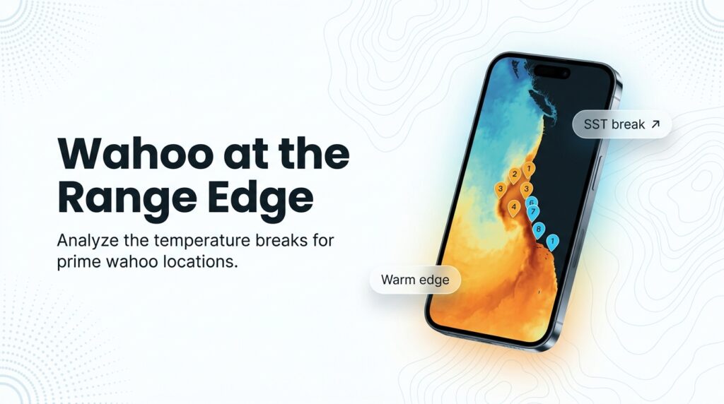
The Pacific Southwest sits at the northeastern edge of the wahoo’s range, and wahoo fishing here follows warm water that comes and goes. The species (Acanthocybium solandri, called "ono" by Hawaii anglers) is tropical and subtropical, and only sometimes reaches this coast.
For the fundamentals (biology, tackle basics, general behavior), start with our wahoo species guide. This page covers what changes here.
There are three ways to fish for wahoo in this region:
- San Diego long-range trips to the Pacific Baja banks and islands. This is the most reliable path.
- Baja Sur charters and pangas around Cabo San Lucas and the Cape.
- Warm-year opportunities off Southern California for private boaters.
Below: when, where and how by sub-region, what the fleet record shows, and what nobody knows.
Regional Differences
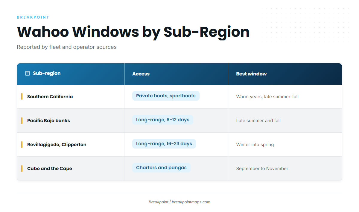
Fleet and operator sources point to late summer through fall for Southern California and the Pacific Baja banks, winter into spring for the long trips to Revillagigedo and Clipperton, and September through November around Cabo. All of these windows shift with water temperature.
Wahoo at the Edge of Their Range
NOAA Fisheries describes wahoo as widely distributed through the tropical and subtropical Pacific. This coast is where that warm water sometimes reaches and sometimes does not. In Baja, the planning question is when. In Southern California, it is whether.
The Documentation Record: 2014 to 2018
Wahoo can be caught in Southern California in warm years. The first confirmed California wahoo was reported in late August 2014.
According to NOAA’s warm-period ocean indicators, an extended warm period from 2014 to 2018 began with the marine heatwave known as "the Blob" and ended with El Niño. Scientists documented 36 unusual species off California in that stretch. Wahoo were among those spotted in the California Current for the first time on record.
A Southern California charter operator’s account describes a 50 lb wahoo weighed at the Balboa Angling Club in Newport Beach in late August 2014, caught about 20 miles offshore near the 267. The same account describes 2015 as a strong warm year. It reports a single day when the Legend out of Point Loma put 29 wahoo on deck, and hundreds recorded by the sportfleet that season. Treat those numbers as reported, not audited.
Sport Fishing magazine reported an 84.3 lb California state record at the time. Verify the current record on CDFW’s record list before you call it current.
What Nobody Knows: An Unassessed Stock
According to NOAA Fisheries, there is no directed fishery for Pacific wahoo. Population status and fishing rate are unknown because scientists do not formally assess wahoo populations. NOAA assumes the stock is stable because the species is highly productive and widely distributed. The agency also notes wahoo reach up to 8 ft and 158 lb, commonly 3.3 to 5.4 ft.
No one can say how many wahoo will push north in a given year, and any prediction is a guess.
Reading a Warm Year from the Dock
A real Southern California opportunity looks different from a one-off. These are reasoning cues, not rules:
- Several boats in the same area report trolled jigs or leaders cleanly cut off, as local operators have described.
- Warm water holds on SST imagery for weeks, not days.
- Wahoo show up in fleet counts across multiple boats and trips.
A single fish is an anecdote; the same catch repeated across boats points to a pattern.
How Seasonality Shifts by Latitude
Southern California is warm-year only, with fish reported in late summer and fall. The Pacific Baja banks fish best in late summer and fall. The far offshore islands run in winter into spring. Cabo peaks in fall. The table in the next section lays it out.
Habitat & Conditions in the Pacific Southwest
Temperature sets the boundaries at the range edge, and structure decides where fish sit inside them.
Temperature and Breaks: What the Numbers Do and Don’t Say
A temperature break is where warmer and cooler water meet. For a range-edge species, the warm side of that edge defines where wahoo can be at all.
Two reported figures help set a starting search range:
- The Southern California state record came in 72.8°F water, per Sport Fishing magazine and one angler’s reading.
- Cabo charter operators report a preference for 75 to 83°F water. That is operator experience, not science.
Cloud can also block satellite SST passes, and surface temperature does not describe what is happening below it.
Southern California: High Spots and Banks
One Southern California angler’s account points to high spots like the 267, the 14 and the ledge from Laguna down to Oceanside. These are hard-bottom zones. The piece is undated, so read it as a single warm-year account.
Operator accounts also describe fish landed from the Coronado Islands and San Diego banks north to Dana Point and Newport in 2015. These spots matter only when warm water is present.
Pacific Baja: Alijos Rocks, The Ridge and Thetis Bank
Point Loma Sportfishing’s trip lineup lists 8 to 12 day trips fishing Alijos Rocks and "The Ridge" from Pt. Eugenia south to Thetis Bank. Anglers there encounter tuna, wahoo, yellowtail, dorado, grouper and the occasional marlin in fall and early summer.
BD Outdoors’ long-range wahoo guide says the best odds from a San Diego sport boat come on a 6 to 10 day trip in late summer or fall. More wahoo show up in the counts with each returning trip.
The shorter 4 to 6 day trips to Guadalupe, San Benitos and Cedros are marketed for yellowtail and calico bass in spring, not wahoo.
Revillagigedo and Clipperton
Point Loma Sportfishing runs 16 to 23 day trips in winter and into spring, targeting large yellowfin tuna and wahoo. See the Regulations section for protected-area status.
Cabo San Lucas and the Cape
Cabo charter operators report a September through November peak. Named grounds from Cabo sources include Gordo Banks and the 1150 Bank. Fall also overlaps with dorado, tuna and marlin, so expect a mixed bag.
Seasonal and Access Table
| Sub-region | Typical access | Best-reported window | Source |
|---|---|---|---|
| Southern California | Private boats, local sportboats | Warm years only, late summer and fall | NOAA feature; operator accounts |
| Pacific Baja banks (Alijos, The Ridge, Thetis) | San Diego long-range, 6 to 12 days | Late summer and fall | BD Outdoors; Point Loma Sportfishing |
| Revillagigedo and Clipperton | San Diego long-range, 16 to 23 days | Winter into spring | Point Loma Sportfishing |
| Cabo and the Cape | Local charters and pangas | September to November | Cabo charter operators |
Windows are reported by fleet and operator sources and shift with water temperature year to year.
Tactics for the Pacific Southwest
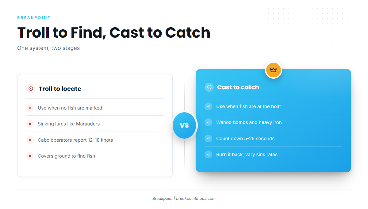
Wahoo fishing in the Pacific Southwest comes down to one system: troll to find fish, cast to catch them. Sport Fishing magazine describes the sequence: troll first, then cast. Speed trolling locates productive areas, and casting to fish around the boat can start a feeding frenzy.
The general case for wire is covered in our wahoo fishing guide. What follows is how the local fleet rigs.
Troll to Locate vs. Cast to Catch
| Troll to locate | Cast to catch | |
|---|---|---|
| When | Searching grounds, no fish marked | Fish around the boat or a bite on the troll |
| Lures | Sinking trolling lures (e.g., Marauder) | Wahoo bombs, heavy iron |
| Reported detail | Cabo operators report 12 to 18 knots | 5 to 25 second countdown, then burn it back (BD Outdoors) |
The knot figure is Cabo operator-reported and may not apply to Southern California private boats.
The Long-Range Bomb and Iron System
BD Outdoors describes fishing the drift with a 50 lb outfit and a stiff 6.5 to 7 ft rod, usually from the bow. Cast slightly upswell from the boat, count down 5 to 25 seconds, then burn the lure all the way back. Pause, then bring it over for a new cast. Varying sink rates is the way to find the pattern.
The author’s box is mostly Captain Jimmy’s wahoo bombs and heavy Tady 4/0s. A gear brand’s blog describes the West Coast tradition as gaudy bombs and iron fished fast on reels with a gear ratio no lower than 4:1.
Marauders in the SoCal Tuna Spread
In the warm year described by Pacific Coast Sportfishing Magazine, a Marauder or similar lure was part of nearly every sportboat’s spread on the tuna grounds.
Leaders: Wire vs. Heavy Mono
Cabo operators specify 30 to 50 lb class tackle with wire, and say wahoo bite through mono and fluoro. The Pacific Coast Sportfishing author says you can try heavier mono instead of cable, but you may lose tackle. Which risk to accept is your call.
Tackle Checklist
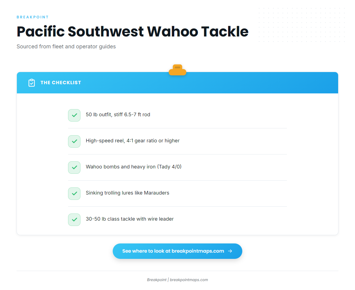
Drawn from the fleet and operator sources above:
- 50 lb casting outfit with a stiff 6.5 to 7 ft rod (BD Outdoors)
- High-speed reel, gear ratio no lower than 4:1 (Pelagic Gear)
- Wahoo bombs and heavy iron such as Tady 4/0s (BD Outdoors)
- Sinking trolling lures such as Marauders (Pacific Coast Sportfishing)
- 30 to 50 lb class trolling tackle with wire leader (Top Anglers Charters)
Frequently Asked Questions
When is wahoo season in the Pacific Southwest?
BD Outdoors and Point Loma Sportfishing point to late summer and fall for Southern California and the Baja banks. Revillagigedo trips run winter into spring. Cabo operators report September through November. Windows shift with water temperature each year.
Can you catch wahoo in Southern California?
Yes, in warm years. The first confirmed California wahoo was reported in late August 2014, and NOAA notes wahoo were spotted in the California Current for the first time on record during the 2014 to 2018 warm period. Catches are irregular.
Do I need a Mexican fishing license on a San Diego long-range trip?
Confirm with CONAPESCA and your landing before you go. Requirements can differ by trip and change over time. Ask what your booking includes.
Where to Look Next
Wahoo here track warm water that moves from season to season. A daily look at where temperature and structure line up can help you decide where to run.
Breakpoint’s hotspots feature scores wahoo in the Pacific Southwest, using layers like OBS SST, Chlorophyll and Chart Contours. It cannot guarantee fish. Clouds can block satellite SST passes, and a forecast is a forecast, but the layers can help you decide where to look.
Chart layers are not for navigation.