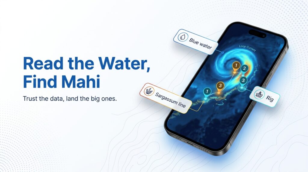
Mahi-mahi fishing in the Gulf of Mexico comes down to three things: where Loop Current water sits, where sargassum lines up, and which rigs hold bait. For the fundamentals (biology, gear basics, why mahi are worth chasing), start with our mahi-mahi species guide. This page assumes you’ve already decided to go and covers what’s different here.
Scientists call the species dolphinfish (Coryphaena hippurus). Regulations use "dolphin," so search agency pages under that name. Federal agencies now call the water the Gulf of America. Most anglers, and most of this page, still say Gulf of Mexico.
The page covers three things:
- How blue water reaches each coast, and why the run from your port changes month to month.
- What timing sources say by sub-region, and where they disagree.
- Where to check current limits before you leave the dock.
It can’t promise fish, only a better decision about where to look.
Regional Differences
Gulf mahi fishing differs from the Atlantic in three ways. Oil and gas platforms act as fixed structure. Blue water reaches the northern shelf through Loop Current eddies rather than a steady stream. And fish size sorts sharply by distance from shore.
That shapes how you plan a trip from Venice, Orange Beach, Destin, Port Aransas or the Keys. The same species behaves like a different fishery depending on which port you leave from.
| Factor | Gulf pattern | What it means for you |
|---|---|---|
| Structure | Permanent platforms off Louisiana and Texas | Fixed targets in blue water, not just drifting weed |
| Blue water | Arrives in pulses via the Loop Current and its eddies | The run from a given port changes month to month |
| Fish size | Small schools nearshore, larger fish farther out | Match tackle and expectations to distance |
Platforms Change the Game
Off Louisiana and Texas, oil and gas platforms are permanent vertical structure in blue water. Weedlines and debris drift; rigs stay put.
Alabama’s tourism board notes that baitfish and crustaceans gather around offshore gas and oil platforms. Bait draws mahi, and many captains fish rigs specifically for larger fish, though that is local preference rather than a rule.
Blue Water Arrives in Pulses, Not a Stream
On the Atlantic side, the Gulf Stream is a fairly reliable conveyor. In the northern Gulf, blue water shows up when the Loop Current pushes north or sheds an eddy. The run from a given port can be short one month and long the next. The Habitat section covers why.
Schoolies Nearshore, Bulls Offshore
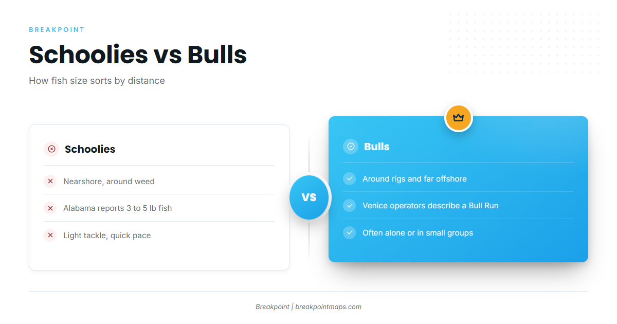
Size splits by distance. Alabama’s tourism board reports "chicken dolphin" schools of 3 to 5 lb, with an occasional 10-pounder, passing the Gulf State Park Pier. These schoolies passing Gulf State Park are worked from the pier and nearshore.
Farther out, Venice operators describe a Bull Run of large bull and cow mahi riding currents to the northern Gulf in spring and summer. That is an operator description, not a measured migration.
For the species ceiling, Mote Marine Laboratory’s species profile puts mahi at up to 6 feet and 65 lb, averaging 3 feet and 30 lb.
The Keys and Southwest Florida Overlap
The Keys sit where Gulf water meets Atlantic, Florida Straits and Gulf Stream patterns, so fishing there often looks more Atlantic than northern Gulf. FWC sets the regulation boundary through the Keys. Check the Regulations section and the agency before you fish.
Habitat & Conditions in the Gulf of Mexico
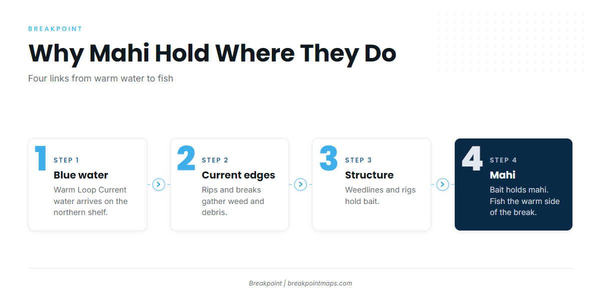
For mahi-mahi fishing in the Gulf of Mexico, the distance you run depends more on where blue water sits than on mileage. The chain runs in order: warm blue water arrives, current edges gather weed and debris, structure holds bait, and bait holds mahi.
The Loop Current and Its Eddies
Warm Caribbean water enters the Gulf between the Yucatán and Cuba, loops north, and exits through the Florida Straits. Eddies, sometimes called rings, pinch off and drift west, carrying warm blue water across the northern Gulf.
Eddy shedding is irregular. Sometimes it happens months apart, and sometimes more than a year passes. Nobody can set a calendar by it.
An eddy’s position changes the run from Venice. When warm water sits close to the Mississippi River delta, the blue-water run shortens. When the eddy drifts west or detaches, the same trip may need to go much farther, or head on a different bearing.
To track the Loop Current, look at GCOOS and NOAA CoastWatch, and check them the day you fish. An eddy map from last week shows last week’s water.
Sea Surface Temperature
North Carolina Sea Grant has summarized tagging research showing mahi spent most of one study period in surface water of roughly 77 to 84°F, with a preference around 80 to 82°F during northward migration. That was one study and not a Gulf-specific threshold, so treat it as a starting range.
The edge matters more than the number. A break is where warm and cooler water meet, and mahi often work the warm side.
Color Change and Chlorophyll
Three layers are worth reading together:
- SST shows you the warm side of the break.
- Chlorophyll shows clean blue water versus green or dirty water, and the line between them.
- Current data suggests where weed and debris organize.
When all three point to the same zone, that zone is a better bet than a mileage number.
Satellites have blind spots. Cloud cover blocks SST and chlorophyll passes, imagery can’t resolve small patches of weed or a single floating pallet, and yesterday’s image shows yesterday’s water.
Sargassum: What Makes a Line Hold Fish
Venice operators link calm summer conditions to sargassum "balling up along current eddies or rips" in open water. A ball of weed on a rip is a different situation from a thin scatter on flat water.
Water and prey drive the fish, not the weed alone. Salt Strong’s Capt. Hubbard says it’s "all about the surface water temps and the prey present," and reports mahi around weedlines past 100 feet of water, occasionally as shallow as 30 feet.
To track bloom extent, use the USF Optical Oceanography Lab’s Sargassum Watch and Outlook.
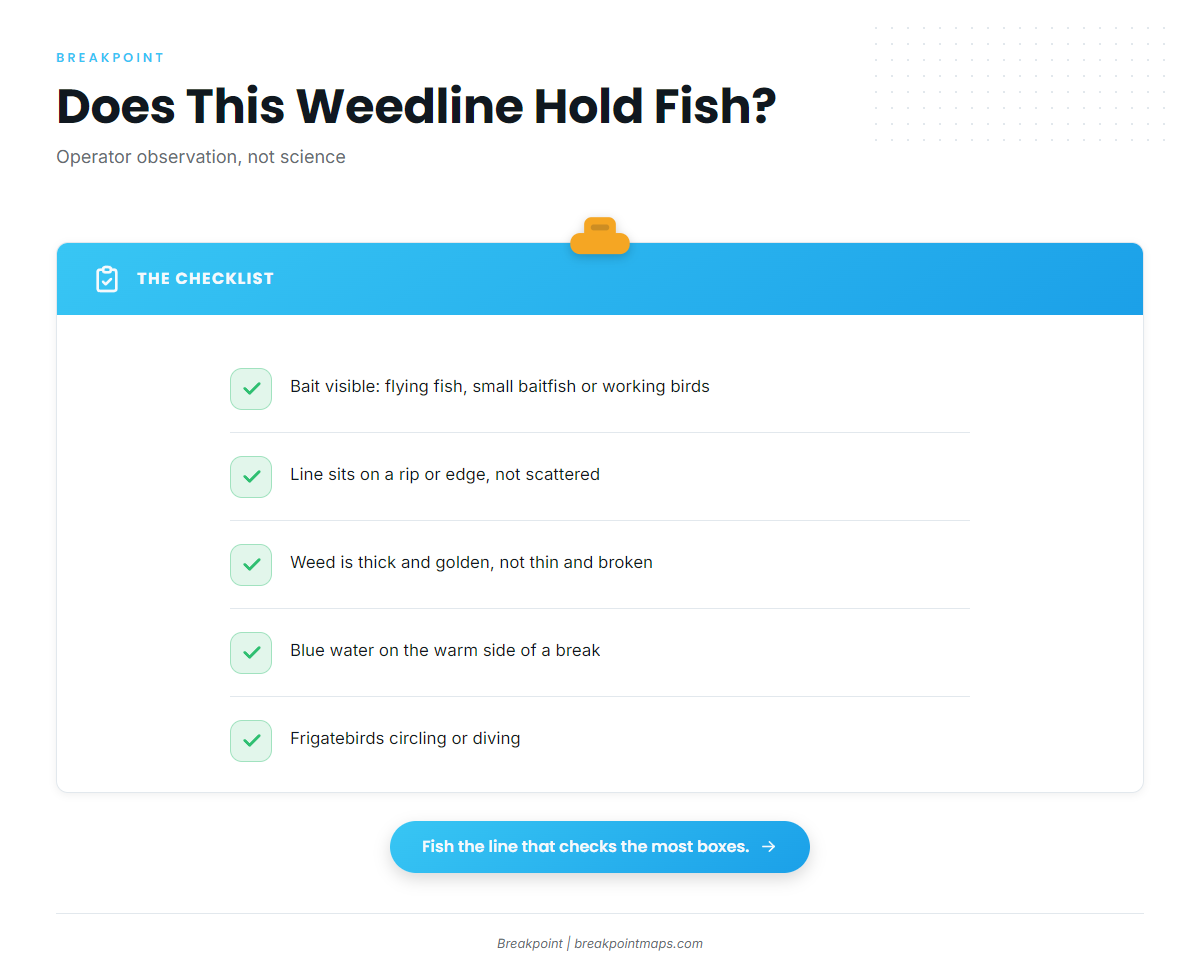
Before you stop on a line, check it against the list below. These points reflect operator observation and common practice, not controlled science:
- Bait visible: flying fish, small baitfish, or birds working.
- On an edge: the line sits on a rip or current edge rather than scattered across flat water.
- Thick weed: operators generally prefer thick, golden weed over a thin, broken scatter.
- Blue water: it sits on the warm side of a break.
- Birds: frigatebirds are circling or diving.
When Mahi Show Up, by Sub-Region
Seasonal timing sources conflict, and the water decides more than the calendar does. Capt. Troy Wetzel’s timing puts the best Louisiana window in spring, "up until June." Venice Fishing frames the Bull Run as spring and summer.
| Sub-region | Commonly cited window | Typical fish | Source basis | Confidence |
|---|---|---|---|---|
| Keys / SW Florida | Varies, verify locally | Varies, verify locally | Atlantic overlap; no sourced timing | Low |
| Panhandle / Alabama | Spring and summer (tourism board) | Schoolies ("chicken dolphin," 3 to 5 lb) near the pier; larger fish offshore | Gulf Shores tourism | Moderate |
| Louisiana | Spring to June (Wetzel) vs spring and summer (Venice Fishing) | Bulls and cows in the Bull Run | Operators, conflicting | Moderate, contested |
| Texas | Varies, verify locally | Varies, verify locally | No sourced timing | Low |
Swipe the table sideways to see every column.
Tactics for the Gulf of Mexico
Troll to find fish, then stop and pitch once you do. The habitat logic above tells you where to start, and the tactics below cover what to do when you get there. For spread basics, see our general trolling setup in the species guide.
Troll to Search, Pitch to Catch
Common practice is a spread of skirted and naked ballyhoo at roughly 6 to 9 knots, with a dink rig as the go-to for many trollers. Wetzel lists Louisiana trolling options as live baits, skirted baits and naked ballyhoo.
Trolling here covers the water between structure. Once you get a bite, stop trolling and switch to pitching.
Keep a Hooked Fish in the Water
Gulf guides commonly leave the first hookup in the water and pitch baits or chum behind it. The school tends to stay near the boat while that fish is hooked, so get more baits in the water before you land it.
Working Rigs off Louisiana and Texas
Operators describe circling the structure, then trolling or pitching along the up-current side, where bait gathers. Start there and adjust to what the current and bait are doing.
Platforms are working industrial sites. Check current Coast Guard and operator restrictions before tying up or fishing close.
Debris, Birds and Anything Floating
Check every pallet, bucket, log and line you pass. Frigatebirds and flying fish are search cues, and small floating objects hold fish that a satellite image will never show.
Bulls vs Schoolies
Match your approach to the size class.
| Fish | Where | How it fishes |
|---|---|---|
| Schoolies | Nearshore and around weed | Light tackle, quick pace, more fish per stop |
| Bulls | Around rigs and far offshore | More often alone or in small groups; slower, more deliberate |
Bulls are big, fast and strong. Keep the boat under control, and have a plan for landing large fish on a center console before you hook one.
The Uncertainty Behind the Tactics
Stock assessment for mahi is hard because of their short lifespan, long migrations and environment-driven abundance. Tagging shows mahi travel 30 to 50 miles or more a day in search of food and water conditions, so a line that held fish yesterday may be empty today.
Where to Look Next
Mahi-mahi fishing in the Gulf of Mexico rewards anglers who follow the water: the Loop Current position, the warm side of the break, a sargassum line with bait on it, and a rig in blue water. The work is lining those up and going to look.
Breakpoint’s hotspots feature scores mahi-mahi water across the Gulf, using temperature, color, current and structure to point you at the best places to start. A score is a starting point for where to look, not a promise, and clouds block satellite passes.
Chart layers are not for navigation.
Frequently Asked Questions
When is mahi season in the Gulf?
Sources differ. Louisiana operators cite spring to June or spring through summer. Alabama’s tourism board cites spring and summer. Water temperature and blue-water position matter more than dates, so watch the conditions rather than the calendar.
How far offshore do you run for mahi from Venice, Orange Beach or Destin?
There’s no fixed mileage. It depends on where blue water, weed and Loop Current eddies sit that week. The nearshore exception is schoolies near the Gulf State Park Pier, which anglers catch close to the beach.
Do mahi hold on oil rigs?
Yes. Alabama’s tourism board notes that baitfish and crustaceans gather around offshore platforms, and many anglers fish rigs off Louisiana and Texas. Platforms are working industrial sites, so check current Coast Guard and operator restrictions first.
What are the Gulf mahi limits?
See the table in the Regulations section and check each agency the week you fish. Confirm the bag, size and vessel limits for your state and for federal waters before you leave.
Does "Gulf of America" change the regulations?
No rule change is sourced. Federal pages now use the new name, so search agency sites under both Gulf of America and Gulf of Mexico. Look for "dolphin" as well as "mahi-mahi."