Overview
From the Outer Banks to Miami-Dade, king mackerel fishing in the Atlantic Southeast runs on water temperature and bait. Kings show where the Gulf Stream, pogy schools and nearshore structure line up. This page covers only how Atlantic-group kings behave in North Carolina, South Carolina, Georgia and Florida’s east coast. For biology, identification and general tackle, start with our king mackerel species guide.
The sections below cover when kings move through each stretch of coast, what water and structure to look for, which local tactics are standard.
Regional Differences: Atlantic Kings Are Their Own Fish
The Atlantic migratory group of king mackerel runs north of the Miami-Dade/Monroe county line. Fish south and west of it are managed as the Gulf group. According to NOAA’s Making Sense of Mackerel, the two groups are recognized and regulated separately. The Atlantic group’s range stretches from that county line north to the point where New York, New Jersey and Connecticut meet.
The same species can carry different rules on either side of the line, and running south from Miami-Dade into Monroe County waters takes you across it. The precise legal definition is in 50 CFR Part 622, Subpart Q, §622.369(a). Agency maps are illustrative, so treat the regulation text as the authority.
Northern and Southern Zones
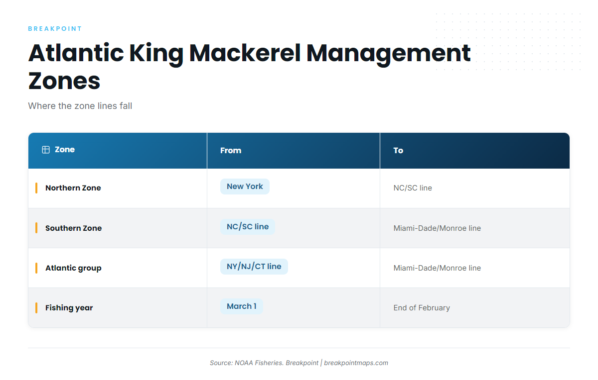
The Atlantic group is split into two management zones. NOAA defines them as follows.
| Zone | From | To | States covered |
|---|---|---|---|
| Northern Zone | New York | NC/SC state line | NC and states to the north |
| Southern Zone | NC/SC state line | Miami-Dade/Monroe county line | SC, GA and Florida’s east coast |
Zone designations mainly drive federal quota and commercial management. If you fish recreationally, check which zone your rules reference before assuming a limit applies.
The March-to-February Fishing Year
The Atlantic group’s fishing year runs March 1 through the end of February, according to NOAA. Rule changes and quota accounting follow that year rather than the calendar year, so check the date on any regulation you read.
Why the Region Changes Behavior
The South Atlantic Fishery Management Council says king mackerel migrate north in spring and south in fall. Temperature sets that pace, and it is the first thing to understand about King Mackerel Fishing in the Atlantic Southeast.
Habitat & Conditions in the Atlantic Southeast
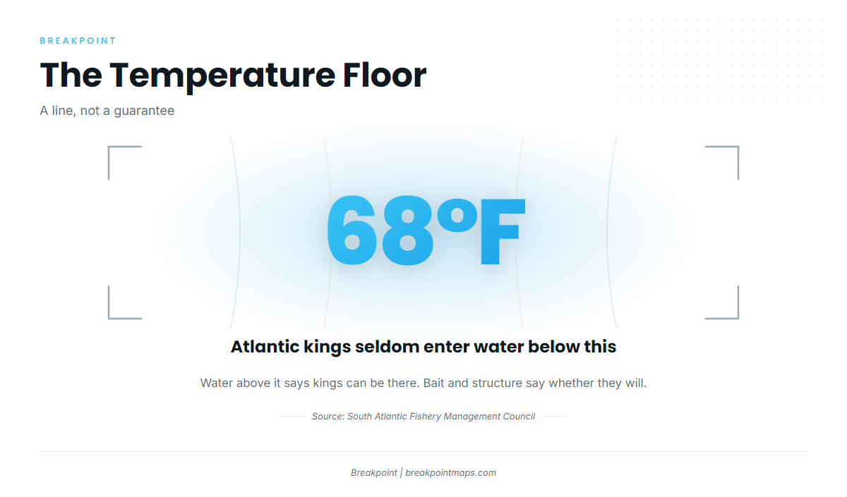
Atlantic kings seldom enter water below 68°F, according to the South Atlantic Council species profile. Some charter and tackle sources describe a warmer sweet spot, but 68°F is the number the council publishes.
Treat it as a threshold, not a guarantee. Water above it means kings can be there, and bait and structure determine whether they will be.
Winter: Inside the Gulf Stream at the Shelf Edge
The NC Division of Marine Fisheries reports that in winter kings congregate just inside the Gulf Stream along the edge of the continental shelf. Off the Carolinas, that makes winter kings a run-and-look proposition: weather and the Stream’s position decide whether the trip is worth it. Farther south, warmer water generally holds fish longer.
Spring and Fall: Beaches, Inlets and River Mouths
According to the same NCDMF profile, kings move inshore in summer and fall along the beaches and near the mouths of inlets and rivers. A regional fall king report from the Brunswick Islands, a tourism source dated August 2026, says the coast is in the middle of the mullet migration from September, and menhaden (pogies) move closer to shore. Once kings arrive, they tend to hold on reefs and live-bottom patches.
Fall is generally the stronger nearshore window in the Carolinas because bait is dense along the beach. Spring fish arrive as water crosses the 68°F line and tend to be more scattered.
Bait First: Menhaden, Mullet and Cigar Minnows
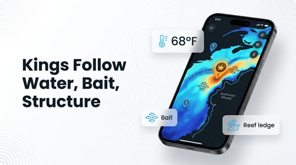
Kings follow bait. Pogy schools outside the breakers and near inlets are the signal, and the Brunswick Islands source ties the September pogy and mullet movement to king arrival. Find the bait first, then the structure that holds it.
Structure: Live Bottom, Artificial Reefs, Ledges and Shoals
Nearshore live bottom, artificial reefs, wrecks, ledges and shoals concentrate bait, and kings set up on them. Carolina examples include the Cape Fear River entrance and Frying Pan Shoals, both covered in the tactics section below. We lack sourced specifics for other ports, so treat structure as a category to search for rather than a list of spots.
Seasonal Windows by Sub-Region
If you’re looking for king mackerel season NC dates or the best time for king mackerel on Florida’s Atlantic coast. The table gives relative windows anchored to the 68°F floor. Every cell is either sourced or labeled a general window.
| Sub-region | Spring window | Fall window | Winter notes | Key structure |
|---|---|---|---|---|
| Outer Banks / northern NC | General window: arrives after water crosses 68°F | Inshore fishing along beaches and inlets (NCDMF) | Offshore, inside the Gulf Stream at the shelf edge (NCDMF) | Inlets, beaches, shelf edge |
| Southern NC (Wrightsville, Cape Fear, Brunswick Islands) | General window: arrives earlier than the Outer Banks | September onward, as pogies and mullet move in (Brunswick Islands) | Offshore, inside the Gulf Stream (NCDMF) | Reefs, live bottom, Cape Fear River entrance, Frying Pan Shoals |
| SC (Charleston area) | General window: follows the 68°F line north | General window: lingers into fall | General window: offshore only | Nearshore live bottom, reefs |
| GA / northeast FL (Jacksonville) | General window: arrives earlier, lingers later | General window: holds later into fall | General window: warmer water farther south holds fish longer | Nearshore live bottom, reefs |
| Central and southeast FL Atlantic (Sebastian/Stuart to Miami-Dade) | General window: earliest arrival in the region | General window: last to lose fish | General window: most likely to hold fish in winter | Reefs, ledges, shoals |
Swipe the table sideways to see every column.
What We Don’t Know
- Run timing shifts year to year, and the fish don’t follow a calendar.
- Clouds block satellite sea-surface temperature passes, and forecasts are only forecasts.
Tactics for the Atlantic Southeast
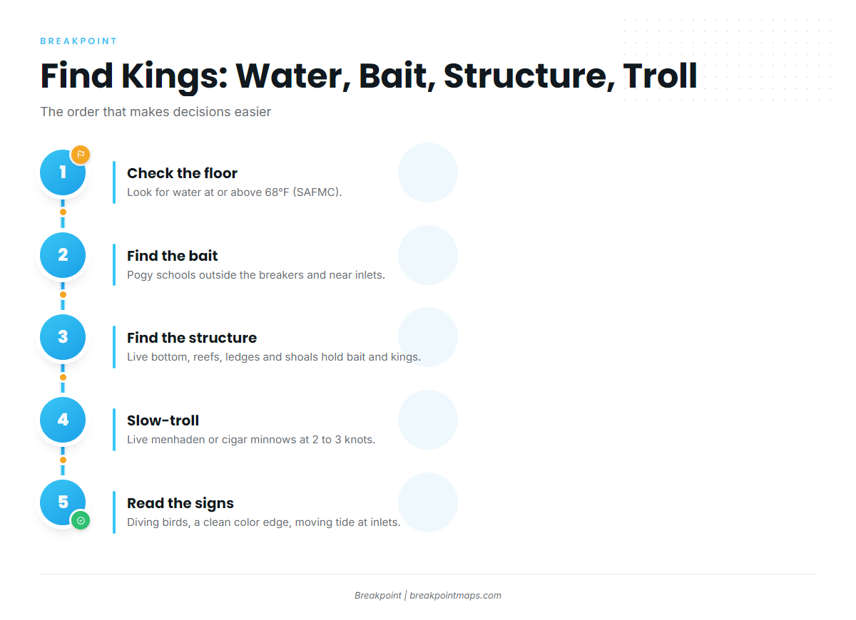
Slow trolling live bait is the most popular way to catch king mackerel off the Carolinas, according to the NC Division of Marine Fisheries. The state describes multiple baits pulled at very slow speed, most often live Atlantic menhaden and cigar minnows plus dead ribbonfish. Anglers fish from boats and from the ends of ocean piers.
The Slow-Troll Spread
Salt Water Sportsman’s kingfish breakdown describes a 4-bait spread: two baits off the long riggers and two off the short riggers, at 2 to 3 knots, "just fast enough to keep them swimming straight."
Tie the spread to the structure described above by working bait-holding live bottom and reef edges. Out of the Cape Fear River, the same source describes working the river entrance and heading toward Frying Pan Shoals. Blue runners are a commonly used live bait alongside menhaden and cigar minnows.
Live vs. Dead Bait
- Live menhaden and cigar minnows are the standard in the region.
- Dead ribbonfish is the standard dead option (NCDMF), and the fallback when live bait is scarce.
- Artificials work, but they are a secondary option here.
Stinger Rigs
Kings commonly short-strike live baits, which is why wire stinger rigs are standard in the region. For construction details, see the stinger rig basics in our species guide.
Reading Bait and Water Signs
These are widely used cues for deciding where to set up:
- Pogy schools outside the breakers or near inlet mouths.
- Diving birds over bait.
- Water temperature at or above 68°F (SAFMC).
- A cleaner water color edge.
- Moving tide at inlets.
- Bait marked on structure.
Pier Kings
Carolina Sportsman on pier kings says October usually represents the best month to get a shot at a king from Hilton Head to Nags Head. NCDMF confirms kings are caught from the ends of ocean piers.
The general method uses two rods. One casts a sand anchor far from the pier end. The other sends a live bait down the anchor line on a trolley. Know the pier’s rules and don’t cross other lines. Pier anglers get few shots at a king, so plan each one.
Tournaments
King mackerel tournaments, including the Southern Kingfish Association circuit, are part of the regional culture. If you plan to enter, get the rules directly from the official SKA source.
Frequently Asked Questions
When do king mackerel arrive in North Carolina and Florida’s Atlantic coast?
Kings move north in spring and south in fall, according to SAFMC. In North Carolina, fall inshore fishing peaks around October at the piers, per Carolina Sportsman. Florida’s Atlantic coast generally holds fish earlier and later. Plan around windows rather than dates.
What water temperature do king mackerel need?
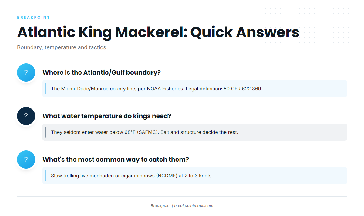
Atlantic kings seldom enter water below 68°F, according to SAFMC. That is a floor rather than a target, and bait and structure decide whether fish actually hold in warmer water.
Where is the Atlantic/Gulf king mackerel boundary?
The boundary is the Miami-Dade/Monroe county line, per NOAA Fisheries. Atlantic-group fish are north of it. The legal definition is in 50 CFR 622.369, so use that text over any map.
Do I need a license to fish for kings in the Southeast?
In North Carolina, yes. You need the Coastal Recreational Fishing License, per NCDMF. For South Carolina, Georgia and Florida, check SCDNR, GADNR Coastal Resources Division and FWC before your trip. Buy the license for the state whose waters you fish.
What’s the most common way to catch Atlantic kings?
Slow trolling live menhaden or cigar minnows, according to NCDMF. Salt Water Sportsman describes a 4-bait spread at 2 to 3 knots.
Close
Know which management group and zone you’re in, treat 68°F as the floor, and find the bait before the structure. Then slow-troll it. That is the working shape of King Mackerel Fishing in the Atlantic Southeast.
Breakpoint’s hotspots feature scores king mackerel across the Atlantic Southeast using the same things this guide covers: temperature breaks, bait and structure. It won’t promise fish. It’s built to help you decide where to look first. Map layers are not for navigation.