Overview
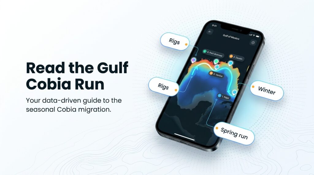
Cobia in the Gulf of Mexico follow a seasonal loop. They winter in the south, run along the northern Gulf beaches in spring, then settle on rigs, wrecks and markers through summer and fall. Timing shifts from year to year, and no source we found gives a fixed schedule.
For biology, tackle and identification, start with our cobia species guide. This page covers what changes in the Gulf: sub-region timing, structure, local tactics and a dated regulations table.
Gulf cobia are managed as the Gulf migratory group. According to the Atlantic States Marine Fisheries Commission, Gulf and Atlantic cobia stocks divide so that Gulf cobia occur throughout the Gulf and extend onto Florida’s east coast, while Atlantic cobia occur from Georgia north. The Gulf Council places the boundary between the two stocks essentially around the Florida Keys. Anglers on Florida’s east coast may be fishing Gulf-group fish under different rules than they expect. The Regulations section covers this.
Federal agencies now label this water the "Gulf of America," and you will see that name on official pages. We use Gulf of Mexico here because it matches how most anglers search.
Regional Differences
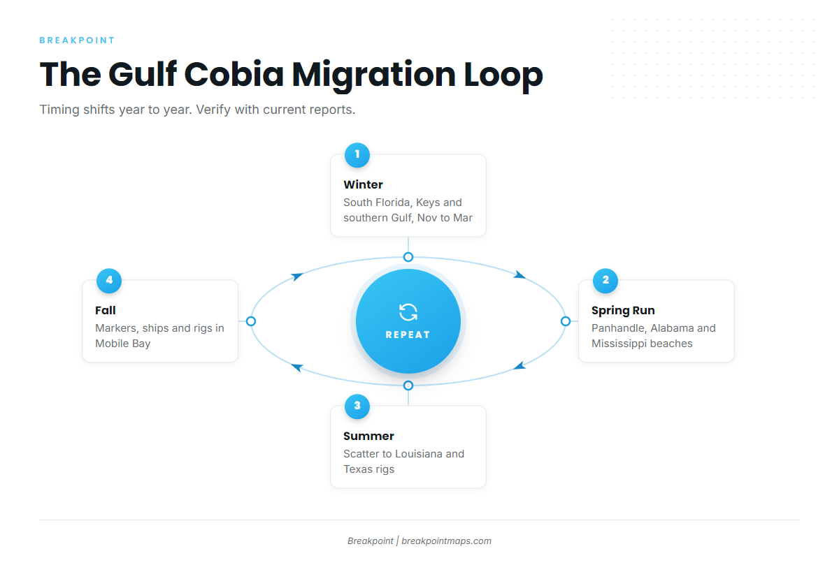
The spring run moves east to west along the northern Gulf beaches from roughly March into May. Fish then scatter to offshore structure off Louisiana and Texas for summer. Exact timing shifts year to year.
The loop runs in three parts:
- Winter: Fish sit in South Florida, the Keys and the southern Gulf. The Gulf Council notes presence there from November to March.
- Spring: They move along the beaches of the Panhandle, Alabama and Mississippi.
- Summer and fall: They scatter around the oil and gas platforms off Louisiana and Texas, and hold on markers and wrecks closer to shore.
What we don’t know. Sources conflict on timing. Some cite March to June, others March to October, and one says "March through October and sometimes into November." The tagging record is real but limited: the GSMFC cobia management profile covers 875 fish tagged from 1988 to 2014 across 7 zones. It shows movement between zones but no fixed schedule. Harte Research Institute says western Gulf movement research is still needed, because stock structure and seasonal movements are not well understood. Treat every window below as approximate.
Table 1: Approximate timing, verify with current reports
| Sub-region | Approximate window | Typical structure | Main tactic |
|---|---|---|---|
| South FL/Keys | Nov to Mar (Gulf Council) | Wrecks, markers, reefs | Sight casting, live bait |
| FL Panhandle | Spring run, roughly Mar to May | Sandbars, beaches under 15 ft | Tower-boat sight casting |
| AL/MS | Early Mar arrival, April peak (charter-reported); fall Aug to Oct in Mobile Bay | Beaches, then markers, anchored ships, gas rigs | Sight casting, then working markers |
| LA | Late spring through fall | Oil and gas platforms | Jigs, live bait, chum |
| TX | Summer through fall | Platforms, reefs | Rigs and chum |
South Florida and the Keys
The winter window runs November to March, according to the Gulf Council. This is the southern end of the loop, and it is where the stock boundary gets awkward. Near the Keys, the stock you are fishing decides which rules apply, so check before you keep a fish.
Florida Panhandle: Pensacola, Destin, Panama City
This is the best-known sight-casting stretch. One Destin charter site describes early-spring fish along sandbars in 15 feet of water or less. That is the site’s observation, not a measured survey.
Expect company. Salt Water Sportsman says the spring run along Florida and Alabama beaches "draws large, fanatical crowds every year," so plan for traffic on the best days.
Alabama and Mississippi: Orange Beach and Mobile Bay
One Orange Beach charter site reports first arrivals in the first week of March, with the heaviest movement in weeks 1 to 3 of April. That is one operation’s observation, so check it against current reports.
Alabama’s artificial reef zones give fish somewhere to hold in summer. The fall pattern in Mobile Bay differs, and we cover it under Tactics.
Louisiana and Texas: Venice and the Platforms
After passing Mississippi, fish scatter around the Louisiana oil rigs, according to Union Sportsmen’s Alliance. Platforms are summer-to-fall habitat.
We keep Texas general on purpose.
Habitat & Conditions in the Gulf of Mexico
Four things matter most for cobia in the Gulf: water temperature, clear water over sand, anything that floats or stands, and large slow-moving animals.
Water temperature. Secondary angling sources cite a range of 68 to 78°F, and one ties the low end to the spring run. Read that as a cited range, not a proven biological trigger. In summer, when shallow water heats up, a Destin charter site says fish sit in 15 feet or deeper, along drop-offs between deep and shallow water.
Structure worth checking, by sub-region:
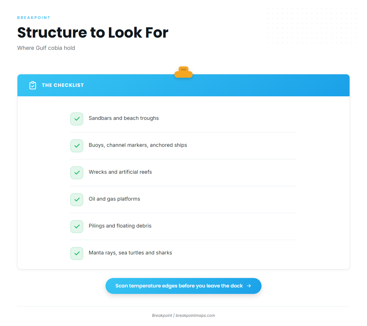
- Sandbars and beach troughs (Panhandle, Alabama)
- Buoys, channel markers and anchored ships (Mobile Bay)
- Wrecks and artificial reefs, including the Alabama reef zones
- Oil and gas platforms (Louisiana and Texas)
- Pilings and floating debris
Big animals. Charter sources report cobia moving with large rays and trailing sharks to pick up scraps. The pattern is widely reported and worth a scan on any run, though it is anecdotal and no guarantee. Look around rays, turtles and sharks before you commit to a spot.
Conditions for sight fishing. Sight fishing works when you can see into the water. Light wind keeps the surface readable, and a high sun lets you look down through it. Water that has gone green or dirty pushes you toward structure and chum.
Reading it before you leave the dock. Temperature edges and bottom contours are visible in public data. That helps you pick where to start, though the water has the final say.
Tactics for the Gulf of Mexico
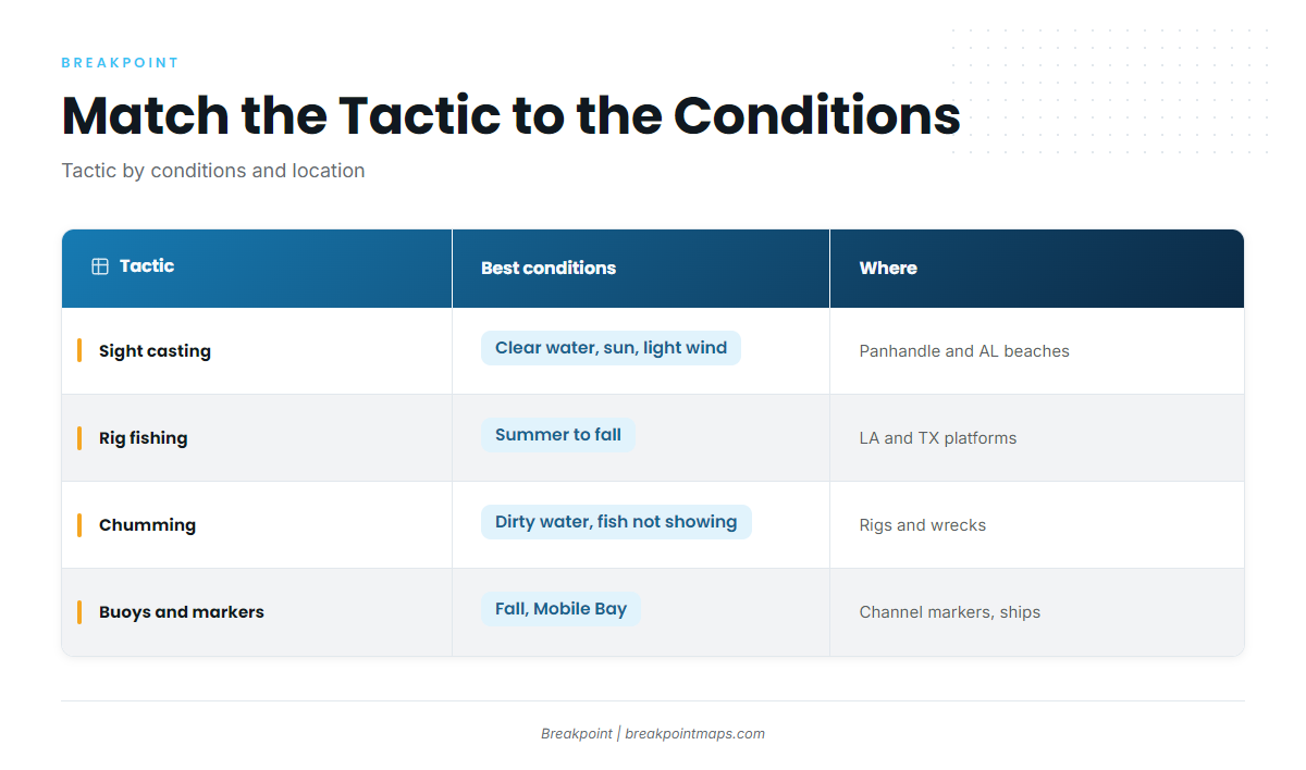
Match the tactic to the phase: sight cast the spring run, fish structure hard in summer, work navigation aids in fall, and go south in winter.
Standard cobia tackle is covered in the species guide. What follows is what changes in the Gulf.
Table 2: Tactic by conditions
| Tactic | Best conditions | Where | Notes |
|---|---|---|---|
| Sight casting | Clear water, sun overhead, light wind | Panhandle and AL beaches, bars | Tower boats |
| Rig fishing | Summer to fall | LA/TX platforms | Heavy line |
| Chumming | Dirty water, or fish not showing | Rigs, wrecks | Draws fish up |
| Buoys and markers | Fall, Mobile Bay | Channel markers, anchored ships | Check each stop |
Spring: Sight Casting the Run
Tower boats cruise the beaches and bars, and the person up top spots the fish. Bucktails and eels are the standard baits, and the Orange Beach charter site names live eels as effective. Cast ahead of the fish rather than on top of it, and scan around rays and turtles.
Summer: Rigs, Wrecks and Chum
Hooked cobia try to go back into the rig and cut you off, according to Mossy Oak (2019). That is why heavy line is standard, and why you work to pull the fish away from the structure early. The same article used 2-ounce white bucktails on near-shore rigs.
Live bait works on structure, and when fish won’t show, chum can raise them. We don’t use that article’s per-rig fish counts, because they reflect one writer’s observation from one season.
Fall: Mobile Bay Navigation Aids
Salt Water Sportsman describes the fall Mobile Bay cobia pattern as fishing from mid-August to mid-October around anchored ships, buoys, channel markers and gas rigs. The article lists eel lures, large swimbaits and bucktails up to 3 ounces, fished on medium-heavy rods with 65-pound braid. Check each marker and move on if it is empty.
Winter: The South Florida Option
The Keys and South Florida hold fish from November to March, per the Gulf Council. For a traveling angler this is a winter option. The stock boundary applies down here, so confirm the rules for the exact water you fish.
Frequently Asked Questions
When is the best time for cobia fishing in the Gulf?
Spring, roughly March to May, along the Panhandle and Alabama, then summer to fall on the rigs. Timing varies from year to year, and sources disagree on the exact window, so check current reports before you commit to a date.
What water temperature do cobia prefer?
Angling sources cite 68 to 78°F. Treat that as a range from secondary sources, not a proven trigger. Fish behavior in the Gulf also depends on structure, clarity and food.
What is the Gulf cobia size limit?
Use the Gulf Council’s cobia regulations page for the federal figure, then confirm your state’s rule with its wildlife agency. Limits change, so verify before you fish.
How do Gulf and Atlantic cobia rules differ?
They are separate stocks managed by different councils, with the boundary essentially around the Florida Keys. Gulf-group fish reach Florida’s east coast, so Atlantic-side anglers should confirm which rules apply where they fish.
Where do Gulf cobia go in winter?
South Florida, the Keys and the southern Gulf from November to March, per the Gulf Council. Tagging shows movement between zones but no fixed route, so winter locations are a pattern and not a promise.
Panhandle beaches or Louisiana rigs?
Beaches suit spring sight casting in clear water. Rigs suit summer and fall, with heavy tackle and chum. Pick by season and water clarity.
Closing
Cobia fishing in the Gulf of Mexico rewards anglers who read the phase of the season, the structure in front of them and the rules for the water they are in. The fish move, the science has gaps, and the timing changes each year. Choosing a good starting point is the part you can control.
Breakpoint’s hotspots feature is built for that. It scores cobia in the Gulf of Mexico to help you decide where to look first, and you can check the OBS SST, Chlorophyll and Chart Contours layers behind a score. The scores do not promise fish, and cloud can block a satellite pass, so treat them as a better starting point and not a guarantee.
Chart layers are not for navigation. Verify regulations with the agencies before you fish.