Atlantic bluefin tuna fishing in the Atlantic Northeast can start within reach of a center console. Salt Water Sportsman reported in 2024 that bluefin from 30 to 300 lb had been coming "very close to shore" along the Northeast coast for several years. For biology, general tackle and why the species is worth chasing, start with our Atlantic bluefin tuna species guide. This page covers where, when and under which rules you fish them in New England.
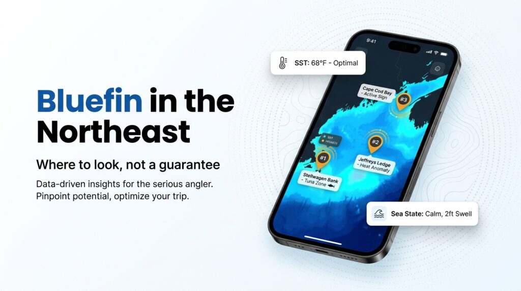
By "Atlantic Northeast" we mean the Gulf of Maine, Jeffreys Ledge, Stellwagen Bank, Cape Cod Bay, Chatham and the Great South Channel, and Block Island and RI Sound.
The page gives size classes in inches, zones with ports, tactics matched to size class, and the permit category that decides what you can keep. We can point to where fish have been found, but we can’t say they will be there. We do not claim our own catches.
Regional Differences: How Gulf of Maine Bluefin Behave
Size class drives this fishery. It sets your tactic, your zone and what you are allowed to keep.
According to FishingBooker, Atlantic bluefin are managed as separate western and eastern stocks, defined by where they spawn. New England fish feed here and spawn elsewhere, so this is a summer-to-fall feeding season. The fish you meet are a mix, and we can’t give stock proportions because none are sourced. Deeper biology is in the species guide.
On stock status, Ray Bogan, a former U.S. recreational commissioner to ICCAT, told Salt Water Sportsman in 2024 that western stocks are "not experiencing overfishing nor are they classified as overfished." That is his view in 2024, not a 2026 NOAA finding. Check NOAA Fisheries’ Atlantic bluefin tuna page for the current assessment.
Size classes in inches
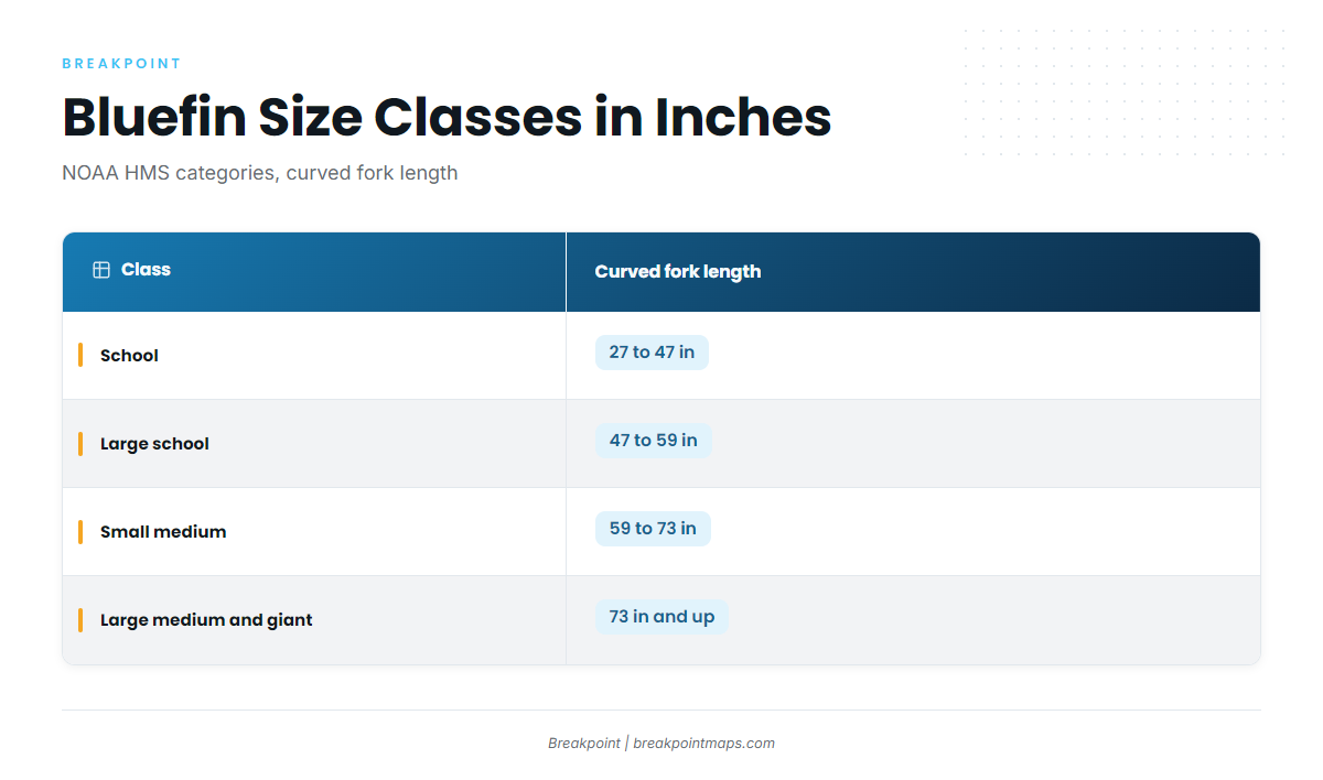
NOAA HMS categories use curved fork length. The 73 in line matters most, because the 2026 Federal Register closure notice uses it as the threshold for General category large medium and giant fish.
| Class | Curved fork length | Typical Northeast zone and tactic | Retention notes (verify) |
|---|---|---|---|
| School | 27 to 47 in | Trolling bars and casting into feeds, Cape Cod Bay and nearshore | Depends on permit category and in-season action. Verify with NOAA HMS. |
| Large school | 47 to 59 in | Trolling bars and casting into feeds, Cape Cod Bay and nearshore | Depends on permit category and in-season action. Verify with NOAA HMS. |
| Small medium | 59 to 73 in | Mixed methods | Depends on permit category and in-season action. Verify with NOAA HMS. |
| Large medium and giant | 73 in and up | Chunking and live bait on Stellwagen, Jeffreys and Tillies | Depends on permit category and in-season action. Verify with NOAA HMS. |
Charter sites describe the size mix very differently, so read these figures as reported rather than typical. High Hook, a Duxbury charter, says the smaller fish it catches are "normally 100-250 pounds." Fish Gloucester says the school fish it catches are mostly 180 to 220 lb. Both are single-operator accounts.
When the fish are here
Sources give a range of June to October or November, with the core roughly July to September. Melton Tackle lists June through October. FishingBooker puts the feeding window at June to November. The American Bluefin Tuna Association says General category vessels target bluefin June to December. Bay State Sportfishing calls July to September "the heart of the season." FishTrack says school-size fish arrive early in summer and that fish start moving south or east from September.
| Month | What sources describe | Notes |
|---|---|---|
| June | Early arrivals, school-size fish showing first | Charter windows begin mid-June in some listings |
| July | Start of the core season | Bay State Sportfishing’s "heart of the season" |
| August | Core season | Fish spread across the bay and banks |
| September | Core season ends; some fish begin moving south or east | FishTrack describes the shift |
| October | Tail of the season | Melton’s window ends here |
| November | Late fish possible | FishingBooker and ABTA extend the window |
Approximate, compiled from charter and industry sources. Timing shifts year to year.
Timing and behavior vary a lot. Melton Tackle’s Cape Cod overview said in January 2026 that "no two years are alike." Some years produce surface feeds and some do not.
Habitat & Conditions in the Atlantic Northeast
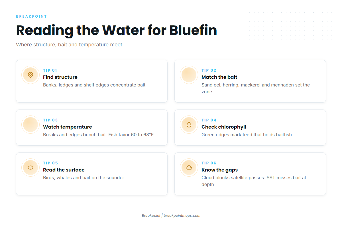
Structure concentrates bait, and bait holds fish. Industry descriptions place Northeast bluefin near "sharp depth changes, offshore banks, and shelf edges."
Bait decides the zone
Four baitfish matter most here:
- Sand eel: Salt Water Sportsman (2024) and Melton Tackle both name it as a driver of inshore bites.
- Herring: Guidesly’s Meat Wagon charter describes fish in 100+ ft of water east and north of Cape Cod chasing herring and mackerel.
- Mackerel: Named by Melton and Guidesly.
- Menhaden (pogies): Salt Water Sportsman (2024) named menhaden, sand eels and Loligo squid as holding fish close to the beach.
The New England Fishery Management Council manages forage species such as herring, not bluefin.
Stellwagen Bank
A Duxbury charter’s estimate puts Stellwagen at a 15 mile run from Duxbury. It is a national marine sanctuary, so check Stellwagen Bank National Marine Sanctuary guidance before you fish it.
Where to start: Work the edges of the bank where bait shows on the sounder. Watch for birds, whales and bait marks before you commit to a spot.
Jeffreys Ledge and Tillies Bank
One Gloucester charter operation says Gloucester has access to Jeffreys Ledge, Tillies Bank, Stellwagen and Cape Cod Bay, which makes it a natural hub for the northern grounds.
Where to start: Begin on the structure itself and look for bait stacked over it. Giants are the usual target here.
Cape Cod Bay and Peaked Hill Bar
Melton Tackle says fishing often happens 5 to 30 miles from shore around Stellwagen, Peaked Hill Bar and Chatham. Cape Cod Bay is where to watch for surface feeds and school-size fish.
Where to start: Look for working birds and bait pushed to the surface, then approach from upwind of the feed.
Chatham and the Great South Channel
Chatham sits at the southern end of this range. Research it through local reports.
Block Island and RI Sound
Research coverage here is thin. Point Judith is the nearest port. Use recent local reports and confirm current rules before you plan a trip around it.
| Zone | Nearest ports | Typical approach | Source note |
|---|---|---|---|
| Stellwagen Bank | Duxbury, Gloucester | Chunking and live bait for giants; trolling for school fish | 15 mile run from Duxbury per a charter |
| Jeffreys Ledge and Tillies Bank | Gloucester | Chunking over structure | Gloucester access per a charter |
| Cape Cod Bay | Cape ports | Casting into feeds, trolling | 5 to 30 miles from shore per Melton |
| Chatham and Great South Channel | Chatham | Local reports needed | No sourced specifics |
| Block Island and RI Sound | Point Judith | Local reports needed | Thin research coverage |
Reading temperature breaks and chlorophyll
A temperature break is an edge where warm and cool water meet, and bait tends to bunch up along it. A chlorophyll edge marks water where feed builds up, which holds baitfish. Neither confirms fish are present, but both help narrow where to look.
SatFish says bluefin favor water between 60 and 68°F. That is an industry source and a general range, not a rule. The High Hook charter notes that upwelling brings bait, whales, seals and tuna. Surface signs still matter: birds, whales and bait on the sounder.
Tide moves bait across structure.
What the data can’t see
- Cloud blocks satellite passes for OBS SST and Chlorophyll.
- Surface temperature says nothing about bait at 80 ft.
- Some seasons never produce surface feeds at all.
Chart layers are not for navigation.
Tactics for the Atlantic Northeast
Match the method to the size class and the zone. Some of these methods have deep local support and some have thin published detail, and we note which is which. General tackle and rigging fundamentals are in the species guide.
Chunking and live bait for 73 in and up
This is the core giant tactic on Stellwagen, Jeffreys and Tillies. Industry coverage describes it the same way:
- Anchor or drift over structure.
- Cut baitfish such as herring or butterfish into chunks.
- Build and keep a steady chum slick.
- Free-line chunk baits at varying depths on 6 to 8 ft fluorocarbon leaders.
Anglers both drift and anchor. Circle hooks pair with this method; see the Regulations section.
Giant tackle and the fight
FishTrack’s guide to New England giants says 99% of bluefin are fought from the stern corner with the rod in a swivel holder. It describes 130-class reels used "more as a winch," with 200-lb mono and backing as standard equipment. That describes what this fleet does, not a minimum for every angler.
Trolling spreader bars for school and large school
Trolling is a search tool that covers water until you find fish. The species guide covers rigging.
Casting stickbaits and jigs into feeds
Melton Tackle says anglers cast stickbaits or fast-sinking jigs into surface feeds. It adds that speed and slow-pitch jigging is growing on offshore banks when fish mark deep. FishTrack describes center consoles with beefed-up spinning gear chasing feeds with poppers.
Kites, balloons and drones
These are advanced methods, and published local detail is thin. We won’t guess at setups. If you want to try them, find someone who runs them regularly and learn the specifics from them.
Sharks and seals
According to the High Hook charter, bait draws whales, seals and porpoise, and pressure on hooked fish is a known problem.
| Size class | Common methods | Gear notes |
|---|---|---|
| School | Trolling bars, casting into feeds | See species guide |
| Large school | Trolling bars, casting into feeds | See species guide |
| Small medium | Mixed methods | See species guide |
| Large medium and giant | Chunking, live bait, stern-corner fight | 130-class reels, 200-lb mono and backing per FishTrack |
Frequently Asked Questions
When is bluefin season in New England?
Sources range from June to October or November, with the core roughly July to September. Melton Tackle lists June through October, while FishingBooker and the American Bluefin Tuna Association extend it into November or later. Timing shifts year to year, so watch current reports.
Do I need an HMS permit on a charter?
The boat’s Charter/Headboat permit covers recreational fishing aboard, so you don’t buy your own for that trip. Ask the captain which permit and endorsement the boat holds, and confirm the details with NOAA Fisheries HMS before you book.
Can I keep a giant bluefin recreationally?
Fish 73 in and up fall under category-specific rules set by NOAA HMS and in-season actions. Whether you can keep one depends on your permit and the current action.
Where do I report a bluefin?
Report recreational landings to NOAA Fisheries HMS through its recreational reporting system, within the window NOAA specifies. Confirm that window on the NOAA HMS site before you land a fish.
Why do bluefin reports change so much week to week?
Bait movement and conditions drive the changes. Charter sources describe everything from 0 to 10 bites per trip, and some years never produce surface feeds. Treat a recent report as a snapshot of that day, not a forecast.
Safety and Handling
Plan your run before you plan your bait. Sourced distances give a starting frame: about 15 miles from Duxbury to Stellwagen, and 5 to 30 miles from shore per Melton Tackle.
Charters leave around 3 to 5 AM and run 8 to 15 hours, per charter sources. On a private boat, plan fuel and set a turnaround time before you leave the dock.
When you fight a fish from a small boat, keep the stern-corner discipline FishTrack describes. Keep your lines clear and your crew out of the fighting area.
When you release a fish, keep it in the water, minimize fight time and revive it before letting go.
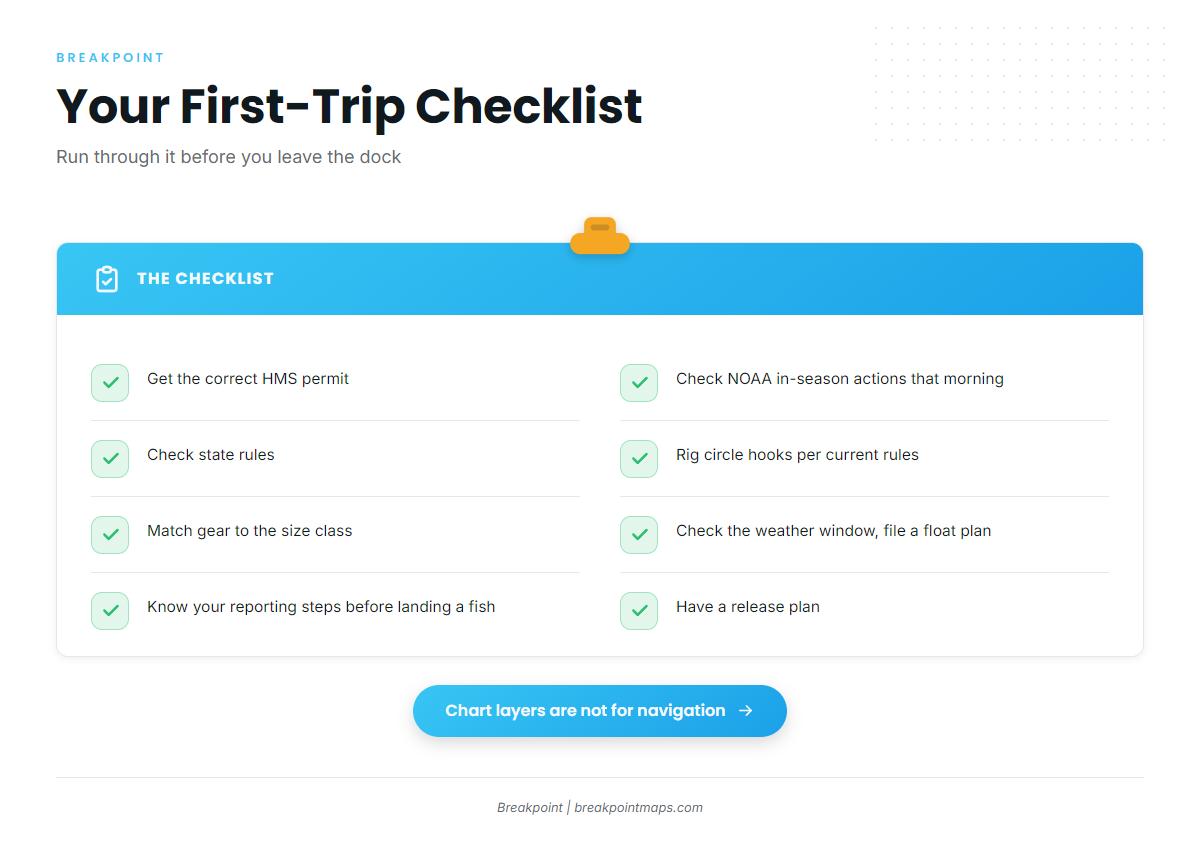
A first-trip checklist:
- Get the correct HMS permit.
- Check NOAA in-season actions the morning you go.
- Check state rules.
- Rig circle hooks per current rules.
- Match gear to the size class.
- Check the weather window and file a float plan.
- Know your reporting steps before you land a fish.
- Have a release plan.
Where to Look Next
Size class sets the zone and the tactic, and permit category sets what you keep. Conditions on the water decide the rest, and each season shifts the details.
To narrow down where to point the bow, Breakpoint’s hotspots feature scores Atlantic Northeast bluefin areas using conditions layers including OBS SST and Chlorophyll. Cloud can block satellite passes, and a score points to where to look, not a guarantee. Chart layers are not for navigation.