Bigeye tuna fishing in the Atlantic Southeast centers on the Gulf Stream, and the fish are an occasional bonus catch here, not a numbers fishery. For biology, gear basics and ID, start with our bigeye tuna species guide. This page assumes you’ve already decided to go.
It covers how to read the Stream from Cape Hatteras south, where productive water sets up, how canyon tactics translate, and what the federal rules require.
NOAA Fisheries lists Atlantic bigeye as overfished but not subject to overfishing, per the 2021 stock assessment. NOAA describes the U.S. fishery as running year-round from Massachusetts to Florida, and U.S. catch is about 1% of the Atlantic-wide harvest. The stock sits under an ICCAT bigeye rebuilding program that runs through 2034 (Rec. 21-01). Rules can move, which is why the Regulations section below is dated.
Many Southeast bigeye come while trolling for yellowfin, so book for the Gulf Stream and treat a bigeye as the upside.
Regional Differences
Off the Southeast, bigeye follow the Gulf Stream rather than canyons.
North of Hatteras, the fleet works named canyons on the shelf edge. From Hatteras south, the Gulf Stream runs close to the shelf, and its western wall, eddies and temperature breaks do the work that canyon walls do farther north. That comes from oceanography, not from catch statistics.
The best-known bigeye ports in the region are Cape Hatteras and Oregon Inlet. Off Hatteras, the "Point" is where the Gulf Stream meets the shelf edge and cooler northern water.
The Mid-Atlantic canyon fishery has a defined rhythm. Capt. Randy Butler told Salt Water Sportsman the canyon season "starts on the first full moon in July and runs through October," yet the same piece says the fish "show up almost anywhere, at almost any time, with little rhyme or reason." Those are Mid-Atlantic bigeye tactics, not Southeast data. No published source we found pins down a Southeast bigeye season. Because published Southeast bigeye data is thin, treat canyon playbooks as a starting point to adapt rather than a proven local pattern.
| Atlantic Southeast | Mid-Atlantic canyons | |
|---|---|---|
| Main driver | Gulf Stream western wall, eddies, temperature breaks, bottom features (Charleston Bump, shelf edge) | Canyon walls and the shelf edge |
| Catch pattern | Often incidental while trolling for yellowfin | Targeted fishery, erratic timing (Salt Water Sportsman) |
| Known hubs | Cape Hatteras, Oregon Inlet (northern anchor) | Norfolk Canyon and canyon ports north |
| Published season data | Not pinned down in available sources | Early July through October (Capt. Butler) |
If you’re booking a charter. A charter’s HMS Charter/Headboat permit covers everyone fishing aboard, per NOAA. Ask the captain how many bigeye they boated last season and on what pattern. Ask whether trips run at dawn and dusk, when the low-light bite happens.
Habitat & Conditions in the Atlantic Southeast
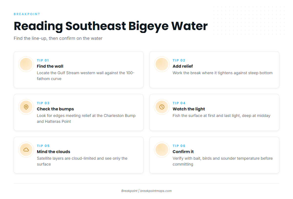
In the Southeast, bigeye water is where the Gulf Stream’s edge, a temperature break and steep bottom line up. That is where we’d look first.
The western wall and temperature breaks
The western wall is the sharp boundary between Stream water and cooler shelf water. Temperature breaks and current edges concentrate bait, and bait draws tuna. Weed lines are a useful surface sign that sits alongside breaks.
Find where the western wall sits relative to the 100-fathom curve, then work the break where it tightens against steep bottom.
The Charleston Bump and the shelf edge off Hatteras
The Charleston Bump is a raised bottom feature that deflects the Gulf Stream and can set up eddies and upwelling downstream. Off Hatteras, the shelf edge and the Point compress currents and bottom relief into a small area.
We can’t attach bite statistics to either feature. Overlay contours on temperature, and look for where the edge meets relief.
Vertical behavior: why depth and light matter
Bigeye live deeper than yellowfin. One Mid-Atlantic canyon guide reports that yellowfin spend roughly 70% of their time above 200 feet, while bigeye commonly hold below 200 feet.
Salt Water Sportsman compares bigeye to swordfish. Shared traits include excellent low-light vision, the ability to raise body temperature in cold deep water, and "a vertical lifestyle that keys around the movements of the squid." Squid go deep by day and rise toward dark, and bigeye follow. The thermocline is the daytime layer where fish and bait stack.
Plan the surface spread around first and last light, and save deep presentations for midday.
What the satellite layers can and cannot see
Each layer answers a different question:
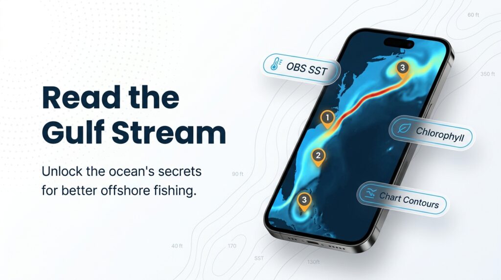
- OBS SST shows surface temperature and edges. Clouds block it, and it shows only the skin of the ocean, not the thermocline where bigeye spend the day.
- Chlorophyll shows color changes and productive water. It is also cloud-limited, and green water is not proof of tuna.
- Chart Contours shows bottom relief, so you can line up edges with structure.
Chart layers are not for navigation.
Use layers to narrow the search, then confirm on the water with bait, birds and temperature on the sounder. Canyon anglers also report that bigeye associate with pilot whales, so a pod is worth a look.
Tactics for the Atlantic Southeast
Fish the low-light windows hard, rig heavy, and treat canyon spreads as a template to adapt. Full ID and tackle fundamentals are in the species guide.
Low-light trolling windows
Salt Water Sportsman reports the best bigeye bite comes at dawn or dusk, as fish follow squid up. Be on the break before first light and stay through sunset.
Spread structure
The canyon spread Salt Water Sportsman describes is a Mid-Atlantic practice that Southeast anglers adapt when trolling Gulf Stream edges:
- Sea Stars close in, off the short rigger.
- Ilanders off a short rigger and one flat line.
- Sea Witches over horse ballyhoo on the long and center riggers.
Heavy tackle for a paper-mouthed fish
Capt. Butler notes bigeye are paper-mouthed, and short fights save fish. His rig is a 25-foot top shot of 200-pound mono, an 8-foot 200-pound fluorocarbon leader and an 11/0 hook. "We’ve gone to International 130s," he said. Deeper tackle discussion belongs in the species guide.
Chunking and drifting
Canyon sources describe drifting as a productive and sometimes safer alternative on crowded grounds at night. Chunking is another option when the trolling bite goes quiet, and bigeye are also taken on cut bait. We have no data on how either performs in the Southeast.
Bigeye vs. yellowfin at the boat
The two fish can look alike at speed. Here is telling bigeye from yellowfin:
- The yellowfin’s second dorsal and anal fins reach farther back than the bigeye’s.
- The bigeye is rounder and thicker in the body.
- Bigeye liver is striated, with lobes of matching size. Yellowfin liver is smooth, with a long right lobe.
A misidentified fish gets misreported, and landing records feed the stock assessments that set future rules.
Safety
Wind blowing against the Gulf Stream current stacks up steep, short seas. Check the forecast against the current direction before you run.
Where to Go From Here
Breakpoint’s hotspots feature scores bigeye tuna across the Atlantic Southeast from the same inputs this page walked through: OBS SST, Chlorophyll and Chart Contours. A score is a place to start looking, not a promise of fish, and a cloudy pass leaves gaps.
Frequently Asked Questions
Do I need a permit to keep bigeye tuna off North Carolina?
Yes, in federal waters. The vessel needs an HMS Angling or Charter/Headboat permit, and it covers everyone aboard, per NOAA. For state licensing, check NC DMF as well.
What is the minimum size for bigeye tuna?
27 inches (69 cm) curved fork length, per the NOAA HMS compliance guide. Verify on the NOAA page before you fish.
How do you tell bigeye from yellowfin?
Look for the shorter second dorsal and anal fins, the thicker body and the striated liver. Correct ID matters because landing records feed stock assessments.
Is there a bag limit on bigeye tuna?
Retention limits vary by species and can change. Check NOAA’s current HMS recreational tuna page.