


Overview
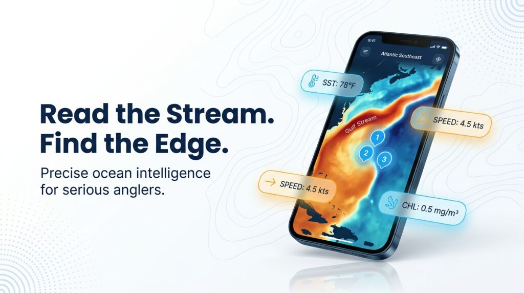
Blue marlin fishing in the Atlantic Southeast depends mostly on how close the Gulf Stream runs to your inlet. For tackle, biology basics, and identification, start with our blue marlin species guide. This page picks up where that one stops.
Blue marlin are warm-water fish. According to the NC Division of Marine Fisheries profile, they migrate seasonally to stay in warm waters near the surface, and they spawn in the North Atlantic from July through September. Where that warm water sits in a given week decides where you should be.
We cover North Carolina, South Carolina, Georgia and Florida’s Atlantic coast: where to start looking and why, which ports and weeks suit a trip, and the rules with their sources. Everything here is built on reading the water: SST, structure and current. The fish don’t follow a calendar.
Regional Differences
Blue marlin don’t school. FishTrack notes that they concentrate along deep-water edges and seamounts where bait is prevalent, traveling mostly in small packs or as individuals. In this region the deep-water edge is the Gulf Stream, so timing and run distance follow the Stream.
Timing Moves North With the Water
Florida’s season runs from May to October, according to the charter marketplace FishingBooker, with Palm Beach high season from April through July. In North Carolina, charter operators out of Atlantic Beach report peak fishing in June and July, with good catches in May and August.
That lines up loosely with the July to September spawning window in the NC Division of Marine Fisheries profile, though we aren’t claiming one causes the other.
Published timing for South Carolina and Georgia is thin. Check current SST rather than relying on a calendar.
Why the Carolinas Have Short Runs
The Stream runs closest to shore off Hatteras, which shortens the run to blue water. Charter operators report warm blue water off the Crystal Coast often within 30 miles of shore, and the Wilmington area reaches the Stream in approximately 40 to 55 miles. These are charter-industry reports, not survey data.
When the Stream pushes inshore, the edge comes to you. When it bows out, you run farther for the same water.
Timing and Run by Port
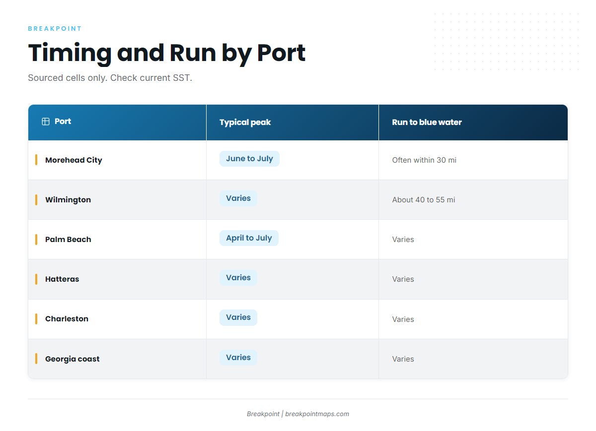
| Port/area | Typical peak | Shoulder months | Approx. run to blue water | Source |
|---|---|---|---|---|
| Hatteras/Oregon Inlet | Varies, check current SST | Varies, check current SST | Varies, check current SST | None sourced |
| Morehead City/Atlantic Beach | June to July | May, August | Often within 30 miles | Saltwater Pros (2026) |
| Wilmington | Varies, check current SST | Varies, check current SST | About 40 to 55 miles | Saltwater Pros (2026) |
| Charleston | Varies, check current SST | Varies, check current SST | Varies, check current SST | None sourced |
| Georgia coast | Varies, check current SST | Varies, check current SST | Varies, check current SST | None sourced |
| Florida east coast (Palm Beach) | April to July high season | May to October season | Varies, check current SST | FishingBooker (industry) |
Swipe the table sideways to see every column.
Versus the Gulf and Caribbean
For context at the region’s southern edge, a Florida Keys charter source reports a fall peak from October into early November when the Stream moves inshore.
On a Charter
Short runs off North Carolina allow half-day and three-quarter-day offshore trips, according to Saltwater Pros. Sort out a few things before you book:
- The boat’s HMS Charter/Headboat permit is a vessel permit. Confirm with NOAA HMS whether clients need anything more.
- Ask about the captain’s release and photo policy.
- Ask whether the day is a blue marlin day or a mixed dolphin and wahoo day.
Habitat & Conditions in the Atlantic Southeast
Start with the Stream edge, then temperature, structure, floating habitat and movement. Chart layers are for planning, not navigation. Run with your plotter and official charts.
Gulf Stream Edges and SST Breaks
Blue marlin have limited ability to regulate body temperature. Their approximate lower temperature tolerance is thought to be about 20 °C (68 °F), though individual fish have been caught in cooler water. Treat that as a rough floor rather than a rule.
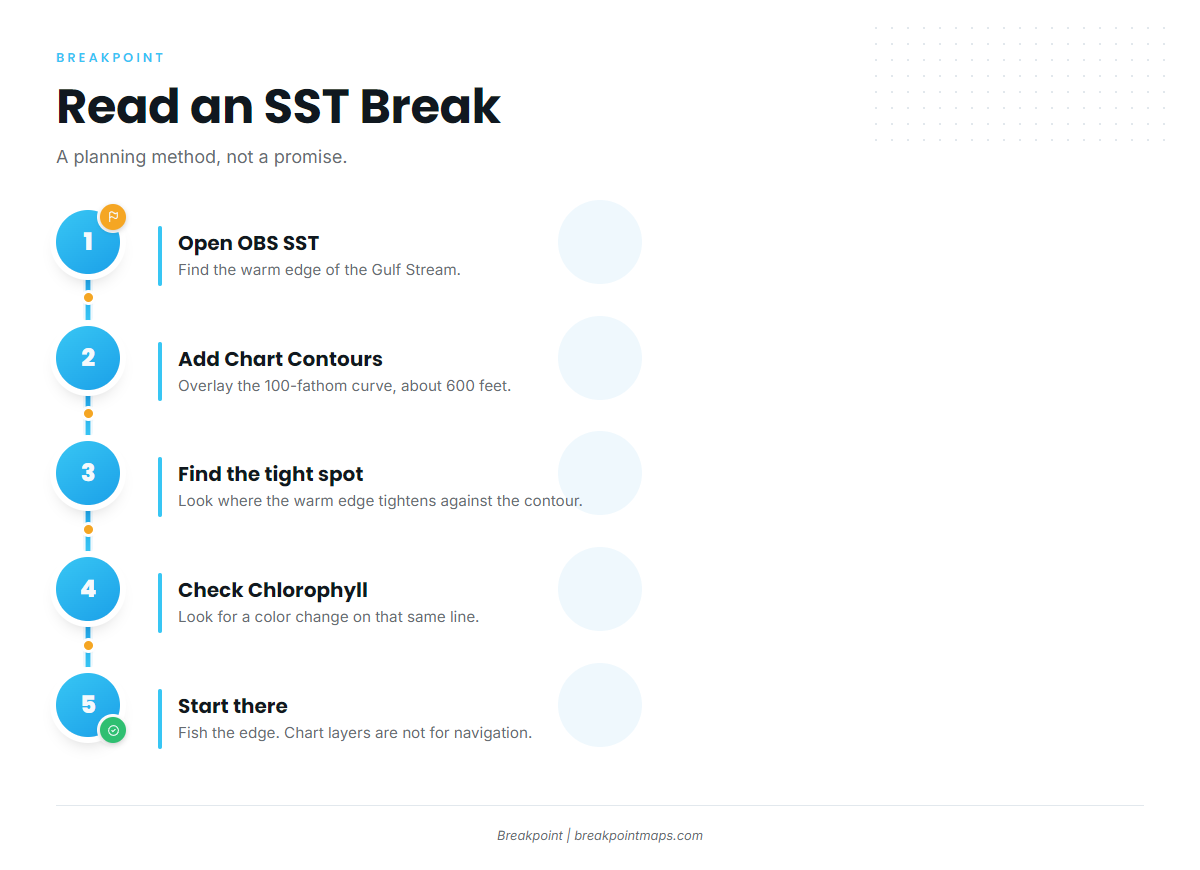
To read a break against the 100-fathom curve (600 feet):
- Find where the warm edge tightens against the contour line on OBS SST and Chart Contours.
- Check Chlorophyll for a color change on the same line.
- Start there.
This is a planning method, and the edge moves.
The Point Off Cape Hatteras
Off Hatteras, the Gulf Stream meets colder water from the north, stacking temperature edges in a small area. Look for the tightest part of the break, and for bait on the color line.
The Charleston Bump
Deep bottom structure off South Carolina deflects the Gulf Stream offshore, setting up eddies and upwelling downstream. Watch for the edge and eddies the Bump creates, as well as the Bump itself. The South Atlantic Fishery Management Council addresses areas like this in its habitat work (Essential Fish Habitat and Habitat Areas of Particular Concern), but that is habitat context, not blue marlin management.
Ledges and Shelf-Edge Structure
Ledges along the North and South Carolina shelf edge matter where the Stream edge crosses them. Structure alone doesn’t hold marlin; structure combined with a temperature or color edge does.
Weedlines and Sargassum
Floating weed holds bait and dolphin, and blue marlin work those lines. Charter operators describe fishing along temperature breaks and weed lines from spring through fall. A weedline sitting on a temperature edge is worth a long pass.
Eddies and Meanders
A meander can move the edge several miles between passes, so yesterday’s numbers go stale fast. If Friday’s satellite pass is clouded out, you are fishing Wednesday’s picture. Plan for the edge to have moved.
What We Don’t Know
Tagging data only tells us so much about regional movement. The Stream’s position also varies from year to year in ways no seasonal table captures. According to NC Division of Marine Fisheries, blue marlin can live more than 15 years, though most fish caught are younger than 10.
Tactics for the Atlantic Southeast
Spread fundamentals are in the blue marlin fishing guide. This section covers what changes off the Carolinas.
The NC Division of Marine Fisheries describes boats pulling up to eight lines at speeds from 4 to 8 knots, with two lines pulled close to the boat on the surface as flatlines. One outfitter blog cites 8 to 10 knots. Sources differ, and we defer to the state agency’s range.
Adjusting the Spread to Stream Conditions
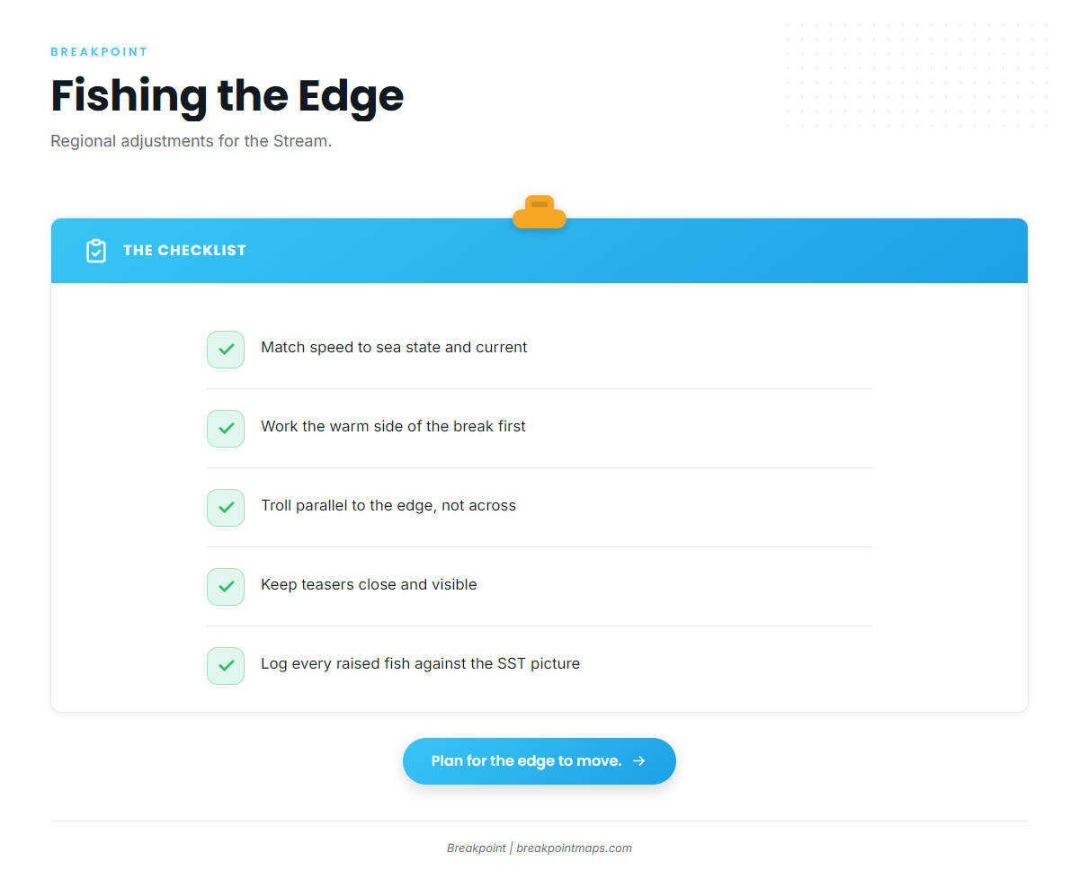
- Match speed to sea state and current direction relative to the edge.
- Work the warm side of the break first, trolling parallel to the edge rather than across it.
- Keep teasers close and visible.
- Log the time and position of every raised fish against the SST picture.
Lures Versus Rigged Ballyhoo
Marlin Magazine notes that trolling skirted lures is one of the more popular ways to target Atlantic blue marlin. Rigged ballyhoo suit mixed-species days when you are also working for dolphin and wahoo. Tournament circle-hook rules change how you rig natural and combination baits; see Regulations below.
Teasers, Pitch-Baiting, and Bait-and-Switch
Use teasers and pitch baits to convert a raised fish. Fish may follow a spread without committing, or short-strike a pitch bait without eating it, so a follow isn’t a failure. In tournaments, pitch baits fall under the circle-hook rule.
Blues on a Dolphin and Wahoo Day
Boats out of Atlantic Beach target blue marlin, yellowfin tuna, dolphin, wahoo and sailfish from spring through fall. Keep one marlin-capable rig in the spread along weedlines. For telling white marlin from blue, see the species guide, since the two species carry different rules.
Frequently Asked Questions
What is the minimum size for blue marlin in the Atlantic?
The federal minimum is 99 inches lower jaw fork length, per NOAA HMS. Tournaments may set higher minimums. Verify the figure in the current HMS Recreational Compliance Guide before you fish.
Do I need an HMS permit on a charter?
The for-hire vessel carries a Charter/Headboat permit. Confirm with NOAA HMS whether clients need anything beyond that. Permits and answers are at hmspermits.noaa.gov or (888) 872-8862.
When is blue marlin season in North Carolina?
Charter operators out of Atlantic Beach report peak fishing in June and July, with good catches in May and August. The Gulf Stream’s position varies by year, so check current SST before you commit to a week.
Are circle hooks required for blue marlin?
In HMS billfish tournaments, NOAA requires non-offset circle hooks with natural or combination baits.
Who manages blue marlin in the Southeast?
NOAA Fisheries’ Atlantic Highly Migratory Species division manages Atlantic blue marlin, not the South Atlantic Fishery Management Council. The council’s role here is habitat context, such as Essential Fish Habitat.
Conclusion
Blue marlin fishing in the Atlantic Southeast starts with the Stream’s position. Find the break against the contour, fish the edge, and confirm the rules before you leave the dock. A clouded satellite pass is a gap in the picture that a guess can’t fill. Breakpoint’s hotspots feature scores blue marlin in the Atlantic Southeast, which gives you a better read on where to start looking. It is a model reading satellite data, not a guarantee, and cloud cover can blind a pass.