


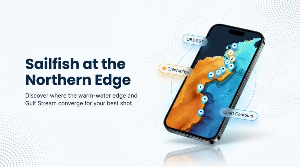
Sailfish do reach the canyons off the Northeast, but they arrive when the water allows it, and no calendar predicts that. For the fundamentals, start with our sailfish species guide. What follows covers when, where and how to approach sailfish fishing in the Atlantic Northeast.
The NC DEQ sailfish species profile describes Atlantic sailfish (Istiophorus platypterus) as occurring offshore from the Gulf of Maine to Brazil. In the Northeast they sit at the northern edge of their range and show up as a conditions-driven bonus. The goal here is to help you read the water so you are in the right place when one does.
Planning comes down to four questions:
- What is different about sailfish here.
- Where to look.
- How to fish.
- What is legal.
Regional Differences
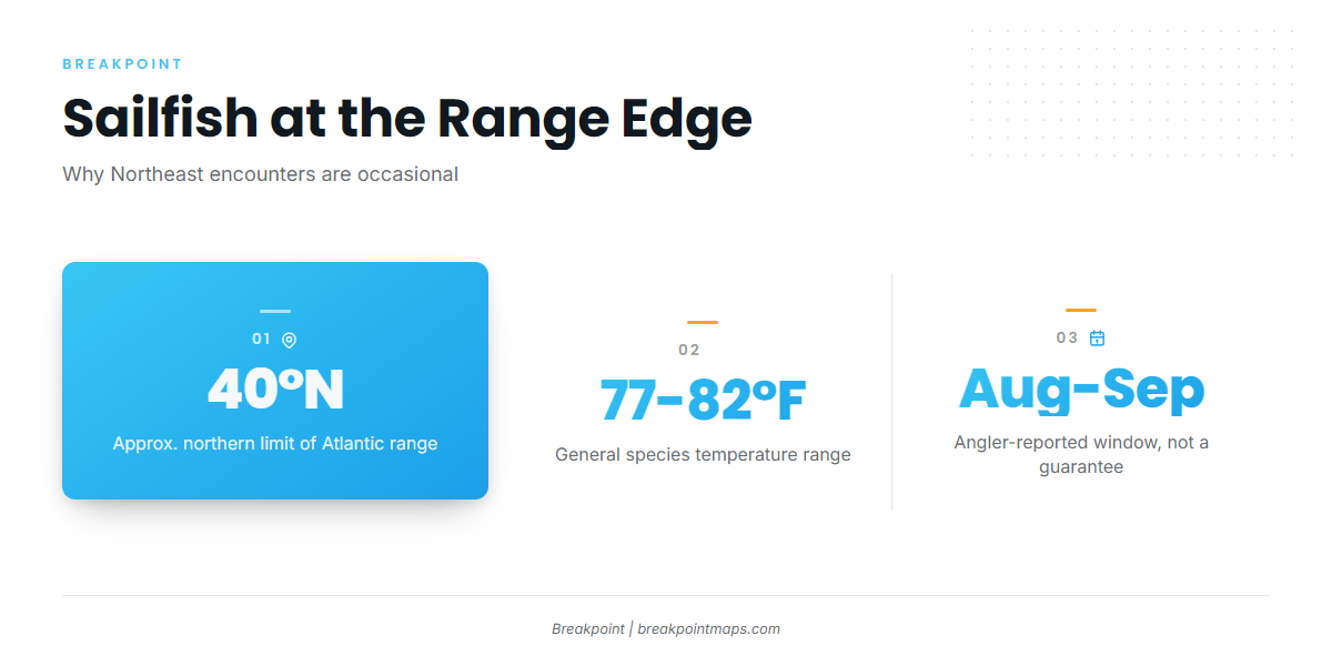
Northeast sailfish appear when warm Gulf Stream water pushes toward the shelf edge in late summer, usually during the white and blue marlin trolling bite and not as a stand-alone fishery.
The Florida Museum’s sailfish profile places the western Atlantic distribution at approximately 40° N to 40° S. Much of the Northeast canyon edge sits near that 40°N limit, which is why encounters are occasional here.
South Florida’s recognized peak is winter. The Northeast window is late summer into early fall, tied to warm-water intrusions. Anglers widely report those months. In South Florida you target sailfish; here you set up for the chance of one.
Sailfish in this region typically come up in spreads rigged for white marlin, blue marlin, tuna and mahi. According to The Fisherman, the species mix in the canyons is mostly yellowfin, bigeye, longfin, blue and white marlin, wahoo and mahi, so a trip still has value when the sailfish doesn’t show.
What we can’t tell you. No agency publishes Northeast sailfish encounter rates, and reports are anecdotal. Treat the fish as a bonus, not a numbers fishery.
Ocean City MD, Cape May, Montauk and Point Judith are the region’s offshore charter hubs. Billfish tournaments such as the White Marlin Open are part of the regional calendar and draw a lot of attention to the mixed billfish bite.
| Factor | South Florida | Atlantic Northeast |
|---|---|---|
| Approach | A fishery you target | A chance you set up for |
| Timing | Winter peak | Late summer into early fall, conditions-driven |
| Typical bite | Sailfish-focused | Mixed spread for marlin, tuna and mahi |
| Data on encounters | Widely reported | No agency encounter rates |
Habitat & Conditions in the Atlantic Northeast
The causal chain is simple: warm intrusions explain when a sailfish might show, and the temperature break and blue-water edge explain where.
The Shelf-Edge Canyons
Hudson Canyon, Baltimore, Norfolk and Washington are the region’s offshore billfish grounds. Watch them when warm water pushes in.
The NC DEQ profile describes sailfish as generally closer to shore than marlins, in depths of 120 to 300 feet. The depth range describes the species overall, not any one canyon. Use Chart Contours to watch the shelf-edge transition and canyon walls.
Warm-Core Rings, Gulf Stream Eddies and Blue Water
Warm-core rings and Gulf Stream eddies pinch off and push warm, clean blue water and bait onto or near the shelf edge. That is when a sailfish encounter becomes possible.
Reading the SST Break and Chlorophyll
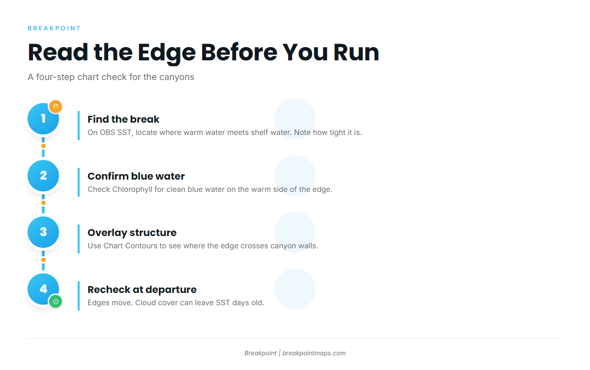
FishTrack’s Northeast canyons guide calls an SST service the key to success in the canyons. Anglers use it to read the shape and location of the temperature break before leaving the dock.
NC DEQ gives a general sailfish range of 77 to 82°F. Treat that as a species-wide range, not a canyon-verified threshold.
A working sequence:
- On OBS SST, find where the warm intrusion meets shelf water and note how tight the break is.
- Cross-check Chlorophyll to confirm clean blue water on the warm side of the edge.
- Overlay Chart Contours to see where that edge crosses canyon structure.
- Recheck close to departure, because edges move.
Cloud cover can block satellite SST passes, so a clear-looking chart may be days old. Chart layers are not for navigation.
Bait, Weed and Signs of Life
Signs of life, including bait, often show before the temperature break itself. Fixed lobster gear can hold life such as mahi, and weedlines and squid are also worth working.
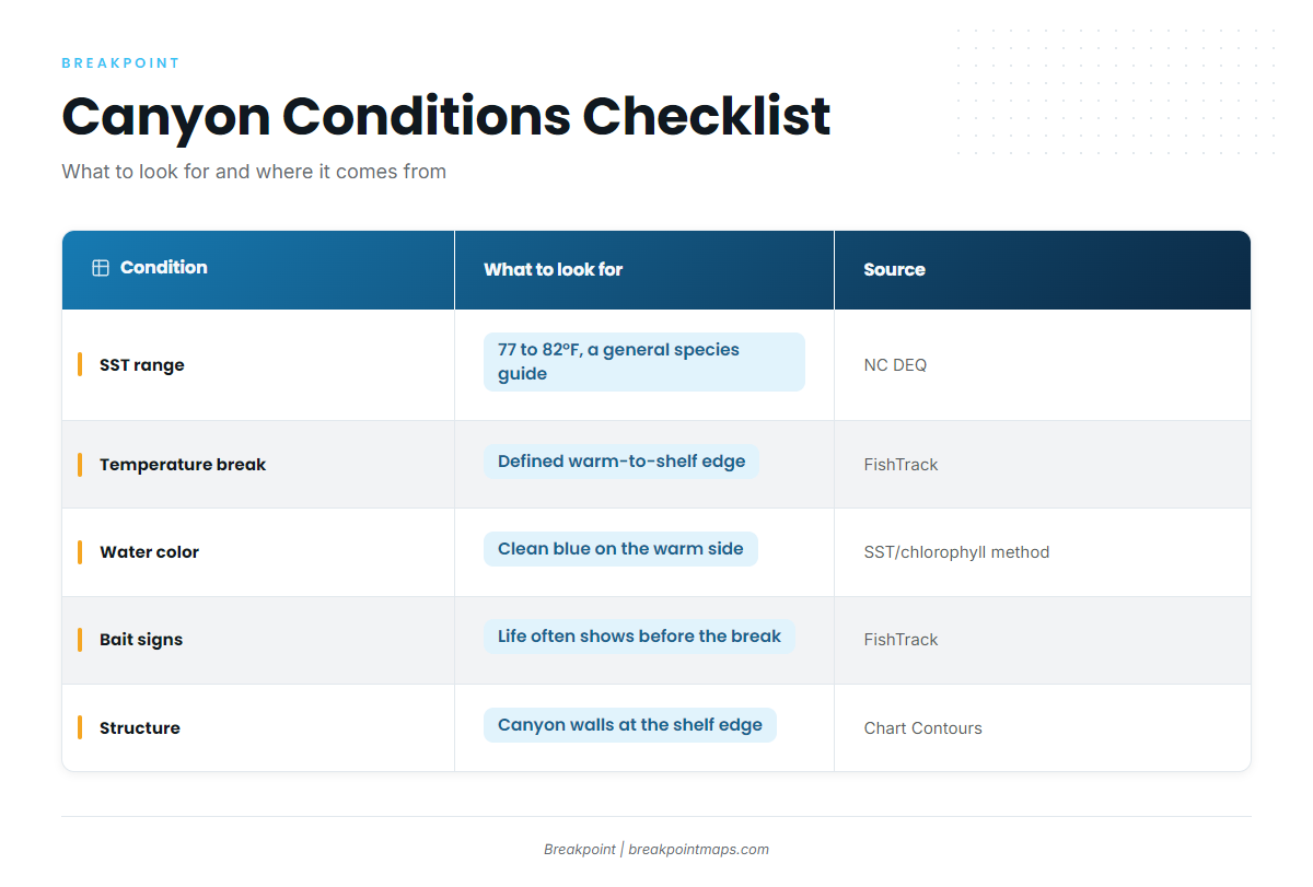
Conditions Checklist
| Condition | What to look for | Source |
|---|---|---|
| SST range | 77 to 82°F general species range; a guide, not a canyon threshold | NC DEQ |
| Temperature break | Defined edge where warm intrusion meets shelf water | FishTrack (practitioner) |
| Water color | Clean blue water on the warm side, confirmed on Chlorophyll | General SST and chlorophyll method |
| Bait signs | Life often shows before the break; fixed gear can hold mahi | FishTrack (practitioner) |
| Structure | Canyon walls and the shelf-edge transition where the edge crosses them | Chart Contours (not for navigation) |
Tactics for Sailfish Fishing in the Atlantic Northeast
Treat the tactics below as a starting point and adjust to what the water shows you.
The Mixed Canyon Spread and Sailfish Adjustments
The Florida Museum says sailfish are usually taken by trolling whole mullet or ballyhoo. FishTrack describes skirted ballyhoo with teasers and dredges off the riggers and cockpit corners. The fundamentals, including circle-hook ballyhoo rigging basics, are covered in the species guide. The canyon-specific changes are below.
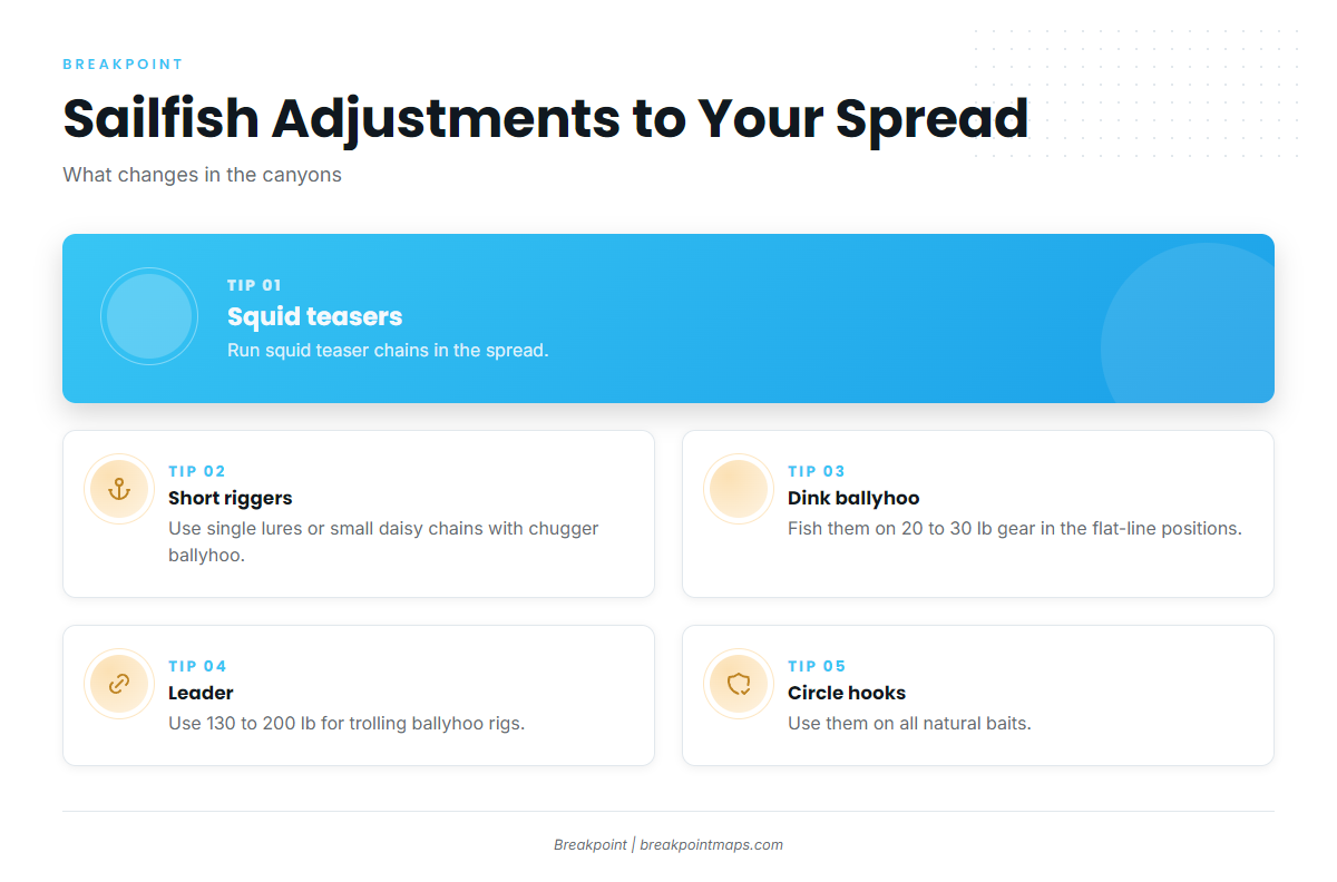
BD Outdoors describes a Northeast canyons mixed trolling spread with these adjustments:
- Run squid teaser chains.
- Swap short-rigger spread bars for single lures or smaller daisy chains with chugger ballyhoo.
- Put dink ballyhoo on 20 to 30 lb gear in the flat-line positions.
FishTrack adds that a 130 to 200 lb leader suits trolling ballyhoo rigs. Use circle hooks on natural baits, and see the Regulations section for the federal rules.
Dinks and Pitch Baits
Dink ballyhoo work like pitch baits already in the water. Keep one ready for a fish raised on a teaser so you can offer it without a scramble.
Sailfish or White Marlin?
Identification matters for rules and reporting. The NOAA HMS compliance guides include identification figures. The tall, sail-like first dorsal fin is the obvious field mark.
Day Trolling vs. Night Chunking
BD Outdoors notes that crews commonly troll by day and chunk at night, depending on season and conditions. The middle of the day, 10am to 3pm, can be slower for tuna. Trolling remains the sailfish method.
Trip Logistics
Per BD Outdoors, a typical canyon trip is an overnighter, commonly 2 to 3 days, though some crews run day trips. Check the weather window and the edge’s location together before you commit fuel.
Questions to Ask Your Captain
- What has the water temperature been doing at the edge in recent days?
- Do you run a billfish spread with circle hooks, or a tuna-first spread?
- What are your release practices, and is the boat covered by an HMS Charter/Headboat permit?
Frequently Asked Questions
When can you catch sailfish in the Northeast?
Late summer into early fall, when warm Gulf Stream water reaches the canyons. That timing is angler-reported and conditions-driven, and no season is guaranteed.
Do you need a permit to fish for sailfish off New Jersey?
In federal waters, yes. NOAA requires an HMS permit. Also check New Jersey’s registry requirements, and verify before you fish.
What water temperature do sailfish prefer?
NC DEQ gives a general range of 77 to 82°F. In the canyons, read the break and look for blue water instead of chasing a single number.
Is a Northeast sailfish trip still worthwhile if none show?
Often, yes. The canyon species mix includes yellowfin, bigeye, longfin, wahoo, mahi and white and blue marlin, so the trip has value beyond the sailfish.
Setting Up for the Chance
The range edge explains why encounters are rare, warm intrusions explain the timing, the temperature break explains the location, the spread explains the method, and the rules keep it legal. Together these make up sailfish fishing in the Atlantic Northeast.
If you want help deciding which edge is worth the fuel, Breakpoint’s hotspots feature scores sailfish in the Atlantic Northeast from habitat, conditions and presence, and shows why each pin is there. It is a decision aid and does not promise fish. Cloud cover can block satellite SST, and chart layers are not for navigation.