


Overview
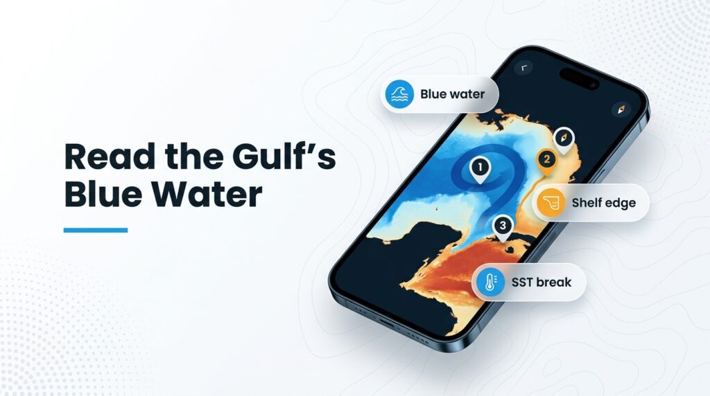
Sailfish fishing in the Gulf of Mexico depends on where the Loop Current pushes blue water, and that varies by coast and season. On the west Florida shelf the water is shallow, so the edge can sit a long way offshore. In most of the northern Gulf, sails are often caught while trolling for other pelagics rather than targeted the way they are on Florida’s Atlantic coast.
This page assumes you know the fish. If you want the fundamentals first, start with our sailfish species guide and come back. Here we cover only what changes in the Gulf.
The page gives a seasonal window for each stretch of coast, a checklist of features to look for on SST and chart layers, local tactics, and regulations. We can’t promise fish, but we can help you decide where to look.
Tagging has not fully resolved how northern Gulf sailfish move, so treat every seasonal pattern below as a tendency rather than a schedule.
| What the Gulf changes | What it means for you |
|---|---|
| Loop Current and eddies | Blue water arrives on its own timetable, not the calendar’s |
| Shallow west Florida shelf | A long run to the edge |
| Northern Gulf effort | Sails often come as a bonus on mahi, wahoo or marlin trips |
Regional Differences
The Gulf is at least five separate sailfish fisheries, and the Loop Current determines which of them are fishing at a given time.
Gulf vs. Atlantic
Florida’s Atlantic coast has the Gulf Stream running close to a narrow shelf, which produces a winter nearshore run. Most of the northern Gulf has no equivalent.
On the Gulf side, timing follows blue water. A Clearwater charter operation notes that the west coast "is relatively shallow" and reports sails "mainly in the spring and summer months as the Loop current pushes deep blue water towards our fishing grounds." That is one operation’s local view, not a study.
Biology helps explain the summer bias. Pew reports that most spawning activity occurs from May to September, and that new research indicates the Gulf is an important spawning ground for Istiophorus platypterus. Some older sources still use I. albicans for the same fish.
Many northern Gulf sails come while trolling for mahi, wahoo or marlin, so the fishery is often opportunistic, with effort concentrated on those other targets. That is a pattern, not a percentage;.
Which Stretch of the Gulf Fits Your Trip
Keys and Dry Tortugas. This is the closest deep water to U.S. Gulf ports, and blue water sits near the reef edge off Key West. Charter sources describe sails caught year-round. Key West also hosts sailfish tournaments each year.
Southwest Florida and Tampa Bay offshore. The shelf is shallow, so it is a long run to the edge. Timing is conflicting: the Clearwater captain says spring and summer, while Reel Coquina, a St. Petersburg charter, says spring and fall, with fish possible year-round.
Panhandle, Alabama and DeSoto Canyon (Destin, Orange Beach). Canyon walls pull deep water closer to port, and Loop Current eddies sometimes push blue water toward the canyon. Timing here is warm-season and anecdotal.
Mississippi and Louisiana (Venice). The features are the river plume edge, the steep shelf off the delta, and platforms. A green-to-blue edge and rig structure both concentrate bait, and sails follow bait.
Texas (Port O’Connor, Port Aransas, South Padre). The runs to blue water are long, and platforms and weed lines matter. Texas also has stricter billfish size limits, covered under Regulations.
Rely on local operators and Mexican regulations.
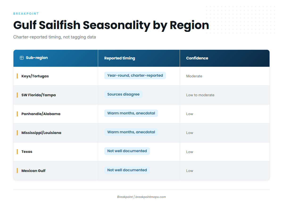
Table 1: Gulf Sub-Region Seasonality
| Sub-region | Key features | Reported timing | Source confidence |
|---|---|---|---|
| Keys and Dry Tortugas | Blue water near the reef edge | Year-round, charter-reported | Moderate, charter-reported |
| SW Florida and Tampa Bay offshore | Shallow shelf, distant edge, Loop Current push | Spring/summer (one captain) or spring/fall (another) | Low to moderate, conflicting charter reports |
| Panhandle, Alabama, DeSoto Canyon | Canyon walls, eddy edges | Warm months, reported anecdotally | Low, anecdotal |
| Mississippi and Louisiana | River plume edge, steep shelf, platforms | Warm months, reported anecdotally | Low, anecdotal |
| Texas | Long runs, platforms, weed lines | Not well documented | Low |
| Mexican Gulf | Not well documented | Not well documented | Low, lightly sourced |
Timing comes largely from charter reports, not tagging data. Treat it as a starting window, and check this week’s water.
Habitat & Conditions in the Gulf of Mexico
Start by locating the blue water, then look for the edge inside it.
The Loop Current. It enters the Gulf through the Yucatán Channel, loops north and exits past the Keys. Eddies that shed from it carry blue water toward the northern Gulf. When an eddy edge sits near your port, the fishing map can change quickly.
The shelf edge and DeSoto Canyon. The 100-fathom curve (600 feet) and the canyon walls are where bathymetry and current edges stack. Bait gets pushed against structure, and predators know it.
Surface cues you can see and map:
- SST breaks where warm and cool water meet
- Color changes, where green water meets blue
- Sargassum weed lines
- The Mississippi River plume edge
Platforms. Oil and gas platforms hold bait in otherwise featureless water. In the northern Gulf, that matters more than it would on a reef-lined coast.
What the data can’t see. Cloud blocks satellite SST passes, a current forecast is only a forecast, and chart layers are not for navigation. Check the age of your last clean image before you trust an edge.
Pre-Trip Feature Checklist
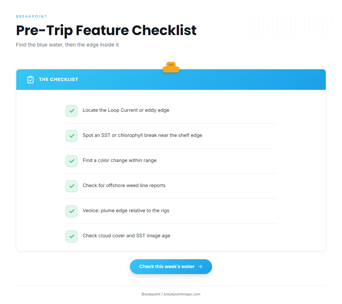
- Where is the Loop Current or the nearest eddy edge this week?
- Is there an SST break or a chlorophyll edge near the 100-fathom curve on your side of the Gulf?
- Is there a color change within range, and is it holding or moving?
- Have weed lines been reported offshore?
- Venice only: where is the plume edge sitting relative to the rigs?
- Is cloud cover hiding the latest SST pass? If so, how old is your last clean image?
Tactics for the Gulf of Mexico
Match the tactic to the feature: troll the edges, bait the rigs, and keep a pitch rod ready.
Troll edges and weed lines. The Florida Museum sailfish profile says Atlantic sailfish are usually hooked by trolling whole mullet or ballyhoo. In the northern Gulf, a mixed spread built for mahi, wahoo and sails is common, which is also why so many sails show up as bycatch.
Live bait around rigs. Slow-trolling or drifting live baits near platforms puts a bait where the structure holds fish. Reel Coquina reports using live sardines, cigar minnows and pilchards, plus flat-lining live bait. That is one operation’s method, so adjust to what your local bait supply allows.
Keep a pitch rod rigged. Sails that rise into the spread often need a bait in front of them quickly, so have one ready before you need it.
Circle hooks and drop-back. Drop back, let the fish turn and swim, then come tight without a hard hookset. Circle hooks support release survival. The legal requirement is in Regulations below;. Rigging basics are in our sailfish species guide.
Frequently Asked Questions
When is sailfish season in the Gulf of Mexico?
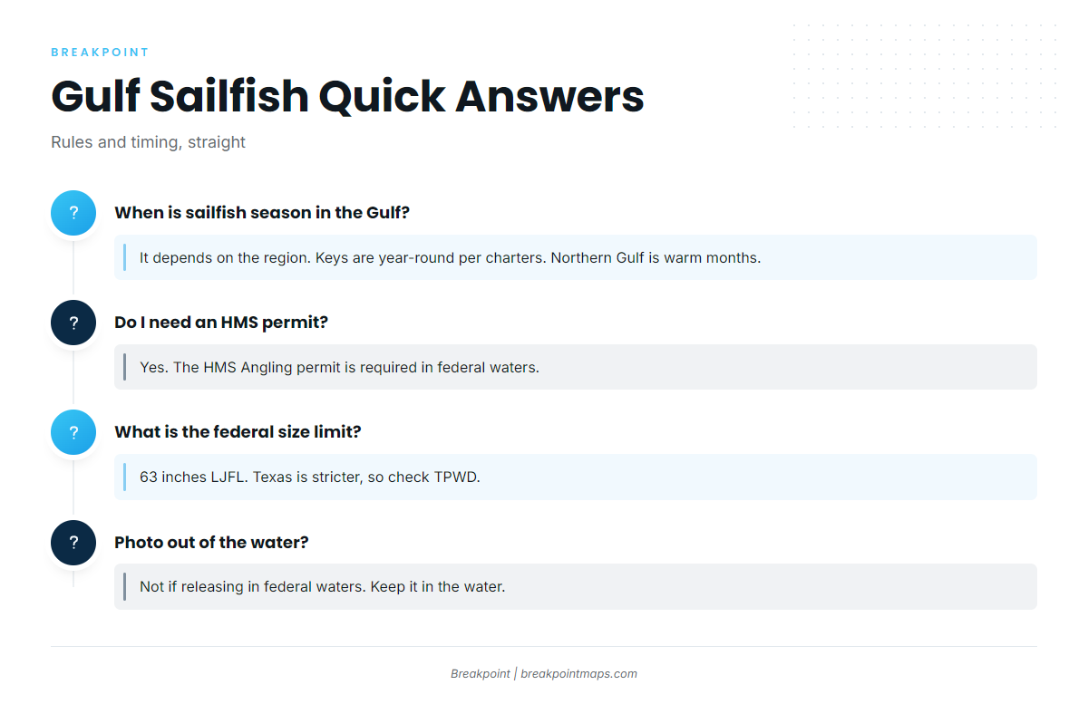
It depends on the sub-region. Charter sources report sails caught year-round off the Keys. Southwest Florida captains report spring and summer, or spring and fall. In the northern Gulf, sails show up mostly in warm months, often as incidental catch. See Table 1.
Do I need an HMS permit for sailfish?
Yes. Per FWC, an HMS Angling permit is required in federal waters. Charter boats carry their own HMS permit, so confirm their category with your captain. Check NOAA Fisheries HMS for current permit details.
What is the sailfish size limit in Texas vs. federal waters?
The federal minimum is 63 inches lower jaw fork length. Texas sets a stricter billfish minimum than the federal rule. Check the current figure with Texas Parks and Wildlife before you fish.
Can I take a sailfish out of the water for a photo?
Not if you are releasing it in federal waters. Federal rules require that a released billfish stay in the water. Cut the leader near the hook or use a dehooking device, and keep the fish wet.
How do I tell a sailfish from a white marlin?
Look for the tall, sail-like first dorsal fin on a sailfish. Their size limits differ, so identification matters. If you are unsure which fish you have, release it.
Before You Run
Breakpoint’s hotspots feature scores sailfish in the Gulf of Mexico, which gives you a starting point for where to look this week. It works from satellite data, so a cloudy pass can leave gaps, and chart layers are not for navigation.