Wahoo fishing in the Atlantic Northeast, roughly New Jersey through the southern New England canyons, depends on warm water and timing. The fish (Acanthocybium solandri) sits at the northern edge of its range here. Most anglers hook one while trolling for tuna, mahi or marlin, and it shows up when Gulf Stream water does. On The Water describes wahoo in the Northeast canyons as a rare catch, a chance encounter when targeting tuna and marlin.
No one can say whether warm water will reach the canyons in a given week, so no one can promise wahoo. This page can help you decide where to look and how to set up when the water is right.
If you want the fundamentals first (biology, general rigging, why speed matters), start with our wahoo species guide. This page covers what changes in the Northeast:
- Why this region fishes differently from the rest of the Atlantic
- Where to look on the charts
- How to adjust a canyon spread when wahoo water sets up
- A cited rule table you can check before you go
Regional Differences
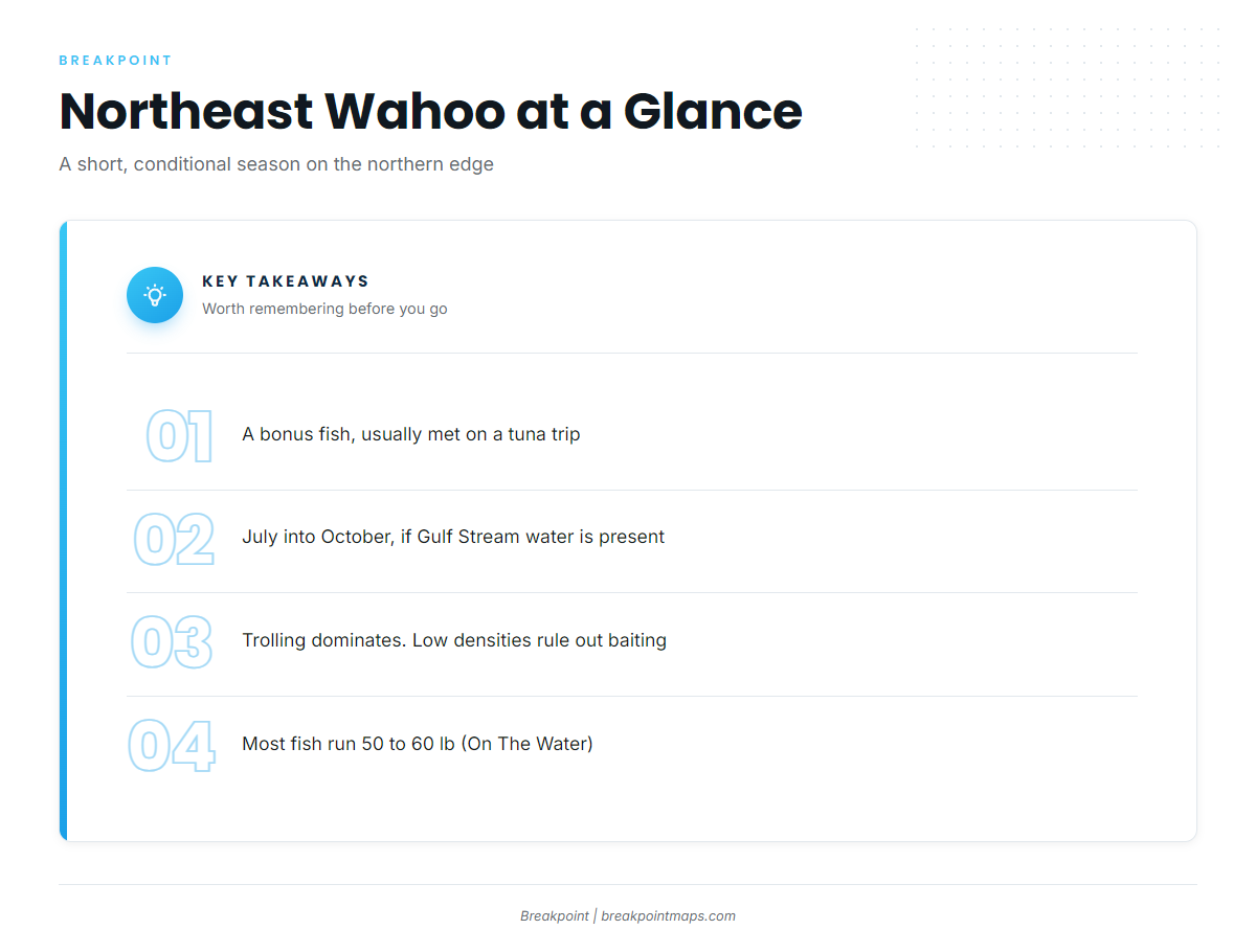
In the Northeast, wahoo are a short-season, Gulf Stream-dependent bonus fish, usually found on hard temperature breaks along the canyon edges. Most of what follows comes from On The Water’s regional reporting. Much of the tactical record here is angler accounts and magazine reporting rather than survey data, and we flag it that way.
Short, conditional season. On The Water says wahoo can be caught from near-shore to offshore waters in the Northeast from July into October, as long as warm Gulf Stream water is in the area. One angler’s account narrows that to mid-August through September on the hardest temperature breaks.
Low densities, so baiting rarely works. On The Water notes that chunking and live baiting routinely produce wahoo in southern waters, but concentrations here are too low for that to be a viable plan. This is why trolling dominates.
Bite-offs. The same author describes clean bite-offs of mono-rigged baits as the usual sign that wahoo were there. A bite-off on the break is information about what’s in the water.
The cold side of the break. From that same angler’s account: "More often than not, the hits came on the cold side of the break." One angler’s experience is not a rule, but it shows where he found them.
Typical size. On The Water reports that most Northeast wahoo weigh 50 to 60 lb.
Timing and Expectations at a Glance
| Item | What the sources say | Source |
|---|---|---|
| Season window | July into October, if Gulf Stream water is present | On The Water |
| Anecdotal peak | Mid-August through September | One angler’s account, On The Water |
| Typical size | 50 to 60 lb | On The Water |
| How you’ll meet one | Usually a bonus fish on a tuna, mahi or marlin trip | On The Water |
| Run length example | Hudson Canyon from New Jersey: 75 miles or more each way, usually an overnight trip | My Fishing Cape Cod |
Habitat & Conditions in the Atlantic Northeast
Northeast wahoo follow Gulf Stream water onto the shelf edge, so the search starts with warm-core eddies and ends on a hard break over canyon structure. The subsections below follow the order we would work it on the charts.
One limit applies throughout: clouds block satellite SST passes, and conditions shift between the chart you read at the dock and your arrival 75 miles out.
Warm-core eddies and the Gulf Stream
Through spring, summer and fall, the Gulf Stream spins off warm-water eddies that move into the canyon country. There they converge with the colder water of the Labrador Current, and that convergence is the setup to look for.
On an SST chart, find where the warm lobe’s boundary crosses the canyon heads and the shelf edge, and where the isotherms stack tightly. When cloud hides the SST, altimetry (sea-surface height) can still outline an eddy.
Canyons and the shelf edge
The canyons are sharp cuts in the continental shelf, formed by prehistoric glacial melt, along the line where the shelf drops to the abyssal plain. How the canyons formed matters because that structure concentrates bait along the shelf edge and the 100-fathom line (600 feet).
Hudson Canyon and Veatch Canyon have sourced examples. A report from Veatch’s west wall describes a crew trolling that wall and catching 2 wahoo over 60 lb, along with yellowfin. The same report says runs to the Hudson of 75 miles or more each way are common out of New Jersey, so most crews make it an overnight trip.
Block, Atlantis and Hydrographer are also Northeast canyons.
Temperature breaks and color changes
On The Water’s angler reports his wahoo on the hardest breaks in 120 to 240 feet (20 to 40 fathoms), mid-August through September, with most hits on the cold side. The same author says fish tolerate water down to about 65°F when warm water is close.
A Hull Truth forum report describes wahoo on "a sharp temp break from 69 to 75." That is a single forum post, so 69 to 75°F is one data point and not a threshold.
On the chart, a hard break shows as tightly packed isotherms. Check the Chlorophyll layer too: a green-to-blue color edge that lines up with an SST edge is a stronger candidate than either signal alone. Check both before you commit fuel to a 75-mile run.
Floating structure: debris, pot buoys and weed
Canyon crews also fish weedlines and lobster pot lines, the "high flyers." ROFFS describes debris and pot-line fishing in the canyons, including one day when a captain trolled past a large chunk of debris and had 12 rods go down at once. They worked it for 6 hours and caught 2 white marlin, 6 wahoo, 3 big mahi, yellowfin, albacore and scores of school mahi. That is one notable report and not something to expect.
Conditions checklist
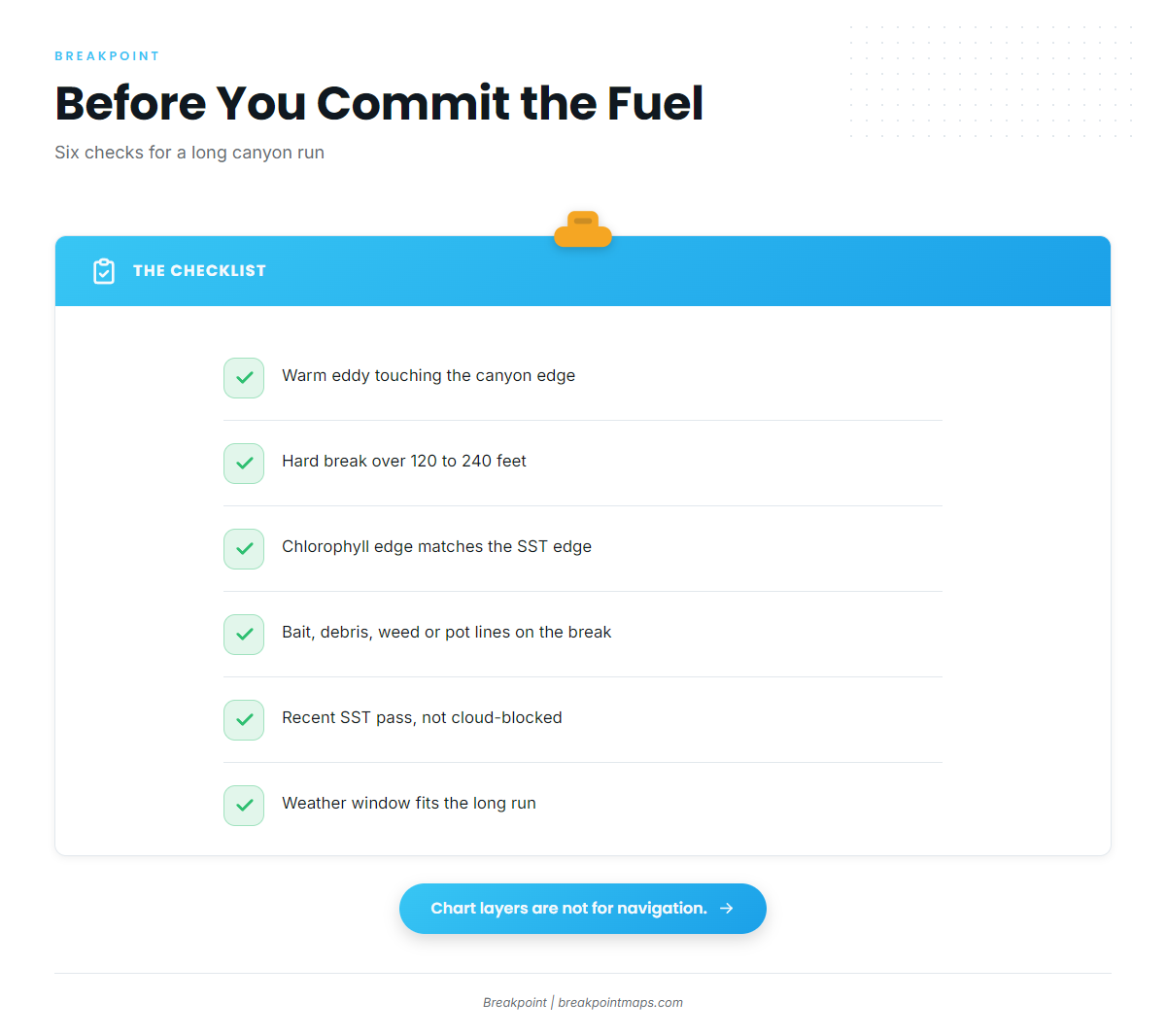
Run through these before and during the trip:
- Gulf Stream water or a warm-core eddy touching the canyon edge on SST or altimetry
- A hard break over 120 to 240 feet, per On The Water
- A color edge on Chlorophyll that matches the SST edge
- Bait, floating debris, weed or pot lines on the break
- A recent SST pass that is not cloud-blocked
- A weather window that fits the long run
These are long offshore trips, so plan fuel and weather accordingly.
Tactics for Wahoo Fishing in the Atlantic Northeast
On a Northeast canyon trip, the practical wahoo move is a midday switch: wire-rigged plugs in the prop wash, run faster than your tuna spread. The rigging fundamentals are in the species guide. The rest of this section covers what changes in the canyons.
The speeds and spreads below come from two regional publications. Treat them as starting points, not proven formulas.
The midday wahoo spread
On The Water describes switching to a wahoo spread while trolling the canyons at midday: a couple of wahoo plugs, such as a Rapala deep-diving X-Rap or a Braid Marauder, rigged on wire and fished off flat lines in the prop wash at 7 to 8 knots. That fits alongside a daytime tuna program. The same source describes an 8-line mixed spread of ballyhoo, marlin lures, a daisy chain, a spreader bar and squid-chain teasers.
Salt Water Sportsman advises keeping wahoo tackle ready whenever you are searching for tuna, marlin or mahi. The plugs go on the flat lines, and the switch happens midday, when the bigeye bite is less of a factor.
Speed and wire
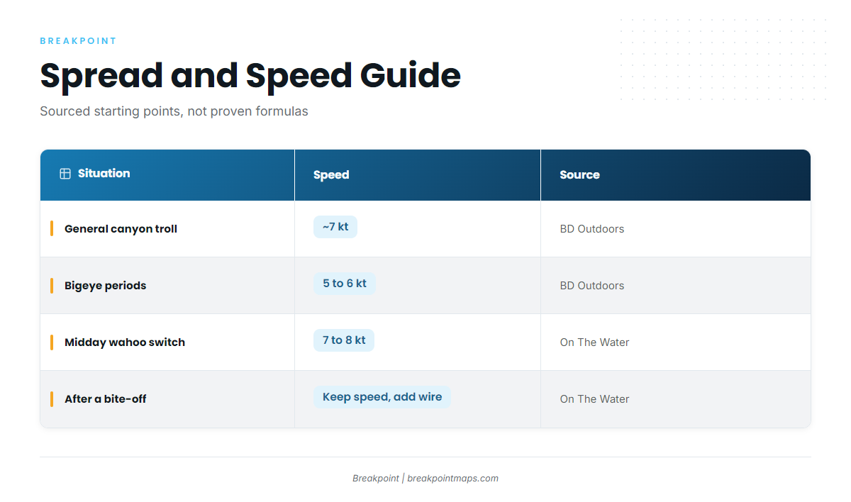
BD Outdoors gives its average canyon trolling speed as about 7 knots, slowing to 5 to 6 knots during bigeye time and rising to 7.5 to 8 knots midday.
On The Water calls strong hooks, split rings and wire leaders a must for wahoo, and says to add wire behind the trolling leads once wahoo bite. Because mono bite-offs are how many Northeast wahoo reveal themselves, a bite-off on the break is the cue to add wire.
One tackle note from FishTrack’s source: 30 and 50 Tyrnos and 80-class Tiagras for canyon trolling.
| Situation | Speed | Rigging note | Source |
|---|---|---|---|
| General canyon troll | About 7 kt | Mixed spread | BD Outdoors |
| Bigeye periods | 5 to 6 kt | Tuna spread | BD Outdoors |
| Midday wahoo switch | 7 to 8 kt (7.5 to 8 kt per BD Outdoors) | Deep-diving plugs on wire, flat lines, prop wash | On The Water, BD Outdoors |
| After a bite-off | Keep current speed | Add wire behind leads | On The Water |
Working structure and a hooked fish
When you find debris or a pot line, make repeat passes, the method ROFFS describes. Per On The Water, a live wahoo on deck is dangerous, so subdue it before you take photos.
Frequently Asked Questions
When is wahoo season in the Northeast?
On The Water says wahoo can be caught in the Northeast from July into October, but only when warm Gulf Stream water is in the area. One angler’s account narrows the best window to mid-August through September on the hardest temperature breaks. That is anecdote, not survey data.
What is the federal wahoo bag limit?
NOAA Fisheries lists the recreational bag limit at 2 fish per person.
Do Northeast charters target wahoo?
According to On The Water, the sources we found describe wahoo as a chance encounter on tuna and marlin trips. If wahoo matter to you, ask the captain whether a midday wahoo spread fits the trip.
Where Breakpoint Fits
Three things matter most for wahoo fishing in the Atlantic Northeast: warm water, a hard break over canyon structure, and a midday switch to wire and speed.
Breakpoint’s hotspots feature scores wahoo in the Atlantic Northeast using layers like OBS SST, Chlorophyll and Chart Contours, and shows you why each pin is there. A score is a guide to where to look and does not promise fish, and a cloud-blocked SST pass limits what any score can see. Chart layers are not for navigation.