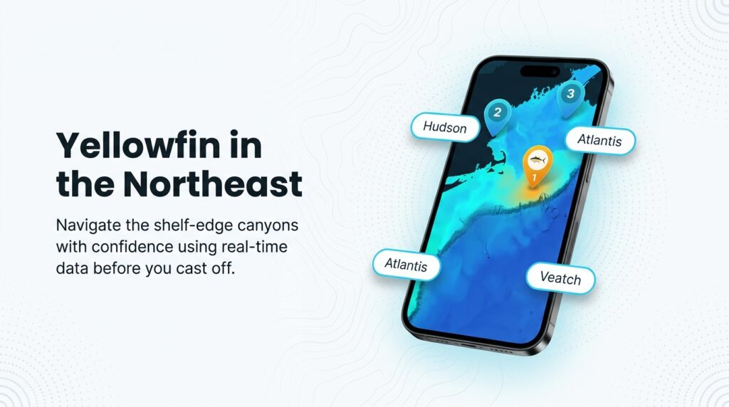
Yellowfin tuna fishing in the Atlantic Northeast centers on the shelf-edge canyons: Hudson off New Jersey and Long Island, and Atlantis and Veatch off Southern New England. In some years fish also push onto inshore lumps in 120 to 240 feet. Yellowfin begin arriving in the canyons between late June and early July, according to yellowfin arrival in the canyons reporting from FishTrack. Party-boat chunking runs from late August into early November, per The Fisherman. Anglers troll by day and chunk and jig at night and into the fall.
For the fundamentals (biology, general tackle, why yellowfin fight the way they do), start with our yellowfin tuna species guide. This page covers what changes when you fish them from Northeast ports. Where the fish sit shifts year to year, and sometimes week to week.
Regional Differences
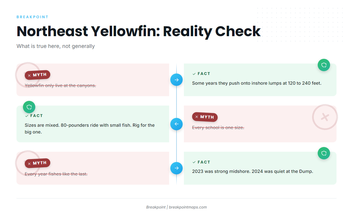
Four things set this fishery apart from the general picture, and one open question runs under all of them.
Canyons and inshore lumps. Marlin and Salt Water Sportsman report that in summer, as the water warms, many yellowfin move inshore onto 20 to 40 fathom lumps and humps (120 to 240 feet) and feed on sand eels. Trolling for yellowfin in the mid-Atlantic is nothing new. A focused spin and topwater fishery on these fish is newer, and the inshore topwater yellowfin fishery has grown up around it. The Fisherman adds that fish sometimes show "as close as 15 miles from the beach," particularly in August and September.
Mixed-size schools. Bluefin tend to school with similar-size fish, while yellowfin sizes vary quite a bit. One angler quoted by Salt Water Sportsman put it this way: "the 80-pounders are just randomly mixed in." Size your tackle for the biggest fish that could be in the school, not the average one.
Overlap with other tuna. Bigeye, bluefin and albacore share the canyons. On The Water’s 2024 recap reported that yellowfin were at times so abundant they were a nuisance to crews targeting 200-pound bigeye. Correct identification matters because the rules differ by species, so check the NOAA species resources. In August 2025, recreational bluefin closed for the season, according to On The Water, which pushed more effort onto yellowfin and bigeye.
Year-to-year variability. Yellowfin action was strong in 2023. In 2024, the Dump was mostly quiet and midshore fish were few. On The Water’s 2024 recap described a slow summer at Atlantis and Veatch, while boats that could reach Munson found strong fishing. Good water moved west in September for a short fall window at Veatch and Atlantis, and September storms then disrupted the bite. Some years the fish never come inside the shelf edge.
What we still don’t know. University of Maine and NOAA Southeast Fisheries Science Center researchers, including Walt Golet and Joe Dello Russo, have studied these fish by tagging. University of Maine tagging work reports more than 100 pop-up satellite tags deployed since 2010, including in the Northeast Canyons. Individual fish were tracked for up to 319 days, and 5 Northeast-tagged fish were recaptured off Africa. Researchers are still working out whether the fish seen here each year are the same group, and the question is not yet settled.
Habitat & Conditions in the Atlantic Northeast
Planning a yellowfin trip here comes down to a port, a month and a forecast that holds. What follows covers where the fish are, when they show up, and what to read before you commit the fuel.
Grounds by port
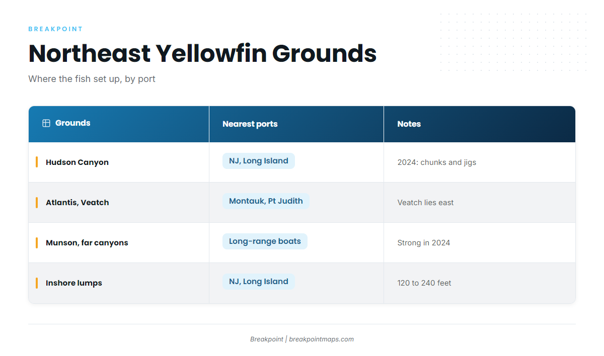
| Grounds | Nearest ports | Notes |
|---|---|---|
| Hudson Canyon | New Jersey, Long Island | In 2024, fish loaded in during late summer and took chunks and jigs, day and night (On The Water) |
| Atlantis and Veatch canyons | Montauk; Point Judith and Newport | Veatch lies east of Atlantis, closer to Point Judith or Newport than to Montauk |
| Munson and far canyons | Longer-range boats | Strong fishing in 2024 while closer canyons were slow (On The Water) |
| Inshore lumps and humps | NJ, Long Island | 120 to 240 feet, in years when fish push inshore (Marlin, Salt Water Sportsman) |
Marlin puts the run to the canyons at 50 to 100-plus miles, depending on where you leave from. That distance drives the fuel decision.
Season timeline
Treat each of these as a dated observation, not a rule:
- Late June to early July: yellowfin begin arriving in the canyons (FishTrack).
- August and September: some years bring inshore pushes, sometimes within 15 miles of the beach (The Fisherman).
- September 2024: good water moved west to Veatch and Atlantis for a short window (On The Water).
- Late August to early November: party-boat chunking season (The Fisherman).
- Mid-August 2025: one On The Water report noted a slight lull in the bite after the full moon.
Eddies and temperature breaks
Eddies steer where the fish travel. On the west side of an eddy, the side closest to shore, current often runs north to south. Fish typically move with the current, so you troll with it. The Fisherman describes trolling with the eddy current while looking for the temperature break at the edge of the eddy or a warm finger of water.
Chlorophyll
Chlorophyll is a secondary signal. Marlin notes that tuna school on the leading edge of warm eddies, temperature breaks and water-color changes. A color change on the chart can confirm an edge you already found in the temperature data, but it rarely finds one for you.
Go signals
Captains run canyon trips when two things line up:
- A clearly defined warm finger of Gulf Stream water pushing onto the canyon’s western wall.
- A multi-day forecast that holds.
Party boats generally will not sail in winds above 25 mph, per The Fisherman. Weather cancels many canyon trips, so pick backup dates.
What the data cannot see
Cloud blocks satellite SST passes, so a clear chart may be a day or two old. Surface temperature says nothing about bait or about what is happening at depth. Use the data to choose where to look first, and expect it to be wrong sometimes.
Tactics for the Atlantic Northeast
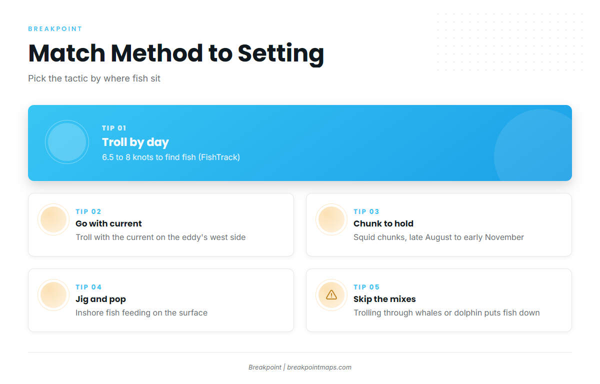
Pick the method by where the fish are. Troll to find fish by day in the canyons, chunk to hold them at night and in fall, and jig or pop fish feeding at the surface inshore. General tuna rigging is covered in the species guide, so this section sticks to what is specific to these waters.
Daytime trolling
Troll at 6.5 to 8 knots, per FishTrack. A typical Northeast spread mixes skirted ballyhoo, spreader bars, daisy chains and big swimming plugs. FishTrack recommends this setup for yellowfin:
- 50-pound tackle
- 50-pound monofilament on the reel
- A 25-foot wind-on leader of 150-pound mono
- A 10-foot leader of 130-pound test, joined with a wind-on swivel
Troll with the current on the west side of an eddy. Trolling through whales, dolphin, skipjack or albie schools is likely to put the fish down, according to Salt Water Sportsman.
Chunking
Squid is the primary chunking bait, per FishTrack. Party-boat chunking runs from late August into early November, according to The Fisherman. In 2024, Hudson Canyon produced on chunks both day and night, per On The Water. The method, the bait and the season are what we can support.
Jigging and popping
Inshore, a focused spin and topwater fishery has grown up on fish over the lumps, per Salt Water Sportsman. An August 2025 On The Water report noted poppers and live chumming with small baits like peanut bunker inshore. Jigs also worked at Hudson Canyon in 2024.
Frequently Asked Questions
When do yellowfin show up in the Northeast?
Yellowfin begin arriving in the canyons between late June and early July, according to FishTrack. Party-boat chunking season runs from late August into early November, per The Fisherman. Timing varies by year, so treat these as typical windows rather than guarantees.
How far are the canyons?
Marlin puts the canyon run at 50 to 100-plus miles, depending on your port. In some years, fish show up much closer. The Fisherman reports fish sometimes appearing as close as 15 miles from the beach, particularly in August and September.
Who manages yellowfin tuna in the Atlantic?
NOAA Fisheries’ Atlantic HMS division manages Atlantic yellowfin under ICCAT recommendations. The Mid-Atlantic and New England councils do not set yellowfin rules. Confirm current details on the NOAA HMS site before you fish.
Do I need an HMS permit on a charter?
For-hire vessels fall under the HMS Charter/Headboat permit category. Private boats use an HMS Angling permit. Check NOAA Fisheries HMS for who holds the permit on your trip and for any current requirements.
Where to look next
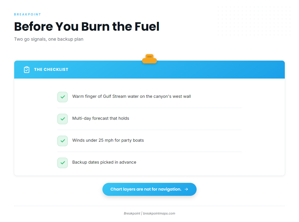
The grounds are the canyons and, some years, the inshore lumps. The go signals are a defined warm finger on the western wall and a forecast that holds.
Breakpoint’s hotspots feature scores yellowfin tuna across the Atlantic Northeast using layers like OBS SST and Chlorophyll, which helps narrow where to look before you burn the fuel. Cloud cover blocks satellite passes, and a score is a starting point rather than a prediction. Chart layers are not for navigation.