Overview
According to NC DEQ’s yellowfin tuna profile, North Carolina anglers land more pounds of yellowfin tuna than anglers in any other state. The state calls yellowfin the primary species supporting its offshore charter fleet.
We define the Atlantic Southeast here as North Carolina, South Carolina, Georgia and Florida’s Atlantic coast. This page covers the region-specific questions: which edges and grounds to check, when, how local crews fish them, and which permits and licenses apply. For biology, general gear and identification basics on yellowfin tuna (Thunnus albacares), start with our yellowfin tuna species guide and come back.
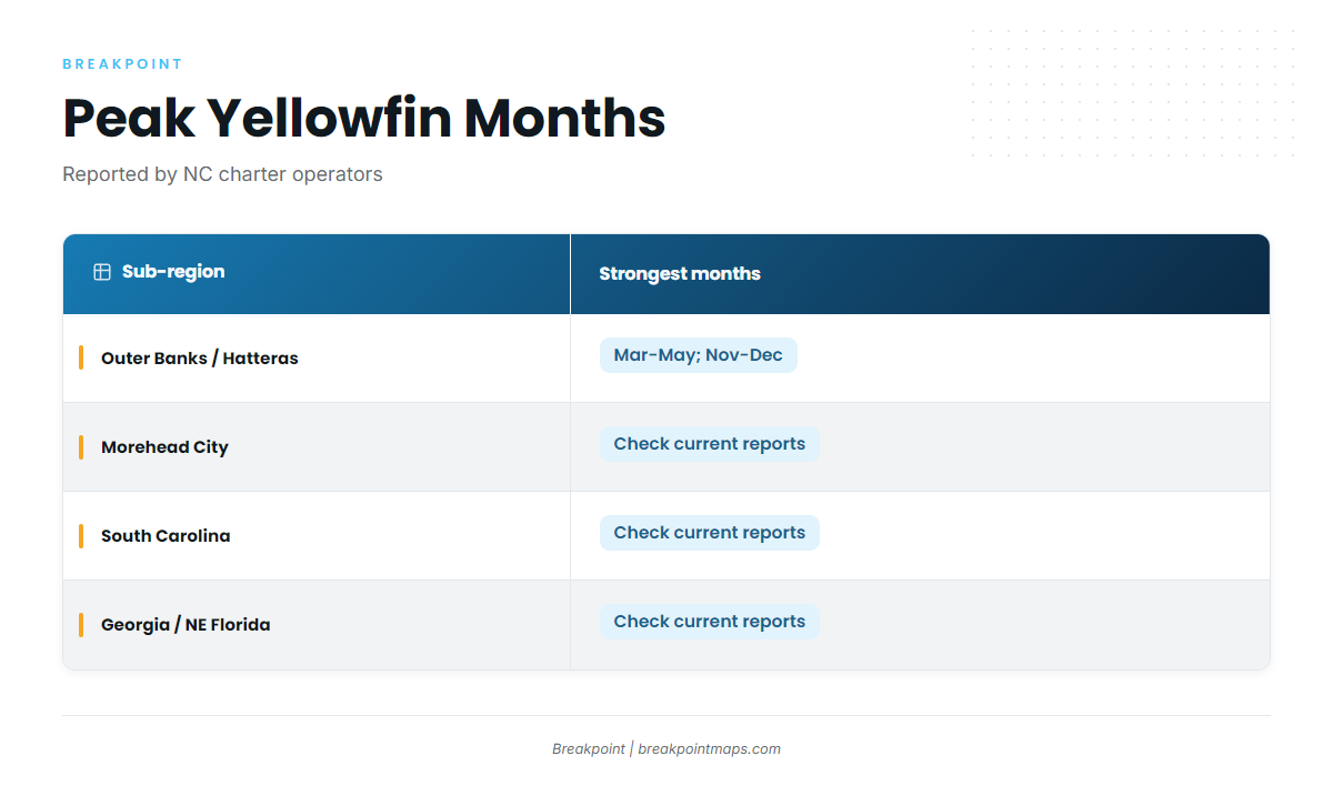
Off North Carolina, local charter operators say yellowfin are most reliable in spring (March to May) and from late fall into winter (November to December). The reason is the Gulf Stream, covered below. Nobody can say where the fish will be on a given Saturday, but the timing and conditions below show where the odds line up.
| Sub-region | Months reported as strongest | Source note |
|---|---|---|
| Outer Banks / Hatteras (Oregon Inlet, Hatteras Inlet) | March to May; November to December | Local charter operators’ reports for NC |
| Morehead City | Varies; check current reports | Only NC-wide charter reports found |
| South Carolina (Charleston, Georgetown) | Varies; check current reports | No sourced timing |
| Georgia / NE Florida | Varies; check current reports | No sourced timing |
These months come from charter reports, not a survey, and the Gulf Stream’s position shifts them from year to year.
Regional Differences
The Gulf Stream runs close to the shelf here, especially off Hatteras, which operators describe as one of the closest points on the East Coast to the Stream. In the mid-Atlantic, anglers wait for a different setup. FishTrack describes mid-Atlantic yellowfin as following "the sweep of warm water eddies pushing onto the edge of the Continental Shelf from the Gulf Stream."
That changes how you read the water. Canyon anglers hunt for eddies over canyon heads. Southeast anglers read the main Stream edge where it meets the shelf break, plus bottom features that deflect current, like the Charleston Bump.
Size and behavior follow the same logic as elsewhere on the coast. Tackle industry guides put yellowfin at 20 to over 200 lb, with the 100 lb-plus fish tending to run deeper and more solitary. Yellowfin also often mix with blackfin tuna near the surface, so expect both on the same spread.
Tagging data is a reason to hold any spot loosely. NOAA Southeast Fisheries Science Center and University of Maine scientists have deployed more than 100 pop-up tags since 2010, including on Outer Banks fish. Satellite tagging research on yellowfin tracked individual fish for up to 319 days, and these fish travel widely. Last week’s spot is a hypothesis, not a plan.
Management also differs by species:
- Yellowfin are managed federally by NOAA Fisheries Atlantic HMS, under ICCAT recommendations.
- Dolphin and wahoo fall under the South Atlantic Fishery Management Council (SAFMC), which does not manage yellowfin.
- The catch is often mixed. Mahi and wahoo commonly hit the same trolling spread, so the rules for your tuna and your mahi come from different agencies.
Habitat & Conditions in the Atlantic Southeast
Yellowfin here follow bait, and bait gathers where the Gulf Stream runs into something: colder water, the shelf break, or bottom that deflects current. An edge works like a fence line for bait.
FishTrack offers a mid-Atlantic rule of thumb that works as a starting point here: find a temperature break from the upper 60s to lower 70s that crosses the 100-fathom drop. FishTrack’s temperature break guidance adds that fish can hold on either side of the break, wherever the bait is.
The 100-fathom curve matters because the Stream pushes against the shelf there, creating current edges and upwelling where bait stacks up. Anglers also talk about the Ledge as a named ground on the Southeast shelf.
Here is how we read the data:
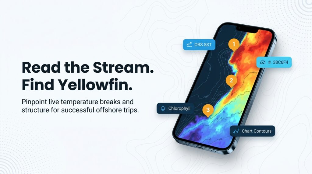
- OBS SST shows where the breaks sit.
- Chlorophyll shows color changes, meaning green productive water against blue Stream water, where bait may be.
- Chart Contours show where those edges cross the 100-fathom curve or a named ground.
Chart layers are not for navigation.
Satellite SST is a snapshot, and cloud cover leaves gaps. The water you fish is hours or days newer than the last clear pass, and the Stream and its eddies shift day to day.
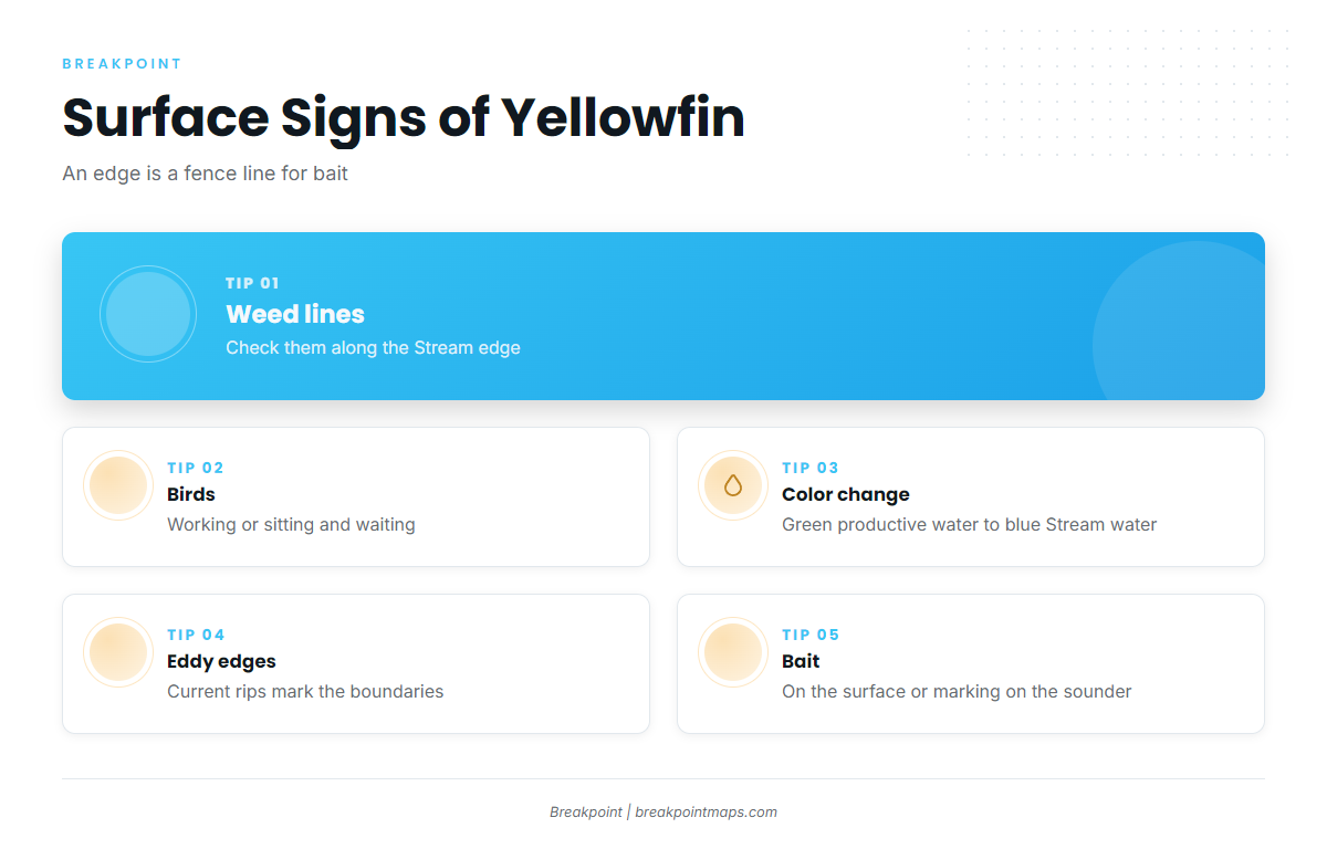
Surface signs that point to bait and tuna:
- Weed lines, especially along the Stream edge
- Birds working, or birds sitting and waiting
- Color changes from green to blue
- Eddy edges and current rips
- Bait on the surface or marking on the sounder
North Carolina: the Point, Big Rock and the Steeples
The Point off Cape Hatteras is where the Gulf Stream meets colder water from the north, concentrating bait. Oregon Inlet and Hatteras Inlet are the usual departure points, and Oregon Inlet Fishing Center is widely treated as a yellowfin hub.
Big Rock and the Steeples, out of Morehead City, are well-known central NC grounds. Big Rock is also a tournament landmark. Bottom relief near the shelf break deflects current and holds bait.
South Carolina: the Charleston Bump and the Georgetown Hole
The Charleston Bump is a bottom feature that deflects the Gulf Stream, creating eddies and edges that hold bait and pelagics. The Georgetown Hole is a known SC offshore ground where the same principle applies.
Off Georgia and northeast Florida, the same Stream and shelf logic holds, but sourced ground-specific detail is thin. Check current reports.
Tactics for the Atlantic Southeast
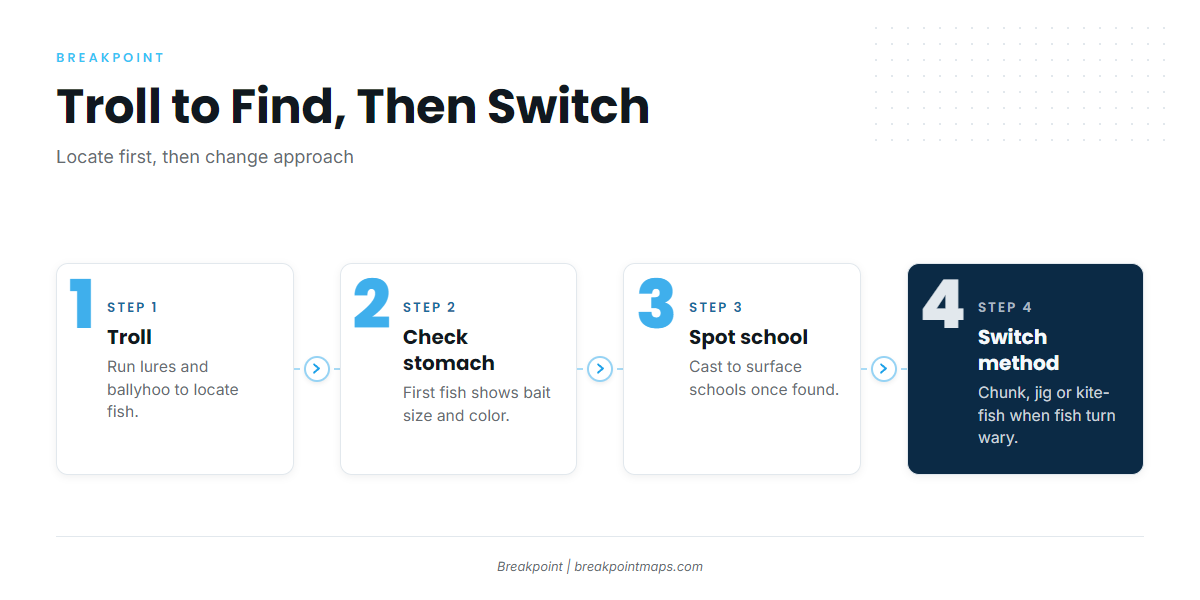
Trolling finds the fish. Other methods take over once you have found them or once they turn wary.
NC DEQ says sport fishermen catch yellowfin by trolling brightly colored lures with ballyhoo at high speeds. That is the official baseline for the region. General rigging is covered in the species guide.
One published 10-rod spread is not a standard, but it shows what a full spread looks like:
- 8 skirted ballyhoo
- 2 spreader bars pulled off the short riggers
- 2 squid daisy chains run as teasers
The same source suggests checking the stomach contents of the first fish to learn the bait size and color to match. FishTrack lists blue-and-white, pink-and-white and chartreuse-and-white as top skirt colors for canyon crews, with black-and-red or red-and-pink on cloudy days. Treat those as a starting point here.
Charter operators say the green-stick is used off the Outer Banks as one method for schooling yellowfin.
Once fish move inshore and turn wary, Marlin’s yellowfin technique roundup says chunking, jigging and kite-fishing have become the best way to target them. You can also cast to surface schools once you spot them. These are options, not a protocol.
For identification, NC DEQ lists bigeye, blackfin and albacore as look-alikes. Blackfin show up on the same spreads and run smaller, about 20 inches on average per industry guides. For full ID, use the species guide.
Bleed and ice fish promptly, since the run home from the Stream is long.
Frequently Asked Questions
When is the best time for yellowfin off North Carolina?
Local charter operators report March to May and November to December as the strongest periods. The Gulf Stream’s position decides each season, so timing can shift. Check current reports before you commit to dates or book a trip.
Do I need an HMS permit for yellowfin?
Yes. Private boats need the HMS Angling permit. For-hire boats need the Charter/Headboat permit. Both come from NOAA Fisheries Atlantic HMS. Requirements can change, so verify before you fish.
Do I need my own license on a charter?
In North Carolina, the charter’s license typically covers clients. Rules differ by state, so confirm with your captain and the state agency: NC DEQ, SCDNR, GA DNR or FWC.
How do I tell blackfin from yellowfin?
NC DEQ lists blackfin tuna as a yellowfin look-alike. Blackfin generally run smaller and show up on the same spreads. For full identification features, use the species guide before you keep fish.
Planning Your Next Run
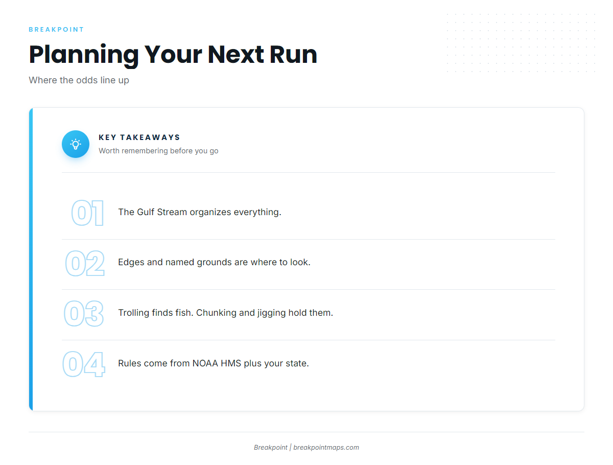
The Gulf Stream shapes this fishery. Edges and named grounds are where to look, trolling locates fish, and chunking or jigging holds them once they turn wary. Federal rules come from NOAA HMS, and licenses come from your state.
If you plan trips the night before, Breakpoint’s hotspots feature scores yellowfin tuna in the Atlantic Southeast by weighing conditions like the OBS SST and Chlorophyll layers, and shows where yellowfin conditions line up. It is a planning aid, not a promise. Chart layers are not for navigation.