


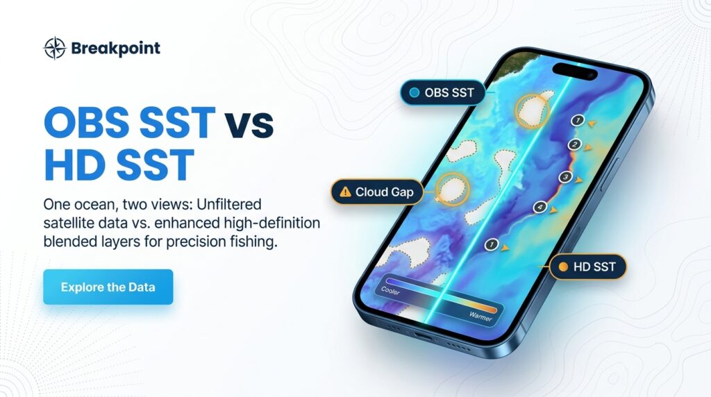
Open OBS SST first when skies were clear and you want what the satellite actually saw. Use HD SST when clouds left gaps or when you want a fuller, sharper-looking picture that loads fast on a phone. Check the timestamp on both.
This guide covers how each layer is made, where each falls short, and how to decide which to check first. Neither layer is always complete. It also gives a rule of thumb, an explanation for blank areas, and the name of the satellite behind your water.
OBS SST and HD SST at a Glance
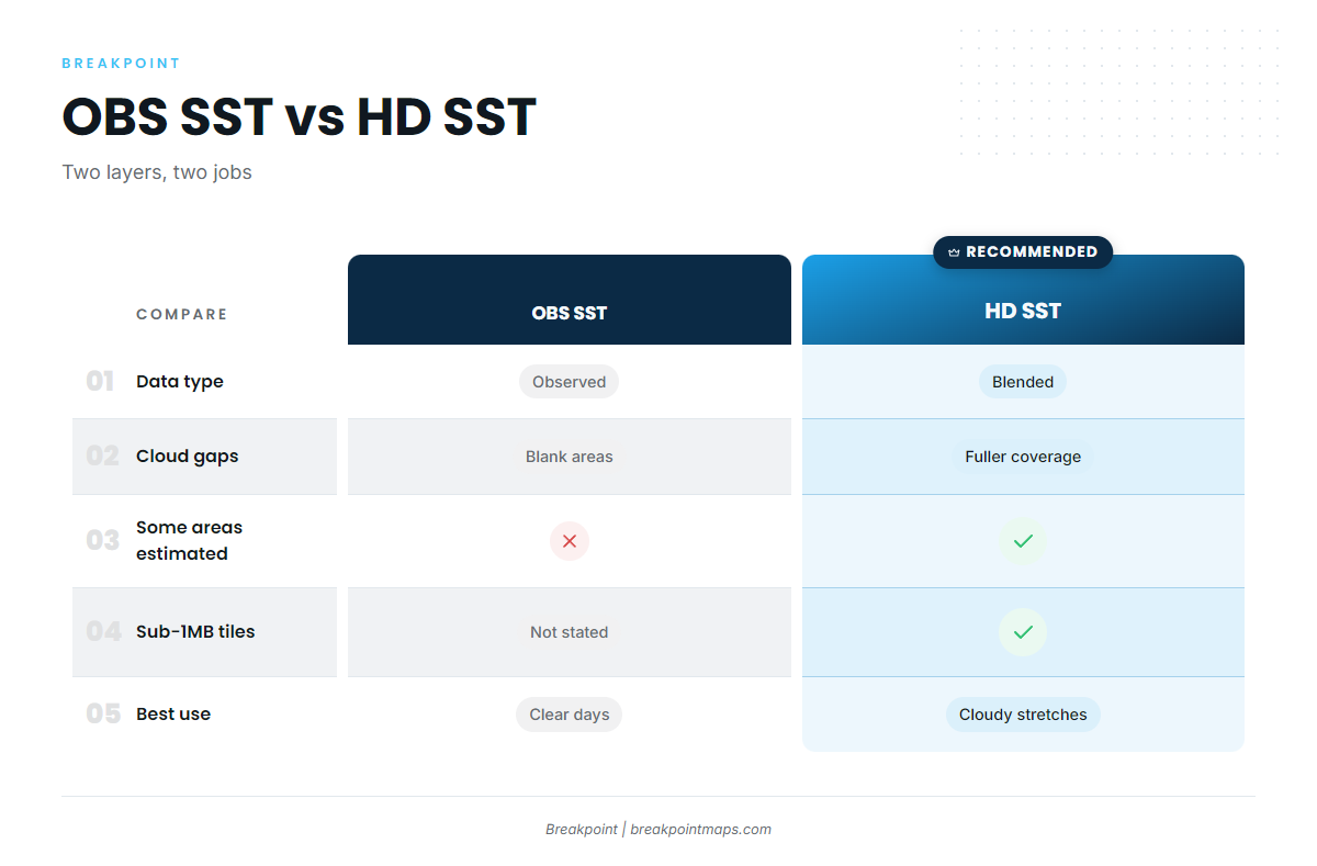
OBS SST shows what the satellite saw. HD SST shows a fuller, blended picture. The table compares them:
| OBS SST | HD SST | |
|---|---|---|
| What it is | Observed satellite SST | Higher-resolution blended product |
| Source | GOES satellites (see region table below) | Blended from multiple sources |
| Time window | 1-day and 3-day composites | Check the in-app timestamp |
| Refresh | Multiple times daily | Check the in-app timestamp |
| Gaps | Blank under cloud | Fuller coverage, but some areas are estimated |
| File weight | Not specified | Sub-1MB tiles |
| Best use | Clear days, fresh breaks | Cloudy stretches, broad patterns, thin signal |
| Main limit | Cloud gaps, image age | Smooth areas may be estimated, not observed |
Where a spec isn’t documented, the table says so rather than filling the cell with a guess.
What Both Layers Are For
Both layers show sea surface temperature so you can find temperature breaks, which are edges where water changes temperature over a short distance. If that idea is new, start with how to read a temperature break on an SST map.
Breaks show up in every region we cover:
- Gulf: Loop Current eddies and their edges.
- Atlantic: Gulf Stream edges off the Carolinas.
- Pacific: Upwelling fronts off California.
The layer helps you decide where to look. It does not tell you where the fish are.
OBS SST: What the Satellite Actually Saw
OBS SST is observed satellite data. It shows only water the satellite could see through clear sky.
The reason is physical. According to NOAA, the GOES ABI instrument retrieves skin temperature from thermal infrared, and the GOES-R sea surface temperature product covers only cloud-free pixels over water. Where cloud sits over the water, there is nothing to retrieve. A cloud gap is that blank area where cloud blocked the satellite’s view.
You can think of OBS SST as a set of fresh reports from boats that were actually there. Where no boat went, there is no report.
1-Day vs 3-Day Composites
A composite stacks several satellite passes over a set window into one image. The length of the window changes the trade-off:
- 1-day composite: Fresher, but with more gaps.
- 3-day composite: Covers more water, but can show a break that has already moved.
Refresh and Timestamps
OBS SST refreshes multiple times daily. Read the timestamp before you read the colors. A sharp edge on an old image records where the water was, not where it is.
Time of day matters too. Calm, sunny days can warm the surface skin noticeably, so the hour the image was taken changes what you are looking at.
HD SST: A Fuller, Blended Picture
HD SST is a higher-resolution blended product served as sub-1MB tiles.
Resolution is how much detail the map can show. HD SST is higher-resolution than a coarse product.
Blended means combining data sources and filling gaps to give a fuller picture. For a general example of how blended products work, see how blended SST analyses work. That page describes NOAA’s OISST, not the inputs to HD SST.
Blended does not mean gap-free truth. Smooth areas under old cloud may be estimated (interpolated) rather than observed. HD SST gives you the full chart, with some areas drawn from nearby soundings rather than measured directly.
Sub-1MB tiles matter at the marina, on a thin signal, or on a limited data plan. We make no speed promises beyond that.
Two layers of the same water can look different, and three causes cover most cases:
- Different time windows. The two layers may not be showing the same hours.
- Blending smooths edges. A sharp break on OBS SST can look softer on HD SST.
- Blanks versus estimates. OBS SST leaves gaps where HD SST shows filled-in water.
Which Satellite Covers Your Water
GOES-19 (GOES-East) covers the Gulf and Atlantic. GOES-18 (GOES-West) covers the Pacific NW and SW. The table shows the satellite behind each region:
| Region | Satellite | Operational role since |
|---|---|---|
| Gulf | GOES-19 (GOES-East) | 2025-04-06 (replaced GOES-16) |
| Atlantic | GOES-19 (GOES-East) | 2025-04-06 (replaced GOES-16) |
| Pacific NW | GOES-18 (GOES-West) | 2023-01-10 (replaced GOES-17) |
| Pacific SW | GOES-18 (GOES-West) | 2023-01-10 (replaced GOES-17) |
These assignments follow the NOAA CoastWatch satellite assignments. Older guides still name GOES-16 and GOES-17, so if you learned SST from one of those, update your assumptions.
One more caveat concerns what the satellite reads. Under the GHRSST definitions of SST types, infrared satellites measure skin temperature, roughly the top hair of the water. That is not the thermocline where fish may hold.
OBS SST vs HD SST: Which to Check First
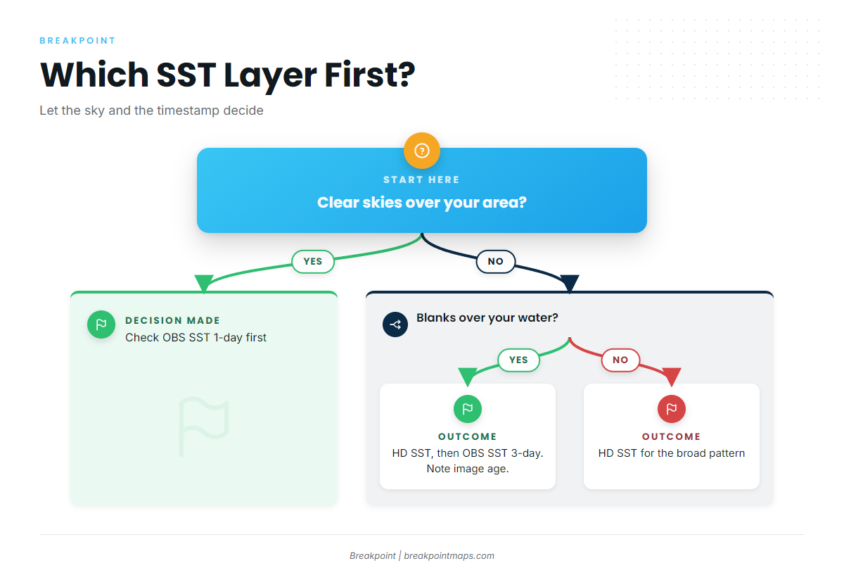
Let the sky and the timestamp decide. Match your situation to a layer:
- Clear skies: Check OBS SST first, the 1-day composite.
- Cloudy stretch, blanks over your area: Check HD SST, then the OBS SST 3-day composite, and note the image age.
- Hunting a fresh, sharp break: Use the OBS SST 1-day. Blending can soften edges.
- Reading a broad pattern, like an eddy’s general position: Use HD SST.
- Planning at home on Wi-Fi: Compare both side by side.
- At the dock on a thin signal: Use HD SST, since its tiles are sub-1MB.
- Night before: Pick candidate areas. Morning of: Recheck the newest OBS SST, because it refreshes multiple times daily.
Which layer you open first matters less than knowing what each one is telling you. Next time you open the map, check the timestamp on OBS SST before you toggle to HD SST.
What Neither Layer Can See
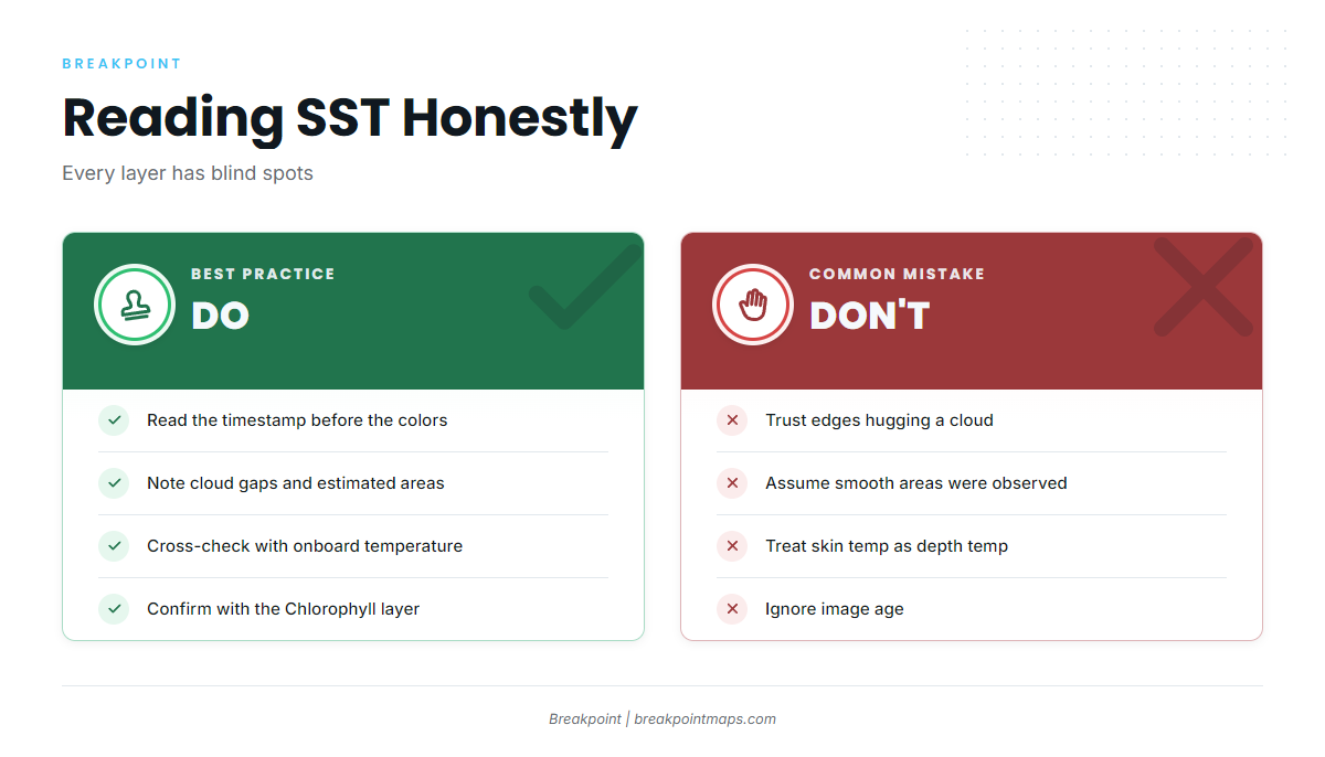
Every SST layer has blind spots:
- Cloud gaps on OBS SST. No clear pass, no data.
- Estimated areas on HD SST. Filled-in water is not measured water.
- Skin temperature, not temperature at depth. The layer does not show what is happening below the surface.
- Image age. A break can move after the image was made.
- Cloud-edge artifacts. NASA notes on cloud masking say cloud classification can struggle, so pixels near clouds can be misclassified. Treat any edge hugging a cloud with suspicion.
- Daytime skin warming. Calm, sunny days can warm the surface skin and shift what the image shows.
Confirm what you see with your onboard temperature readings, other layers, and what you find on the water. Other data, like sea surface height, can add context where clouds block the view.
A Simple Pre-Trip Habit
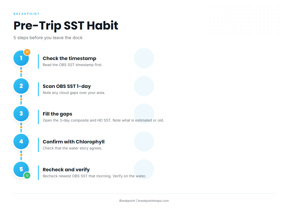
Five steps take a few minutes and give you a clearer plan:
- Check the OBS SST timestamp. Know how old the picture is before you read it.
- Look at the OBS SST 1-day. Note any cloud gaps over your area.
- If there are gaps, open the 3-day composite and HD SST. Note what is estimated or old.
- Confirm with the Chlorophyll layer. See whether water color agrees with the temperature story.
- Recheck the newest OBS SST the morning of the trip. Then verify on the water with your onboard temperature readings.
Frequently Asked Questions
What is the difference between OBS SST and HD SST?
OBS SST is observed satellite data and shows gaps under cloud. HD SST is a higher-resolution blended product served as sub-1MB tiles. It is fuller, but some areas are estimated rather than observed. Use OBS SST for what the satellite saw and HD SST for a fuller picture.
Why does OBS SST have blank spots?
Infrared cannot see through cloud, as NOAA STAR documents for the GOES-R product. If you see blanks, check the timestamp first, then try the 3-day composite or HD SST. If nothing loads at all, check your connection before blaming the data.
Should I use the 1-day or 3-day composite?
Use the 1-day for fresh breaks on clear days. It is newer but has more gaps. The 3-day gives more coverage, but some of it is older data, and a break may have moved since those passes.
Is HD SST more accurate?
Not necessarily. It is more complete and sharper-looking, but where it fills gaps it is estimating. Observed data from a clear pass is what the satellite actually saw, so on a clear day OBS SST is the better first look.
Which satellite covers my region?
GOES-19 (GOES-East) covers the Gulf and Atlantic and took over on 2025-04-06 from GOES-16. GOES-18 (GOES-West) covers the Pacific NW and SW and took over on 2023-01-10 from GOES-17, per NOAA CoastWatch.
Why do the two layers look different?
They can cover different time windows, blending smooths edges that OBS SST shows sharp, and HD SST estimates fill areas where OBS SST is blank. Compare timestamps first, then decide which picture to trust for the question you are asking.
Next Steps
The rule of thumb: with a clear sky and a fresh timestamp, start with OBS SST. With cloud over your water, use HD SST and the 3-day composite, and know which parts are estimated.
Before you commit to a long run, confirm what SST shows with the Chlorophyll layer. For the foundation under all of this, read our guide to reading a temperature break.
Chart layers are not for navigation.