




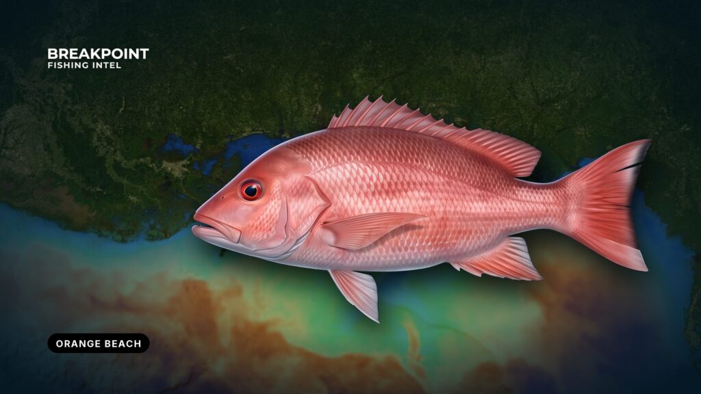
Red snapper fishing off Orange Beach comes down to three things: one jettied pass, a public reef program that Alabama’s Marine Resources Division (MRD) describes as the largest in the United States, and a red snapper season that Alabama runs itself. If you run your own boat on the Gulf of Mexico (Gulf of America in federal documents), you already read charts and buoys. This local guide covers the rest.
MRD manages 14 permit areas with public reefs from inshore waters out to 55 nautical miles. For how red snapper behave and the rigs that catch them anywhere in the Gulf, see our red snapper guide.
This guide is meant to help you decide where to look and how to stay legal. It makes no promises about catching fish.
Before you leave the dock
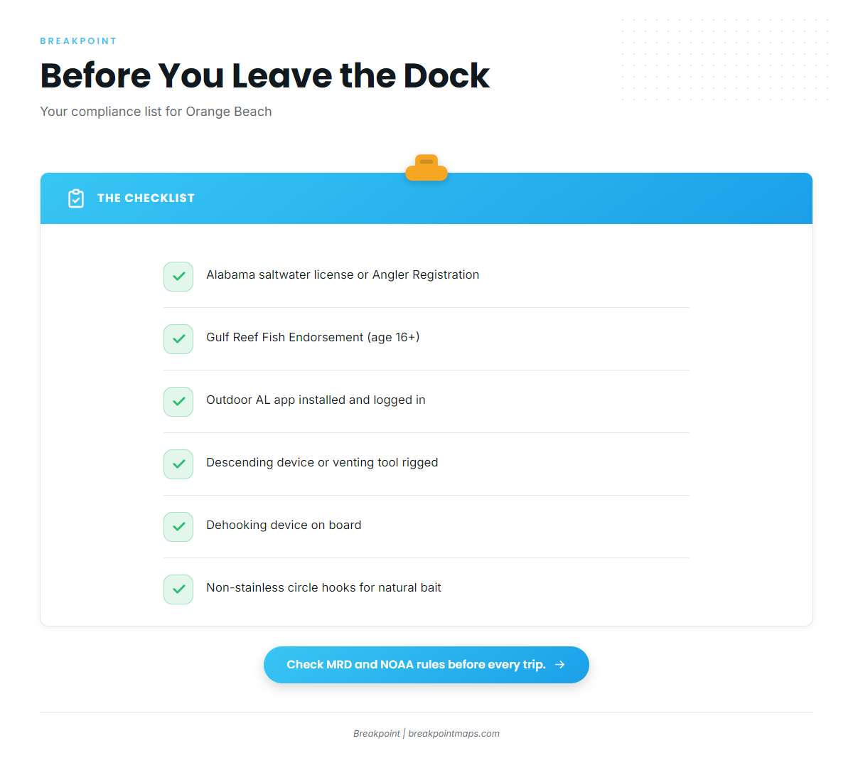
Run this list before you hook up the trailer or cast off the lines:
- Alabama saltwater fishing license. Anglers 16 and older need one, or the free Saltwater Angler Registration if you qualify as a resident. The Outdoor Alabama license page explains who qualifies.
- Gulf Reef Fish Endorsement. Required for anglers 16 and older to take or possess red snapper and other Gulf reef fish, on top of every license type, including lifetime, 65-plus, pier and trip licenses.
- Outdoor AL app. Installed and logged in, so you can file Snapper Check before landing.
- Descending device or venting tool. Rigged and ready.
- Dehooking device. On board.
- Circle hooks. Non-stainless steel circle hooks for natural bait.
Check MRD and NOAA rules before every trip.
Leaving through Perdido Pass
Perdido Pass is a jettied inlet at the mouth of Perdido Bay, and it also connects to the Intracoastal Waterway. Marinas sit on Terry Cove, Cotton Bayou and the Intracoastal Waterway, so your run to the pass depends on where you start.
The City of Orange Beach publishes official no-wake and idle-speed maps. Review them before you run, because a no-wake area can extend farther than you expect. NOAA’s Coast Pilot 5, Chapter 6 is the official description of the pass and its approaches.
Conditions at the pass depend on three variables:
- Tide direction. An ebb runs out through the jetties.
- Wind direction and speed. An onshore wind opposes that ebb.
- Wave height and dominant period. Swell arrives from offshore and meets the outgoing water.
An outgoing tide against an onshore wind shortens and steepens waves at the jetties. Read wind at PPTA1, the NDBC station at Perdido Pass, and read swell height and period at 42012 before you commit. Then compare tide stage against wind direction.
Reading the water before the run off Orange Beach
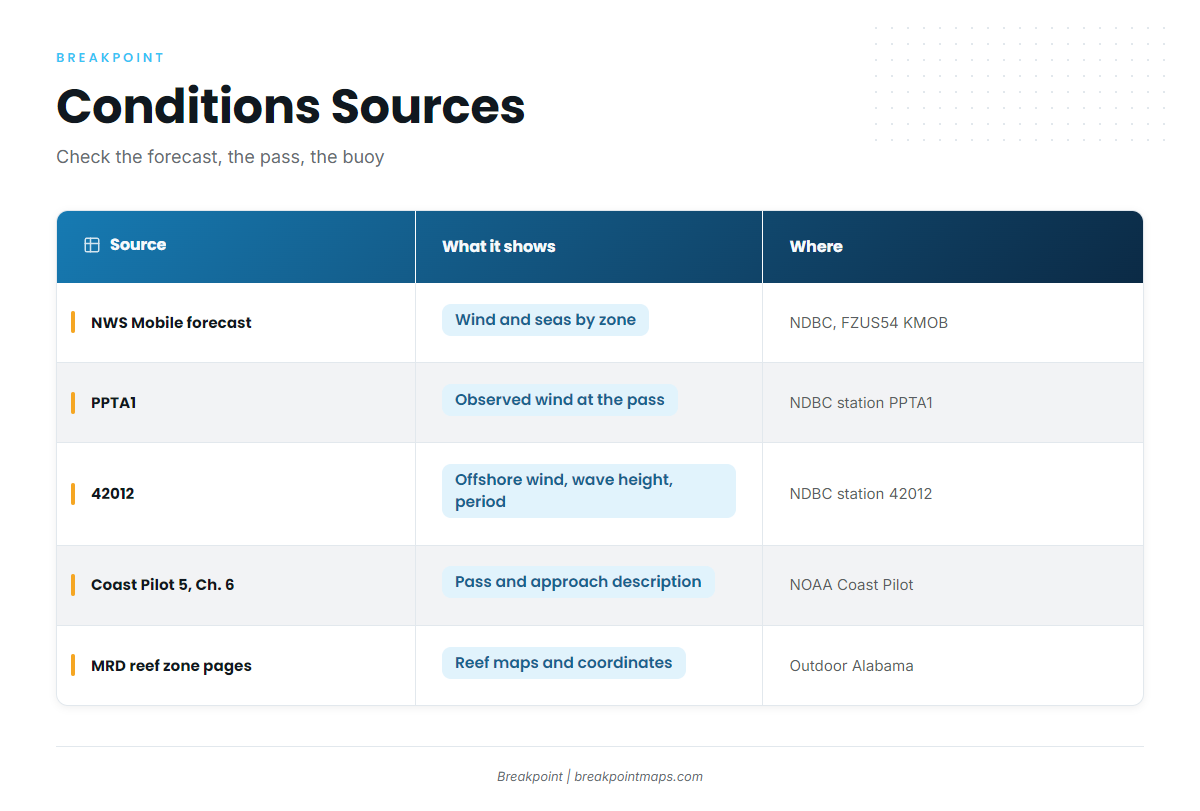
Check three sources in order: the forecast, the pass, the offshore buoy.
- The forecast. Start with the NWS Mobile Coastal Waters Forecast, product FZUS54 KMOB. It is a forecast, and it can change.
- The pass. PPTA1 reports observed wind at Perdido Pass. Compare its direction against the tide stage.
- The offshore buoy. The NDBC station 42012 offshore buoy reports wind, wave height and dominant period. The same wave height at a short period stacks closer together than it does at a long period. We give no thresholds; read the numbers, then read the official forecast.
A buoy reports one point in the Gulf, and conditions on your reef can differ.
Satellite sea surface temperature and chlorophyll show color breaks and clarity. Cloud cover blocks satellite passes and leaves gaps, so treat a missing pass as missing data rather than as clean water.
| Source | What it shows | Where to find it |
|---|---|---|
| NWS Mobile Coastal Waters Forecast | Zone forecast for wind and seas | NDBC forecast page, FZUS54 KMOB |
| PPTA1 | Observed conditions at Perdido Pass | NDBC station PPTA1 |
| 42012 | Offshore wind, wave height and dominant period | NDBC station 42012 |
| Coast Pilot 5, Ch. 6 | Pass and approach description | NOAA Coast Pilot |
| MRD Nearshore and Offshore Reef Zone pages | Reef maps and coordinates | Outdoor Alabama |
For Gulf-wide oceanography, seasons and other species, see our Gulf of Mexico fishing guide.
Before the run, we check OBS SST and Chlorophyll in Breakpoint for color and clarity, alongside the official forecast.
Alabama reef zones and NOAA-charted wrecks
The 9 nautical mile line is the place to start. The Nearshore zone runs 0 to 9 nm, which is also the edge of state reef-fish waters, and beyond it is federal water. Alabama state waters extend 9 nautical miles from the beach for red snapper and other Gulf reef fish, and 3 nautical miles for other species.
The four zones
MRD organizes its public reefs into four zones:
| Zone | Distance band as MRD gives it | Where to get coordinates |
|---|---|---|
| Inshore | Inshore waters | MRD reef pages |
| Nearshore | 0 to 9 nm | MRD Nearshore Reef Zone page |
| Offshore | Beyond the Nearshore zone | MRD Offshore Reef Zone page |
| Circalittoral | Public reefs out to 55 nm | MRD reef pages |
What is down there
The reef program uses ships, barges, oil and gas platform jackets, bridge spans, reef modules, limestone and army tanks. Charted wrecks add structure outside the program’s permit areas. For rigs that suit structure, see our guide to rigs for fishing structure.
From MRD files to a run plan
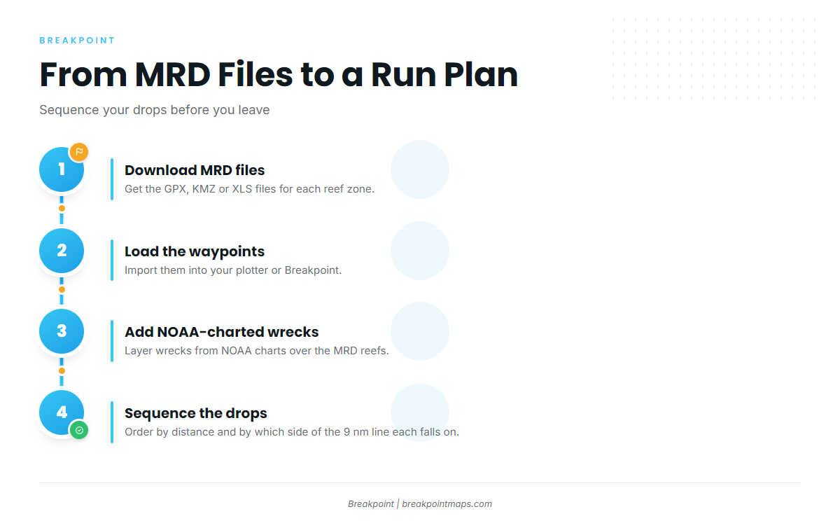
MRD publishes public reef coordinates for each zone as GPX, KMZ and XLS files. To turn them into a plan:
- Download the MRD GPX, KMZ or XLS files for each zone.
- Load the waypoints in your plotter.
- Add wrecks charted on NOAA charts.
- Sequence the drops by distance and by which side of the 9 nm line they fall on, because the line decides which rules apply.
Viewing MRD’s reefs over Chart Contours in Breakpoint lets you lay out a route of drops before you leave the dock. Chart layers are not for navigation.
The Alabama Special Management Zone
The Alabama Special Management Zone is a federal gear rule. In the zone, fishing is limited to hook and line with 3 or fewer hooks per line, plus spearfishing gear. The zone overlaps reef areas, and the rule differs from state waters. Read the Alabama Special Management Zone rule, which lists the boundary points.
What the coordinates cannot tell you
Published reef coordinates are deployment positions. Material shifts and gets buried, and chart wreck symbols vary in position accuracy. Confirm structure on your own sonar before you set up.
How Alabama runs the red snapper season vs. the federal system
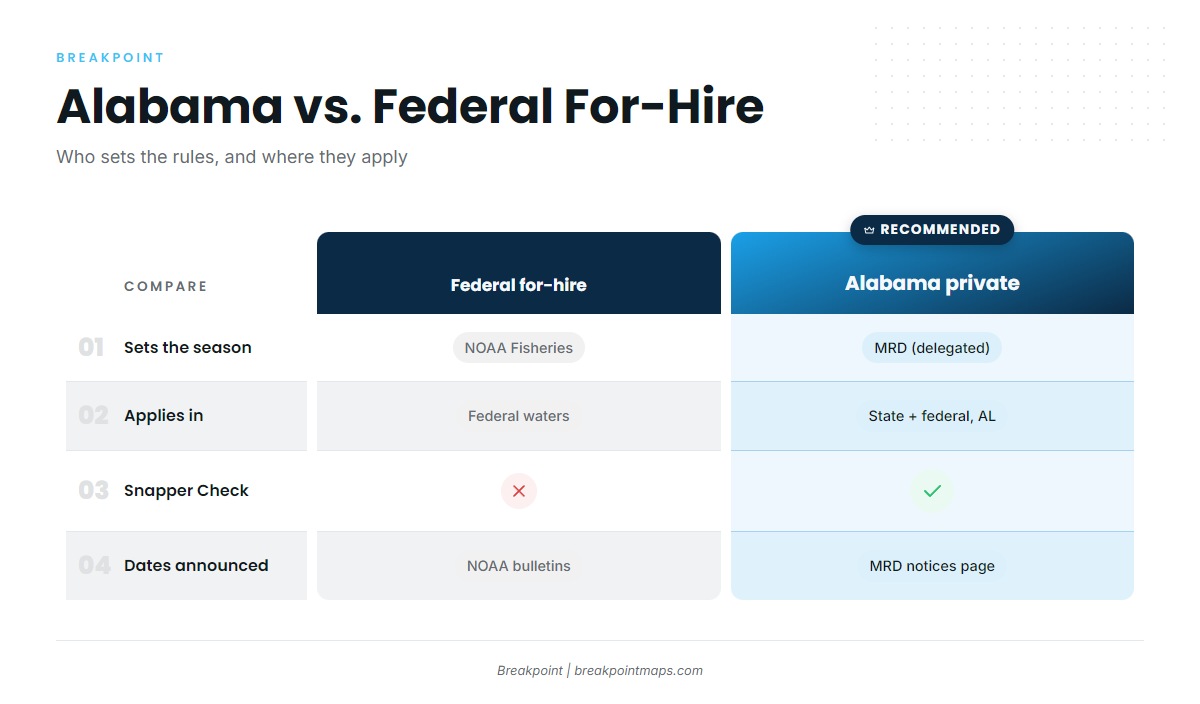
The Gulf of Mexico Fishery Management Council and NOAA Fisheries manage Gulf reef fish under 50 CFR 622. Alabama’s approach layers on top of that framework.
Under delegated state management, Alabama sets the season, bag limit and size for private anglers in both state waters and the federal waters off Alabama. MRD opens and closes the season by announcement. Federally permitted for-hire boats follow NOAA’s for-hire season, which NOAA announces each year. A state-licensed party boat without federal permits follows the state season and fishes only inside 9 nm.
| Item | Alabama, private | Federal for-hire |
|---|---|---|
| Who sets the season | MRD, under delegated state management | NOAA Fisheries |
| Where it applies | State waters and federal waters off Alabama | Federal waters, for federally permitted for-hire vessels |
| Reporting | Snapper Check, 1 report per vessel trip, before landing | Federal for-hire reporting |
| Where the dates are announced | MRD season closures, notices and updates page | NOAA Fisheries bulletins |
Snapper Check, step by step
Snapper Check is Alabama’s mandatory landing report for red snapper, gray triggerfish and greater amberjack. You file one report per vessel trip, in the Outdoor AL app or online, before the fish are landed. An MRD dock interview or enforcement inspection does not count as reporting.
The sequence:
- Finish fishing.
- File the report in the Outdoor AL app or online before the fish reach the dock.
- Land the fish whole, with head and fins intact.
Shore, pier and non-powered vessel anglers also report and need a Conservation ID number. Gray triggerfish and greater amberjack have their own size and creel pages on Outdoor Alabama. The reporting rule is in Alabama reef fish rule 220-3-.30.
Crossing lines with fish aboard
A vessel with recreationally caught red snapper may not travel through Alabama state waters while the Alabama season is closed. Possessing red snapper, gray triggerfish or greater amberjack in state waters during a closure is prohibited. Anglers fishing under another state’s season follow that state’s rules and land in that state.
Know which side of the 9 nm line you are on, and file before you land.
Frequently Asked Questions
Can I keep red snapper in federal waters off Alabama on a private boat?
Yes, during Alabama’s season. Alabama sets the private season in the federal waters off Alabama under delegated state management. Federally permitted for-hire boats follow NOAA’s for-hire season instead. Season dates come from the MRD closures page, so check it before you go.
When do I file Snapper Check?
Before landing. File one report per vessel trip, in the Outdoor AL app or online, before the fish reach the dock.
Does a dock interview count as reporting?
No. An MRD interview or enforcement inspection does not replace the Snapper Check report. You still file one report per vessel trip before landing.
What else goes on the Snapper Check report?
Gray triggerfish and greater amberjack go on the report alongside red snapper. Fish caught by anglers under 16 also go on it. MRD’s species pages carry the size and creel details for each.
Can I run home through Alabama waters with Florida-caught snapper when Alabama is closed?
No. A vessel with recreationally caught red snapper may not transit Alabama state waters while the state season is closed. Fish taken under Florida’s season are landed in Florida under Florida’s rules.
Do I need a descending device?
Yes. Federal rules for reef fish require a descending device or venting tool, rigged and ready. Federal rules also require a dehooking device and non-stainless steel circle hooks with natural bait. NOAA’s release mortality page covers the requirement.
Where do I get the reef numbers?
From the MRD reef zone pages, as GPX, KMZ and XLS files plus interactive maps. For what else lives on those reefs, see the Gulf of Mexico fishing guide.
Do the reef coordinates show what is on the bottom today?
No. They are deployment positions. Material shifts and gets buried. Confirm structure on your sonar before you set up.