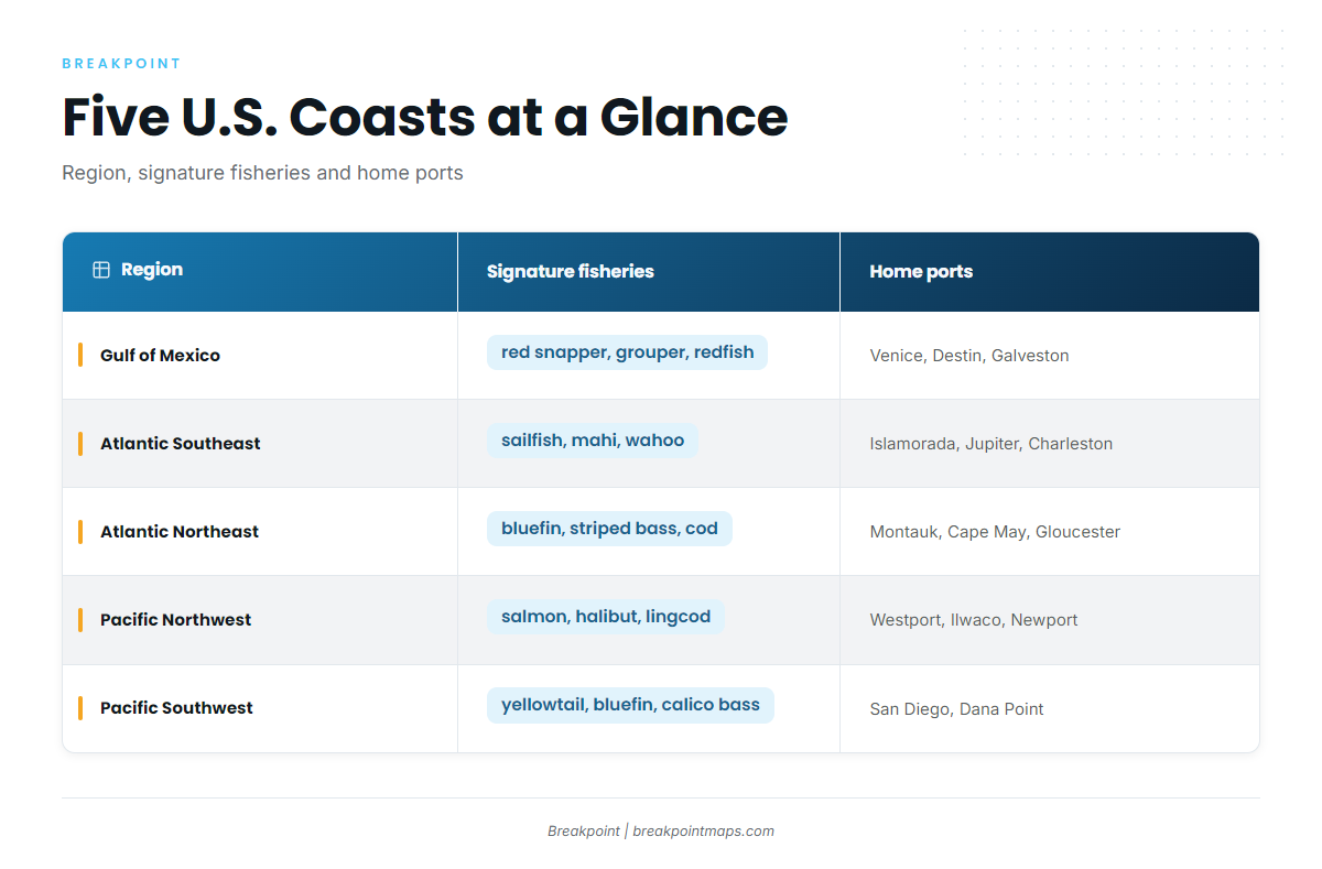
The U.S. has five fishing coasts, each with different water. The table below lays them out side by side, unranked, so you can pick by home port, target, season and kind of trip. Each row links to the matching regional guide.
| Region | Where it starts and ends | Signature fisheries | Water and structure | Home ports | How the season runs |
|---|---|---|---|---|---|
| Gulf of Mexico | Dry Tortugas and the Keys (Gulf side of the council line) west to the Rio Grande | red snapper, grouper, amberjack, yellowfin tuna, redfish, speckled trout | artificial reefs, wrecks, oil and gas platforms, DeSoto Canyon, Loop Current | Venice, Orange Beach, Destin, Galveston, Port Aransas | Bottom trips follow state and federal red snapper openings. Bluewater follows the Loop Current and its eddies. |
| Atlantic Southeast | Atlantic side of the Keys north to Cape Hatteras | sailfish, mahi, wahoo, king mackerel, grouper, red snapper | Gulf Stream close to shore, ledges, live bottom, artificial reefs | Islamorada, Jupiter, Charleston, Morehead City, Hatteras | Pelagics ride the Gulf Stream edge. Bottom trips follow snapper-grouper rules. |
| Atlantic Northeast | Cape Hatteras north to the Canadian border at Passamaquoddy Bay | bluefin tuna, yellowfin tuna, striped bass, mahi, swordfish, cod | Hudson, Baltimore and Norfolk Canyons, shelf edge, Gulf Stream eddies | Virginia Beach, Ocean City, Cape May, Montauk, Gloucester | Runs through the warm-water months. Canyon trips peak as Gulf Stream eddies push onto the shelf edge. |
| Pacific Northwest | Canadian border south to the Oregon-California line | chinook and coho salmon, Pacific halibut, rockfish, lingcod, albacore | cold upwelled water, rocky reefs, Columbia River bar | Neah Bay, Westport, Ilwaco, Newport | Trips are shaped by salmon and halibut openings set by state and federal managers. |
| Pacific Southwest | Oregon-California line south to the Mexican border at San Diego | yellowtail, bluefin tuna, yellowfin tuna, calico bass, white seabass, rockfish | kelp beds, offshore banks, Coronado Islands, California Current | San Diego, Dana Point, Long Beach, Oxnard | Warm-water months bring pelagics north. The long-range fleet runs from San Diego. |
Swipe the table sideways to see every column.
How to Choose a Region
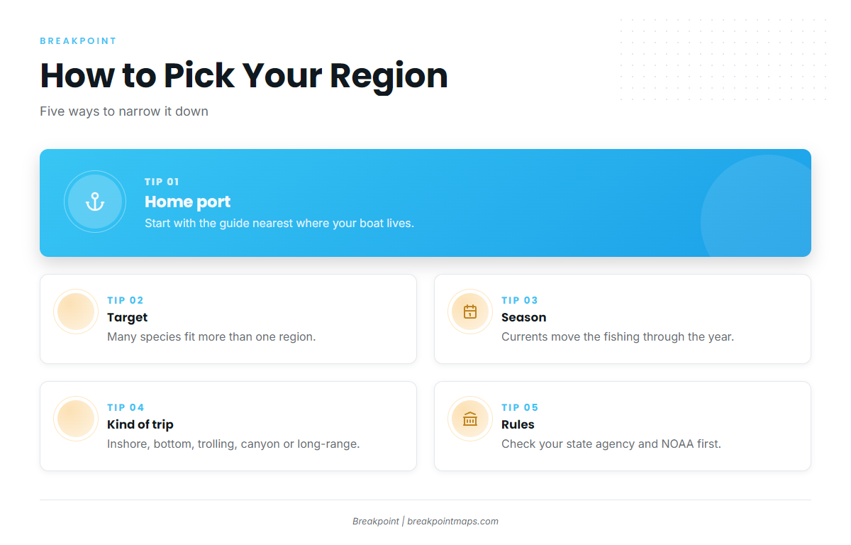
Four things decide it: where your boat lives, what you want to catch, when you can go, and what kind of trip you want to run. No single region wins on all four, and most species and trip types show up in more than one.
A few terms first. Live bottom is hard bottom covered in sponge and coral growth. A ledge is a sudden drop or rock edge on the bottom. A canyon is a deep cut in the continental shelf edge. Kelp is a forest of giant seaweed rooted on rocky bottom. A bar crossing is running the breaking shoal at a river or inlet mouth.
By Home Port
Start with the water you can reach in a day.
- If your boat lives in Venice, Orange Beach or Galveston, start with the Gulf of Mexico fishing guide.
- If you run out of Islamorada, Jupiter, Charleston or Morehead City, start with the Atlantic Southeast fishing guide.
- If you keep a boat at Virginia Beach, Cape May, Montauk or Gloucester, start with the Atlantic Northeast fishing guide.
- If you launch from Westport, Ilwaco or Newport, start with the Pacific Northwest fishing guide.
- If you fish out of San Diego, Dana Point or Long Beach, start with the Pacific Southwest fishing guide.
The Keys sit on a regional boundary. The council line off the Keys runs along 83° W north to 24°35′ N, then east to the mainland, separating the Gulf from the Atlantic Southeast. Florida also sets different rules by coast, so if you fish near the Keys, read the Florida state and federal waters page.
By Target
Most targets live in more than one region.
- Red snapper: Gulf and Atlantic Southeast, both under agency-set seasons.
- Bluefin tuna: Atlantic Northeast and Pacific Southwest.
- Yellowfin tuna: Gulf, Northeast canyons and Southern California.
- Striped bass: Atlantic Northeast.
- Salmon and Pacific halibut: Pacific Northwest.
- Yellowtail and calico bass: Pacific Southwest kelp and islands.
- Sailfish and wahoo: Atlantic Southeast along the Gulf Stream.
By Season
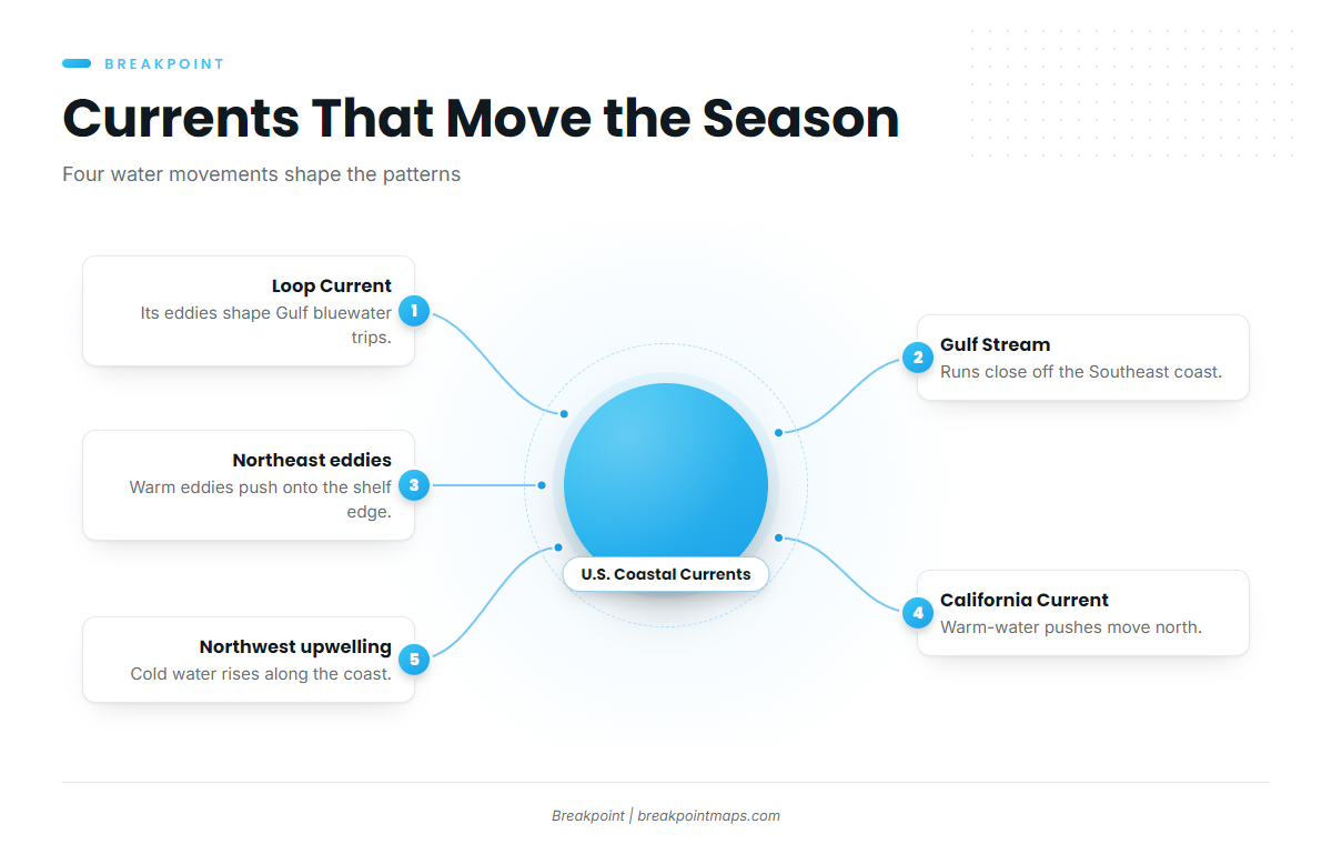
Currents set the calendar. In the Gulf, the Loop Current and its eddies move warm water and bait around the deep structure. Off the Southeast, the Gulf Stream runs close to shore and sheds warm eddies that reach the Northeast shelf edge. Southern California fishes the California Current, where warm-water pushes carry pelagics north. Off Washington and Oregon, upwelling keeps the water cold.
Northeast offshore fishing runs through the warm-water months, with canyon trips peaking as the Gulf Stream pushes eddies onto the shelf edge. State and federal agencies set seasons and limits, and those change, so check with the agency before you fish.
To watch the water move, we put OBS SST up for temperature breaks, Chlorophyll for color edges and Chart Contours for the structure under them. Chart layers are not for navigation.
By Kind of Trip
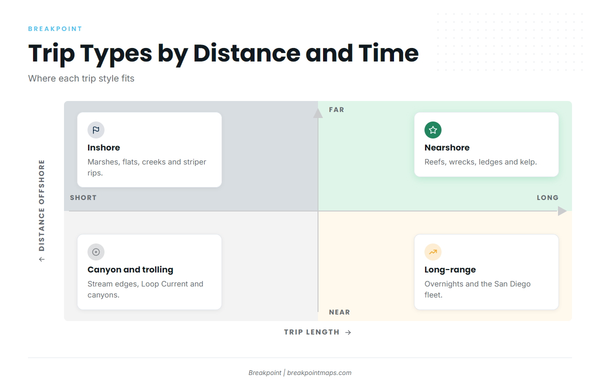
The same coast offers different trips, so match the trip to the water.
- Inshore: Gulf marshes and bays, Southeast flats and creeks, Northeast striper rips.
- Nearshore and bottom: Gulf reefs and wrecks, Southeast ledges and live bottom, Northwest rockfish reefs, Southwest kelp.
- Trolling: The Gulf Stream edge and the Loop Current edges.
- Canyon: Hudson, Baltimore and Norfolk Canyons, plus DeSoto Canyon in the Gulf.
- Overnight and long-range: Northeast canyon overnights and the San Diego long-range fleet.
Bar crossings call for a separate decision. The Columbia River bar and other Northwest bars are governed by wind, wave height, period and the tide, so read the numbers in the NWS marine forecast before you commit.
Rules Change at the State Line
State waters run from the beach out to a set line, and federal waters begin beyond it. That line sits at different distances along different coasts, and the rules change with it.
| Coast | State waters line | Federal manager beyond it |
|---|---|---|
| Florida, Atlantic side | 3 nautical miles | South Atlantic council |
| Florida, Gulf side | 9 nautical miles | Gulf council |
| Alabama | 9 nautical miles for reef fish, 3 for other species | Gulf council |
| Mississippi | 9 nautical miles for reef fish, 3 for other species | Gulf council |
| Maine | 3 miles | New England council |
Florida’s two lines are laid out on the Florida state and federal waters page. Alabama publishes its own limits on the Alabama saltwater size and creel limits page. Mississippi explains its line and its snapper rules on the Mississippi red snapper rules page. For federal permits and regulations by coast, use NOAA Fisheries regional rules.
Check your state agency and NOAA before you fish.
Fishing Guides by Region
Each guide covers one coast in depth. Open the one that matches your port.
Gulf of Mexico
- Gulf of Mexico fishing guide – Keys to the Rio Grande: reefs, rigs, red snapper, DeSoto Canyon and the Loop Current.
Atlantic Coast
- Atlantic Southeast fishing guideKeys to Hatteras: Gulf Stream ledges, live bottom, sailfish, mahi and snapper-grouper.
- Atlantic Northeast fishing guideHatteras north to Maine: canyons, bluefin, striped bass and the Gulf Stream’s northern edge.
Pacific Coast
- Pacific Northwest fishing guideWashington and Oregon: salmon, halibut, rockfish and bar crossings.
- Pacific Southwest fishing guideCalifornia south to the Mexican border: kelp beds, banks, the Coronado Islands and the long-range fleet.