




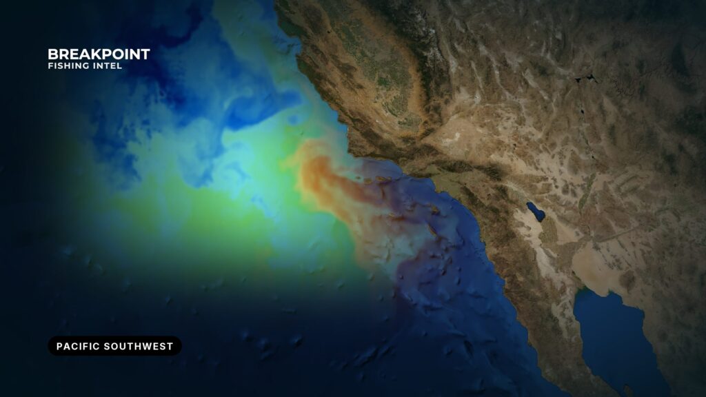
Fishing the Pacific Southwest means reading a coast that runs from Monterey Bay and Big Sur to the Mexican border. Point Conception is the hinge, where the coast turns east and the water changes. North of it, the California Current and upwelling keep the water cold. South of it, the Southern California Bight holds warmer water, the islands and the banks. This page shows how the coast, structure, water and fleet fit together, so you can pick a port, a trip and a place to look. For another coast, start with our fishing guides by region.
The Coast by Stretch and Port
The coast runs north to south from cold, upwelling-driven water to the warmer Bight. Each stretch below opens to different water and a different fleet.
- Central Coast: Moss Landing and Monterey Bay
- Santa Barbara and Ventura: the channel ports
- Los Angeles and Long Beach: the big-harbor departure points
- Orange County: Newport and Dana Point
- San Diego: the widest trip range
Central Coast
Moss Landing is a harbor on the east shore of Monterey Bay, entered through a jettied channel on a 052.5 degree lighted range. The head of Monterey Canyon lies close to the beach. The public Moss Landing North Harbor ramp and a small charter fleet work from here.
The Coast Pilot reports sudden wind shifts from late morning to early afternoon. New west and northwest wind waves cross the existing swell and build a choppy, confused sea. Prevailing wind is northwest.
Monterey Harbor is 3 miles southeast of Point Pinos, and Moss Landing is 12.5 miles northeast of it. Morro Bay and Port San Luis are the Central Coast ports south toward Point Conception.
The water here is cold and upwelling-driven. The season table below covers rockfish and lingcod.
Santa Barbara and Ventura
Port spacing runs close here:
- Santa Barbara Harbor is 29 miles northwest of Point Hueneme.
- Ventura Harbor is 5.8 miles from Channel Islands Harbor.
- Channel Islands Harbor sits in Oxnard, about 1 mile northwest of Port Hueneme.
The Channel Islands Harbor entrance is a gap between two jetties with a detached breakwater in front. Shoaling is rapid and uncertain southeast of the entrance channel and northwest of the north jetty. The Coast Pilot advises approaching from the south and using caution at night. The harbor has a public launch ramp and a fuel dock.
From Point Hueneme to Santa Barbara, fog is most frequent from July through October. Visibility drops below 0.5 mile on about 5 to 10 days a month in those months, with August and September usually the worst. The south jetty sound signal responds to 5 keyings on VHF 81A.
For the Santa Barbara Channel forecast from the National Weather Service, see the Channel Islands Harbor ocean conditions page.
Los Angeles and Long Beach
Marina del Rey, Redondo and San Pedro are the main departure points. Marina del Rey lies down the coast past Point Mugu and Point Dume. The bays and harbors hold inshore fishing.
Vessels leaving the federal breakwater at San Pedro are asked to say whether they will transit northbound through the Santa Barbara Channel or westbound south of the Channel Islands. The reason is the Point Mugu Sea Range, covered in the private-boat section below.
Orange County
Newport and Dana Point are the landing and harbor ports. They face Catalina and San Clemente, covered in the next section.
San Diego
Mission Bay, Point Loma and Oceanside round out the southern end. San Diego has the widest trip range, from half-day local fishing to long-range trips that work south along and offshore of Baja. The 3/4-day Coronado Islands runs sit in the middle.
NOAA reports that most of the US catch of Pacific bluefin comes from within about 100 nautical miles of the California coast. For the offshore runs, see our guide to bluefin tuna off San Diego.
Islands and Banks
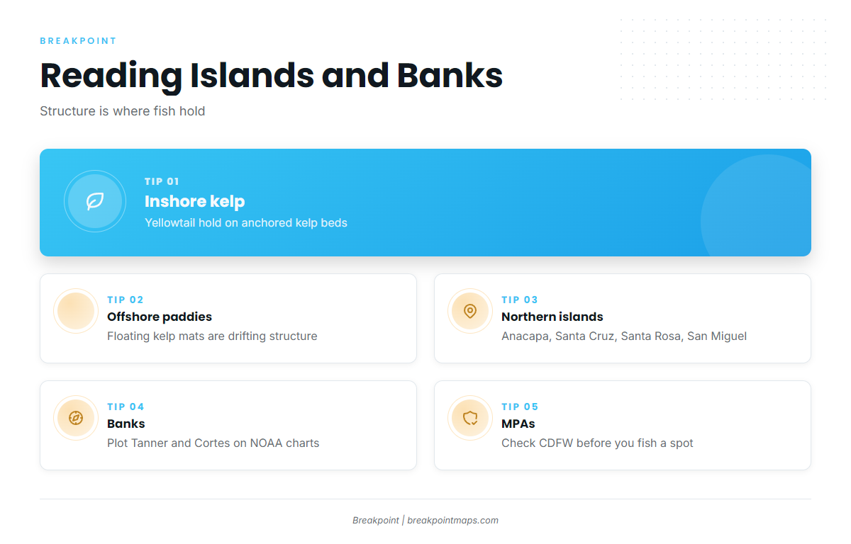
Structure holds fish, and offshore it is often drifting. NOAA tagging work on yellowtail separates fish by anchored kelp and drifting mats. Inshore fish hold around anchored kelp beds. Offshore fish hold near floating kelp mats, or paddies, which are drifting structure in open water and where offshore fish get captured.
Structure falls into four groups:
- Northern Channel Islands: Anacapa, Santa Cruz, Santa Rosa and San Miguel
- Outer and southern islands: Santa Barbara Island, San Nicolas, Catalina and San Clemente
- Offshore banks: Tanner Bank, Cortes Bank, 43 Fathom, 9-Mile and 60 Mile
- Coronado Islands: Mexican waters off San Diego
The Northern Channel Islands are the Channel Islands Harbor fleet’s home water. Anacapa is 11 miles from the landing there. For a species-level look, see yellowtail at the Channel Islands.
Santa Barbara Island and San Nicolas are also on the Channel Islands Harbor fleet’s list. Catalina and San Clemente are the southern islands off Los Angeles and Orange County. Calico bass, white seabass and yellowtail all hold around the kelp.
Tanner Bank, Cortes Bank, 43 Fathom, 9-Mile and 60 Mile are offshore structure. Plot them on NOAA charts before you plan the run.
The Coronado Islands sit in Mexican waters off San Diego, where fishing falls under Mexican rules administered by CONAPESCA. Check permit requirements before you leave the dock. For the fishing itself, see yellowtail at the Coronado Islands.
Marine Protected Areas surround parts of the islands and coast, so check CDFW before fishing a spot.
Where Warm and Cold Water Meet
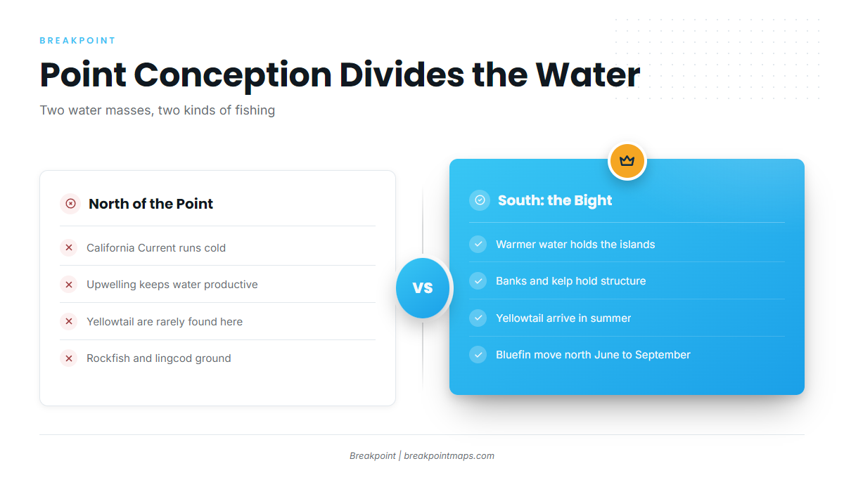
Point Conception divides two kinds of water. North of it, the California Current and upwelling keep water cold and productive. South of it, the Bight holds warmer water.
Yellowtail follow that line. They move north into the Bight in summer and retreat south along Baja in winter and spring. They are rarely north of Point Conception except in highly anomalous warm years. NOAA has yellowtail moving north in early spring as the water warms. Our guide to yellowtail across the Pacific Southwest covers the pattern in depth.
Pacific bluefin tuna make a similar run. They move north along Baja California and California, and FishBase lists the species as one that migrates north between June and September. Our Pacific bluefin tuna guide covers it.
Ocean conditions swing between years. El Niño years push warm water and tropical species farther into the Bight, which is when anglers may see yellowfin tuna, mahi-mahi and wahoo in places they usually do not appear.
The edges show up on the maps. OBS SST in Breakpoint shows observed surface temperature, so you can see where the warm and cold water edges sit. Chlorophyll shows where the green, productive water meets the blue. Where the two edges line up, that is the break to check first.
Both layers have limits. Cloud blocks the satellite pass, and a cloudy day leaves gaps in each. Neither layer finds the fish; both narrow where to look.
Two Ways to Fish: Landing or Private Boat
You fish this coast one of two ways: book a seat on a sportfishing landing boat, or run your own boat.
Sportfishing Landing
The trip length sets the range:
- Half-day: local grounds, back the same day
- 3/4-day: farther grounds, such as the Coronados from San Diego or the islands
- Overnight: islands and offshore
- Multi-day: offshore runs
- Long-range: San Diego trips that work south along and offshore of Baja
Landings carry live bait and rental gear. Fish counts and daily reports help you time a booking.
Private Boat
Your port sets your ramp or harbor, as covered in the stretches above. Live bait comes from the bait receiver at your port. Plan your range against the forecast.
The Point Mugu Sea Range matters if you run the Santa Barbara Channel. The NOAA Coast Pilot chapter 4 puts it 180 miles southwest from Point Mugu and up to 210 miles wide. Hazardous naval operations can take place there any day of the week. Broadcasts go out about every 30 minutes on VHF 11 and 16 during hazardous operations.
The Coast Pilot also reports gales and seas of 12 feet or more from mid-fall through late spring, particularly off Point Arguello and in the Santa Barbara Channel. In the offshore area between 34N and 36N and 119W and 125W, waves exceed 9 feet in about 10 percent of observations in April and May, and about 4 percent from August through October. Check the National Weather Service forecast before you go.
Chart layers are not for navigation. NOAA charts are the reference.
| Landing | Private boat | |
|---|---|---|
| Range | Set by trip length | Set by boat, fuel and forecast |
| Cost of entry | A fare | Boat, fuel, bait and permits |
| Flexibility | The fixed schedule and the crew’s choice of ground | You choose the ground and the time |
| What you need | A license and a booking | A license, charts, electronics, bait and Mexican permits if you cross |
Season Overview
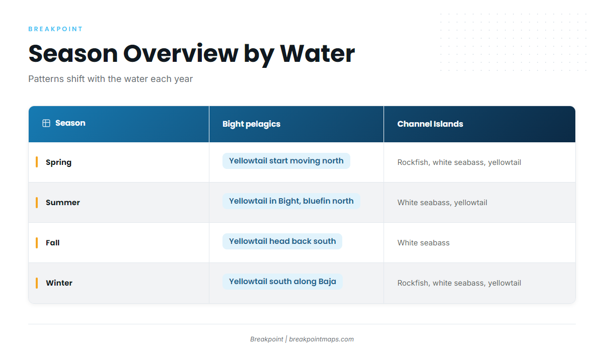
Patterns shift with the water each year. This table shows the fleet patterns from Channel Islands Harbor and Moss Landing, plus the Bight pelagics.
| Season | Bight pelagics | Channel Islands Harbor | Moss Landing |
|---|---|---|---|
| Spring | Yellowtail start moving north as the water warms | Rockfish, white seabass, yellowtail | Rockfish, lingcod, California halibut, king salmon, Dungeness crab, flatfish |
| Summer | Yellowtail in the Bight; bluefin move north June to September | White seabass, yellowtail | Rockfish, lingcod, California halibut, king salmon, bluefin tuna |
| Fall | Yellowtail head back south | White seabass | Rockfish, lingcod, king salmon, bluefin tuna, Dungeness crab, flatfish |
| Winter | Yellowtail south along Baja | Rockfish, white seabass, yellowtail | Dungeness crab, flatfish |
Rockfish and lingcod seasons and depths change, so check CDFW.
Anglers working blue water late in the warm season look for striped marlin and swordfish.
Pacific Southwest Guide Directory
Each guide below covers one species or one local fishery in the Pacific Southwest.
Tunas
- Pacific bluefin tunathe summer migration and where the catch comes from
- Yellowfin tunaa warm-water tuna in the Bight
Billfish
Yellowtail and Other Pelagics
- California yellowtailkelp, paddies and the Point Conception line across the Pacific Southwest
- Mahi-mahipaddy fish of warm years
- Wahooa tropical visitor in warm water
Local Guides
- Bluefin tuna off San Diegooffshore runs from the San Diego landings
- Yellowtail at the Coronado IslandsMexican-water island fishing off San Diego
- Yellowtail at the Channel IslandsAnacapa to San Miguel from Channel Islands Harbor