




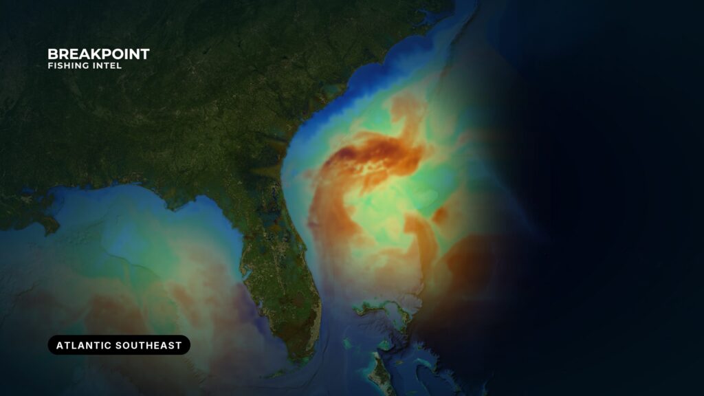
The run to blue water is the first number to know for any port on this coast, and it changes more from one stretch to the next than anything else about the fishing. This guide covers the Atlantic Southeast, from the Florida Keys to Cape Hatteras. The Gulf Stream hugs the shelf in the Keys and South Florida, swings far offshore off Georgia and South Carolina, and comes back close at Hatteras. Below you’ll find where the Stream sits for each stretch, what the shelf and live bottom do, what bites when, and which guide to open next.
What ties the Atlantic Southeast together
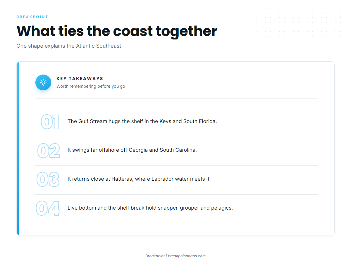
Four things hold this coast together: the Stream’s distance from shore, the bottom structure on the shelf, the inlets that gate every trip, and a warm season that starts early in the south and compresses as you run north. The stretch sections below all depend on these.
The Gulf Stream off South Carolina is the central fact. About 75 miles offshore, the warm Gulf Stream flows north out of the Florida Straits. Its distance from your inlet decides run length, fuel, weather windows and whether a half-day boat reaches blue water at all. Timing for blackfin tuna across the Atlantic Southeast follows the Stream. The Keys humps produce most of the year, and Hatteras fishes best in winter when the Stream comes closest.
The Gulf Stream sets the run
The Stream’s distance from shore changes sharply from south to north:
- Keys: The Florida Reefs sit about 5 miles off the line of keys, with Hawk Channel inside at 9 to 34 feet. Blue water lies just beyond the reef line.
- Georgia and South Carolina: Local sources put the run to the Stream at roughly 60 to 80 miles off Hilton Head.
- Charleston Bump: The raised bottom off Charleston breaks portions of the Stream into giant eddies.
- Hatteras: Operators report the Stream roughly 10 to 20 miles offshore. The shelf edge holds it until it veers east into deeper water at The Point, about 40 miles off Hatteras Island.
Gulf Stream water exceeds 80 degrees for much of the year. That explains winter sailfish in the south and winter bluefin and blackfin near Hatteras, where warm water sits close to cold. Hatteras is also where Labrador Current water meets the Stream.
Live bottom, ledges and the shelf break
Live bottom and hard bottom are rock and reef on an otherwise sandy shelf. They hold snapper, grouper and black sea bass because they give cover and a food chain in open sand. Ledges and the shelf break are where depth changes fast and the Stream meets the shelf, and pelagics and deep-drop species stack along that edge.
Artificial reefs add public structure. The FWC artificial reef locations include the Duane at 118 feet and the Spiegel Grove at 135 feet off Key Largo. Off Hatteras Inlet, AR-230 sits in 70 feet. Some shoals are unsurveyed or keep moving; Diamond Shoals is the clearest example, covered in the Outer Banks section.
Inlets, estuaries and the long warm season
Inlets are the gate for both bait and boats. Estuaries such as Pamlico Sound and the Lowcountry marsh feed the nearshore, and the fall mullet run moves out through them. The warm season is long in the south and compresses as you go north, which the stretch sections below follow.
Reading the edge
You can read the Gulf Stream edge and temperature breaks on the OBS SST and Chlorophyll layers, and find ledges and the shelf break with Chart Contours. Cloud blocks satellite SST passes, so check the pass time before you trust an edge. Chart layers are not for navigation.
The coast by stretch and port, south to north
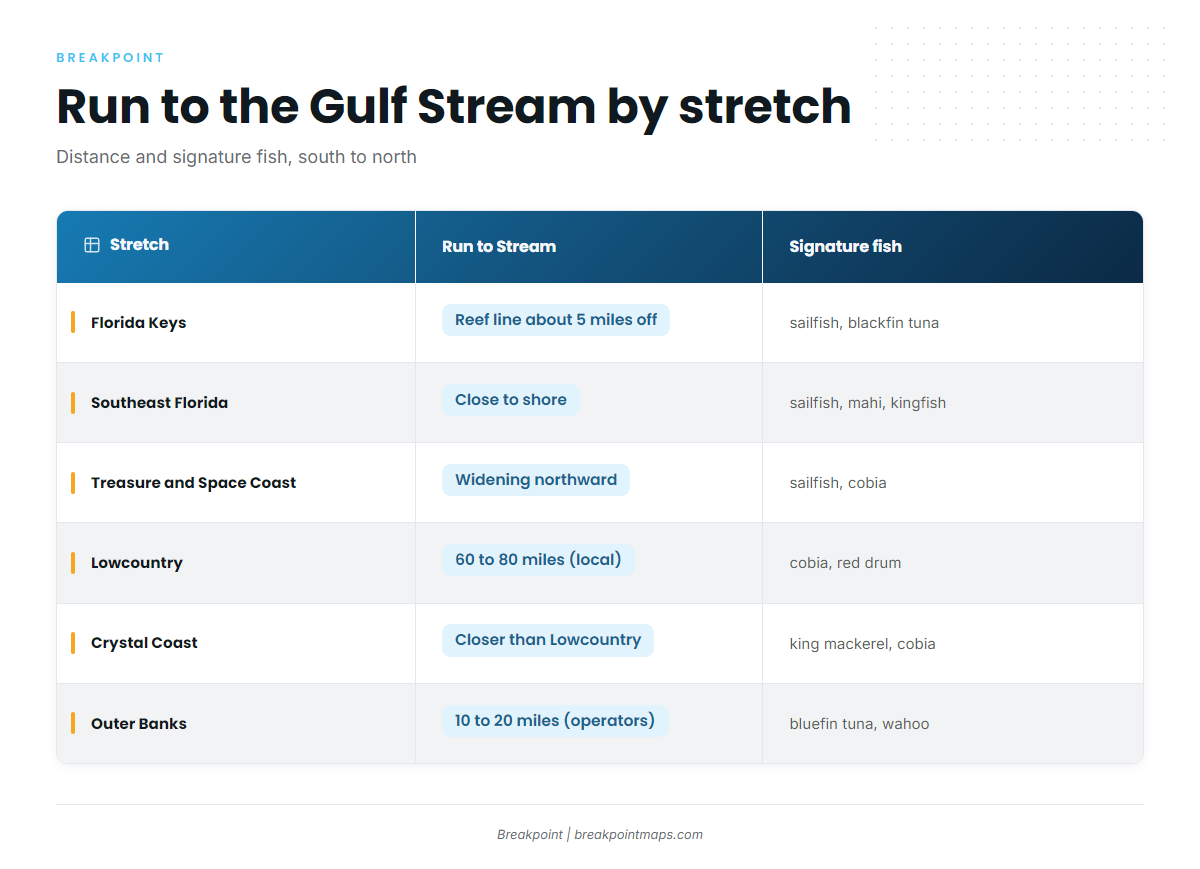
Each stretch below opens with what it is good for. The table gives the quick comparison.
| Stretch | Main inlets | Run to the Gulf Stream | Signature fish |
|---|---|---|---|
| Florida Keys | Boot Key Harbor, Moser Channel, Lower Keys channels | Reef line about 5 miles off. NWS Key West gives the edge from Sombrero Key Light. | sailfish, blackfin tuna, mahi-mahi, yellowtail snapper |
| Southeast Florida | Port Everglades, Lake Worth Inlet | Close to shore | sailfish, mahi-mahi, king mackerel |
| Treasure and Space Coast | Jupiter, St. Lucie, Fort Pierce inlets, Port Canaveral | Widening northward | sailfish, cobia, king mackerel |
| First Coast | St. Johns River, St. Augustine Inlet | Farther offshore | king mackerel, live-bottom fish, red drum |
| Georgia coast | Sounds between barrier islands | Long run | red drum, live-bottom fish |
| Lowcountry | Charleston Harbor entrance, Port Royal Sound | Roughly 60 to 80 miles off Hilton Head (local sources) | cobia, red drum |
| Grand Strand and Cape Fear | Little River Inlet, Cape Fear River | Long run, narrowing north | king mackerel, red drum |
| Crystal Coast | Beaufort Inlet | Closer than the Lowcountry | king mackerel, cobia |
| Outer Banks | Hatteras, Oregon and Ocracoke inlets | Roughly 10 to 20 miles (operator-reported) | bluefin tuna, wahoo, red drum |
Florida Keys: Key West, Lower Keys, Marathon, Islamorada, Key Largo
The Atlantic side of the Keys has the shortest run to blue water on the coast, with reef, wreck and Stream all within reach.
The Florida Reefs sit about 5 miles off, and Hawk Channel runs inside them at 9 to 34 feet. Trades run 10 to 20 knots through the year, and winds of 22 knots or more blow about 7 to 12 percent of the time from October through March, according to the Coast Pilot. The NWS Key West marine forecast gives the Gulf Stream edge as a distance and bearing from Sombrero Key Light. Read it alongside station SMKF1 at Sombrero Key.
A few hazards to know before you run:
- Overfalls near the Moser Channel bridge at large tides can swamp a small boat.
- Lower Keys tidal channels run about 3 to 5 feet in older surveys.
- Fishing by any means is prohibited in the Carysfort, Elbow and Molasses areas. See the sanctuary preservation area map.
- Inside the Looe Key preservation areas, only catch-and-release trolling is allowed.
Grounds worth knowing include Marathon Hump, 408 Hump, Sombrero Reef, and the Duane and Spiegel Grove wrecks. For targeted guides, see blackfin tuna off Key West, wahoo on the Islamorada humps, sailfish off the Florida Keys and red grouper in the Keys. The bay side and backcountry fall outside this guide. See "Where this guide ends."
Southeast Florida: Miami to Palm Beach
The Stream runs closest to the mainland here, and winter sailfish are the reason most people come. The run is short, sailfish peak in winter, and mahi-mahi follow in spring.
Treasure Coast and Space Coast: Jupiter, Stuart and north
This is the winter sailfish coast, where the Stream starts to pull away from shore going north. Two guides cover the best-known ports: sailfish off Jupiter and sailfish off Stuart. Bigger blackfin run from Jupiter to Miami in spring.
First Coast: Jacksonville, St. Augustine
The shelf widens here and the Stream sits farther off, so nearshore live bottom and ledges do most of the work. Northeast Florida blackfin sit farther offshore than their Keys counterparts.
Georgia coast
Inshore, this is marsh and sound fishing, with a long run across a wide shelf to blue water. Live bottom and artificial reefs hold the nearshore fish. Offshore timing here is less documented than in Florida or the Outer Banks.
Lowcountry: Charleston, Hilton Head
This is red drum marsh and spring cobia inshore, with the Charleston Bump and its eddies at the far end of a long run. The run is roughly 60 to 80 miles off Hilton Head, per local sources. For the cobia run, see cobia off Charleston.
Grand Strand and Cape Fear
This stretch has nearshore king mackerel and live bottom, with the Stream narrowing toward shore as you run north.
Crystal Coast: Morehead City
Beaufort Inlet opens to king mackerel water and a shorter Gulf Stream run than anywhere south of it. The coast from Cape Hatteras to Cape Lookout trends southwest for 64 miles. See king mackerel off Morehead City.
Outer Banks: Hatteras, Oregon Inlet, Ocracoke
The Gulf Stream runs closest here, and this is the northern edge of the warm-water fishery. Operators put the run at roughly 10 to 20 miles, and Labrador water meets the Stream here.
This stretch has the coast’s most important navigation notes:
- The Hatteras Inlet bar shifts continually. The bar buoys are not charted because they are moved often, and the Coast Guard port status lists the inlet as open with frequent shoaling and shifting bottoms.
- Tidal current in the inlet channel reaches about 2 knots.
- Diamond Shoals extend about 9 miles southeast, with depths as shallow as 3 feet. Coast Pilot Chapter 4 says hydrography is not charted there because the bottom keeps changing, and advises staying in 120 feet, preferably 180 feet, when position is uncertain.
- Strangers should not attempt Rollinson Channel at night.
Read conditions at Diamond Shoals buoy 41025 and the NWS Newport/Morehead City marine forecast before you run. Grounds include AR-230 at 70 feet, Rock Pile, 230 Rocks and 280 Rocks. For the pelagic fishery, see wahoo off Cape Hatteras.
Season overview
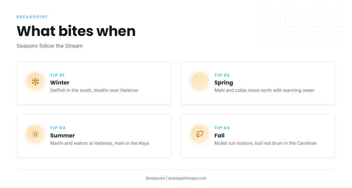
The Stream’s position decides the exact week, but the pattern holds by season.
Winter
- South Florida and the Keys: sailfish, wahoo, king mackerel, blackfin tuna.
- Hatteras: bluefin tuna, king mackerel, yellowfin tuna.
- More on sailfish along the Atlantic Southeast and winter bluefin tuna.
Spring
- Keys: mahi-mahi, cobia, tarpon, permit, sailfish.
- Hatteras: yellowfin tuna, mahi-mahi, red drum, white and blue marlin.
- Both the mahi run and the cobia migration move north with warming water.
Summer
- Keys: mahi-mahi, wahoo, yellowtail snapper, blackfin tuna.
- Hatteras: blue and white marlin, sailfish, wahoo, Spanish mackerel, amberjack.
Fall
- Inshore: the fall mullet run and its predators.
- Carolinas: red drum and bull red drum.
- Hatteras: wahoo, yellowfin tuna, bluefin tuna, blackfin tuna, false albacore.
- Keys: mahi-mahi, wahoo, sailfish, grouper.
Rules and licenses
Each state and the federal fishery councils set their own rules, and they differ by side of the Keys and by distance from shore. Check the agency before you fish:
- Florida: Florida Fish and Wildlife Conservation Commission (FWC).
- Georgia: Georgia DNR Coastal Resources Division.
- South Carolina: SCDNR.
- North Carolina: NC Division of Marine Fisheries (NCDMF).
- Federal waters: South Atlantic Fishery Management Council and NOAA Fisheries, including Highly Migratory Species rules for tunas and billfish.
State waters run to 3 miles. Federal waters run from 3 to 200 miles. South Atlantic red snapper is the clearest case of a rule that changes by season and quota, so we print no dates or limits here. In the Keys, the Gulf and Atlantic sides fall under different councils, so confirm which one applies to the water you are fishing.
Where this guide ends
The Gulf side of the Keys and the backcountry belong to the Gulf guide, and the rules differ by side. North of Cape Hatteras, at 35°15.3′ N, black sea bass follows the Mid-Atlantic plan, and the Stream leaves the shelf and becomes a meandering jet. Both handoffs run through fishing guides by region.
The guides, grouped
Tunas
- Atlantic bluefinwinter fish near Hatteras where the Stream comes close
- bigeyedeep-water tuna along the Stream edge
- blackfintiming that follows the Gulf Stream from the Keys to Hatteras
- yellowfinan Outer Banks staple through much of the year
Billfish and swordfish
- blue marlinsummer fish on the Stream edge
- white marlinspring through fall offshore
- sailfishthe winter fishery in the south, with summer and fall fish farther north
- swordfishdeep-water targets along the shelf edge
Other offshore pelagics
- mahi-mahithe spring and summer run up the Stream
- wahoofall and winter fish off Florida and the Carolinas
Nearshore and inshore
- cobiathe spring migration moving north up the coast
- king mackerelnearshore fish from the Keys to the Outer Banks
- spanish mackerelbeach and nearshore runs in spring and fall
- striped bassthe northern edge of the range along the Carolinas
Florida Keys guides
- sailfish off the Florida Keysreef-edge sailfish on the Atlantic side
- red grouper in the Florida Keysbottom fishing on live bottom and wrecks
- wahoo on the Islamorada humpstrolling the humps off the Upper Keys
- blackfin tuna off Key Westblackfin along the edge at the southern end
Southeast Florida guides
- sailfish off Jupiterwinter sailfish close to the inlet
- sailfish off Stuartthe Treasure Coast winter run
Carolinas guides
- cobia off Charlestonthe spring cobia run in the Lowcountry
- king mackerel off Morehead Citykings out of Beaufort Inlet
- wahoo off Cape Hatteraswahoo where the Stream runs closest
More regions and species
- fishing guides by regionneighboring coasts, including the Gulf and Northeast
- saltwater fish species guidesevery species we cover
More species guides for the Atlantic Southeast: black sea bass in the Atlantic Southeast, blueline tilefish in the Atlantic Southeast, golden tilefish in the Atlantic Southeast, gray triggerfish in the Atlantic Southeast, greater amberjack in the Atlantic Southeast, red grouper in the Atlantic Southeast and vermilion snapper in the Atlantic Southeast.
Before you run
Pick a stretch and open its guide, or check the Gulf Stream edge on OBS SST before you run. Breakpoint reads the temperature breaks, depth changes and bait signs the way a good captain would, and gives you a better decision about where to look. It does not promise fish. Download Breakpoint from the App Store or Google Play when you are ready to plan the next trip.