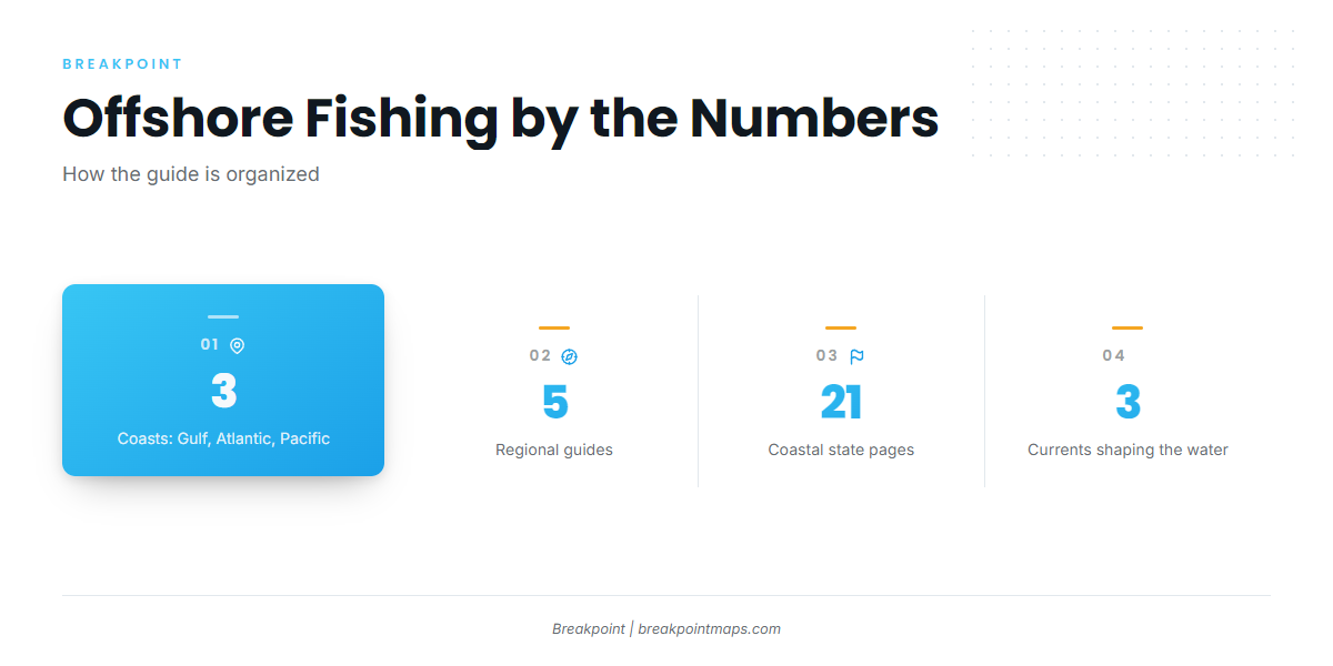
Offshore fishing in the United States happens on three coasts that work differently. The Gulf, the Atlantic and the Pacific each have their own shelf, current and structure, and those things set how far you run and what you fish for. We cover the lower-48 coast in 5 regions, and every coastal state is listed below by coast.
How Offshore Fishing Differs on the Gulf, Atlantic and Pacific Coasts
The shelf break is where the continental shelf ends and depth falls off toward bluewater. How far offshore that edge sits sets the length of your run to pelagic water.
Gulf Coast offshore fishing
Gulf Coast offshore fishing runs over a broad continental shelf. Reef, wreck and rig fishing happen in moderate depths, and in most places bluewater sits a long run out. The shelf runs wide off the Florida Panhandle, Alabama and west Florida, but the edge comes close off the Mississippi River delta near Venice, Louisiana. The Loop Current and the eddies it sheds carry warm bluewater and pelagics into reach.
Structure is the draw. Oil and gas platforms stand off Louisiana and Texas, artificial reefs hold fish off Alabama, Mississippi and Florida, and natural ledges and hard bottom run off west Florida. Red snapper, grouper and amberjack hold on the structure, while yellowfin tuna, wahoo, mahi and billfish work the bluewater.
Atlantic Coast offshore fishing
Atlantic Coast offshore fishing is shaped by the Gulf Stream in the south and by submarine canyons and banks in the north. Off Southeast Florida the edge comes in close. The shelf widens off Georgia and the Carolinas, then narrows again where the Gulf Stream swings near Cape Hatteras. In the Mid-Atlantic the shelf ends at a line of canyons.
The Gulf Stream runs north along the Southeast and turns offshore past Hatteras. Its edges hold weedlines, temperature breaks and bait. Wrecks, ledges and live bottom define the Southeast, where the targets are sailfish, mahi, wahoo, grouper and snapper. Hudson, Baltimore and Norfolk canyons anchor the Mid-Atlantic for yellowfin and bigeye tuna, white marlin and tilefish. In New England, banks and ledges such as Stellwagen Bank and Jeffreys Ledge hold bluefin tuna and groundfish. The Atlantic Southeast and Atlantic Northeast guides cover both halves in detail.
Pacific Coast offshore fishing
Pacific Coast offshore fishing works over a narrow shelf, where deep water comes close to shore and the cool California Current sets the pattern. Rocky reef sits close in along most of the coast. Warm-water intrusions push tuna and yellowtail into reach off Southern California, and albacore follow temperature breaks offshore farther north.
Southern California has offshore banks such as Cortes Bank and Tanner Bank, plus kelp paddies. Oregon and Washington fish rocky reef for rockfish, lingcod and halibut. Yellowtail, bluefin tuna, yellowfin tuna and dorado lead the Southern California target list, and albacore lead offshore in the north. The Pacific Southwest and Pacific Northwest guides cover each half.
Coast comparison
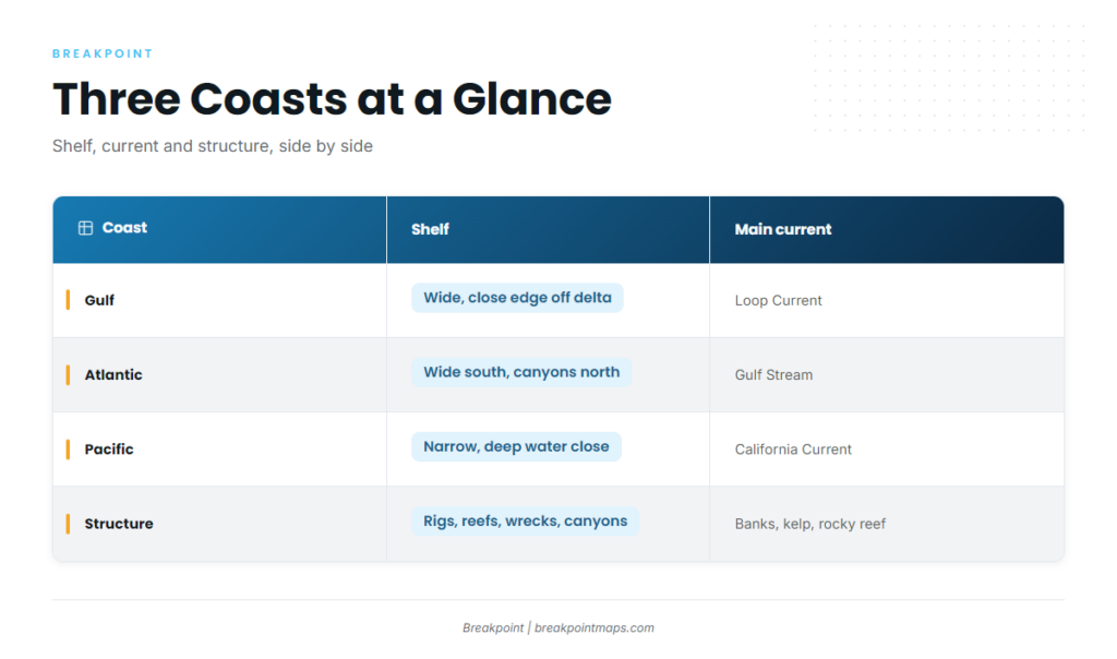
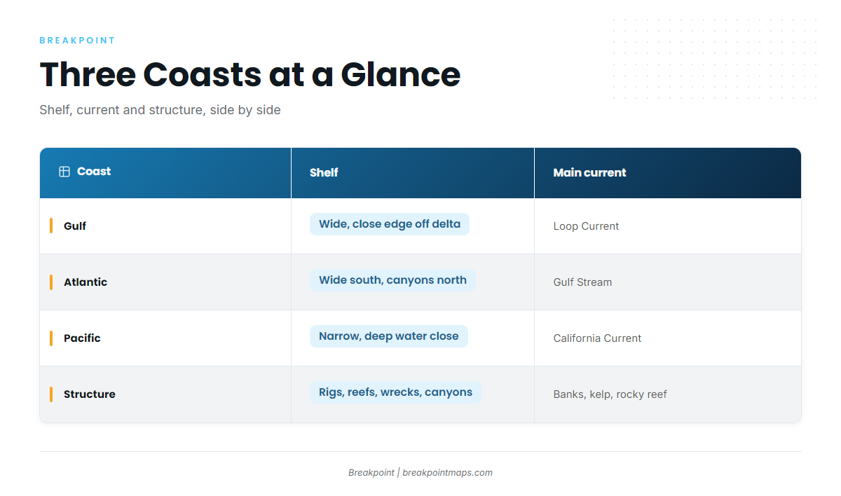
| Coast | Shelf | Main current | Typical structure | Core offshore targets |
|---|---|---|---|---|
| Gulf | Wide in most places, close edge off the delta | Loop Current | Platforms, artificial reefs, ledges | red snapper, grouper, yellowfin tuna, wahoo |
| Atlantic | Close off Southeast Florida, wider north of it | Gulf Stream | Wrecks, live bottom, canyons, banks | sailfish, mahi, tuna, white marlin, tilefish |
| Pacific | Narrow along most of the coast | California Current | Offshore banks, kelp paddies, rocky reef | yellowtail, bluefin tuna, albacore, rockfish, lingcod |
Swipe the table sideways to see every column.
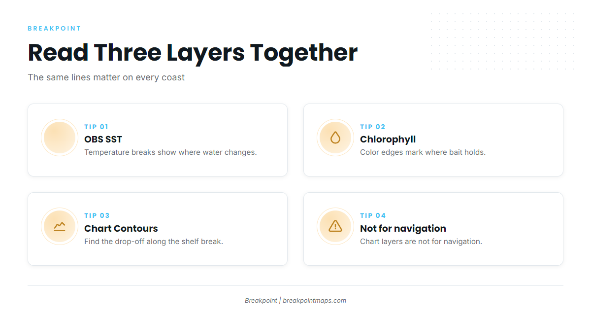
The same three layers are useful on every coast. Temperature breaks show on OBS SST, color edges on Chlorophyll, and the drop-off on Chart Contours. Read together, they tell you where to look. Chart layers are not for navigation.
How Breakpoint Splits the Coast
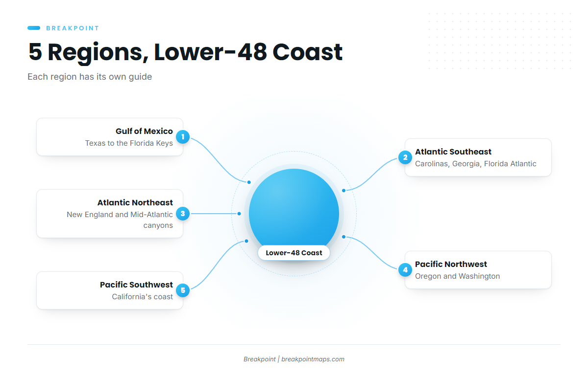
We cover the lower-48 coast in 5 regions:
- Gulf of MexicoTexas to the Florida Keys. Platforms, artificial reefs, the Loop Current and a shelf that runs wide in most places.
- Atlantic SoutheastThe Carolinas, Georgia and Florida’s Atlantic coast, with the Gulf Stream, ledges and live bottom.
- Atlantic NortheastNew England and the Mid-Atlantic canyons, with bluefin tuna, canyon edges and offshore banks.
- Pacific NorthwestOregon and Washington. Albacore offshore, rocky reef, and the cool water of the California Current.
- Pacific SouthwestCalifornia’s coast, with offshore banks, kelp paddies and warm-water tuna and yellowtail.
Open the guide for your water to see its structure and the layers worth watching there.
Offshore Fishing by State
Every coastal state in the lower 48, listed along the coast the way you’d run it.
Gulf Coast
West to east, from the Texas platforms to Florida’s west coast ledges.
- TexasPlatforms, natural banks such as the Flower Garden Banks, and long runs to bluewater for red snapper, yellowfin tuna and wahoo.
- LouisianaThousands of platforms and a shelf edge close to the delta near Venice, for yellowfin tuna, red snapper and wahoo.
- MississippiArtificial reefs and rigs past the barrier islands, for red snapper, amberjack and mahi in deeper water.
- AlabamaWide shelf and large artificial reef zones off Orange Beach and Gulf Shores, for red snapper, amberjack and grouper.
- FloridaGulf side: a wide shelf, ledges and hard bottom off the Panhandle and west coast, for grouper, red snapper and amberjack.
Atlantic Coast
South to north, from the Gulf Stream off Florida to the ledges of the Gulf of Maine.
- FloridaAtlantic side: the Gulf Stream comes in close off Southeast Florida and the Keys, for sailfish, mahi and wahoo.
- GeorgiaWide shelf, live bottom including Gray’s Reef, and a long run to the Gulf Stream, for grouper, snapper and wahoo.
- South CarolinaLedges, live bottom and the Gulf Stream edge, for wahoo, mahi and grouper.
- North CarolinaThe Gulf Stream swings close off Hatteras, for billfish, yellowfin tuna and mahi, with wrecks closer in.
- VirginiaNorfolk Canyon and wrecks off the coast, for yellowfin tuna, billfish and tilefish.
- MarylandCanyon runs from Ocean City toward Baltimore Canyon, for white marlin, yellowfin tuna and mahi.
- DelawarePermitted artificial reef sites inshore and canyon runs offshore, for tuna, sea bass and tilefish.
- New JerseyCanyon runs to Hudson Canyon and its neighbors, plus wrecks and lumps, for tuna, tilefish and mahi.
- New YorkRuns from Long Island to Hudson Canyon and the canyons east, for tuna, sharks and tilefish.
- ConnecticutRuns east out of Long Island Sound past Block Island to open ocean, for bluefin tuna, sharks and striped bass.
- Rhode IslandBlock Island, Cox Ledge and the canyons farther out, for bluefin tuna, sharks and cod.
- MassachusettsInshore banks such as Stellwagen Bank and the Cape Cod grounds, for bluefin tuna, cod and haddock.
- New HampshireA short coast with Jeffreys Ledge in reach, for bluefin tuna and groundfish.
- MaineLedges and basins of the Gulf of Maine, for bluefin tuna, cod and haddock in cold water.
Pacific Coast
South to north, from the Southern California banks to the Washington coast.
- CaliforniaOffshore banks such as Cortes and Tanner and kelp paddies to the south, for yellowtail, bluefin tuna and rockfish.
- OregonA narrow shelf and rocky reef close to shore, with albacore offshore, plus rockfish, lingcod and halibut.
- WashingtonAlbacore offshore and rocky bottom off the coast, for rockfish, lingcod and halibut.
Rules and Permits
Inside state waters the state agency sets the rules. Past that line, NOAA Fisheries and the regional fishery management councils do. State waters extend 3 nautical miles off the Atlantic and Pacific coasts. Florida’s Gulf state waters extend 9 nautical miles, and the FWC explains Florida’s state and federal waters on its own page.
A private vessel fishing for Atlantic tunas, billfish, swordfish or sharks needs a NOAA HMS Angling Permit. Each state page points to its state agency. Check the state agency and NOAA Fisheries before you fish.
Satellite SST can’t see through cloud. Bottom charts in some areas rest on old surveys. Chart layers are not for navigation.