Sailfish fishing off Jupiter, Florida, starts a short run from the jetties. The fish come south with the winter bait, and the Gulf Stream runs close to this coast. This guide covers the inlet, the water, the timing, the methods used here and how the 3 nm line changes the rules. For biology, kite rigging and tackle, see our sailfish fishing guide.
Getting out of Jupiter Inlet
Jupiter Inlet is a jettied opening that links the Loxahatchee River, Jupiter Sound and Lake Worth Creek to the Atlantic. The Intracoastal Waterway sits 0.5 mile inside the entrance. The U.S. Coast Pilot 4 describes the approach and reports these hazards:
- A sandbar extends south and east from the north jetty across the whole inlet, usually 1 to 2 ft under the surface. The openings through it shift with the weather.
- A second sandbar at the junction of the Intracoastal and the entrance builds up continuously.
- Tidal currents reach 6 knots, with eddies and turbulence near the south jetty.
- Breaking, confused seas frequently sit over the bars off the jetty mouth.
- Conditions are reported worst on an ebb tide with easterly wind, and in winter, the same season the sailfish arrive.
Nor’easters can bring gale to storm force winds from October through March, especially north of the inlet. Waves above 6 ft are reported 8 to 15 percent of the time on this coast over the same months. The sources below give the numbers for your day.
Read before you run
| Source | What it tells you | Link |
|---|---|---|
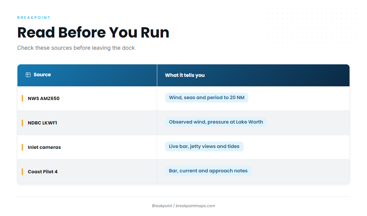
| NWS Miami marine forecast AMZ650 | Wind, seas and period for the coastal waters from Jupiter Inlet to Deerfield Beach, out to 20 NM | AMZ650 marine forecast |
| NDBC station LKWF1 | Observed wind and pressure at Lake Worth Pier | LKWF1 Lake Worth Pier station |
| Jupiter Inlet cameras and tide chart | Live surf, jetty, east and south views, plus tide timing so you can see whether you are on an ebb | Jupiter Inlet live cameras |
| Coast Pilot 4, Ch. 10 | Bar, current and approach notes | Linked above |
The forecast covers a broad zone, and LKWF1 sits at Lake Worth Pier, about 11 miles south of the inlet. Use the cams to see the bar itself.
Ramps and fuel
The closest public ramp to the inlet is at Burt Reynolds Park ramps, run by Palm Beach County. Other ramps and marinas on this stretch:
| Name | Type | Operator |
|---|---|---|
| Burt Reynolds Park | Ramp | Palm Beach County Parks and Recreation |
| Waterway Park | Ramp | Palm Beach County Parks and Recreation |
| Bert Winters Park (Juno Beach) | Ramp | Palm Beach County Parks and Recreation |
| Juno Park (Juno Beach) | Ramp | Palm Beach County Parks and Recreation |
| Jupiter Inlet Marina (U-Tiki Beach) | Marina, fuel listed | U-Tiki Beach |
| Castaways Marina (Square Grouper) | Marina, fuel listed | Square Grouper |
| Jupiter Pointe Club & Marina | Marina, fuel listed | Jupiter Pointe |
When Jupiter Inlet is not the call
Two other inlets sit within a short run. Weigh each against the trip back.
- Lake Worth Inlet: 11 miles south of Jupiter Inlet Light. It is a dredged, jettied cut with a 35 ft federal project depth and reported currents of 2.4 knots on the flood and 3.6 knots on the ebb. The north side of the channel tends to shoal along the north jetty.
- St. Lucie Inlet: 14 miles north. It is the Stuart entrance.
Where the sailfish are
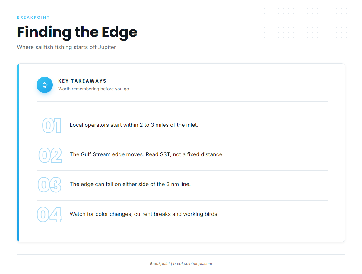
Local operators describe starting to fish within about 2 to 3 miles of the inlet. The Gulf Stream runs close to this coast, which keeps the run short.
Two named reefs sit inshore of the edge: Andrew "Red" Harris No Shoes Reef, in 55 ft, and Jupiter Inlet Step Reef. Use both as landmarks for orientation and bait. We make no claim that sailfish hold on them.
The inshore edge of the Gulf Stream moves, and it can fall on either side of the 3 nm state line. Find it on SST and current data rather than by a fixed distance from the beach. Local operators also read the water for color changes, current breaks and birds working the surface.
The state line matters more here than in most places:
- Atlantic state waters run from shore to 3 nautical miles. Federal waters begin beyond.
- A drift along the edge can carry you across that line.
- The permit and release rules change when it does. Details are in Regulations below.
Finding the edge before you leave the dock
Check OBS SST and Chlorophyll for the inshore Stream edge and the color change, then Chart Contours for the drop-off. Chart layers are not for navigation. SST passes can be blocked by cloud after a front, and when that happens Chlorophyll and the last clear pass are what you have.
Season
Sailfish are a winter and autumn fish off Jupiter. Wahoo and king mackerel share the winter water.
Local operators tie the winter bite to cold fronts. As fronts come down from the north, they push southbound bait, and sailfish follow it. The same fronts bring the nor’easter conditions described above, and those govern the inlet. Check the AMZ650 forecast for wind, seas and period.
| Season | Species listed for Jupiter |
|---|---|
| Winter | Sailfish, wahoo, king mackerel |
| Spring | Wahoo, mahi-mahi, yellowfin tuna, blue marlin, king mackerel |
| Summer | Wahoo |
| Autumn | Wahoo, sailfish, king mackerel |
The same southbound fish show up farther down the coast. See sailfish off the Florida Keys.
Tactics for sailfish off Jupiter
Kite fishing and trolling are both used locally, and operators differ on which they favor. One prefers the kite but finds trolling produces more bites. Another trolls as the main method and switches to the kite when conditions suit. For gear and rigging, see our guide to sailfish rigging and tackle.
Kite with live bait
Kites hold live baits at the surface along the edge and spread them over more water. Hardy baits such as goggle-eyes, blue runners and threadfin herring are the most productive under a kite. Pilchards are also used locally. Rigging steps are in the species guide.
Drifting or slow-trolling live bait
Drifting live bait suits days or boats that do not suit a kite. A drift along the edge can carry you across 3 nm, so mark your position against the line.
Trolling dead baits
Dead baits such as ballyhoo let you cover water along the color change. Operators note that trolling can produce more bites than the kite.
Reading the surface
Operators watch for these cues:
- Birds working the surface
- A color change in the water
- A current break
- Showering bait
At the boat
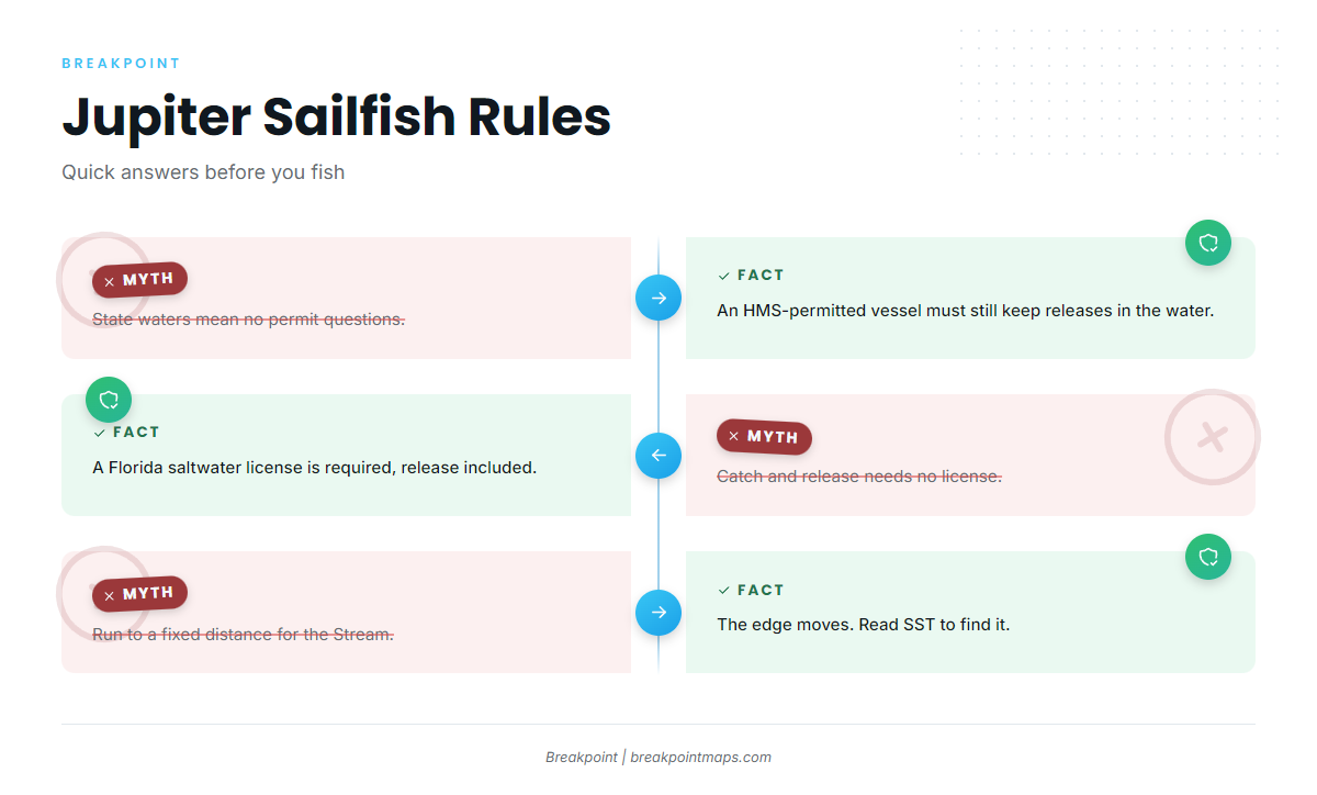
Release handling stays in the water. If you are past 3 nm, or your vessel holds an HMS permit, a sailfish you plan to release may not come out of the water. Because the edge crosses the line, treat every fish as an in-water release.
FAQ
Do I need an HMS permit to fish sailfish off Jupiter?
In federal waters beyond 3 nm, yes. In state waters, no. The permit is issued to the vessel. The Stream edge can sit on either side of the line, so plan for federal water.
What is the minimum size for a sailfish in Florida?
The minimum is 63 inches lower jaw fork length. The bag limit is 1 billfish per person per day. Both figures come from FWC.
How do I report a sailfish I keep?
Report every landed billfish to NOAA within 24 hours. Call 800-894-5528 or use the HMS permit portal at hmspermits.noaa.gov.
Can I lift a sailfish out of the water for a photo?
Not if you plan to release it in federal waters, or in state waters when the vessel holds an HMS permit. Keep it in the water for the photo.
What if Jupiter Inlet is bad?
Lake Worth Inlet is 11 miles south, with a 35 ft project depth. St. Lucie Inlet is 14 miles north. The Coast Pilot reports Jupiter at its worst on an ebb with east wind. Check AMZ650 and the inlet cams.
How far out are the sailfish?
Local operators describe starting to fish within about 2 to 3 miles of the inlet. The Stream edge moves, so read SST for it rather than running to a fixed number.
Do visiting anglers need a Florida license to release sailfish?
Yes. A Florida saltwater license is required to take or attempt to take saltwater fish, including catch and release. Non-resident short-term options exist. Check FWC for details.