




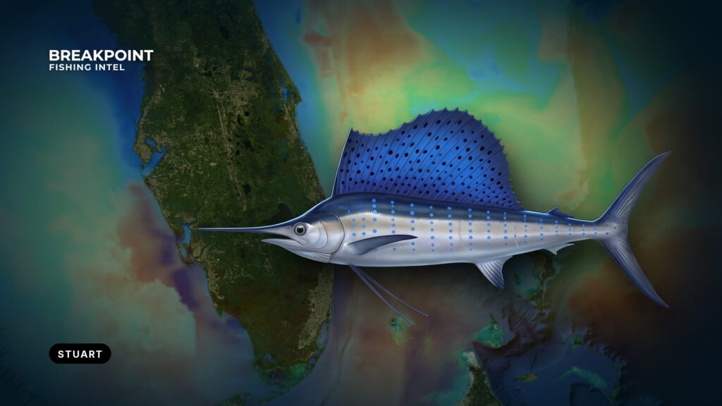
Sailfish fishing off Stuart, Florida starts with one inlet and a short run to the edge of the Gulf Stream. Boats from Stuart and Port Salerno reach the Atlantic through St. Lucie Inlet, which sits between Fort Pierce Inlet, 20 miles north, and Jupiter Inlet, 14 miles south. Marinas sit inside Manatee Pocket and on the St. Lucie River. The town’s "Sailfish Capital of the World" nickname is earned on the water.
This guide is for anglers running their own boat. It covers the inlet, the edge, the winter fishery, the kite method and the day’s read. For how sailfish feed and fight, see our sailfish guide. What follows helps you decide when to run the inlet and where to set the drift.
Getting Out of Stuart: Ramps, Marinas and Fuel
Most trailer boats launch at Sandsprit Park in Manatee Pocket, the Martin County public ramp. Fuel is listed at Sailfish Marina of Stuart and Pirate’s Cove Resort & Marina.
The run from the ramp to the inlet crosses the St. Lucie River and the Intracoastal Waterway. Three notes from the local navigation record:
- Cross currents are reported where the St. Lucie River meets the Intracoastal Waterway.
- A hard ledge lies on the north side of the channel at the river mouth.
- For the short turn from the waterway, stay about 100 yards south of a line between Light 4 and Daybeacon 6.
Bait is part of the morning plan and is covered in the kite section below.
Running St. Lucie Inlet
St. Lucie Inlet changes with tide phase and wind direction, and the hardest combination is an ebb running out against an onshore sea.
The NOAA U.S. Coast Pilot 4 describes what the bar does:
- The entrance buoys are not charted, because they are moved to mark the best water. They may be off station after heavy storms.
- Shoaling builds across the channel from both the north and south sides. Extensive sandbars lie inside the north jetty, and channel depths vary.
- Tidal currents are reported to reach 7 knots. They keep running about 2 hours after high and low water.
- Breakers can occur throughout the channel as seas, ground swell and wind build, particularly on the ebb.
- Entry is reported to be easiest just on the flood side of slack water.
The lag matters because the printed high or low tide time is not when the water turns. The current keeps running about 2 hours past it in both directions, so plan the transit for the flood side of slack and count the lag on the way out and on the way home.
An ebb with an east wind or swell is what stands water up on the bar. How much of that your boat and crew can take is your call.
Chart layers, ours included, are not for navigation in the inlet. The buoys move, so read the water rather than a stored track.
Inlet Go/No-Go Checklist
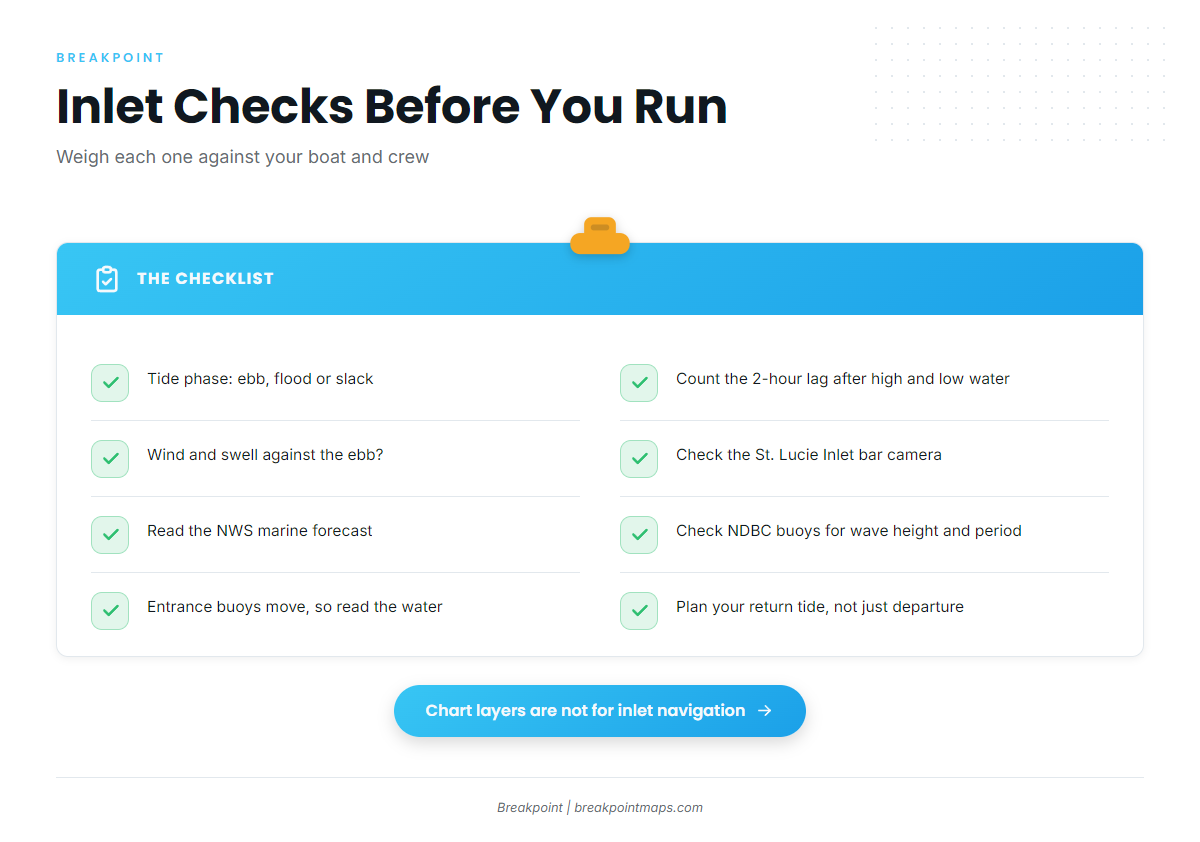
Run these checks before the ramp and again before the return:
- Tide phase. Ebb, flood or slack, and the roughly 2-hour lag after high and low water.
- Wind against the ebb. Is an east or northeast wind or swell opposing the outgoing current?
- Bar camera. Look at the St. Lucie Inlet bar camera. It is a private site, not a navigation aid.
- NWS marine forecast. Wind speed and direction, wave height and wave period.
- NDBC buoys. Observed wave height and period.
- Entrance buoys. They move and may be off station after storms.
- Return trip. Check the tide phase for your planned return, not only your departure.
Weigh the numbers against your boat and your crew.
The Nearshore Edge and Reef Lines off Stuart
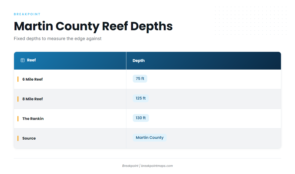
Off Stuart the Gulf Stream edge works close to the reef lines, and the named reefs of the Martin County artificial reef program give you fixed depths to measure it against.
| Reef | Depth |
|---|---|
| 6 Mile Reef | 75 ft |
| 8 Mile Reef | 125 ft |
| The Rankin | 130 ft |
Bill Donaldson Reef, Edgar Ernst Reef, Sirotkin Reef Site, South County Reef Site and King Fish Hole are further named grounds along the coast.
The St. Lucie Hump is a federal marine protected area between 27°04′ and 27°08′ N, 79°58′ and 80°00′ W. Fishing for or possessing snapper-grouper is prohibited there, and transit with gear stowed is allowed. Read the St. Lucie Hump MPA rules before you plot a drift near it.
The edge moves with every front, so no fixed distance applies. As the water cools, fish tend to slide shallower toward the reef lines, which makes the depths above the first place to check against your chart.
The Winter Sailfish Fishery off Stuart
The winter bite off Stuart follows the cold fronts, and the condition anglers wait for is a north wind against the north-flowing Gulf Stream.
Winter is the core of the fishery, though sailfish also appear on the spring and summer species lists for Stuart. Stuart sits inside the regional run covered in our guide to sailfish along the Atlantic Southeast, the Sailfish Alley stretch from Palm Beach to Fort Pierce.
Two condition-and-action chains drive the day:
- North or northeast wind against the Stream. The sea stands up, and sailfish tail down-sea. Set the drift along the color edge and look down-sea.
- The front and the days after it. Fish can move ahead of the bait, and bait often needs a dip in sea surface temperature to push south. The day after a front reads differently from the days of settling that follow. Watch for the bait as well as the fish.
The same fronts that bring the bite also shape the bar, so return to the inlet checklist before you commit.
Kite and Live Bait off Stuart
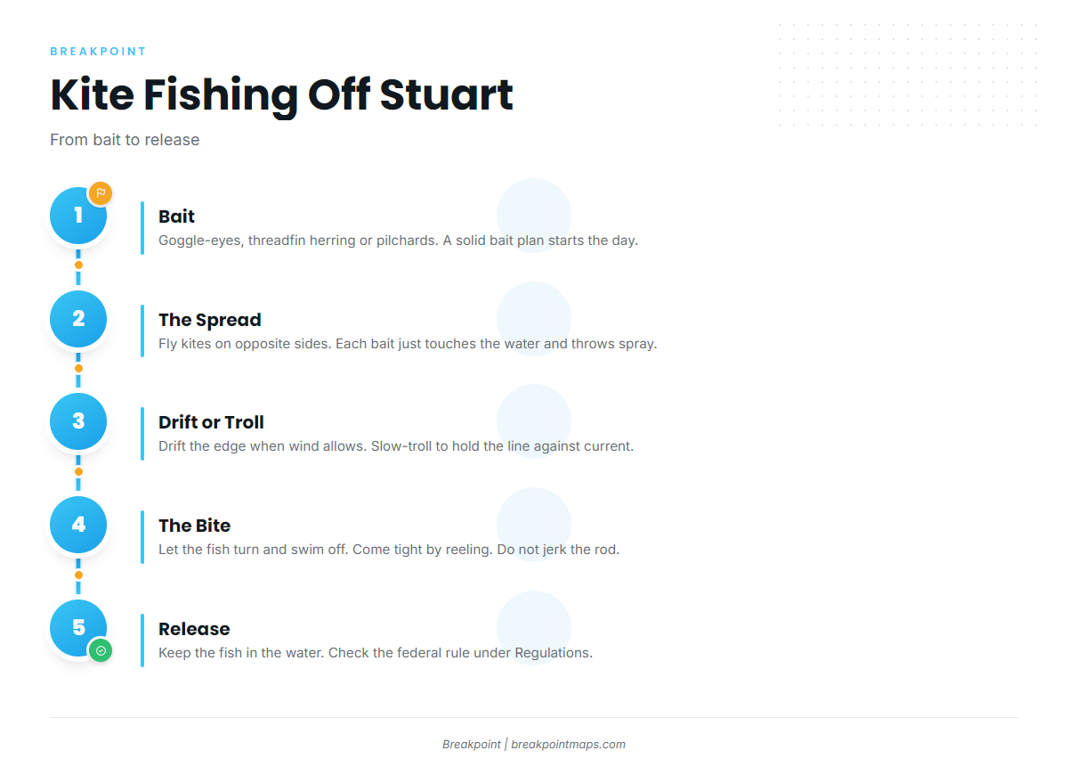
The local live-bait approach flies baits under kites so they splash at the surface, while some Stuart boats troll dredges instead.
Bait. Goggle-eyes, threadfin herring and pilchards are the live baits. A reliable bait plan shapes the start of the day, so settle it before you leave the dock.
The spread. Fly two kites on opposite sides of the boat to widen the spread. Each bait should just touch the water, kicking and throwing spray. If it dangles above the surface, let out more line. If it swims freely under the surface, reel up.
Drift or troll. Drift with the kites when the wind lets you hold along the edge. When current and wind fight the drift, slow-troll or bump the engine in and out of gear to stay on the line. Some local boats run dredges and cover ground instead.
The bite. With circle hooks, let the fish turn and swim off, then come tight by reeling. Reeling too soon pulls the bait out of the mouth, so don’t jerk the rod. Circle-hook rules are under Regulations below.
Release. Keep the fish in the water. The federal rule is under Regulations below.
For rigging beyond this, see the rigging in our sailfish guide.
Reading the Edge on the Day
Find the temperature and color break on satellite before you leave, then confirm it on the water with color, current and life.
Check the OBS SST and Chlorophyll layers before you leave the ramp, and see where the break sits relative to Chart Contours and the reef depths above. OBS SST shows the temperature break. Chlorophyll shows the green-to-blue water. They often line up and sometimes do not, and where they disagree, the water decides.
Satellite data has limits. A cloudy pass after a front leaves gaps, and the readings show the surface only. The layers are not for navigation.
Signs of the Edge
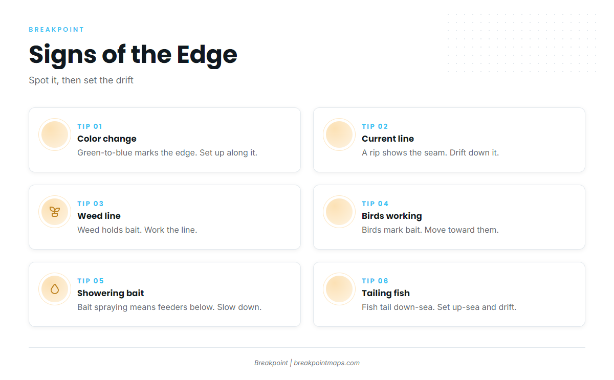
On the water, each sign comes with a next move:
- Green-to-blue color change. Fish along it, with the drift running down-sea.
- Current line or rip. Find the current and you find the fish. Work the baits along it.
- Weed line. It marks where the water converges. Run its length before you commit.
- Birds working. Move toward them and set up on the up-sea side.
- Showering bait. Bait under pressure means something is feeding. Slow down and fish the area.
- Tailing fish down-sea. Put the baits in front of them, up-sea of the sign.
Set the drift up-sea of the sign and let it carry you down the line.
Mark 6 Mile Reef, 8 Mile Reef and The Rankin with Chart Contours so you can plan the drift against known depths.
Frequently Asked Questions
When is the sailfish bite off Stuart?
Winter is the core of the fishery. Cold fronts and north wind against the Gulf Stream drive it. Sailfish also appear on the spring and summer species lists for Stuart. Plan around the front and the day’s wind rather than a calendar date.
Do I need an HMS Angling Permit to fish sailfish off Stuart?
You need it in federal waters, beyond 3 nautical miles, and it is issued to the vessel. You do not need it in state waters. A Florida saltwater fishing license is required either way. Check NOAA HMS and FWC before you fish.
When should I avoid running St. Lucie Inlet?
Weigh the variables. An ebb with an onshore wind or swell stands water up on the bar. Currents are reported to reach 7 knots and run about 2 hours past high and low water. Entry is reported easiest on the flood side of slack. Check the NWS marine forecast and the bar camera.
Should I kite fish or troll off Stuart?
Both are used. Kites hold live baits splashing on the surface along the edge, and dredge trolling covers ground. Choose by how the wind and current let you hold the line. If you cannot hold the edge on a drift, slow-troll or run dredges.
How far out is the Gulf Stream edge off Stuart?
It moves with every front, so no fixed distance applies. Read OBS SST and Chlorophyll against Chart Contours, and use the reef depths of 75, 125 and 130 ft as reference points. Confirm the break on the water with color and current.
What do I fish if the inlet or the sailfish bite says no?
Wahoo, kingfish and Spanish mackerel sit on the local seasonal lists. Check the FWC and federal rules for each before you go. For more options along the coast, see our Atlantic Southeast fishing guide.