




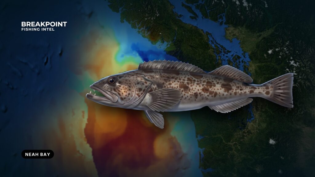
Neah Bay sits about 5 miles east of Cape Flattery, with the Strait of Juan de Fuca on one side of the cape and the open Pacific on the other. Lingcod fishing off Neah Bay runs across both waters, and the rules change where the two meet.
WDFW defines Marine Area 4 as running from Cape Alava north to Cape Flattery, then east in the Strait to the Sekiu River. WDFW also notes that Neah Bay has no dangerous bar to cross, and the Coast Pilot describes the harbor as protected from all but east weather.
This page covers how to get out of the bay, where the structure is, when the current lets a jig hold, and which rule lines decide where you can fish. Jigging, gear and biology are in our lingcod guide. The regional picture is in our Pacific Northwest fishing guide. This page stays at Neah Bay.
Getting Out of Neah Bay
The entrance runs between Waadah Island and Baada Point. The U.S. Coast Pilot 10 chapter says you can carry 17 feet into the bay. Two hazards matter on the way out:
- A reef and foul ground extend 0.2 mile from the southwest side of Waadah Island.
- A reef that bares extends 500 yards northwest from Dtokoah Point, southeast of the entrance.
The Green Can marks the entrance and doubles as a fishing mark.
Traffic, VHF and fog
Traffic separation schemes cover the approaches and the inside of the Strait, and a precautionary area lies west-northwest of Cape Flattery. The vessel traffic service in the Strait is mandatory for the vessels it covers, and ships work SEATTLE TRAFFIC on VHF-FM channel 5A. Monitor it.
Sea fog is most frequent at the west end of the Strait and is worst from about July through October. In light wind it can hang over the entrance for days. Ships often break into clear weather before passing Tatoosh Island.
Where to read conditions
Check these sources before you leave the dock:
- NDBC Station 46087 readings, 6 nm north of Cape Flattery. Real-time wind, wave height and period.
- NWS PZZ130 marine forecast, West Entrance U.S. Waters Strait of Juan de Fuca.
- Coast Pilot 10, Chapter 7, for currents, wind patterns and hazards.
- The sanctuary weather and tides page from Olympic Coast National Marine Sanctuary, which links to NOAA Tides and Currents predictions.
Compare the buoy readings with the forecast before you round Waadah.
Strait and Outer Coast Structure off Neah Bay
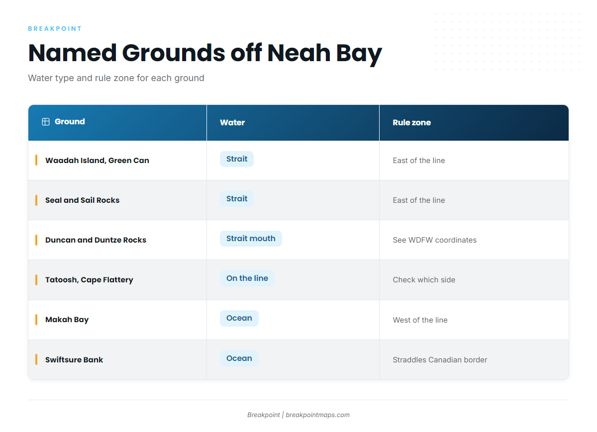
The grounds split into Strait water east of Tatoosh and ocean water off and south of the cape. That split drives the rules later in this guide.
Waadah Island and the Green Can. These inside waters sit close to the harbor. Small boats fish around Waadah when the forecast allows.
Seal and Sail Rocks. These Strait reefs lie east of the bay and are rock structure.
Duncan Rock and Duntze Rock. These sit off the cape’s north side. The flood sets with considerable velocity over them, which ties to the tide section below.
Tatoosh Island and Cape Flattery. Tide rips off the cape can be heavy.
Makah Bay. This ocean-side bay lies south of the cape.
Table Rock, the Garbage Dump and Blue Dot. These are named banks. The names are local, and no coordinates or depths are printed here.
Swiftsure Bank. This offshore bank crosses into Canadian waters. Canadian rules and licensing apply on that side, so check with Fisheries and Oceans Canada before you go.
| Ground | Water | Rule zone |
|---|---|---|
| Waadah Island and Green Can | Strait | East of the Bonilla–Tatoosh line |
| Seal and Sail Rocks | Strait | East of the line |
| Duncan and Duntze Rocks | Strait mouth | See WDFW coordinates |
| Tatoosh and Cape Flattery | On the line itself | Check which side |
| Makah Bay | Ocean | West of the line |
| Swiftsure Bank | Ocean | Straddles the Canadian border |
| Table Rock, Garbage Dump and Blue Dot | Outer coast | Plot against WDFW lines |
In Breakpoint, Chart Contours shows the ledges and pinnacles around Seal and Sail Rocks, Duncan and Duntze Rocks, and Tatoosh, so you can see where the bottom breaks before you run there. Chart layers are not for navigation.
Neah Bay and its neighbors
- Sekiu and Marine Area 5. Clallam Bay lies about 15 miles southeast of Neah Bay, and Marine Area 5 is managed separately.
- La Push and Marine Area 3. Area 3 shares the North Coast halibut season and quota with Area 4, along with the June–July 20-fathom restriction.
Rockfish and Lingcod Together
Black rockfish share the reefs with lingcod. East of the line, the rockfish allowed year-round are black, blue/deacon, yellowtail and widow only, per WDFW. Bag figures are in the Regulations table below.
Yelloweye retention is prohibited in all marine areas. Yelloweye favor deeper reefs, so staying shallower, and leaving a spot that produces them, reduces encounters. The C-shaped yelloweye conservation area has its own coordinates in the next section.
Copper, quillback and vermilion rockfish may not be possessed in May, June and July, per WDFW.
A descending device is part of the kit:
- WDFW requires one aboard and rigged for immediate use when you fish for or hold bottomfish or halibut.
- The federal rule requires one working device per vessel.
- Clip the fish, lower it to the depth of capture, and release it.
Bait and jig technique are in the technique section of our lingcod guide.
Current and Tide Timing at Cape Flattery
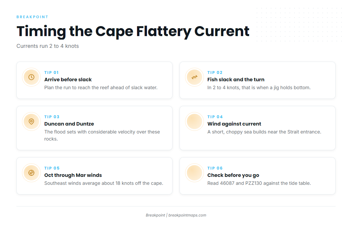
Currents between Cape Flattery and Race Rocks may reach 2 to 4 knots, and tide rips off the cape can be heavy.
At those speeds, slack and the first of the turn are the windows when a jig holds bottom without a wide scope. Plan the run so you arrive on the reef before slack. Tide predictions are on the sanctuary weather and tides page above.
The flood sets with considerable velocity over Duncan and Duntze Rocks, so plan your drifts and approach accordingly.
When wind and swell run against the current, a short choppy sea builds near the entrance to the Strait. From October through March, winds blow mostly from the southeast through southwest. Southeast winds average about 18 knots and raise confused seas off Cape Flattery where they meet long southwest swell. In summer, fog is the factor, from about July through October, and it bears on rounding Tatoosh.
Check 46087 and PZZ130 against the tide table before committing to the outside.
The Lines That Decide Where You Fish
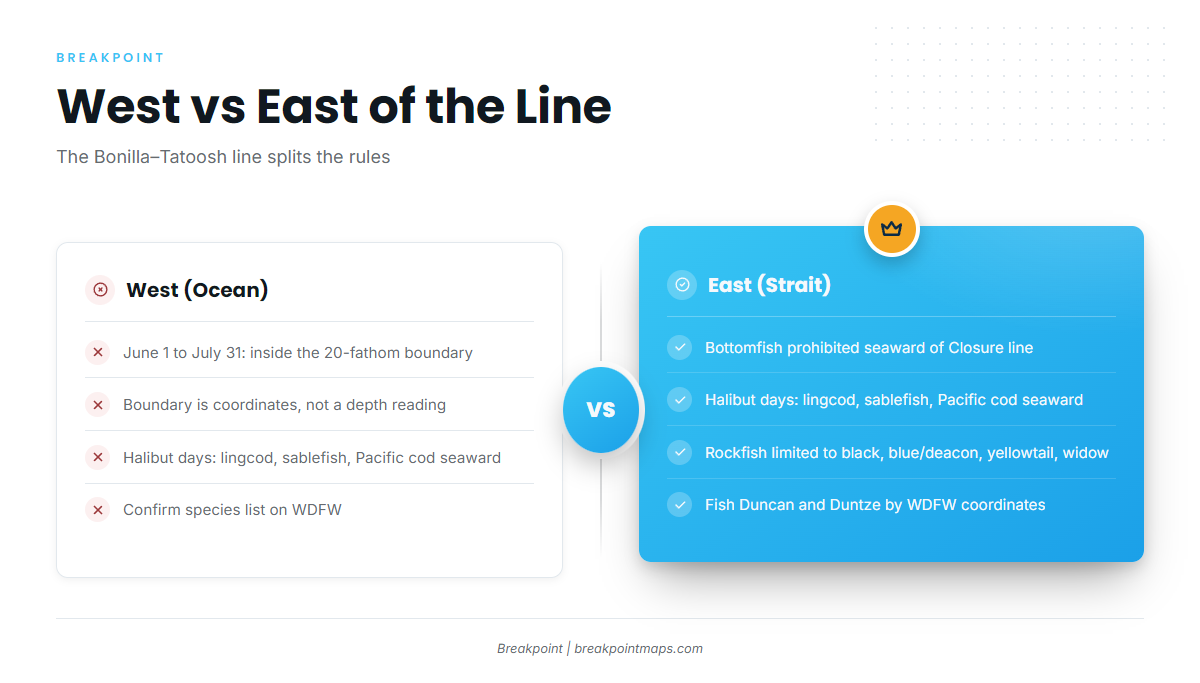
The Bonilla–Tatoosh line, which runs between Bonilla Point and Tatoosh Island, does most of the work. Ocean waters lie west of it and Strait waters lie east of it, and the rules differ on each side. From here on it is "the line." "Seaward of" means on the deeper, offshore side of a boundary.
West of the line
- From June 1 through July 31, bottomfishing is limited to inside a boundary approximating the 20-fathom contour (120 feet).
- On days open to halibut, lingcod, sablefish and Pacific cod may be kept seaward of the line. Confirm the species list on WDFW.
The 20-fathom boundary is a set of coordinates, not a depth reading. It approximates actual depths but does not match them. Your sounder could read 110 feet on the wrong side of the line, so treat the coordinates as the rule and the sounder as a guide.
The rules around Duncan and Duntze were adjusted for the June–July restriction, with rules clarified around Duntze Rock reported in the Peninsula Daily News. Fish them by WDFW’s coordinates.
East of the line
- Bottomfishing is prohibited seaward of the Bottomfish Closure line year-round.
- On halibut days, only lingcod, sablefish and Pacific cod may be kept seaward of it, per WDFW.
Yelloweye conservation area. The C-shaped area off La Push, between 48°00’N and 48°18’N and 124°59’W and 125°18’W, is closed to recreational bottomfish and halibut fishing.
Viewing the bottomfish boundaries against Chart Contours helps you plan which reefs are in play in June and July. WDFW’s coordinates are the authority, and chart layers are not for navigation.
Launching, Fuel and Access
The Makah Marina launch and fuel listing covers the launching ramp, run by the Makah Tribe (Port of Neah Bay), and fuel at the marina. Big Salmon Fishing Resort is a second marina.
Neah Bay is on the Makah Reservation. Check access requirements with the Makah Tribe before you arrive.
Frequently Asked Questions
Is lingcod open year-round inside the Strait?
Under WDFW’s rule, bottomfish are open year-round east of the line, with the rockfish species restrictions. Confirm lingcod dates and the Bottomfish Closure line on the WDFW North Coast page, since in-season changes post there.
What is the Bonilla–Tatoosh line?
It runs between Bonilla Point and Tatoosh Island. Ocean rules apply west of it and Strait rules apply east of it. WDFW publishes the lines and any changes.
Can I fish past 120 feet in June and July?
West of the line, not for bottomfish, except on halibut days for the species WDFW lists. The line is a set of coordinates, not a depth reading. Check WDFW before you fish.
Do I need a descending device?
Yes. State rules require one aboard and rigged for immediate use when you fish for or hold bottomfish or halibut. Federal rules require one working device per vessel.
How do I tell a yelloweye?
Yelloweye have a red back, orange-to-yellow sides, black fin tips and a bright yellow eye. Retention is prohibited. Release it with a descending device.
Where do I check Cape Flattery conditions?
Use NDBC 46087, NWS PZZ130, the Coast Pilot chapter and the sanctuary tides page. Compare the buoy readings against the forecast.
Can I fish Swiftsure on a Washington license?
Only on the U.S. side. The Canadian portion falls under Fisheries and Oceans Canada rules and licensing, so check with them first.