




Not for navigation. Breakpoint charts are for trip planning. Navigate with official charts and your vessel’s instruments.
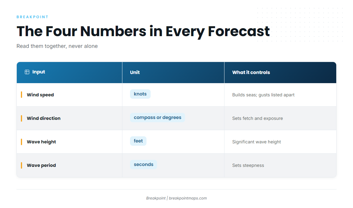
A marine forecast comes down to 4 numbers: wind speed, wind direction, wave height and wave period. Each one means little alone. This page shows how to read them together for the run out and the ride home. The National Weather Service (NWS) forecast and warnings for your zone are the official word. If you run 10 to 50+ nm to reefs, wrecks or canyons, you can read all 4 numbers before you leave the dock.
By the end, you will be able to read a forecast line number by number, step the Breakpoint wind and wave layers through a trip window, and find the NWS product for your zone.
The four numbers in every marine forecast:
| Input | Unit | What it controls | Where to read it |
|---|---|---|---|
| Wind speed | Knots | Builds the seas. Gusts are listed as a separate number | NWS zone forecast and the Breakpoint wind layer |
| Wind direction | Compass point or degrees | Sets fetch and exposure, and whether wind opposes swell or current | Forecast text and the wind layer arrows |
| Wave height | Feet, as significant wave height | Sets the size of the seas | "Seas" line and the wave layer |
| Wave period | Seconds | Sets steepness | "Wave Detail" line and the wave layer |
How do wind speed and direction build the seas you run through?
Wind builds seas through 2 things: fetch, the distance of open water the wind blows across, and duration, how long it blows. The same wind speed builds bigger seas with more fetch and more time.
Forecasts also separate sustained wind, the average speed over a period, from gusts, the short spikes above it. Read both. Here is an NWS Mobile line:
"West winds 10 to 15 knots with gusts up to 20 knots, becoming north 25 to 30 knots after midnight."
That line holds 3 separate numbers:
- Sustained wind: 10 to 15 knots
- Gust: up to 20 knots
- Timed shift: north 25 to 30 knots after midnight
The word "becoming" and the time stamp tell you when the shift arrives. Match that time against your ride home.
Direction decides fetch. At Point Judith, the Coast Pilot says seas built by winds from southeast through southwest are usually the highest in Block Island Sound, because no land interrupts the fetch. The same wind speed from a different direction produces different seas.
What does wave height mean, and why does period matter as much?
Height tells you how big the waves are, and period tells you how closely they are packed. You need both, and period affects the ride as much as height does.
What is significant wave height?
NWS seas are given as significant wave height, "the average height of the highest 1/3 of the waves." It is not the height of the biggest wave. Individual waves run larger, and NWS forecasts flag this with phrasing like "Seas 5 to 8 feet, occasionally to 10 feet." Plan around the "occasionally to" value for the larger waves.
What does wave period mean?
Wave period is the time in seconds between successive crests. The same height packed into fewer seconds makes a steeper face. Read period alongside height rather than after it.
Why does 3 feet at 4 seconds differ from 3 feet at 6 seconds?
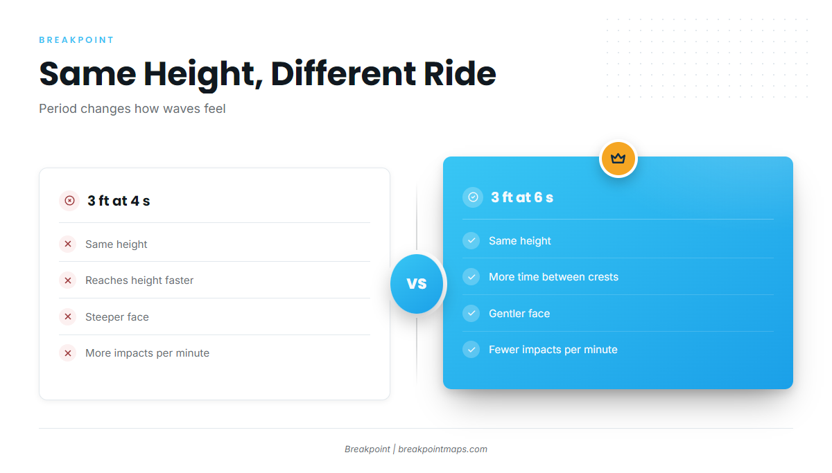
The Tampa Bay coastal waters forecast carries both lines in its Wave Detail: "North 3 feet at 4 seconds" and "North 3 feet at 6 seconds."
The height is the same. The 4-second wave reaches that height in less time, so its face is steeper and the waves arrive more often. On the bow, that means more impacts per minute.
Your limits for height and period are yours to set. The zone forecast is the official check.
How do wind sea and swell combine into one forecast?
Two kinds of waves share the same water: wind sea, built by local wind, and swell, which comes from wind elsewhere and travels in. ECMWF ocean wave forecasting models wind sea and swell as separate components, each with its own mean direction and mean period.
Forecasters report the same split in the Wave Detail line. Here is the full NWS Mobile forecast with each number labeled:
"West winds 10 to 15 knots [sustained] with gusts up to 20 knots [gust]… Seas 2 to 4 feet [significant height range], occasionally to 5 feet [larger individual waves]. Wave Detail: Northwest 4 feet at 3 seconds [wind sea: direction, height, period] and southeast 1 foot at 6 seconds [second component from the opposite direction]."
The 2 components come from roughly opposite directions. Read each component’s period, not only the combined "Seas" value.
What happens when wind opposes swell or current?
Opposing directions between wind and swell produce steeper, more confused seas. Wind against a current has the same effect, including on the edge of the Gulf Stream. That is why you read the direction of each Wave Detail component and not only the wind.
Montauk Point shows how strong the effect can get. The Coast Pilot gives the tidal current at about 2.8 knots east of the Point, and says southerly or easterly winds against an ebbing tide are "able to make almost any rip stand up." See the U.S. Coast Pilot 2 chapter for the passage.
Models do not resolve a tide rip or an inlet bar. Check your tide and current tables and local knowledge for those, and time the ride home against the tide at your inlet.
How do you read the Breakpoint wind and wave layers along your route?
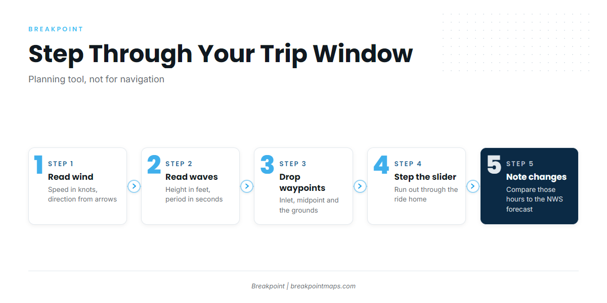
Breakpoint’s wind and wave model data comes from ECMWF. The layers are a planning tool and are not for navigation.
- Open the wind layer. Read speed in knots and direction from the arrows.
- Open the wave layer. Read height in feet and period in seconds.
- Drop waypoints at the inlet, the midpoint and the grounds. Save your waypoints and offline maps before you lose signal.
- Step the time slider through your window at each waypoint, from the run out through the ride home.
- Note when speed, direction, height or period change. Those are the hours to compare against the NWS zone forecast.
Cross-check the timing of model shifts against "becoming" statements in the zone forecast. A model forecast changes with lead time, so recheck closer to departure.
Open the wind and wave layers for your run and step through the hours you plan to be out.
Which NWS forecast covers your offshore run?
The NWS products below are the ones to read for your zone.
| Product | Issued by | Coverage stated in the product |
|---|---|---|
| Coastal Waters Forecast | Local NWS office | Varies by office. The NY forecast covers Montauk Point NY to Sandy Hook NJ out 60 nm |
| Offshore Waters Forecast | Ocean Prediction Center | Waters beyond 60 nm to 250 nm |
| NHC Offshore Waters Forecasts | National Hurricane Center | Caribbean Sea and Tropical N Atlantic |
How to check your NWS zone forecast:
- Find your local office’s marine page. For Hatteras, that is NWS Newport/Morehead City marine.
- Identify every zone your route crosses. A run can span coastal and offshore zones.
- Read the active advisories and warnings first.
- Read wind, Seas, "occasionally to" and Wave Detail for each period of your trip.
- Compare the morning-of NDBC buoy observations against the forecast. For Hatteras, that is Station 41025, Diamond Shoals.
NWS issues the Small Craft Advisory, Gale Warning and Storm Warning. Small Craft Advisory criteria vary by NWS region, so read your local office’s definition and the advisory text for your zone.
The forecast does not resolve every inlet. At Hatteras, the Coast Pilot says the buoys over the bar are not charted because they are moved often. Tidal currents in the inlet are influenced by winds and reach about 2 knots. Local knowledge fills that gap.
What should you check before you leave the dock?
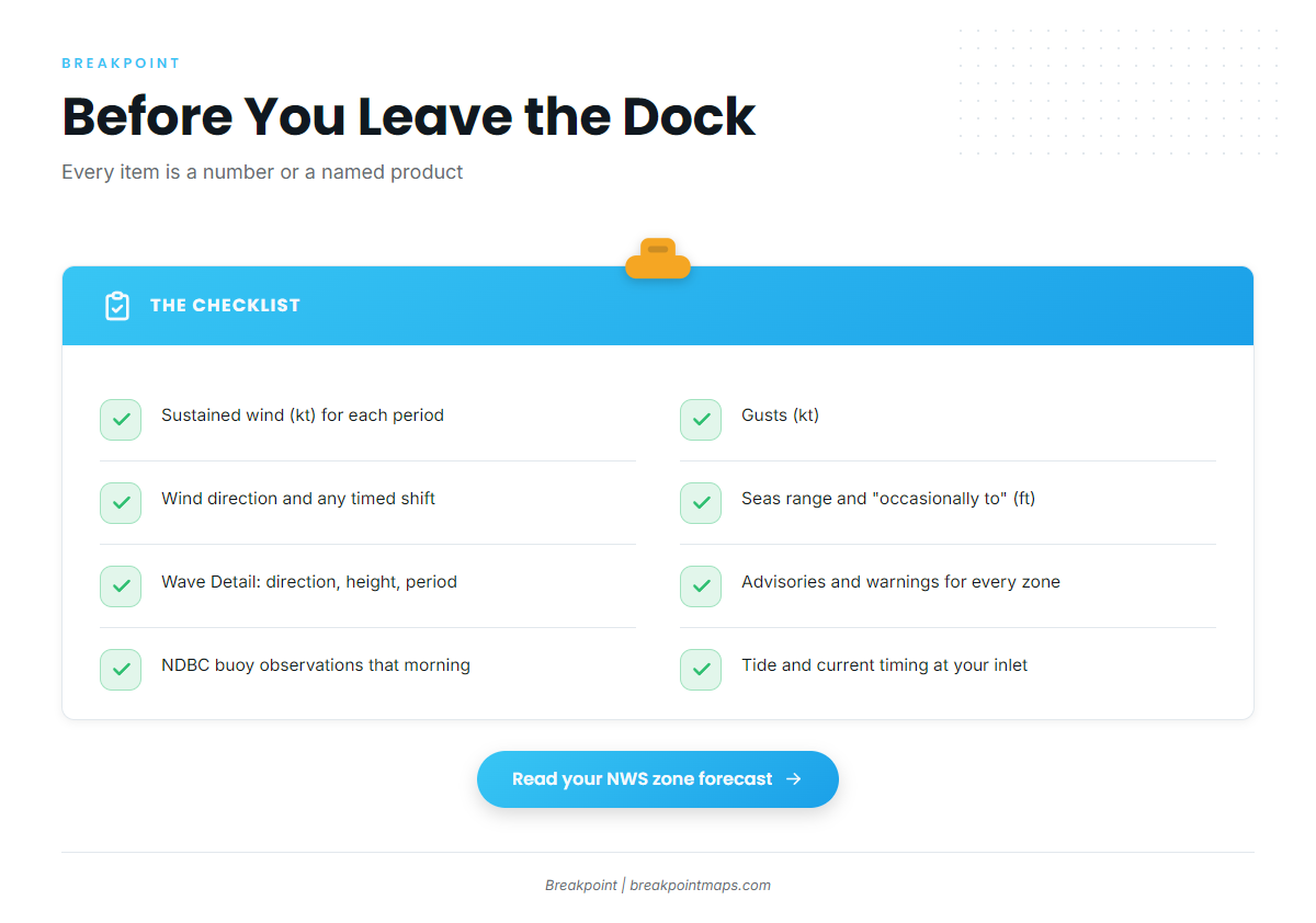
Run down this list, and write each number down:
- [ ] Sustained wind (kt) for each period of the trip
- [ ] Gusts (kt)
- [ ] Wind direction in degrees, and any timed shift
- [ ] Seas range and the "occasionally to" value (ft)
- [ ] Each Wave Detail component: direction, height, period (s)
- [ ] Active advisories and warnings for every zone on the route
- [ ] NDBC buoy observations the morning of the trip
- [ ] Tide and current timing at your inlet for the ride home
Frequently Asked Questions
What does wave period mean?
Wave period is the time in seconds between successive crests. At the same height, a shorter period gives a steeper face and more impacts per minute. Read it together with wave height, using the Wave Detail line in your NWS zone forecast.
What is significant wave height?
NWS defines it as "the average height of the highest 1/3 of the waves." It is not the height of the biggest wave. Individual waves run larger, which is why forecasts add an "occasionally to" value. Plan around that number.
Why does 3 feet at 4 seconds differ from 3 feet at 6 seconds?
The height matches, but the 4-second waves reach it in less time. Their faces are steeper and they arrive more often. The Tampa Bay forecast lists both "North 3 feet at 4 seconds" and "North 3 feet at 6 seconds."
What is the difference between a Coastal Waters and an Offshore Waters Forecast?
Coverage is stated in each product. The NY Coastal Waters Forecast runs out 60 nm. The Ocean Prediction Center’s Offshore Waters Forecast covers beyond 60 nm to 250 nm. Offices differ, so check the product for your own zone.
What does a Small Craft Advisory mean?
It is an NWS advisory, and its criteria vary by region. Read your local office’s definition and the advisory text for your zone. The forecast and warnings for your zone are the official word.
Where does Breakpoint’s wind and wave data come from?
The wind and wave model data comes from ECMWF. The layers are a planning tool and are not for navigation. Read the NWS forecast for your zone before you go.
Plan the next run
The 4 numbers work together, and period matters as much as height. A forecast line makes sense only when you take speed, direction, height and period together, hour by hour.
To plan your next run, you can step through those hours in Breakpoint’s wind and wave layers, with the numbers laid out along your route.
Before you leave, read the NWS forecast and warnings for your zone.