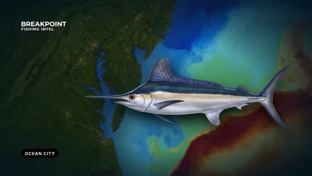
White marlin fishing off Ocean City, Maryland starts at one inlet and ends at the canyons, where blue water from the Gulf Stream meets the shelf edge. Fish set up where that water pushes against canyon structure, and finding the overlap before you leave the dock is most of the work. This guide covers the inlet, the run, the canyons, the season, reading the water, and the rules. Biology, tackle and trolling basics are in our white marlin fishing guide.
Ocean City Inlet and the Run Offshore
Ocean City Inlet is the only break in the barrier beach between Indian River Inlet and Chincoteague Inlet. It connects the coastal bays (Isle of Wight, Assawoman and Sinepuxent) and the West Ocean City berths to open ocean, so every local boat goes out through the same opening.
Check wind, wave height and period before you commit to the inlet and the run, using the NWS marine forecast and the offshore NDBC buoys. Go by the numbers rather than the descriptive wording in a forecast.
Everything inside 3 nautical miles is Maryland state water, and you cross it on every trip, so state license rules apply. Federal water begins at 3 nm.
The inshore structure on the way out:
- Jackspot: An inshore lump on the run that can be worth a look with the troll when the water is right.
- Hambone: Similar to Jackspot. A stop on the way, best at the edges of the season.
- Massey’s Canyon: Inshore structure that gets a pass or two on the way out.
- The Parking Lot: The last of the inshore stops before the shelf edge.
The shelf edge and the canyons are the main destination. Measure your run to each canyon tip on your own plotter or on Breakpoint’s Chart Contours layer, and plan fuel around that. Chart layers are for planning, not navigation.
The Canyons off Ocean City
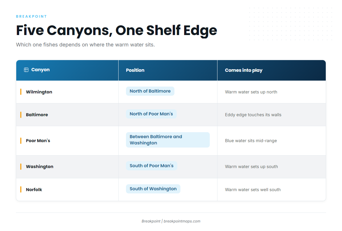
Five canyons cut the shelf edge within Ocean City’s range. North to south they are Wilmington, Baltimore, Poor Man’s, Washington and Norfolk. Which one fishes depends on where the warm water sits.
Baltimore Canyon is the best-known name off Ocean City. Poor Man’s Canyon sits between Baltimore and Washington and is often the choice when you want to save fuel. Washington Canyon is the southern main option. Wilmington comes into play when the water sets up north, and Norfolk when it sets up south.
| Canyon | Position relative to the others | When it comes into play |
|---|---|---|
| Wilmington Canyon | North of Baltimore | When the warm water and eddy edges set up to the north |
| Baltimore Canyon | North of Poor Man’s | When an eddy or Gulf Stream edge touches its walls |
| Poor Man’s Canyon | Between Baltimore and Washington | When blue water sits in the middle of the range |
| Washington Canyon | South of Poor Man’s | When the warm water sets up south of the middle canyons |
| Norfolk Canyon | South of Washington | When the warm water sets up well to the south |
A canyon that held fish last week may not be the one to run to tomorrow if the eddy has moved.
The same shelf edge and eddy picture runs north and south of here. Our Atlantic Northeast fishing guide covers the neighboring ports.
When White Marlin Show Up off Ocean City
White marlin arrive in summer. The peak follows the warm water onto the canyons, and timing shifts from year to year with where the Gulf Stream and its eddies set up. Fish leave in fall as the water cools and the eddies decay or move off.
The best season indicator is the water itself: watch for the warm water closing on the canyons in the SST picture instead of going by the calendar.
The White Marlin Open runs the first full week of August. Expect crowded docks, busy fuel lines and heavy traffic at the inlet that week, and book dock space early.
Ocean City’s window is one stretch of a longer run. See white marlin across the Atlantic Northeast.
Reading Eddies and Temperature Breaks
How Warm-Core Eddies Set Up the Canyons
The Gulf Stream meanders, and loops pinch off as warm-core eddies that spin clockwise and drift. When an eddy edge rides onto a canyon, it pushes clean blue water and bait against the canyon wall.
Eddies drift and decay, so the setup is temporary. It can hold for days or slide off in a day or two.
What a Good Break Looks Like
Read the picture in layers:
- SST: A tight color gradient, with colors bunched over a short distance, means a sharp physical edge. A gradual spread means a soft edge that concentrates less bait.
- Chlorophyll: Ocean color separates blue water from green. You want the blue side of a blue-green edge.
- Chart Contours: The bottom pins the edge in place. The best edges hold where they meet a canyon wall or head.
- Altimetry: Sea surface height shows the eddy as a raised dome, which helps you see its shape and drift when SST is patchy.
The Overlay Method
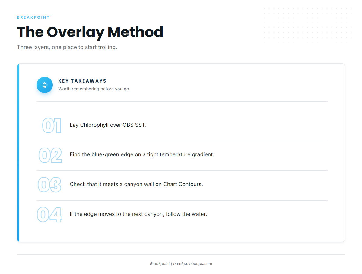
Lay Chlorophyll over OBS SST and look for where the blue-green edge meets a tight temperature gradient over Chart Contours at the canyon wall.
When all three line up, start trolling there. When they disagree, trust the overlap you can confirm on the water: color, bait, and temperature on your own sensor. If the edge has moved off one wall and onto the next canyon, follow the water rather than the original plan.
What the Data Cannot See
A satellite pass blocked by cloud shows nothing under the cloud. An SST composite lags the water by a day or more, so plan for where the feature is heading, not where it was.
When clouds block SST, fall back on altimetry for eddy position and on the last clear pass. Then confirm with your own surface temperature reading on the run.
Night-Before Chart Check
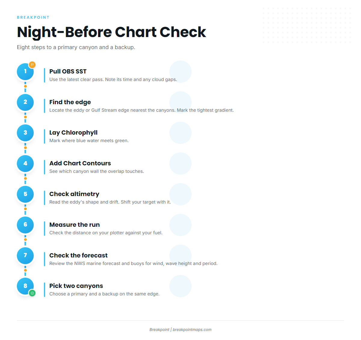
- Pull the latest clear OBS SST pass. Note its time and any cloud gaps.
- Find the warm-core eddy or Gulf Stream edge nearest the canyons. Mark where its tightest gradient sits.
- Lay Chlorophyll over it. Mark where blue water meets green.
- Turn on Chart Contours. See which canyon wall the overlap touches: Wilmington, Baltimore, Poor Man’s, Washington or Norfolk.
- Check altimetry for the eddy’s shape and likely drift. Shift your target in the direction it is moving.
- Measure the run to that spot on your plotter and check it against your fuel.
- Check the NWS marine forecast and the offshore buoys for wind, wave height and period.
- Pick a primary canyon and a backup on the same edge.
A Note on the Spread
Ballyhoo spreads are the standard Ocean City presentation. Rigging is covered in the white marlin fishing guide. For hook requirements, see Regulations below.
None of this guarantees a bite, but it gives you a better basis for deciding where to look.
FAQ
Do I need a Maryland license to run offshore from Ocean City?
Yes for state waters. The stretch inside 3 nm requires a Chesapeake Bay and Coastal Sport Fishing License or a Maryland Saltwater Angler Registration, or a boat license decal with passengers registered. Federal water beyond 3 nm falls under NOAA HMS rules. Check Maryland DNR before you fish.
Do I need an HMS permit for white marlin?
Yes. An Atlantic HMS permit from NOAA Fisheries is required to fish for billfish in federal waters. You get it through the HMS Permit Shop. One permit covers the vessel, so confirm it is valid before you leave the dock.
How do I report a landed billfish?
Report within 24 hours of completing the trip, through the HMS Catch Reporting app, the HMS Permit Shop, or (888) 872-8862. Under Maryland rules, keep the fish whole with head, fins and bill intact through offloading.
What is the size limit for white marlin?
NOAA Fisheries HMS sets the size and retention limits, so check them before fishing. Roundscale spearfish look similar and fall under the same HMS rules. Use NOAA for identification and current limits rather than relying on memory.
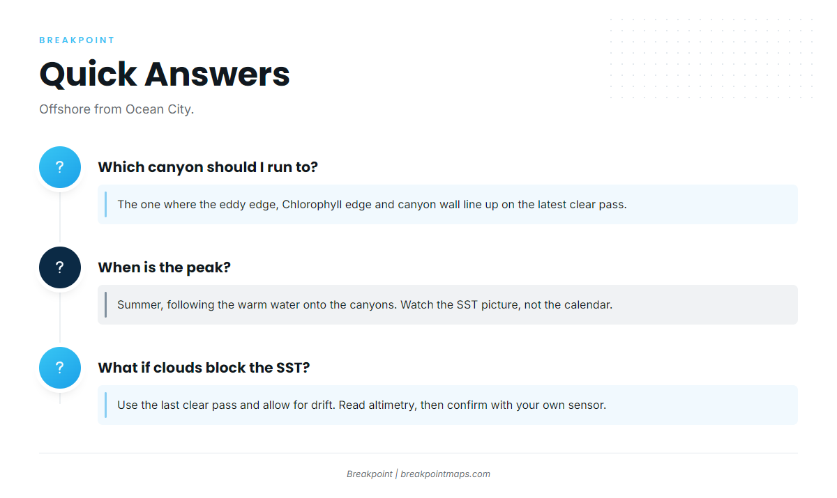
When is the peak?
Summer, following the warm water onto the canyons. It shifts from year to year with where the Gulf Stream and its eddies set up. Watch the SST picture rather than the calendar.
Which canyon should I run to?
Run to the one where the eddy edge, the Chlorophyll edge and the canyon wall line up on the latest clear pass. Work through the night-before check, pick a primary and a backup on the same edge, and follow the water if it moves.
What do I do when clouds block the SST?
Use the last clear pass and allow for drift. Read altimetry for eddy position. Confirm with your own surface temperature on the run before you commit to a canyon.