
About Bodega Bay
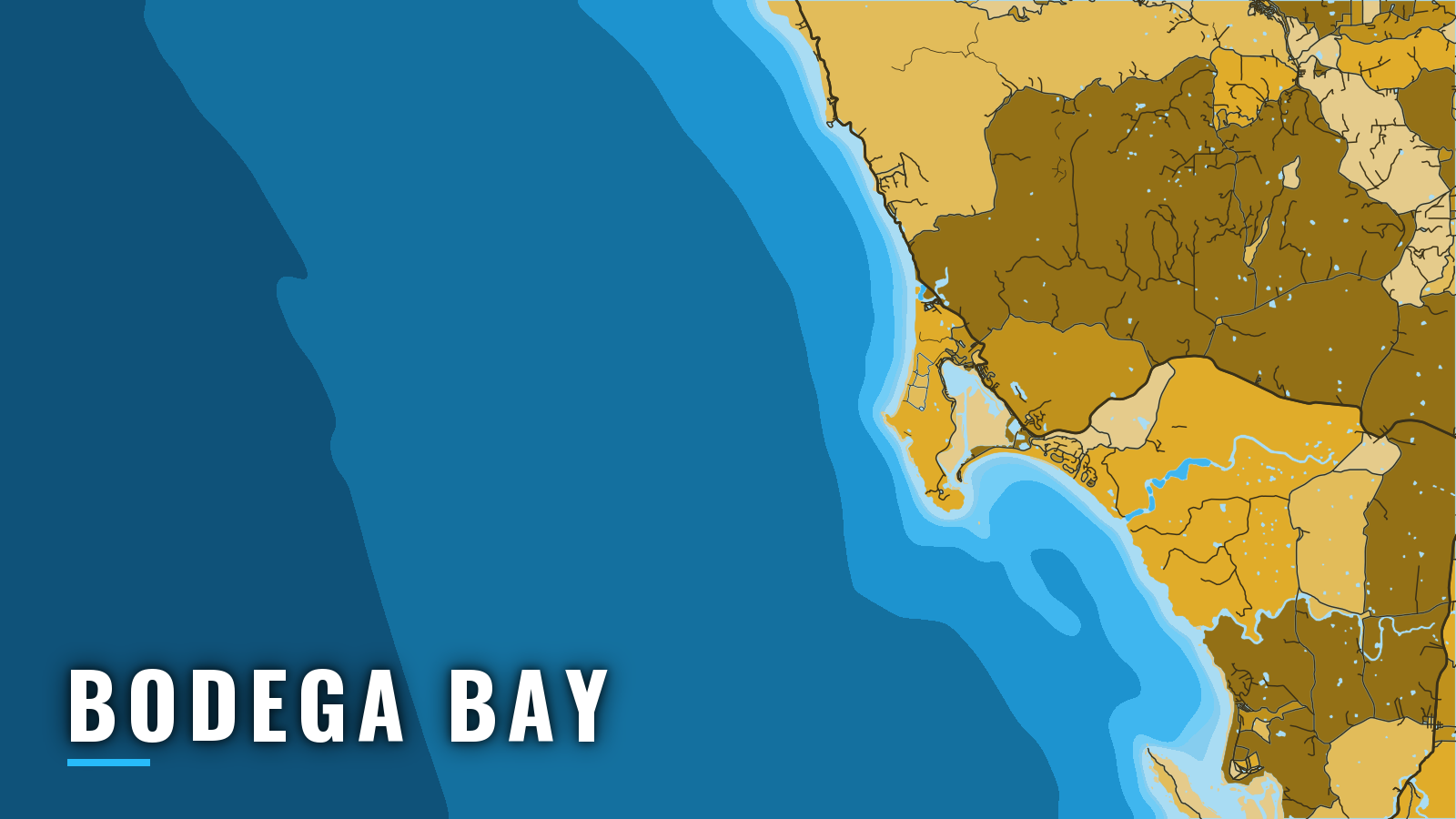
Bodega Harbor sits in the north part of Bodega Bay on the Sonoma Coast and connects to the Pacific through a jettied, dredged channel. It lies between San Francisco to the south and Point Arena to the north-northwest, and it is one of the California ports we cover.
The fishery runs year-round, with seasonal peaks. Boats go after rockfish, lingcod, Dungeness crab, king salmon, albacore and bluefin tuna, and California halibut. Most days start on the nearshore reefs, and boats run offshore for tuna when warm water sets up.
This guide covers the public ramps, how the entrance tends to behave, where to read conditions, and what each season holds.
Access and navigation
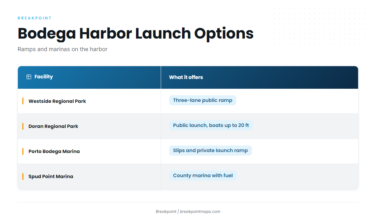
Four public ramps and marinas serve Bodega Harbor:
- Westside Regional Park boat launch – three-lane public ramp on Bodega Harbor, run by Sonoma County Regional Parks.
- Doran Regional Park – public launch on Bodega Harbor for boats up to 20 feet.
- Porto Bodega Marina – slips and a private launch ramp.
- Spud Point Marina – county marina with fuel.
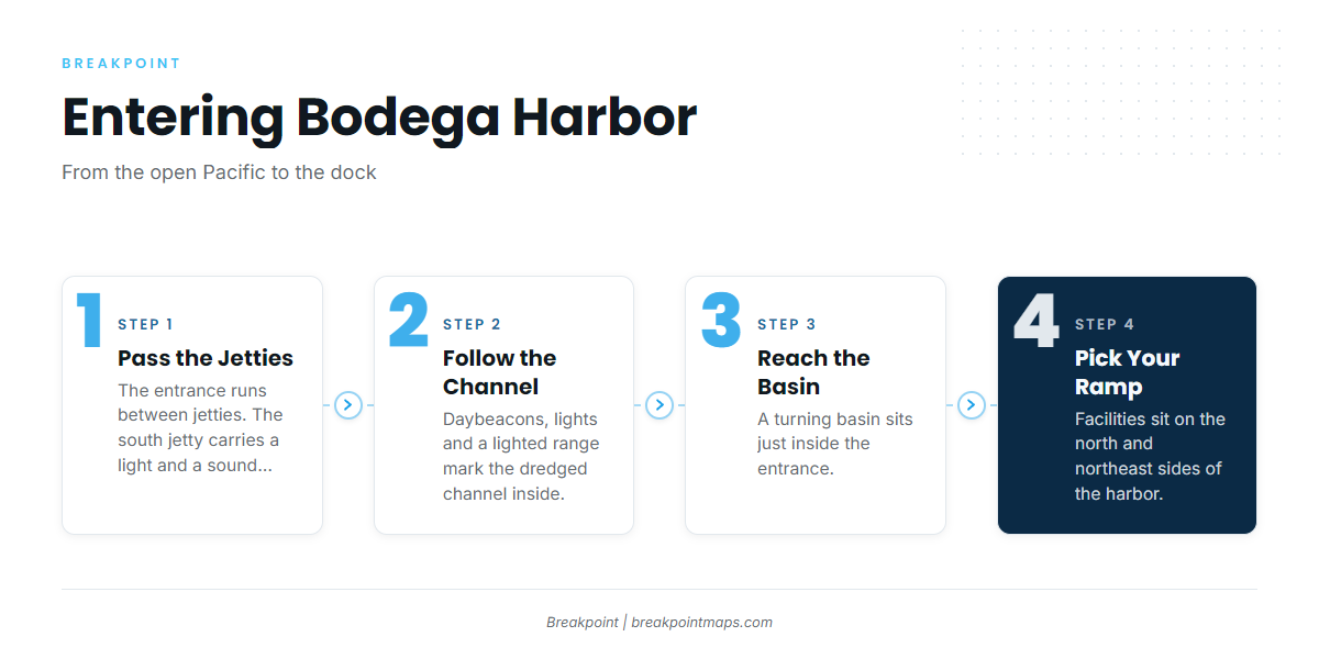
A dredged channel with a turning basin just inside the entrance leads to the facilities on the north and northeast sides of the harbor. The entrance runs between jetties. The south jetty carries a light and a sound signal, and inside, the channel is marked by daybeacons, lights and a lighted range. Coast Pilot 7, Chapter 8 covers the entrance and approaches in full.
The approach to the harbor runs through the passage between Bodega Head and Bodega Rock. The north end of the bay gives shelter from northwest weather but is open to south and west weather.
Breakers from heavy ground swells can narrow that passage, and large breaking waves can occur inside the 30-foot contour northwest and southwest of Bodega Rock. When the passage narrows, the charted approach into Bodega Bay passes south of Bodega Harbor Approach Lighted Gong Buoy BA, which appears as Buoy BA on the chart and on the water.
Summer winds along this coast tend to run northwest through north and are reinforced by the sea breeze, reaching 20 to 30 knots 10 to 20 percent of the time. Advection fog tends to occur July through September, with visibility under 1 mile on about 10 to 15 days a month.
Three sources cover most of what you need to read before and during a run:
- NDBC buoy 46013 sits offshore and reads the open ocean, not the jetties. Read swell period and wave height together, since the gap between them tells you more than either number alone.
- NWS forecast zone PZZ540 covers Point Arena to Point Reyes, out to 10 nm.
- NOAA interactive chart catalog is the reference for nautical charts. Navigate by the charts and the Coast Pilot.
Check the entrance and the PZZ540 forecast when you arrive. If conditions look bigger than you want, take the approach south of Buoy BA, or stay in.
Fishing conditions
The grounds sit inside the wider Pacific Southwest fishing guide region. Working outward from the harbor, boats fish these grounds:
- The reefs off Bodega Head and Bodega Rock.
- Fort Ross to the north.
- Cordell Bank offshore.
- The Farallon Islands, a long run for those who want it.
The Greater Farallones sanctuary extends north to Bodega Head.
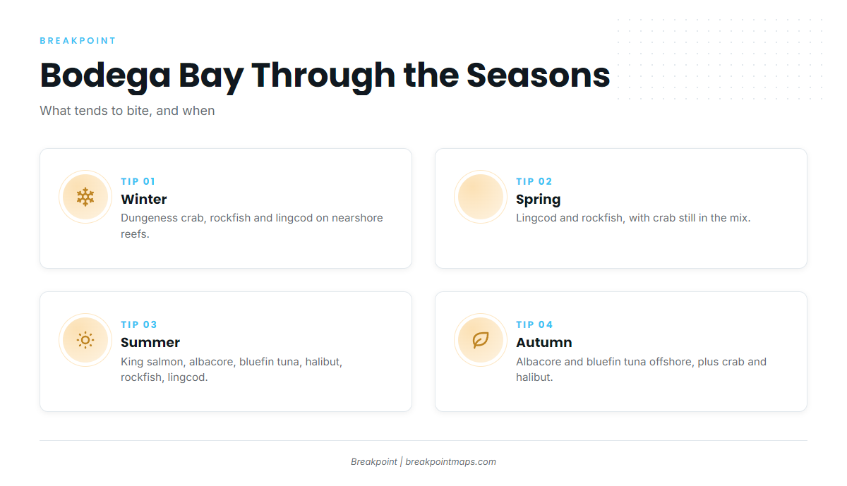
| Season | Main targets |
|---|---|
| Winter | Dungeness crab, rockfish, lingcod |
| Spring | Lingcod, rockfish, Dungeness crab |
| Summer | King salmon, albacore, bluefin tuna, rockfish, lingcod, California halibut |
| Autumn | Albacore, bluefin tuna, Dungeness crab, rockfish, lingcod, California halibut, king salmon |
Winter
Dungeness crab, rockfish and lingcod make up the winter catch. Crab openers vary, so check CDFW before you set gear. Rockfish and lingcod hold on the nearshore reefs, and our lingcod fishing guide covers the species in detail. The bay is open to south and west weather, so watch the forecast for those directions.
Spring
Lingcod and rockfish lead the spring catch, with Dungeness crab still in the mix. Work the Bodega Head and Bodega Rock reefs, with Fort Ross to the north and Cordell Bank when the window allows. Northwest wind can shorten days.
Summer
Summer has the widest mix of the year: king salmon, albacore, bluefin tuna, rockfish, lingcod and California halibut. King salmon openers and closures change, so check CDFW before you plan a trip around them.
Offshore, our albacore tuna fishing guide covers the fish. Albacore track warm, clean water, and OBS SST, Chlorophyll and Chart Contours show where breaks sit relative to the shelf edge. Chart layers are not for navigation.
Expect northwest wind through the season, and fog from July through September.
Autumn
Albacore and bluefin tuna work offshore in autumn, alongside crab, rockfish, lingcod, California halibut and king salmon. Autumn can bring the same northwest wind and fog as late summer, so keep the forecast in front of you.
Rules for salmon, groundfish depth limits and crab change by season and quota. Check the CDFW ocean sport fishing regulations before fishing.