
About Ocracoke
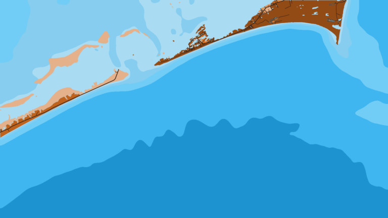
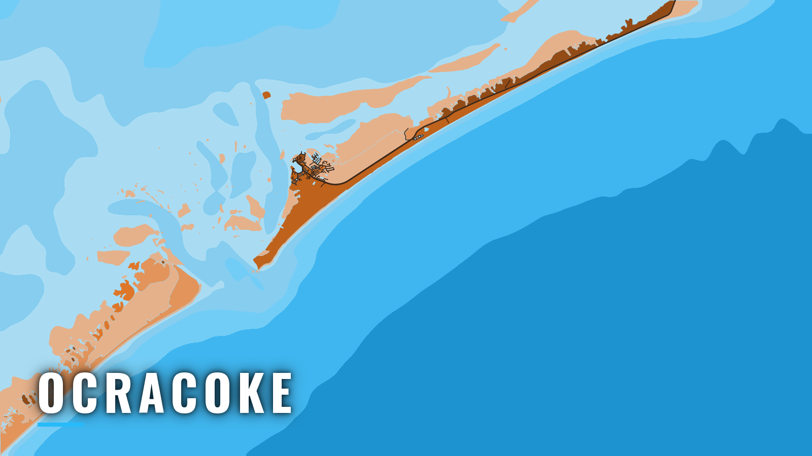
This guide is for people who run their own boat out of Ocracoke. Ocracoke Village sits on Silver Lake, a harbor on the Pamlico Sound side of Ocracoke Island, and boats reach the Atlantic through Ocracoke Inlet and its connecting channels.
Ocracoke is south of Cape Hatteras, with Hatteras and Oregon Inlet to the north. The offshore species turn over through the year: bluefin and blackfin tuna in the cold months, cobia and dolphin in spring, mahi and wahoo in summer, and wahoo and king mackerel in autumn.
Size, bag and season limits change, so check North Carolina fishing and regulations before you fish.
The sections below cover where to launch, how the inlet and channels tend to behave, and what the reefs and the Gulf Stream hold by season.
Access and navigation
Visiting boaters have two public launches and one marina:
- Ocracoke Boat Launch – NPS, Cape Hatteras National Seashore, two ramps and docks on Pamlico Sound.
- Anchorage Marina boat ramp – on-site ramp at the marina.
- Anchorage Marina at Silver Lake – Silver Lake Harbor slips, fuel listed.
The National Park Service piers on the north side of Silver Lake have berths with electricity and water.
Harbor to bar
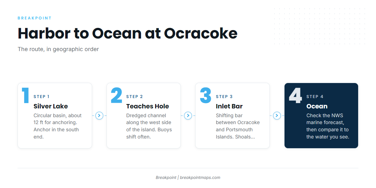
The route runs from Silver Lake through Teaches Hole Channel to the Ocracoke Inlet bar and out to the ocean. The figures below come from NOAA Coast Pilot 4, Chapter 4.
- Silver Lake: a circular basin with about 12 ft of water for anchoring. Anchor only in the southern end to stay out of the ferry lanes.
- Teaches Hole Channel: follows the west side of Ocracoke Island and connects to Silver Lake through a dredged channel. Its buoys are often shifted.
- Ocracoke Inlet: entered over a shifting bar between the south end of Ocracoke Island and the north end of Portsmouth Island. An unlighted buoy marks the approach, other inlet buoys are often moved, and shoals off the inlet may extend about 1.6 miles.
The bar can move faster than charts and buoys get updated, so what you see in front of you is the most current information available.
Currents
Wind influences the currents in the inlet and connecting channels. The ebb usually runs faster than the flood, and velocities up to 4 knots have been observed. An ebb running against an onshore wind can stand the bar up, and the bar often looks different on a flood than on an ebb with the same wind.
Alternative approach
Big Foot Slough Channel leads from the inlet area to Pamlico Sound and is the recommended channel. It is reported to shoal considerably between dredgings, and strong currents have been experienced in it. A swash channel with about 5 ft controlling depth links Big Foot Slough to Nine Foot Shoal Channel, and some local vessels use it as a shortcut.
From the sound, the other route to the ocean is Hatteras Inlet. It is also entered over a shifting bar, and local knowledge is recommended.
Before you commit
Look at the water when you arrive, and read the NWS Newport/Morehead City marine forecast. The zones that matter here are Pamlico Sound, S of Cape Hatteras to Ocracoke Inlet, and S of Ocracoke Inlet to Cape Lookout. Compare the forecast wind, wave height and period against what you see at the bar. If conditions look bigger than you want, switch approaches or wait.
Fishing conditions
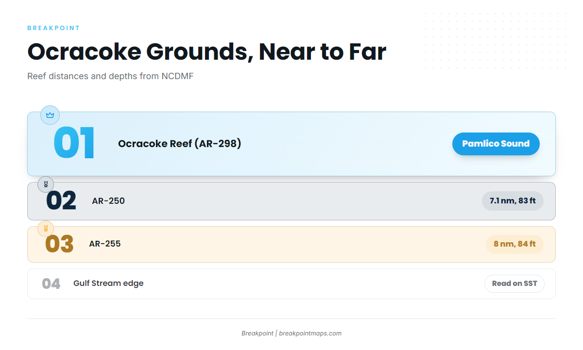
From Ocracoke you can reach sound reefs, nearshore artificial reefs within about 8 nm of the entrance, and the Gulf Stream edge. The NCDMF Artificial Reef Guide lists the reefs below.
- Ocracoke Reef and Oyster Sanctuary (AR-298 / OS-06) – Pamlico Sound.
- AR-250 – 7.1 nm from the entrance, 83 ft.
- AR-255 – 8 nm from the entrance, 84 ft.
- Gulf Stream edge – the position moves, so read it on SST before you run.
- Big Rock, off Cape Lookout – a long run, usually fished from the Morehead City side.
To find the Stream edge and color breaks before you pick a ground, check OBS SST and Chlorophyll in Breakpoint. Cloud can block a satellite pass, and chart layers, including Chart Contours, are not for navigation.
Anglers 16 and older need a Coastal Recreational Fishing License. See the NCDMF recreational size and bag limits for the rules. Tunas and billfish need a federal HMS permit; blackfin tuna and false albacore are excluded.
Winter
Blackfin tuna and false albacore fish alongside amberjack, and bluefin tuna are in the mix. For bluefin and the cold-water side of the Hatteras transition, see the Atlantic Northeast fishing guide. Amberjack has an April closure, so check NCDMF before you go.
Spring
Bluefin tuna, cobia and dolphin lead the spring list. Cobia migrating north sometimes stack up along Ocracoke and Portsmouth Islands. Cobia rules change by season, so check NCDMF before you fish.
Summer
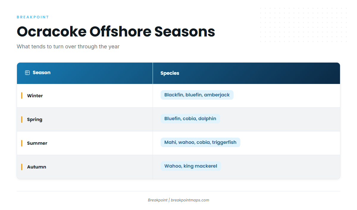
Mahi and wahoo work the Stream edge, and cobia remain in the mix. Triggerfish hold on wrecks and on the AR-250 and AR-255 reefs. Ocracoke is south of Cape Hatteras and falls under South Atlantic management. For mahi, wahoo and king mackerel, see the Atlantic Southeast fishing guide.
Autumn
Wahoo and king mackerel carry the autumn. Spanish mackerel and flounder run in the shallows. Check the day’s SST and the NWS forecast before you decide where to run.