When bluefin show up off Kennebunkport
Atlantic bluefin tuna fishing out of Kennebunkport is mostly a groundfish story. Bluefin turn up as occasional bycatch on the ledges, and nobody books a trip for them.
This page covers the grounds, the depth band and the method, so you can decide whether it’s worth burning fuel.
Timing follows the wider Gulf of Maine run. The bluefin tuna fishing guide explains how the fish behave and when they move through, and the Atlantic Northeast bluefin guide (see also the wider Atlantic Northeast guide) shows the wider run and the other ports along it.
- Fishery type: groundfish first, bluefin as an unplanned bonus
- Water: Gulf of Maine
- Where it happens: the ledges and banks listed below
Where boats run and the structure that holds fish
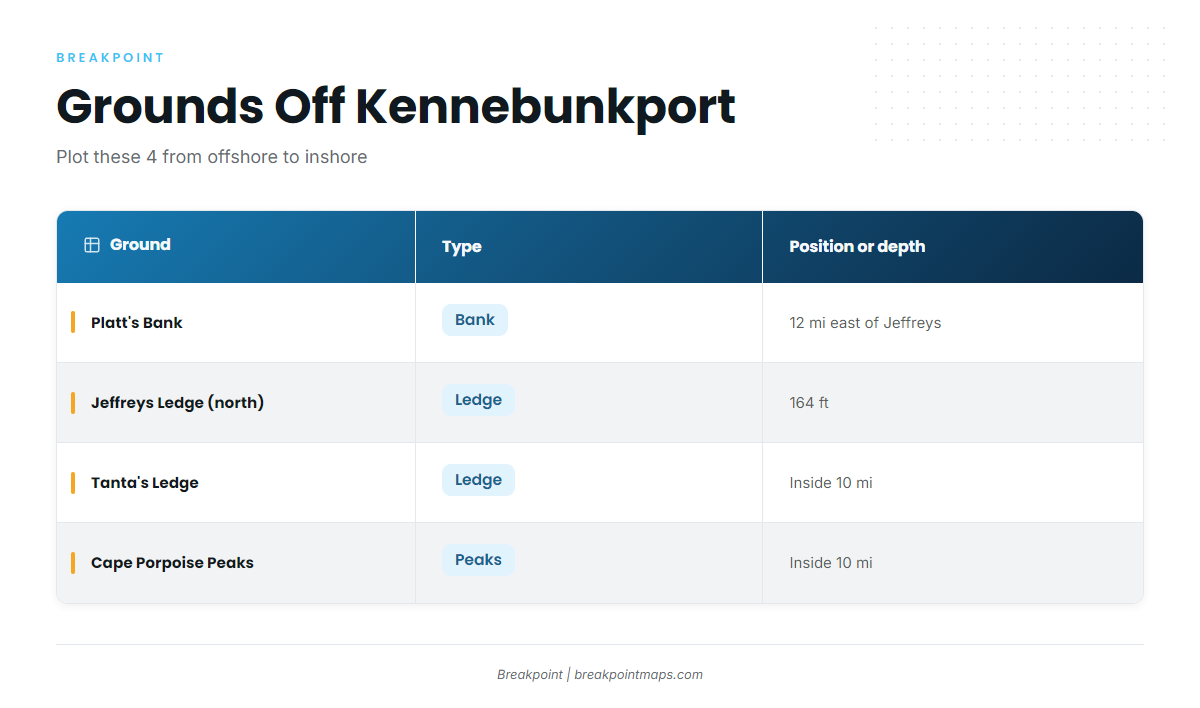
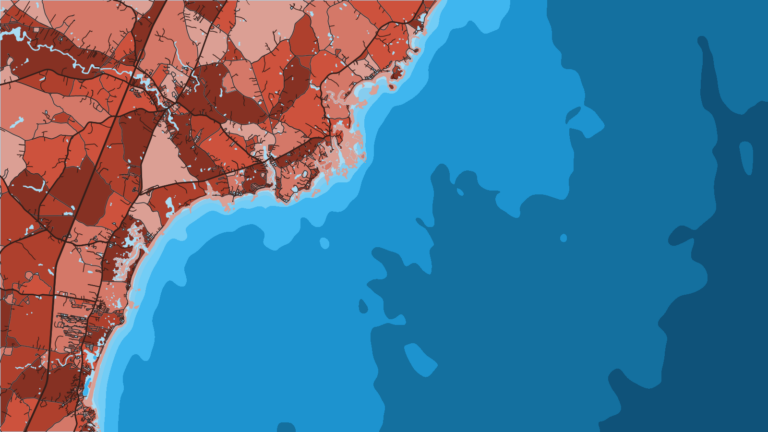
Nor’easter fishes northern Jeffreys Ledge and Platt’s Bank out of Kennebunkport, as described in The Fisherman’s offshore Gulf of Maine haddock coverage. The two plot as one line, with Platt’s east of the ledge. The two inshore options sit closer to the beach.
The four grounds, ordered from offshore to inshore:
| Ground | Type | Position or depth | Note |
|---|---|---|---|
| Platt’s Bank | Bank | Roughly 12 mi east of Jeffreys Ledge | Fished by Nor’easter |
| Jeffreys Ledge (northern end) | Ledge | 164 ft | Fished by Nor’easter |
| Tanta’s Ledge | Ledge | Inside 10 mi | Inshore option |
| Cape Porpoise Peaks | Peaks | Inside 10 mi | Inshore option |
The Chart Contours layer in Breakpoint shows the ledge edges and where the bottom drops into the 280 to 300 ft band. Chart layers are not for navigation.
Northern Jeffreys Ledge
Jeffreys Ledge is 164 ft deep. The local boats run to the northern end, and the jigging happens off the top of the ledge in about 280 ft.
Platt’s Bank
Platt’s Bank lies roughly 12 miles east of Jeffreys Ledge and is the second ground in the Nor’easter pattern. Because the two sit on one plotted line, a day that starts on Jeffreys can move east without a new plan.
Tanta’s Ledge and Cape Porpoise Peaks
Both are inside 10 miles, which makes them the options when you want shorter water under the hull.
How bluefin get hooked here
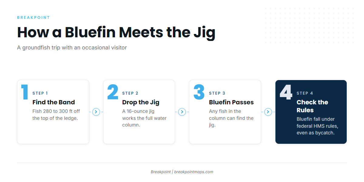
Bluefin come up on groundfish gear, and the depth band and jig size explain why.
16-ounce jigs in 280 to 300 ft
The local method is groundfish jigging with 16-ounce jigs in 280 to 300 ft. A jig that heavy works the whole water column on every drop and retrieve, so any bluefin passing through can find it. Incidental catches come this way, per The Fisherman’s profile of the Nor’easter skipper.
What that means on the drift
You are groundfishing. A bluefin is an occasional, unplanned hookup and doesn’t change what the trip is, though it does raise the permit question covered under Regulations.
To target tuna deliberately, start with our tuna fishing guides.
Who fishes for them out of Kennebunkport
Nor’easter is the local operator whose grounds define the run: northern Jeffreys Ledge and Platt’s Bank. Its bluefin come as incidental catches while groundfish jigging. No operator listed for this port offers bluefin as a trip type.
FAQ: bluefin out of Kennebunkport
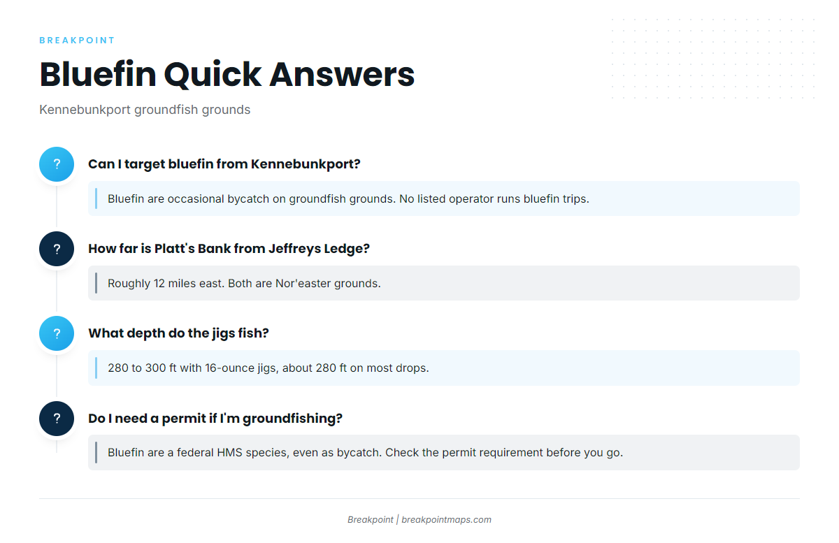
Can I target bluefin from Kennebunkport?
Bluefin are occasional bycatch on the groundfish grounds here, not a stated target, and no operator listed for this port runs bluefin trips. The Atlantic Northeast bluefin guide above covers the wider run.
How far is Platt’s Bank from Jeffreys Ledge?
Platt’s Bank is roughly 12 miles east of Jeffreys Ledge. Nor’easter fishes both out of Kennebunkport.
What depth do the jigs fish?
The jigs fish 280 to 300 ft, about 280 ft on most drops, with 16-ounce jigs. Jeffreys Ledge itself is 164 ft, so the jigging runs well deeper than the ledge top.
What are the inshore grounds?
Tanta’s Ledge and Cape Porpoise Peaks. Both sit inside 10 miles.
Why do bluefin hit groundfish jigs?
A 16-ounce jig works through the water column in 280 to 300 ft, so a passing bluefin can find it. That is a mechanism, and nothing here guarantees a hookup.
Do I need a permit if I’m groundfishing?
Bluefin are a federal HMS species, so NOAA rules apply even when one comes up as bycatch. Check the HMS permit requirement before the trip. The Regulations section above points to the agencies.