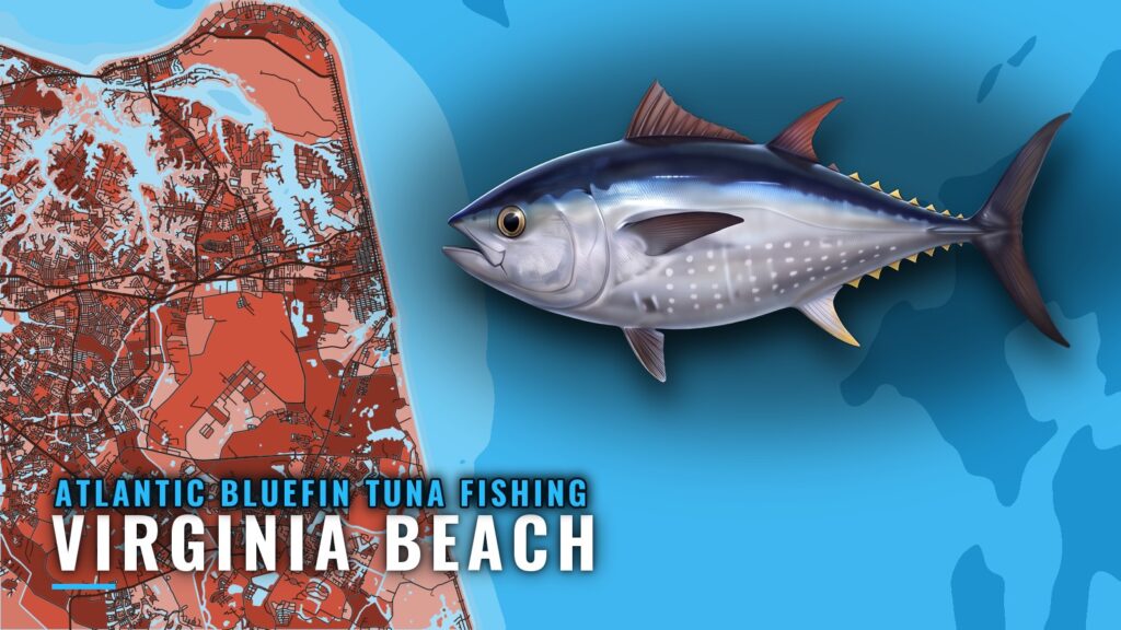
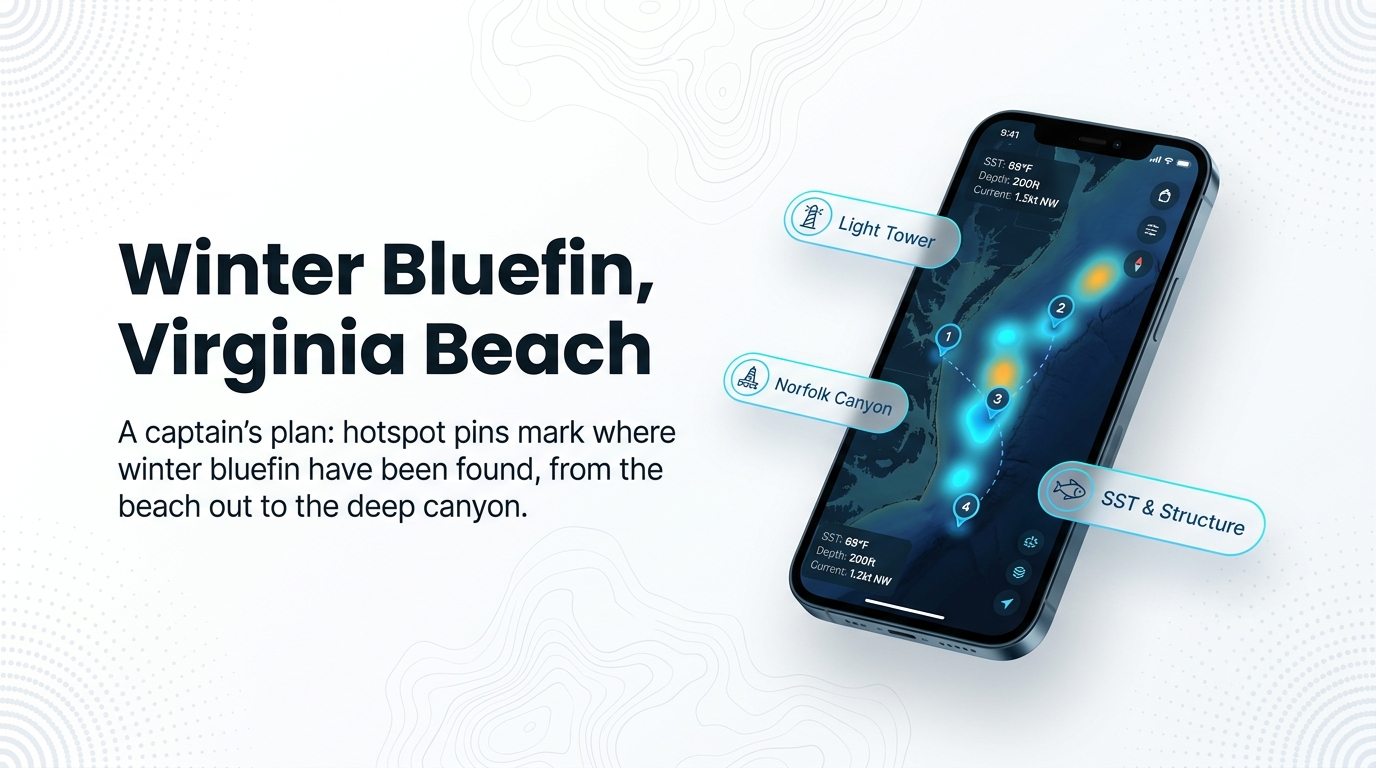
Atlantic bluefin tuna fishing out of Virginia Beach is a winter fishery, running from late November through about February, with December and January the months when boats make dedicated trips. Winter fish have been found from right off the beach out to the Chesapeake Light Tower and the offshore wrecks. This page covers where boats run, the named grounds, how the local fleet fishes, and who runs bluefin trips out of Rudee Inlet at Virginia Beach. For biology and general tackle, see the species guide.
When bluefin are off Virginia Beach
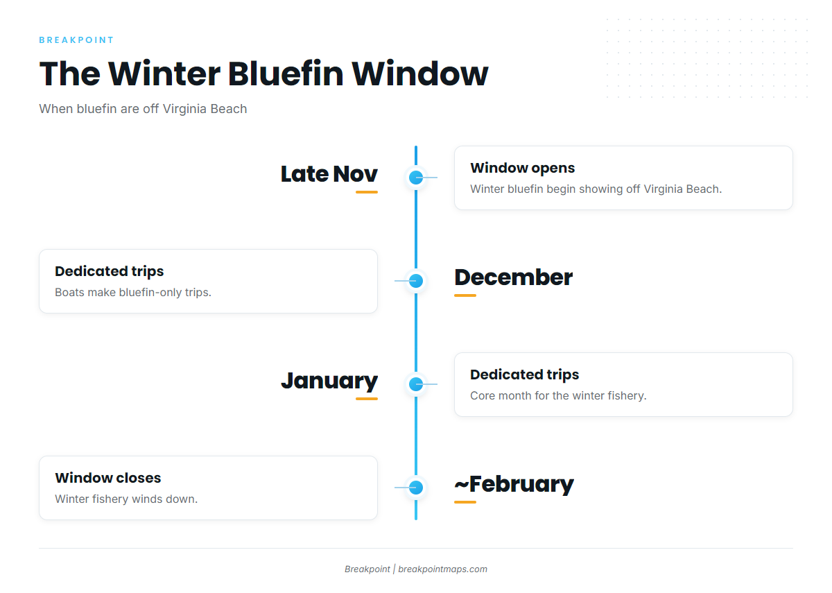
Winter is the core fishery, with spring and fall passage fish filling out the calendar.
Winter fish
The winter window runs late November through about February. December and January are the months boats make dedicated trips.
Spring and fall passage fish
Passage fish also move through in spring and fall. For the bigger picture, see the wider Atlantic migration (see also the Atlantic Northeast fishing guide).
| Window | Fishery |
|---|---|
| Late November through about February | Winter fishery |
| December and January | Dedicated bluefin trips |
| Spring and fall | Passage fish |
Where boats run and the grounds that hold bluefin
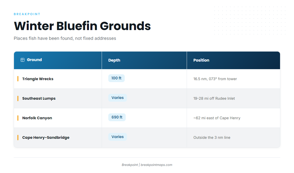
Winter fish have been found from right off the beach out to the Chesapeake Light Tower and the Triangle Wrecks, 16.5 nm on 073° true from the tower. These are places fish have turned up, not fixed addresses. Read the NWS Wakefield marine forecast and check nearby NDBC buoy observations before you run. No current NOAA buoy or tide station specific to Rudee Inlet appeared on a fetched page, so the nearby observations are the reference.
Right off the beach to the Light Tower
The Chesapeake Light Tower is the reference point other positions are measured from. Winter fish have been found anywhere from right off the beach out to the tower, and the Cigar and the Fingers are two more places they have turned up.
Cape Henry to Sandbridge, outside 3 nm
Ken Neill puts the prime area from Cape Henry to Sandbridge, outside the 3 nm line. Boats sit outside 3 nm to stay clear of the striper fleet.
The offshore wrecks and lumps
Working outward from the tower, the grounds line up like this:
- Triangle Reef (Triangle Wrecks): 100 ft of water, 16.5 nm on 073° true from the Chesapeake Light Tower.
- Tower Reef: One of the state-listed offshore reef sites.
- Southeast Lumps: 19 to 28 miles off Rudee Inlet.
- Norfolk Canyon: 690 ft, about 62 miles east of Cape Henry.
- 26 Mile Hill and 21 Mile Hill: Northern reference points, named for their distance from Wachapreague Inlet.
| Ground | Depth | Position/distance |
|---|---|---|
| Chesapeake Light Tower | ||
| Triangle Reef / Triangle Wrecks | 100 ft | 16.5 nm on 073° true from the Light Tower |
| The Cigar | ||
| The Fingers | ||
| Tower Reef | ||
| Southeast Lumps | 19 to 28 miles off Rudee Inlet | |
| 26 Mile Hill and 21 Mile Hill | Named for distance from Wachapreague Inlet | |
| Norfolk Canyon | 690 ft | About 62 miles east of Cape Henry |
You can view these grounds against depth in the Chart Contours layer in Breakpoint. Chart layers are not for navigation.
How bluefin are fished locally
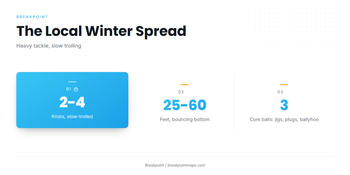
The local winter pattern is parachute jigs and swimming plugs on heavy tackle, slow-trolled at 2 to 4 knots. The spread has three parts:
- Parachute jigs
- Swimming plugs on heavy tackle
- Horse ballyhoo on Ilanders, off the long riggers
Parachute jigs and swimming plugs
Both are trolled on heavy tackle.
Slow trolling at 2 to 4 knots, bouncing bottom in 25 to 60 ft
Boats troll at 2 to 4 knots, with baits bouncing bottom in 25 to 60 ft of water.
Horse ballyhoo on Ilanders off the long riggers
Horse ballyhoo on Ilanders go out on the long riggers. For spread fundamentals beyond the local pattern, see our tuna fishing guides.
Who fishes for bluefin out of Virginia Beach
These Virginia Beach charters list Atlantic bluefin tuna:
- E-Fishinsea Sport Fishing Charters: Capt. Greg Weaver.
- AquaMan Sportfishing out of Virginia Beach: The Flat Line, and the 54 ft Game On, Coast Guard certified for up to 18.
- Payback Sport Fishing: A 35 ft vessel the operator describes as the fleet’s fastest 35-footer. Departs Rudee Inlet.
- Playin Hookey Charters: Capt. Bill Pappas, with first mate Russ Morrow.
- Knot Tell’n Charters: Capt. Scott Horton, 36 ft Albemarle Express.
FAQ about bluefin tuna fishing out of Virginia Beach
When is the bluefin bite off Virginia Beach?
Late November through about February, with December and January the dedicated-trip months. Spring and fall passage fish also move through.
How far do boats run from Rudee Inlet?
From right off the beach out to the Chesapeake Light Tower and the Triangle Wrecks. The Southeast Lumps are 19 to 28 miles off Rudee Inlet, and Norfolk Canyon is about 62 miles east of Cape Henry.
What depth and troll speed do local boats use?
Boats slow-troll at 2 to 4 knots, bouncing bottom in 25 to 60 ft.
Why do boats fish outside the 3 nm line?
To stay clear of the striper fleet. Ken Neill puts the prime area from Cape Henry to Sandbridge, outside 3 nm.
Which charters target bluefin tuna off Virginia Beach?
E-Fishinsea Sport Fishing Charters, AquaMan Sportfishing, Payback Sport Fishing, Playin Hookey Charters and Knot Tell’n Charters.
Where are the rules?
On the Virginia state rules page and the federal Atlantic tunas page linked in the Regulations section. Check both before fishing.