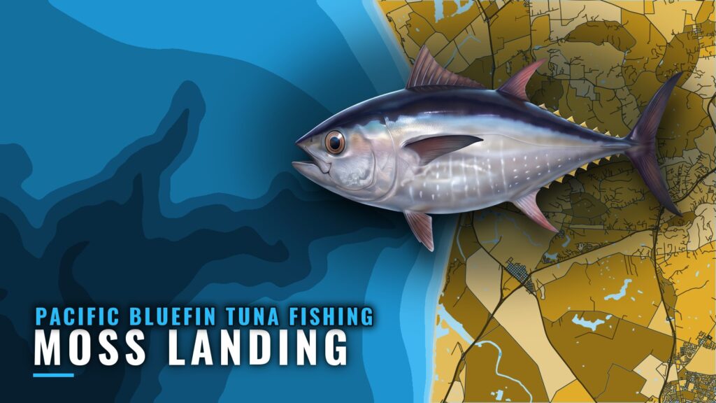
Pacific bluefin tuna fishing out of Moss Landing means an offshore run past the mouth of Monterey Bay, from a harbor on the bay’s east shore. This page covers when fish are reported, how far boats run, what structure sits along the way, how local boats hunt, and who runs trips from the harbor. For the species itself, see our Pacific bluefin species guide. The focus here is local, with numbers to plan around. No fish are guaranteed.
When bluefin are around Moss Landing
The timing data for this port is thin. It amounts to two months of fall reports and one operator’s phrase.
| Source | What it says |
|---|---|
| Moss anglers’ fall reports | August and October |
| Blue Knuckles Sport Fishing Charter | "when the season is right" |
For the wider timing picture along the coast, see our Pacific Southwest bluefin guide (see also the Pacific Southwest region guide).
Fall reports
Moss anglers’ fall reports are from August and October. Treat them as the cue to start watching the water, not as a promise of fish.
What local captains say
Blue Knuckles says to fish "when the season is right." The phrase points toward the warm water and temperature breaks covered below. Charters time trips to conditions on the water rather than a date on the calendar.
The run offshore from Moss Landing
The harbor sits on the east shore of Monterey Bay, and the head of Monterey Canyon lies close to the beach nearby, per the U.S. Coast Pilot 7 chapter. From the channel (ramp and harbor detail are on our Moss Landing port page), boats run offshore past the mouth of Monterey Bay.
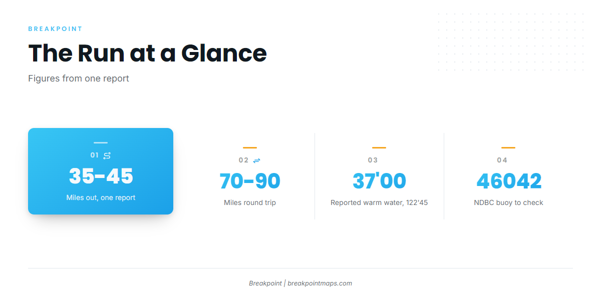
- Direction: Offshore, past the mouth of Monterey Bay
- Distance (one report): 35 to 45 miles out
- Reported warm water (same report): near 37’00/122’45
- Buoy to check: NDBC 46042 Monterey, 36.787N 122.408W
The distance and the position come from a single report. Warm water moves, and the buoy reads conditions only at its own position, which may differ from the bubble. Chart layers are not for navigation.
Distance and direction
One report put fish 35 to 45 miles out. That makes a 70 to 90 mile round trip, so plan the day around the full run.
The reported warm water
The same report placed the warm-water bubble near 37’00/122’45. Use that position as a starting reference for where to look, not as a waypoint that holds fish.
Long-range trips past Point Sur and Año Nuevo
Kahuna Sportfishing lists long-range trips past Point Sur and Año Nuevo. Those two points mark the long end of the range.
Reading NDBC 46042
NDBC 46042 Monterey sits 27 NM WNW of Monterey, at 36.787N 122.408W, in 1710 m of water. It is a single point and reports conditions there only. Check it, along with the official NOAA marine forecast, before the run.
Grounds and structure near the port
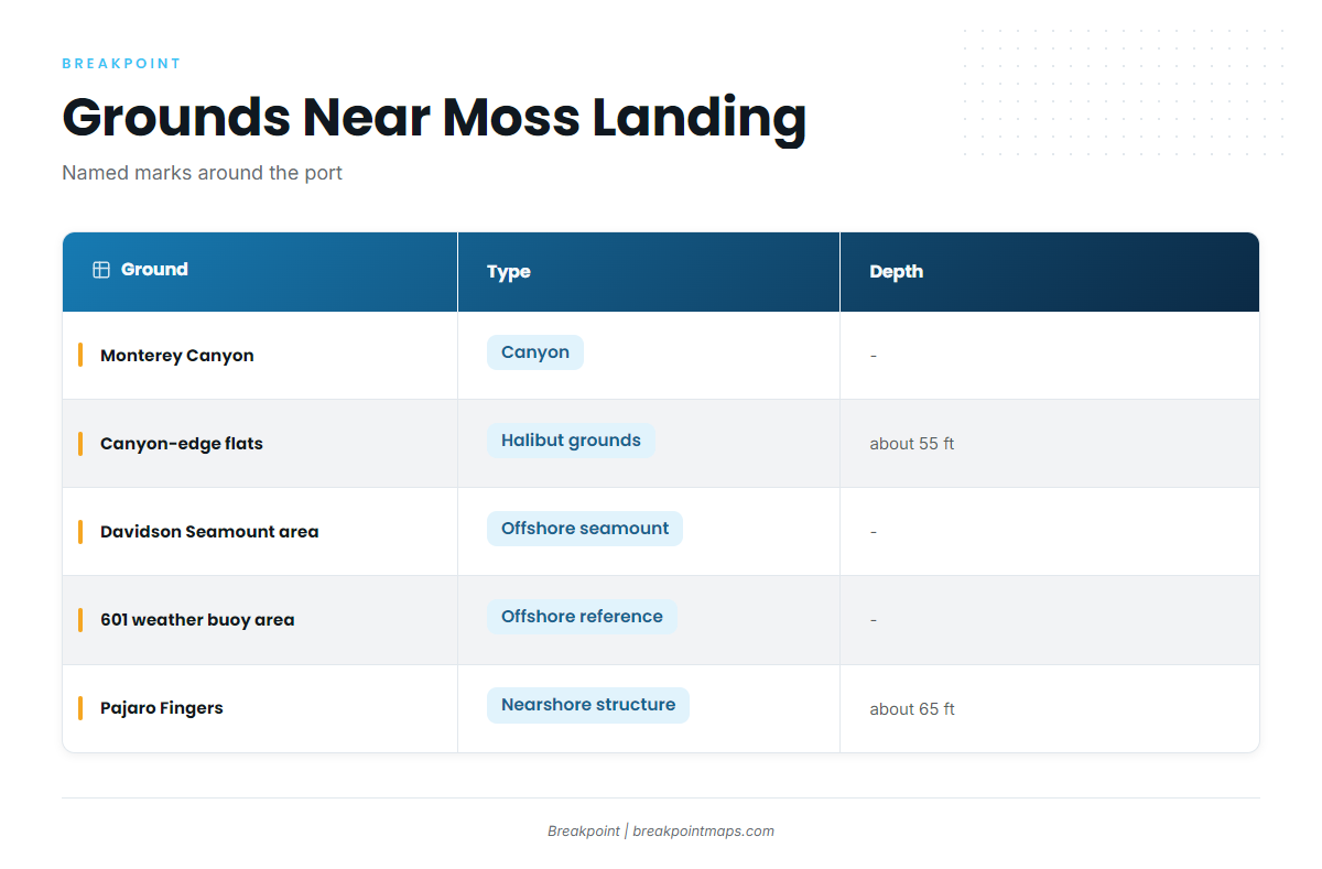
The port’s named grounds run from the canyon at the harbor’s doorstep to offshore references.
| Ground | Type | Depth |
|---|---|---|
| Monterey Canyon | Canyon | |
| Sandy flats along the deep canyon edges | Halibut grounds | about 55 ft (midpoint of the range) |
| Davidson Seamount area | Offshore seamount area | |
| 601 weather buoy area | Offshore reference | |
| Pajaro sewer pipe and Pajaro Fingers | Nearshore structure | about 65 ft |
Monterey Canyon
The head of the canyon lies close to the beach near the harbor. Boats head out along it toward offshore water.
Davidson Seamount and the 601 weather buoy
The Davidson Seamount area and the 601 weather buoy area are the port’s named offshore references.
Nearshore marks: canyon-edge flats and the Pajaro Fingers
The sandy flats along the deep canyon edges are halibut grounds at about 55 ft, the midpoint of a range. The Pajaro sewer pipe and Pajaro Fingers sit at about 65 ft. A crew passes these marks on the way out, or fishes them on the bottom-fishing side of a mixed trip.
How bluefin are fished out of Moss Landing
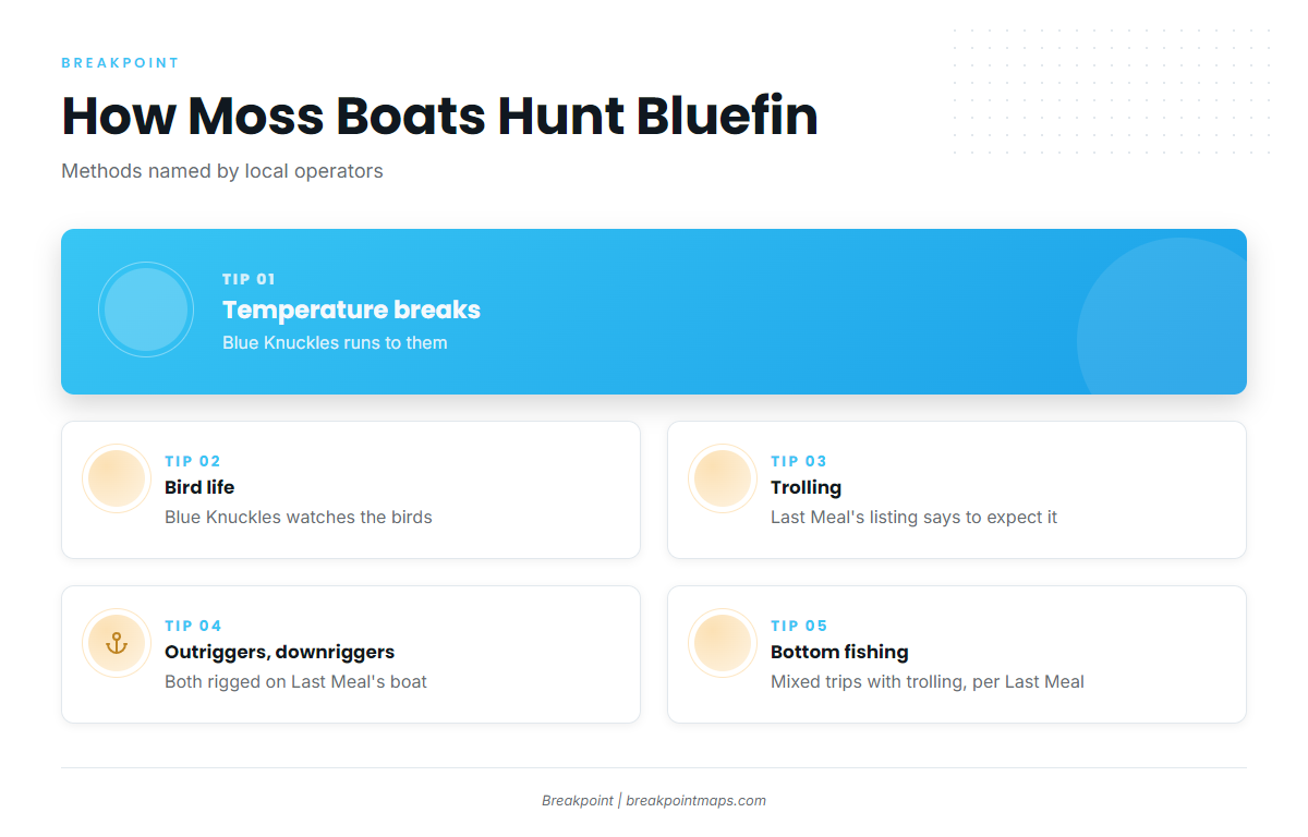
Blue Knuckles describes running to temperature breaks and bird life. That is the local search pattern, and it is why a reported position is only a place to start. For broader technique, see our tuna fishing guides.
- Temperature breaks and bird life: the signs boats run to
- Trolling: outriggers and downriggers on Last Meal’s boat
- Mixed trips: trolling plus bottom fishing
Temperature breaks and bird life
Blue Knuckles runs to temperature breaks and bird life. The break is what boats look for, and the reported warm-water position is a place to begin looking.
Trolling with outriggers and downriggers
Last Meal’s boat carries outriggers and downriggers, and its listing says to expect trolling.
Mixed trips with bottom fishing
Last Meal’s listing also says to expect bottom fishing, which ties the day back to the nearshore marks above.
Who fishes for bluefin out of Moss Landing
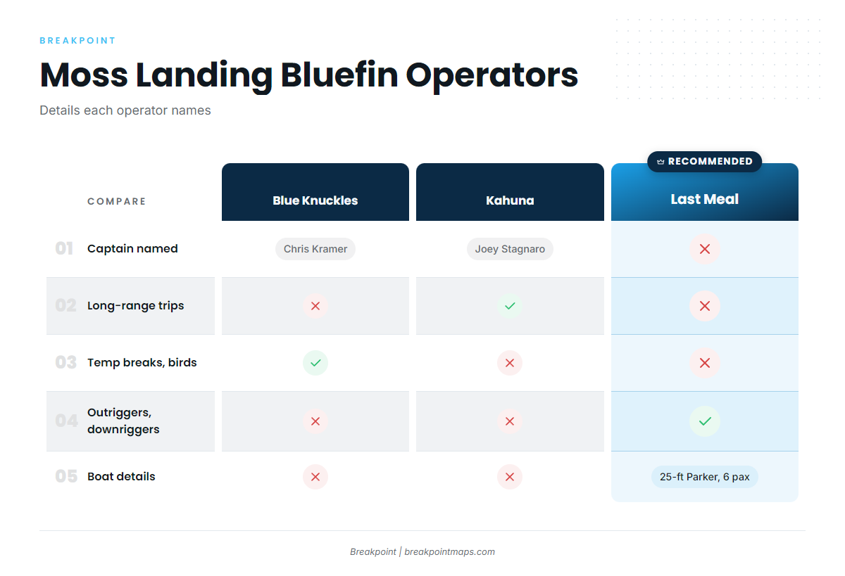
Three Moss Landing charter operators list Pacific bluefin tuna.
Last Meal Sportfishing
Last Meal Sportfishing runs a 25-foot Parker with six passengers, outriggers and downriggers. Its listing says to expect trolling and bottom fishing.
Blue Knuckles Sport Fishing Charter
Blue Knuckles Sport Fishing Charter is run by Captain Chris Kramer. It describes running to temperature breaks and bird life, and fishing "when the season is right."
Kahuna Sportfishing
Kahuna Sportfishing names Captain Joey Stagnaro and owners Angie and Nate Lackey. It lists long-range trips past Point Sur and Año Nuevo.
FAQ: Pacific bluefin tuna fishing out of Moss Landing
How far out are bluefin from Moss Landing?
One report put fish 35 to 45 miles out, past the mouth of Monterey Bay, with warm water near 37’00/122’45. Warm water moves, so treat the position as a starting reference.
When are bluefin around Moss Landing?
Moss anglers’ fall reports are from August and October. Blue Knuckles says to fish "when the season is right."
How do local boats find bluefin?
Blue Knuckles runs to temperature breaks and bird life. Last Meal trolls with outriggers and downriggers.
Which Moss Landing charters target bluefin?
Last Meal Sportfishing (25-foot Parker, six passengers), Blue Knuckles Sport Fishing Charter (Captain Chris Kramer) and Kahuna Sportfishing (Captain Joey Stagnaro) all list Pacific bluefin tuna.
Which buoy should I check?
NDBC 46042 Monterey, 27 NM WNW of Monterey, at 36.787N 122.408W. Check it alongside the official marine forecast. It reads its own position only.
Where are the rules?
CDFW sets the state rules, and Pacific HMS federal rules apply in offshore water. Check both before fishing.