When striped bass are around Wells
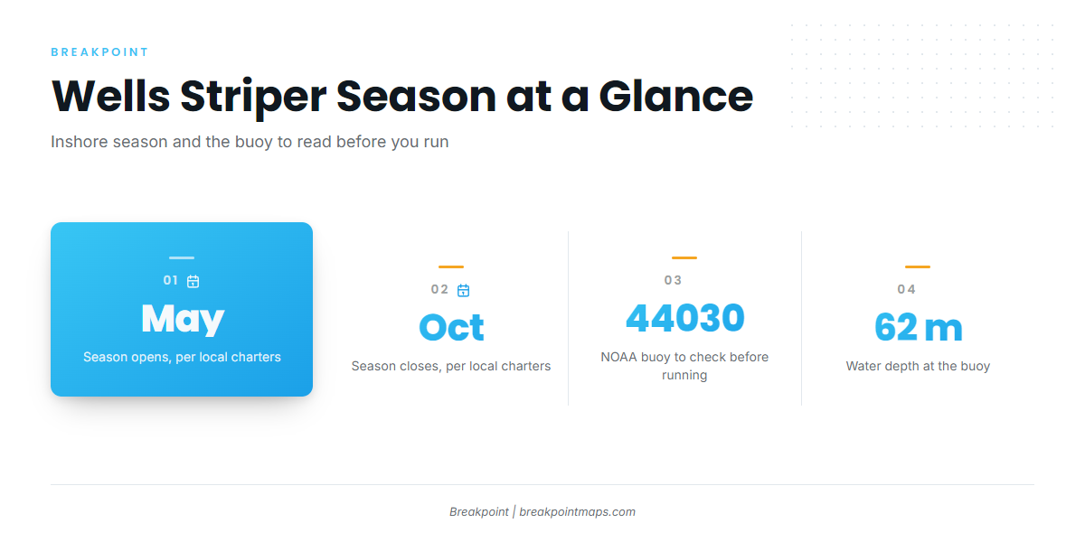
Striped bass fishing out of Wells runs May through October, inshore from Wells Harbor and Perkins Cove along the cliffs, beaches and jetties. This page covers the runs, the structure, the bait and the operators, so you can decide where to look with your own boat. For harbor, entrance and launch detail, see the Wells port page.
Season window
Charter sites give the inshore season as May through October; Salty Lewer and Captain Nick’s both publish that window.
For biology and migration, read the striped bass species guide. For the Gulf of Maine run beyond this port, see the regional picture (see also the wider Atlantic Northeast guide).
Reading conditions at 44030
The nearest buoy is NOAA NDBC station 44030 (Buoy B01, Western Maine Shelf), at 43.179 N, 70.426 W in 62 m of water. Read wind, wave height and period there before you run. It is a shelf buoy, so its numbers describe the shelf and will not match conditions at the surf line along the jetties. Check the official NWS marine forecast as well.
Where boats run from Wells Harbor and Perkins Cove
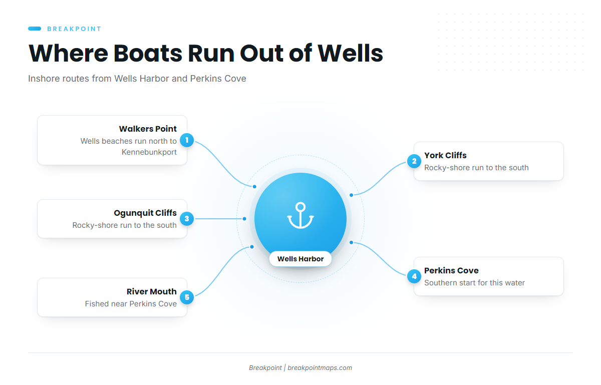
Boats run inshore from Wells Harbor and Perkins Cove. The charters work three stretches of coast.
North along the beaches to Walkers Point
Captain Nick’s runs the Wells beaches up to Walkers Point, Kennebunkport.
South along the York and Ogunquit cliffs
Captain Nick’s also runs the York and Ogunquit cliffs.
Perkins Cove and the river mouth
Salty Lewer fishes the water around Perkins Cove: the rocky coast, the cliffs, the beaches and the river mouth.
Grounds and structure that hold bass
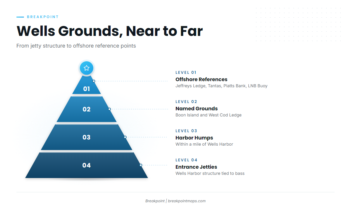
The bass water is the jetties, the humps, and the cliffs and beaches along the charter routes. The islands and ledges farther out serve as named grounds and reference points.
The Chart Contours layer in Breakpoint shows the humps and ledges as bottom shape, and OBS SST shows the surface temperature over them. Chart layers are not for navigation.
Wells Harbor entrance jetties
The Wells Harbor entrance jetties are structure tied to bass, right at the harbor mouth.
Humps near the harbor
Unnamed humps within a mile of Wells Harbor held bait and bass.
Boon Island and West Cod Ledge
Boon Island and West Cod Ledge are named grounds near Wells.
Offshore references
These are named offshore grounds and markers in the area:
- Jeffreys Ledge, 164 ft
- Tantas Ledge
- Platts Bank (Platt’s)
- The LNB Buoy, an offshore buoy used as a marker
For gamefish beyond the inshore bass water, the offshore gamefish guides cover what lives out there.
How bass are fished here and who fishes for them
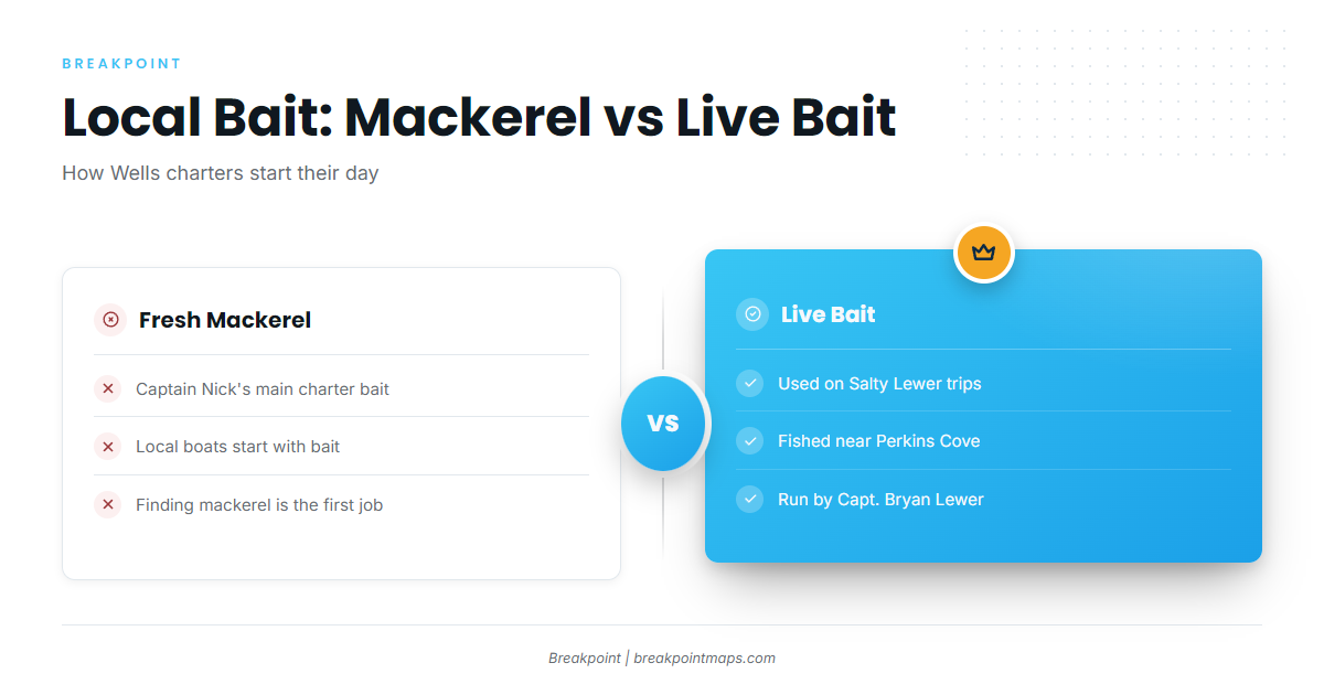
Local charters fish bait, using either fresh mackerel or live bait.
Fresh mackerel
Captain Nick’s uses fresh mackerel as its main bait.
Live bait
Salty Lewer trips use live bait.
Local charters
These operators list striped bass out of this port:
- Apex Charters: two boats.
- Relentless Pursuit Charters (Relentless Fishing Charters): C-Brook, a 25 foot Steiger Craft pilot house.
- Captain Nick’s Fishing Charters: Captain Nick.
- Breton’s Fishing Charters
- Salty Lewer Charter Fishing: Capt. Bryan Lewer.
FAQ: Striped bass out of Wells
When is striper season in Wells?
May through October, according to Salty Lewer and Captain Nick’s.
Where do boats run?
Boats run inshore from Wells Harbor and Perkins Cove. Captain Nick’s covers the York and Ogunquit cliffs and the Wells beaches up to Walkers Point, Kennebunkport. Salty Lewer fishes the rocky coast, cliffs, beaches and river mouth near Perkins Cove.
What bait do local boats use?
Fresh mackerel is Captain Nick’s main bait. Salty Lewer trips use live bait.
Which charters target stripers?
Apex Charters, Relentless Pursuit Charters, Captain Nick’s Fishing Charters, Breton’s Fishing Charters and Salty Lewer Charter Fishing all list striped bass.
Which buoy should I check?
NOAA NDBC station 44030 (Buoy B01, Western Maine Shelf), at 43.179 N, 70.426 W in 62 m of water. Read wind, wave height and period there, then check the official NWS marine forecast.