




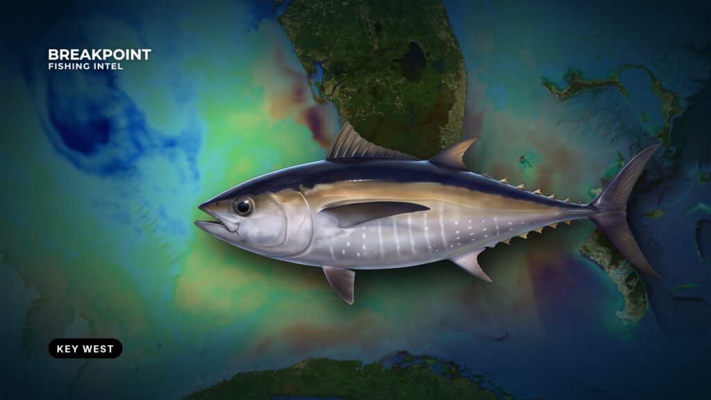
Blackfin tuna off Key West hold on the drop south of the reef line, where the bottom falls away and the Florida Current runs close. They sit on the deep edge, not over the flats or the reef top, so the job is to find the edge and the water along it.
The method has three steps. Find where an OBS SST break or Chlorophyll color edge crosses the drop on Chart Contours, run there, and confirm it on the water. A temperature break works as structure, the same way a ledge does. For the fish itself and general tackle, see our blackfin tuna fishing guide. This guide stays on Key West water: the channels and current figures from the Coast Pilot, the reef line and Sanctuary zones, the Stream, how blackfin are fished here, reading breaks, weather windows and the rules.
Launching and the Key West Approaches
Key West has Straits of Florida water to the south and Gulf of America water to the north and west. The NOAA Coast Pilot 4 chapter covers the channels, harbors and current set in detail, and the figures below come from it.
Where to launch and fuel
| Option | Type | Notes |
|---|---|---|
| City Marina at Garrison Bight | Public ramp, City of Key West | Coast Pilot describes Garrison Bight as protected from wave action from all quarters |
| Simonton Street | Public small-boat ramp | At the foot of Simonton Street |
| Bertha Street | Public small-boat ramp | At the south end of Bertha Street |
| Stock Island Marina | Marina | Fuel listed |
At Safe Harbor on Stock Island, sea and swell from the southern quadrant are reported to cause heavy surf at the entrance. A seiche of 2 to 3 feet is possible inside during southerly winds.
Garrison Bight is reached by a dredged channel around the north end of Fleming Key. Fleming Key Cut is unmarked, about 6 feet deep and has very strong tidal currents. It is not recommended for low-powered vessels.
Pick your launch based on the forecast wind. A southerly points straight at the Stock Island entrance, while Garrison Bight takes wind from any quarter.
Channels out of the harbor
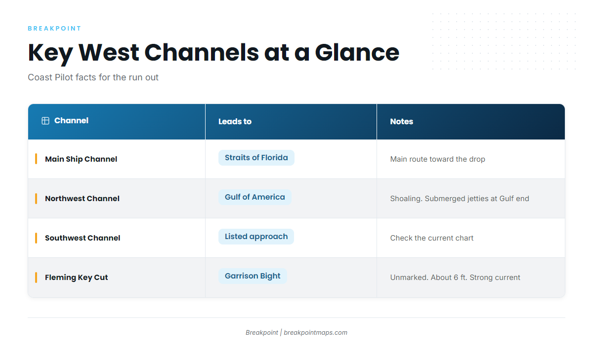
| Channel | Leads to | Notes |
|---|---|---|
| Main Ship Channel | Straits of Florida | Main route south toward the reef line and the drop |
| Northwest Channel | Gulf of America | Medium-draft. Intermittent shoaling along its length. Submerged jetties 0.3 to 0.5 mile either side of the centerline at the Gulf end. The Gulf end is shifting westward |
| Southwest Channel | Listed approach | Check the current chart before use |
| Fleming Key Cut | Garrison Bight shortcut | Unmarked, about 6 ft, very strong tidal currents, not recommended for low-powered vessels |
For blackfin, the Main Ship Channel is the way south. The Northwest Channel serves the Gulf side.
Tidal current at the entrance
West of Fort Taylor the flood sets north at about 2 knots and the ebb sets south at about 3 knots. A westerly current counter to the Gulf Stream, at times exceeding 3 knots, has been reported near Key West Entrance Lighted Whistle Buoy KW. Wind affects both the timing and the strength of the tidal current.
At the helm, a 3-knot ebb sets you south across the channel while you think you are running straight. When wind blows against that set, the water stacks and the wave period shortens. Check the set before you commit to a heading.
Restricted areas
Naval restricted areas lie off the south, west and north sides of Key West. Another extends about 150 yards from the shoreline around Fleming Key.
- Tortugas South: vessels may not stop.
- Tortugas North: you need advance permission to stop.
- Tortugas Ecological Reserve: anchoring is prohibited throughout.
Plot all of these on official charts before you leave the dock.
The Atlantic Reef Line and the Drop
The reef line runs east to west south of Key West, marked by Western Dry Rocks, Sand Key and Eastern Dry Rocks. Seaward of the reef, the bottom falls off toward deep water in the Straits.
That drop is where you fish. Humps and ledges along it break the current and hold bait, and you can find them on Chart Contours and official NOAA charts. Mark them before you go.
Current hitting rising bottom pushes bait up and holds it on the edge, and blackfin feed along it. If you fish the reef for yellowtail, you already know the inside of this edge: the ledge you anchor near for yellowtail is the inside edge of the blue-water fishery.
Atlantic-side wrecks also hold bait:
- Vandenburg
- USS Curb
- Wilkes-Barre
Mind the zones. Fishing is prohibited in Florida Keys National Marine Sanctuary Preservation Areas, except that catch-and-release trolling is allowed at Sand Key. Ecological reserves and conservation areas are transit-only with gear stowed. The Sanctuary Preservation Area rules are the source. Know where each zone sits before you set a spread.
Gulf Stream Blue Water South of Key West
The Gulf Stream through the Straits of Florida is called the Florida Current. It runs close to the reef line off the Lower Keys and carries warm, blue water. The edge of that water is what you are chasing.
The inside edge moves. Meanders push blue water toward the reef or pull it away, and spinning eddies form between the Stream and the reef. A chart from yesterday shows where the edge was, not where it is now.
The Coast Pilot reports a westerly countercurrent, at times exceeding 3 knots, near buoy KW. Opposing water moving side by side close to the reef produces seams, and seams are edges.
Wind against current shortens and steepens the wave period, so read the period figure in the forecast along with the wave height. For the wider water, see our Atlantic Southeast fishing guide.
Features to look for along the Stream edge:
- A rip where two currents meet
- A weedline of sargassum
- A clean blue to green color change
- A step in surface temperature
Blackfin Runs and How They Are Fished
Blackfin show off Key West on a seasonal rhythm, and the local methods follow the bait. This section covers when to expect them and the five ways they are worked here.
When blackfin show off Key West
Local seasonal listings put blackfin off Key West in winter, spring and autumn, and leave them off the summer list. Edges matter more than the calendar, because the fish move with the bait and the Stream. For the wider picture, see blackfin along the Atlantic Southeast.
The same Key West lists carry sailfish, wahoo, king mackerel and mahi-mahi, so rig a spread that can handle the bycatch.
How blackfin are fished here
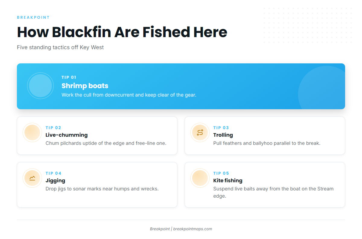
- Shrimp boats: Shrimp boats cull their catch after a tow, and the cull draws bait and blackfin. Approach from downcurrent and keep your distance from the gear and drag lines. Ask on the radio or wave before working the slick, and never cross between the boat and its nets. Drift baits back in the cull rather than running through it.
- Live-chumming pilchards: Set up uptide of an edge or the drop and throw a steady stream of live pilchards. Pin a free-lined pilchard in the chum to draw fish to the surface.
- Trolling: Pull small trolling feathers and rigged ballyhoo along a break, color change or weedline. Work parallel to the edge rather than across it.
- Jigging: When sonar marks fish holding below the surface near humps or wrecks, drop vertical jigs to the marks.
- Kite fishing: Kites suspend live baits at the surface away from the boat along the Stream edge. Blackfin take them alongside sailfish.
Reading Temperature Breaks and Current Edges South of the Keys
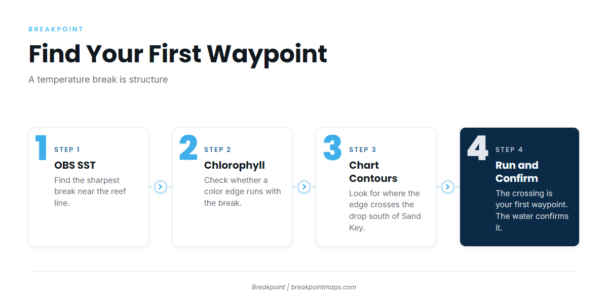
A temperature break is structure. Where a break crosses the ledge, two kinds of structure stack: bait concentrates where current and bottom pin it, and blackfin work that line.
The workflow is short. Open OBS SST and find the sharpest break near the reef line. Add Chlorophyll to see whether a color edge runs with the break. Lay Chart Contours over both and look for where the edge crosses the drop south of Sand Key. That crossing is your first waypoint.
The satellite has limits:
- SST reads only the surface skin.
- Cloud blocks passes, so a gap means no data, not cold water.
- SST does not show subsurface structure or where the bait is today.
The chart narrows where to look, and the water confirms it. On the water, watch for:
- A color change from green to blue
- A rip line or slick seam
- A weedline of sargassum
- Birds working over bait
- Bait and fish marks on sonar near the edge
- A temperature step on the hull sensor
Chart layers are not for navigation. Run on official charts.
Weather Windows
Read the NWS Key West marine forecast and take three numbers from it: wind speed and direction, wave height, and wave period.
Wind opposing the Florida Current, or a strong ebb in the channel, shortens the period at the same wave height. Compare the forecast wind direction against the current set described above. The forecast supplies the numbers, and your boat and your judgment decide what to do with them.
Pull the latest OBS SST pass before you idle out of the bight.
Frequently Asked Questions
When is the best time for blackfin off Key West?
Local seasonal listings put blackfin in winter, spring and autumn and leave them off the summer list. Edges matter more than the calendar, so a good break on the drop is worth more than a good month on the wrong water.
Do I need an HMS permit for blackfin tuna?
No. Blackfin needs no HMS Angling Permit in state or federal waters, according to FWC. Yellowfin and other tunas do need one.
What is the blackfin bag limit in Florida?
The FWC limit is 2 fish per person or 10 fish per vessel per day, whichever is greater. There is no minimum size.
How far out are the blackfin?
Look to the drop and the Florida Current edge south of the reef line rather than a mileage figure. Find the drop on Chart Contours and official charts, then let the break and the water color narrow the search.
Can I fish Sand Key?
Sand Key is a Sanctuary Preservation Area. Catch-and-release trolling is allowed there, and other fishing is not.
Which channel do I take?
The Main Ship Channel leads to the Straits of Florida. The Northwest Channel goes to the Gulf of America, with intermittent shoaling and submerged jetties at the Gulf end. Check the current chart for either.
What can’t the SST layer see?
It reads only the surface skin. Cloud blocks passes, and it shows neither subsurface structure nor where the bait is today. Use it to choose where to look, then confirm on the water.