




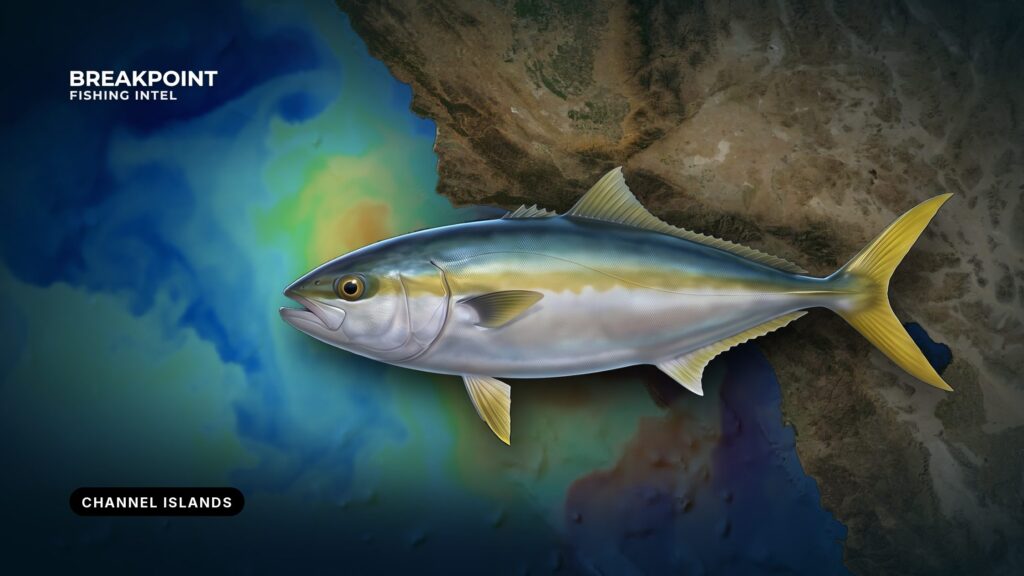
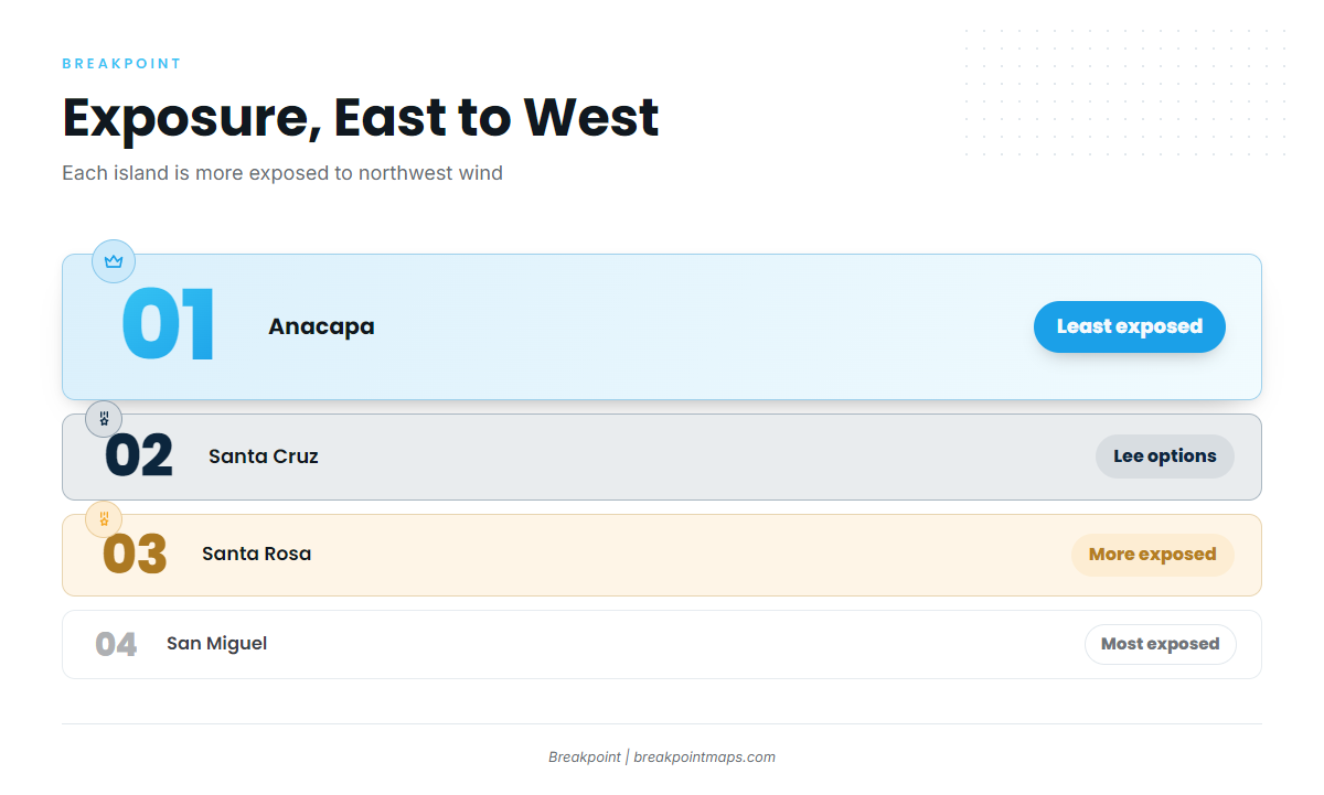
The Northern Channel Islands run east to west across the Santa Barbara Channel: Anacapa, Santa Cruz, Santa Rosa and San Miguel. Each is more exposed to the northwest wind than the last, and each asks more of your boat and your fuel plan. California yellowtail fishing at the Channel Islands starts at a mainland ramp and a channel crossing, and the fish depend on warm water reaching the island you choose.
This page covers ports, crossing hazards, the data to read, named public features and kelp edges at each island, and where the reserve lines fall. Tackle, bait and how yellowtail feed are in our California yellowtail guide. For the broader movement of fish out of Southern California and Baja, see when yellowtail push north.
Launching and Crossing
The run to the islands crosses some of the busiest shipping lanes in California, where ships move at 25 to 35 knots. The National Park Service notes there are no public moorings or all-weather anchorages at the islands. Read the Channel Islands boating information before you plan the trip.
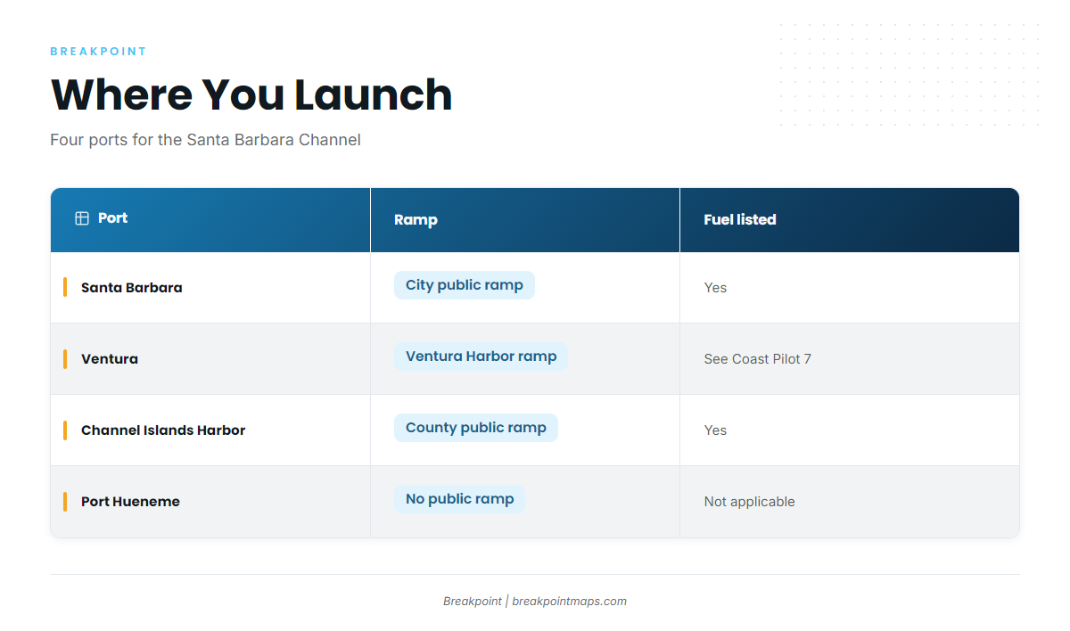
| Port | Ramp / operator | Fuel listed | Entrance notes | Official page |
|---|---|---|---|---|
| Santa Barbara | Santa Barbara Harbor Launch Ramp, City of Santa Barbara Waterfront Department | Yes (City marinas) | Dredged channel shoals after SE storms; lighted buoys frequently relocated | City Waterfront page |
| Ventura | Ventura Harbor ramp | See Coast Pilot 7, Ch. 4 | Pleasure-craft and commercial fishing harbor, 5.8 miles NW of Channel Islands Harbor (harbor authority figure) | Coast Pilot 7, Ch. 4 |
| Channel Islands Harbor | Public launch ramp, Ventura County Harbor Department | Yes (harbor fuel dock) | Approach from the south, caution at night; shoaling SE of the channel and NW of the north jetty | Harbor page |
| Port Hueneme | No public ramp; trailer boats use Channel Islands Harbor, 1 mile NW | Not applicable | Deepwater commercial and Navy port | Coast Pilot 7, Ch. 4 |
Swipe the table sideways to see every column.
Santa Barbara
The Santa Barbara Harbor Launch Ramp is run by the City of Santa Barbara Waterfront Department, with fuel at the City marinas. Details are on the Santa Barbara Waterfront services page. This is the launch point for the central and western islands, including the back side of Santa Cruz and Santa Rosa.
The entrance has some quirks:
- The dredged channel shoals after southeast storms, and its lighted buoys are frequently relocated.
- At night the breakwater light is hard to see against city lights.
- Boats have grounded on the sandbar north of the breakwater light after steering for masts visible over the breakwater.
- Harbor patrol monitors VHF 16 for channel conditions and assists entering boats on request.
Fog is most frequent from August through November, with visibility under 0.5 mile on about 4 to 7 days a month. Mornings are usually the worst.
Ventura
Ventura Harbor sits 5.8 miles northwest of Channel Islands Harbor, per the harbor authority. It is the short-run option toward Anacapa and eastern Santa Cruz. For the entrance, read the NOAA Coast Pilot 7 chapter covering this coast.
Channel Islands Harbor
The public launch ramp is run by the Ventura County Harbor Department, and the harbor has a fuel dock. The Channel Islands Harbor navigation notes describe the approach. The sportfishing landing here puts Anacapa 11 miles away.
The entrance is a gap between two jetties with a detached breakwater in front:
- Approach from the south and use caution at night.
- Shoaling southeast of the entrance channel and northwest of the north jetty is rapid and uncertain.
- The radio-activated sound signal at the south jetty light answers 5 keyings on VHF 81A.
Between Point Hueneme and Santa Barbara, fog is most frequent July through October, with visibility under 0.5 mile on about 5 to 10 days a month. August and September are usually the worst. NOAA charts 18720 and 18725 cover the harbor and approach.
Port Hueneme
Port Hueneme is a deepwater commercial and Navy port. Trailer boats launch at Channel Islands Harbor, 1 mile northwest.
Shipping Lanes, the Sea Range and Fog
The Traffic Separation Scheme is the lane system across the channel, and ships in it run at 25 to 35 knots. Cross as directly as you can and keep a radar and AIS watch.
The Point Mugu Sea Range extends 180 miles southwest from Point Mugu and is up to 210 miles wide. Hazardous naval operations can happen any day. Broadcasts go out about every 30 minutes on VHF 11 and 16 during operations.
Wind, Seas, Buoys and the Forecast
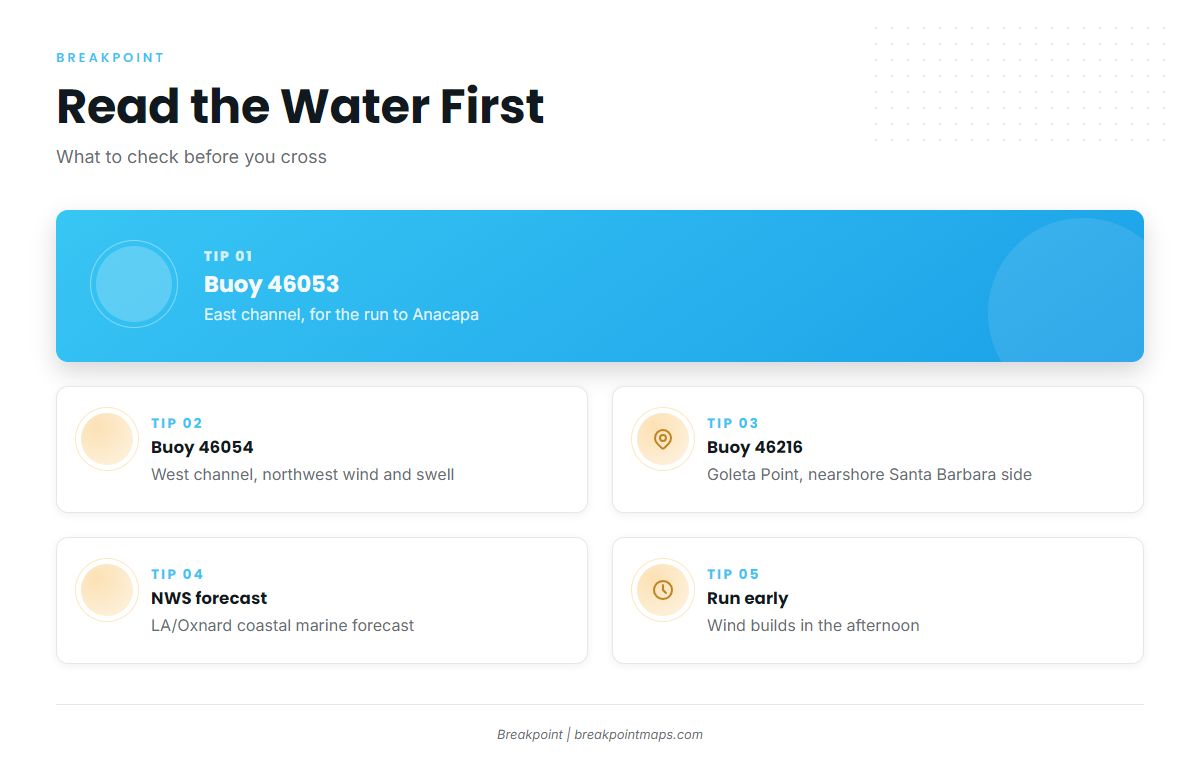
Wind builds in the afternoon, so plan an early departure and an early run home.
The Coast Pilot puts gales and seas of 12 feet or more from mid-fall through late spring, particularly in the Santa Barbara Channel and off Point Arguello. Offshore, waves over 9 feet appear in about 10% of April and May observations and about 4% of August through October observations.
Three buoys show what the channel is doing:
- 46053, East Santa Barbara Channel. The eastern channel, relevant to the run to Anacapa and the front side of Santa Cruz. See the East Santa Barbara Channel buoy.
- 46054, West Santa Barbara Channel. The western channel, toward Santa Rosa and San Miguel. Read it for the northwest wind and swell coming down the channel.
- 46216, Goleta Point. The nearshore read off the Santa Barbara side.
For the official forecast, use the NWS coastal marine forecast for Los Angeles/Oxnard. The forecast is a prediction, while the buoys report current conditions.
These harbors also run for white seabass, rockfish and calico bass. See our guide to other species and grounds out of these ports.
Anacapa Island
Anacapa is the closest island to Oxnard and Ventura, 11 miles from Channel Islands Harbor per the landing. It is three islets: East, Middle and West Anacapa.
Named features:
- Arch Rock
- Cathedral Cove
- Frenchy’s Cove
Frenchy’s Cove sits within the Anacapa Island SMCA. Some SMCAs allow limited recreational take, so check the CDFW page for this specific area before you fish.
Fish the down-current edge of the kelp canopy, where bait holds. Canopy moves with swell and season, so a mapped edge is a starting point and may not match what’s there. Surface iron, yo-yo iron and live sardine or squid when it is around all work for yellowtail here. The species guide covers the method.
There are no public moorings or all-weather anchorages. Adjacent protected areas are Anacapa Island SMR and Anacapa Island SMCA. See Marine Protected Areas below.
| Feature | Type | Note |
|---|---|---|
| Arch Rock | Named landmark | Public feature |
| Cathedral Cove | Named landmark | Public feature |
| Frenchy’s Cove | Named cove | Inside Anacapa Island SMCA |
Santa Cruz Island
Santa Cruz is the largest island. When the west end blows, it is the default choice because it offers lee options on both sides.
Front Side: Scorpion to Gull Island
Named features:
- Scorpion Anchorage
- Smugglers Cove
- San Pedro Point
- Yellowbanks
- Gull Island
Kelp beds and hard bottom run from San Pedro Point through Yellowbanks toward the Gull Island reserve. Fish the down-current edge of the canopy.
Scorpion and Smugglers are named anchorages, but per NPS there are no public moorings or all-weather anchorages. Adjacent protected areas are Scorpion SMR, which lies next to Scorpion Anchorage, and Gull Island SMR.
Back Side: Painted Cave to Forney’s Cove
The north shore faces the prevailing northwest wind and the channel. Named features along it and around the west end:
- Prisoners Harbor
- Pelican Bay
- Fry’s Harbor
- Painted Cave
- Willows Anchorage (south shore)
- Forney’s Cove
Painted Cave sits inside the Painted Cave SMCA. Some SMCAs allow limited take, so check the CDFW page for that area. Pelican, Fry’s and Prisoners are named anchorages, but the NPS caveat holds: no public moorings or all-weather anchorages.
| Side | Named features | Adjacent MPAs |
|---|---|---|
| Front | Scorpion Anchorage, Smugglers Cove, San Pedro Point, Yellowbanks, Gull Island | Scorpion SMR, Gull Island SMR |
| Back | Prisoners Harbor, Pelican Bay, Fry’s Harbor, Painted Cave, Forney’s Cove | Painted Cave SMCA |
Santa Rosa Island
Santa Rosa is more exposed to the northwest wind, and the run comes from Santa Barbara. Yellowtail reach this island only when warm water does.
Named features:
- Becher’s Bay
- Johnson’s Lee
- Talcott Shoal
- South Point
- Carrington Point
Talcott Shoal is offshore structure. Fish the down-current edge of any kelp you find along the shore.
SST breaks matter here. Yellowtail push west only as far as the warm water reaches, and a break that stalls near Santa Cruz is often why the bite stops there. Check OBS SST before you commit to the run.
Becher’s Bay and Johnson’s Lee are named anchorages, with the same NPS caveat. Adjacent protected areas are Carrington Point SMR, Skunk Point SMR and South Point SMR. Know these lines before you drift the west end.
San Miguel Island
San Miguel is the most exposed island, sitting in the path of the prevailing northwest wind, and it depends most on warm water. When warm water reaches it, fish can show. Until then, expect to wait.
Named features:
- Cuyler Harbor
- Harris Point
- Point Bennett
- Wilson Rock
- Richardson Rock
Richardson Rock sits inside Richardson Rock SMR, so treat it as a boundary and don’t fish it. Along the rest of the shore, kelp and current lines set where bait holds.
Cuyler Harbor is a named anchorage, with the same NPS caveat. Adjacent protected areas are Harris Point SMR, Judith Rock SMR and Richardson Rock SMR.
Marine Protected Areas
The authoritative boundaries, coordinates and rules for each area are on the CDFW marine protected areas page and its Ocean Sport Fishing interactive map. Use them as the source rather than a map screenshot.
| Island | MPA name | Type | Where to check |
|---|---|---|---|
| Anacapa | Anacapa Island SMR | SMR | CDFW MPA page |
| Anacapa | Anacapa Island SMCA | SMCA | CDFW MPA page |
| Santa Cruz | Scorpion SMR | SMR | CDFW MPA page |
| Santa Cruz | Painted Cave SMCA | SMCA | CDFW MPA page |
| Santa Cruz | Gull Island SMR | SMR | CDFW MPA page |
| Santa Rosa | Carrington Point SMR | SMR | CDFW MPA page |
| Santa Rosa | Skunk Point SMR | SMR | CDFW MPA page |
| Santa Rosa | South Point SMR | SMR | CDFW MPA page |
| San Miguel | Harris Point SMR | SMR | CDFW MPA page |
| San Miguel | Judith Rock SMR | SMR | CDFW MPA page |
| San Miguel | Richardson Rock SMR | SMR | CDFW MPA page |
SMRs allow no take. Some SMCAs allow limited recreational take, and it varies by area, so check that area’s CDFW page.
The Channel Islands National Marine Sanctuary’s federal marine reserves extend several state reserves into federal waters. Check both the state and the sanctuary before you fish.
To load boundaries into your plotter:
- Take the coordinates from the CDFW page for each area.
- Enter them as waypoints or boundary lines.
- Cross-check them against the chart.
The MPA boundary layer in Breakpoint, shown with Chart Contours and OBS SST, puts the kelp edge, the depth break and the reserve line on one screen, so you can set a drift that ends before the line with the current in mind. Chart layers are not for navigation. The CDFW coordinates are the authority.
Which island you cross to depends on where warm water sits that day. OBS SST and Chlorophyll show the break and the color line. A cloud-blocked satellite pass is a limit of the data, so read the buoys too.
FAQ
Can I launch at Port Hueneme?
No public ramp is listed. It is a deepwater commercial and Navy port, so trailer boats launch at Channel Islands Harbor, 1 mile northwest.
Which buoys do I check before crossing?
Check 46053 for the east channel, 46054 for the west channel and 46216 for Goleta Point, plus the NWS Los Angeles/Oxnard marine forecast. 46053 and 46054 show channel wind and swell. 46216 gives the nearshore read off Santa Barbara.
Can I fish Frenchy’s Cove or Painted Cave?
Both sit inside SMCAs. Some SMCAs allow limited recreational take, so check the CDFW page for that specific area before fishing.
How do I load MPA boundaries into my plotter?
Take the coordinates from the CDFW page and enter them as waypoints or boundary lines. Cross-check them against the chart. Chart layers are not for navigation.
Is Richardson Rock open?
It sits inside Richardson Rock SMR. Treat it as a boundary and verify the lines with CDFW.
Are there moorings at the islands?
No. NPS states there are no public moorings or all-weather anchorages. Smugglers, Scorpion, Cuyler and Becher’s are named anchorages that depend on conditions.
Do federal reserves differ from state MPAs?
Yes, in jurisdiction. The sanctuary’s federal reserves extend several state reserves into federal waters. Check both CDFW and the sanctuary.
Which island do I pick when the northwest wind is up?
Santa Cruz is the usual default, because it offers lee options. Read 46054 and the forecast before you commit west.
To see the ocean data behind these decisions on one map, download Breakpoint from the App Store or Google Play. The SST break, the water color line and the MPA boundary layer can be viewed together before you leave the dock.