Blackfin tuna fishing out of Sarasota at a glance
Blackfin tuna fishing out of Sarasota means a run of 22 to 75 miles, depending on whose numbers you use. This page covers when the fish are around, how far boats go, named structure off New Pass with bearings and depths you can plot, how blackfin are worked locally, who runs trips, and the nearest weather station. Each figure carries its source, and where sources disagree, both are shown.
When blackfin are off Sarasota
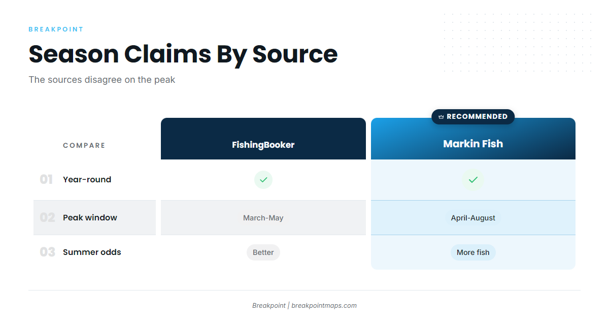
Blackfin are caught year-round, and the sources disagree on the peak. The pattern is a spring and summer push inside a fishery that never fully shuts off, much like blackfin across the eastern Gulf (see also the Gulf of Mexico fishing guide). The Sarasota blackfin tuna season is a window of better odds with no hard start or stop.
Year-round
Both sources report blackfin in every month, so there is no season to wait for. Only the odds change.
The spring and summer push
Two sources give two windows:
- Markin Fish: year-round, with more fish April through August.
- FishingBooker: year-round, with better odds in summer and a March through May window, per FishingBooker’s Sarasota offshore listing.
The two windows overlap in April and May. Neither source explains its dates, so we don’t pick between them.
How far boats run
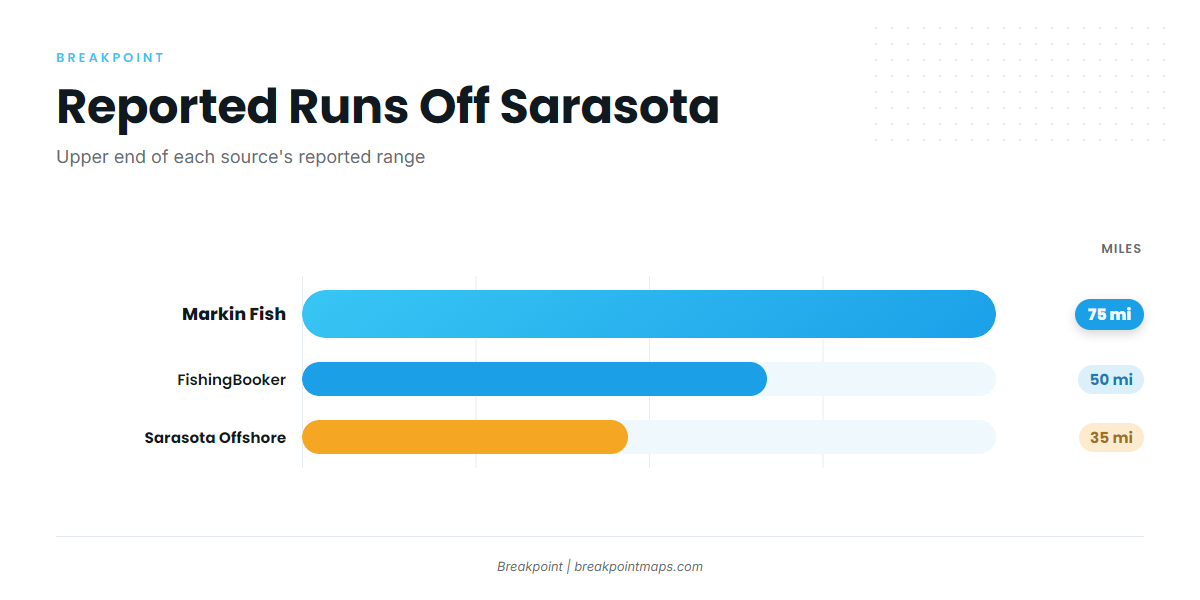
Reported runs range from 22 to 75 miles:
- Sarasota Offshore Fishing: 22 to 35 mile trips
- FishingBooker: about 50 miles, starting from the end of the Egmont Shipper Channel
- Markin Fish: 50 to 75 miles
Plan fuel and timing against the long end of that range. Runs of this length cross from state water into federal waters.
Reading conditions before you go
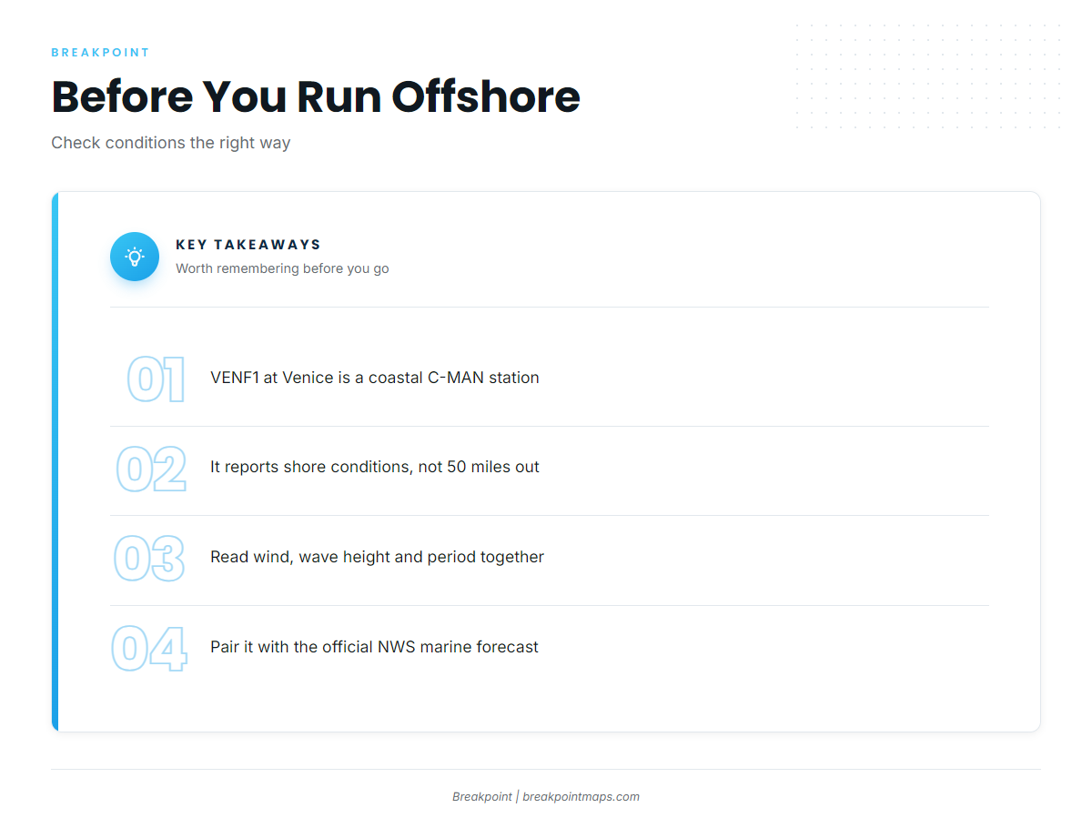
The nearest station we can name is NDBC station VENF1 at Venice, a C-MAN station at 27.072 N 82.453 W. It is a coastal station and reports conditions at the shore, not 50 miles out.
Read wind, wave height and period from VENF1 alongside the official NWS marine forecast, and use both to make your own call on the run.
Named grounds and structure off New Pass
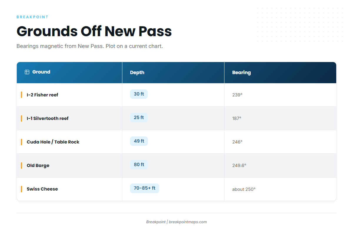
The listed grounds sit 1.4 to 18 miles out, inside the reported blackfin runs. Treat them as named structure and reference points along and within the run, not as blackfin spots.
Bearings are magnetic and given from the stated origin. Plot them on a current chart. Chart layers are not for navigation, including our Chart Contours layer, which helps when laying out the run but does not replace your chart and your judgment.
| Ground | Depth | Bearing (magnetic) | Distance | From |
|---|---|---|---|---|
| Cuda Hole / Table Rock ledge | 49 ft | 246° | 9.54 miles | New Pass Gulf marker |
| The Gully | 259° | 10.29 miles | New Pass | |
| Old Barge | 80 ft | 249.6° | 17.69 miles | New Pass |
| Swiss Cheese | 70–85+ ft | about 250° | 18 miles | New Pass |
| I-1 Silvertooth reef | 25 ft | 187° | 1.74 nm | New Pass |
| I-2 Fisher reef | 30 ft | 239° | 1.43 nm | New Pass |
| Casey Key Beach / Grassy Key ledges | 25 ft | 152° | 11 nm | |
| Point of Rocks (Siesta Key) |
Swipe the table sideways to see every column.
Nearshore reefs: I-1 and I-2
I-1 Silvertooth (25 ft, 1.74 nm at 187° magnetic) and I-2 Fisher (30 ft, 1.43 nm at 239° magnetic) are the closest reference points to the pass.
South toward Casey Key
The Casey Key Beach / Grassy Key ledges sit in 25 ft, 11 nm at 152° magnetic, with ledges of 5 to 8 ft. Point of Rocks lies off Siesta Key beach.
How blackfin are fished here
Local methods are simple. General blackfin tackle and biology are in the blackfin tuna guide.
Topwater baits and lures
Markin Fish reports topwater baits and lures for blackfin, with fish worked at the surface.
Chumming to hold fish
Markin Fish reports that chumming is sometimes used to bring fish to the boat.
Trolling
Trolling is also used to cover water on the run.
Who fishes for blackfin out of Sarasota
Four operators list blackfin tuna out of this port. Our coverage of other tuna fisheries compares ports beyond the Gulf.
Sarasota Offshore Fishing Charters
- Boat: FISH TALES, a 2001 Luhrs 40 ft sportfisher
- Captain: Captain Tyler, named on its FAQ
- Trips: lists blackfin on 22 to 35 mile trips
- Details: Sarasota Offshore Fishing Charters
Gulfcoast Offshore Ventures
- Captain: Capt. Tim Noe, based on Siesta Key
- Boat: 42 ft Freeman
- Details: Gulfcoast Offshore Ventures out of Siesta
Kokomo Charters
- Boat: Kai Fin, 45 ft, a federally permitted six-pack
- Captain: Captain Rob
- Details: Kai Fin offshore trips
Markin Fish Charters
- Captain: Captain Mark Fewox
- Details: Markin Fish Charters
FAQ: blackfin tuna out of Sarasota
When is the best time for blackfin tuna out of Sarasota?
Blackfin are caught year-round. Markin Fish reports more fish April through August. FishingBooker gives better odds in summer and lists March through May.
How far do I need to run?
Sarasota Offshore Fishing lists 22 to 35 mile trips. FishingBooker suggests about 50 miles. Markin Fish reports 50 to 75 miles.
Where do I start the run?
FishingBooker names the end of the Egmont Shipper Channel as a starting point. The bearings for the named grounds on this page are given from New Pass.
Which buoy should I check?
NDBC C-MAN station VENF1 at Venice, 27.072 N 82.453 W. It is a shore station, so read it with the NWS marine forecast.
Who runs blackfin charters out of Sarasota?
Sarasota Offshore Fishing Charters, Gulfcoast Offshore Ventures, Kokomo Charters (Kai Fin) and Markin Fish Charters.