




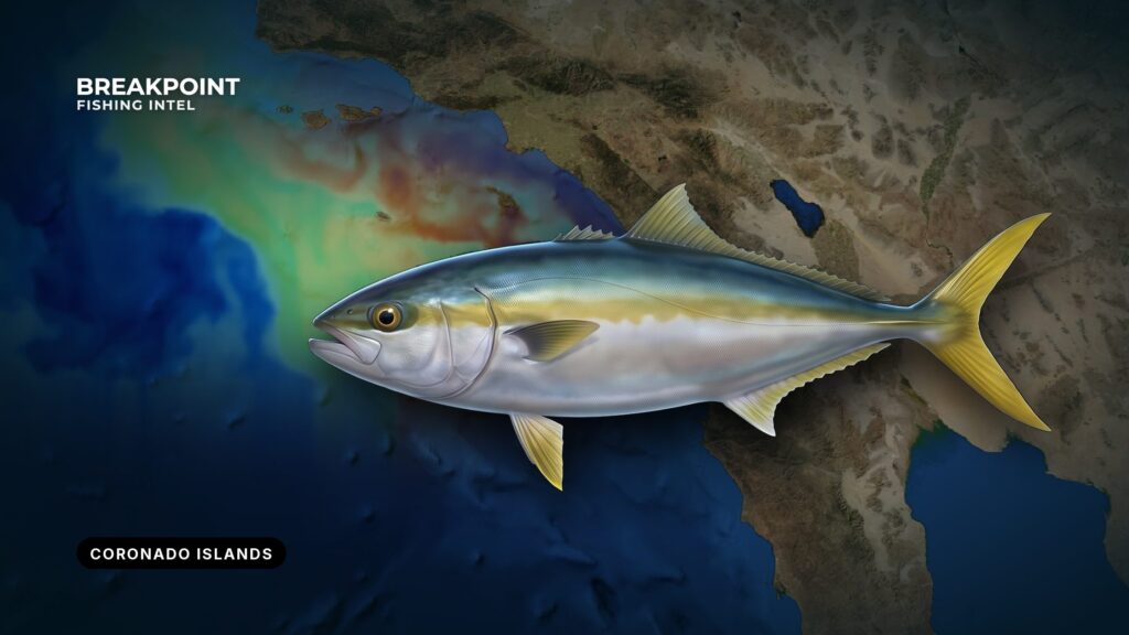
Islas Los Coronados sit in Mexican waters off San Diego, and California yellowtail at the Coronado Islands are the reason most private boats make the run. Biology and general tactics are in our California yellowtail fishing guide. This page covers where fish hold around the islands, when they show, which method fits each piece of structure, and which agencies govern a two-country trip.
Ports and the Run Out of San Diego Bay
Most private boats launch inside San Diego Bay and run out past Point Loma.
Ramps
Four public ramps serve the bay, all listed on the Port of San Diego ramps page:
- Shelter Island Boat Launch
- Chula Vista Boat Launch (J Street Marina Park)
- National City Boat Launch (Pepper Park)
- Glorietta Bay Boat Launch (Coronado), operated by the City of Coronado
The Shelter Island ramp sits nearest the entrance. Mission Bay is a separate harbor with its own jetty entrance, 5.5 miles north of Point Loma.
The bay entrance
The NOAA Coast Pilot 7 chapter covers the entrance. Its figures:
- Currents: Entrance currents usually run 0.5 to 5 knots, depending on the stage of the tide, and follow the channels.
- Zuñiga Shoal: On the ebb there is a slight set toward Zuñiga Shoal, south of the Zuñiga jetty. A crosscurrent off Ballast Point can cause a sudden sheer.
- Submerged jetty: It runs 1 mile south from Zuñiga Point. Its outer two-thirds shows only in small sections at high water. Lights and a sound signal mark the seaward end.
- Narrow channels: The ship channels are designated narrow channels. Vessels under 20 meters (65.6 feet) and vessels engaged in fishing must not impede a vessel that can only navigate within the channel. The bay is a major Navy base.
- Fog: Visibility drops below 0.5 mile on about 3 to 7 days a month from September through April. December is the foggiest month. Fog is worst late at night and in early morning, and heavier at the entrance than in the north bay.
An early launch on an ebb tide meets the set toward Zuñiga Shoal in the dark, so know where the jetty ends before you leave the channel.
Crossing into Mexican waters
The islands lie south of the US-Mexico maritime boundary. Mexican rules apply once you cross it, and US rules apply again on your return. The paperwork is covered under Regulations below.
Where to read conditions
- NWS coastal waters forecast: San Mateo Point to the Mexican border.
- NDBC 46232, Point Loma South waverider buoy: Wave height and period.
- NOAA Coast Pilot 7, Chapter 4: The reference for the entrance.
Check the buoy before you hitch up from inland, since the forecast can miss local conditions.
Structure and Water Around Islas Los Coronados
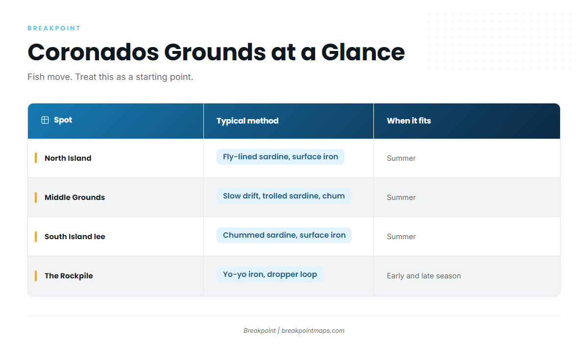
Yellowtail at the islands move between a handful of named grounds. The structure and the current decide which method works.
BD Outdoors describes schools working from North Island to the Middle Grounds and down to the lee of South Island, with method shifting by season. Its late-season Coronados report is the source for that pattern.
North Island
North Island is the northern start of the school route. NOAA’s work shows inshore fish holding around anchored kelp, and that pattern fits the kelp along the island.
The Middle Grounds
The Middle Grounds are the water between the islands. The pattern here is a slow drift on the Middle Grounds with a sardine trolled behind the boat. When fish meter under the boat, chum brings them up.
South Island and its lee
Schools work the lee of South Island. They react to chummed sardines and come to the surface.
The Rockpile
The Rockpile lies south of the islands and is fished as deep structure.
What the current does
The bite tends to die when the current stops, and waiting rarely fixes it. Move to other structure.
Spot table
| Spot | Where | Typical method | When it fits |
|---|---|---|---|
| North Island | North end of the group | Fly-lined sardine, surface iron around kelp | Summer |
| Middle Grounds | Between the islands | Slow drift, trolled sardine, chum | Summer |
| South Island lee | Lee side of South Island | Chummed sardine, surface iron | Summer |
| The Rockpile | South of the islands | Yo-yo iron, dropper loop | Early and late season |
Fish move, so treat this as a starting point.
Reading the water before the run
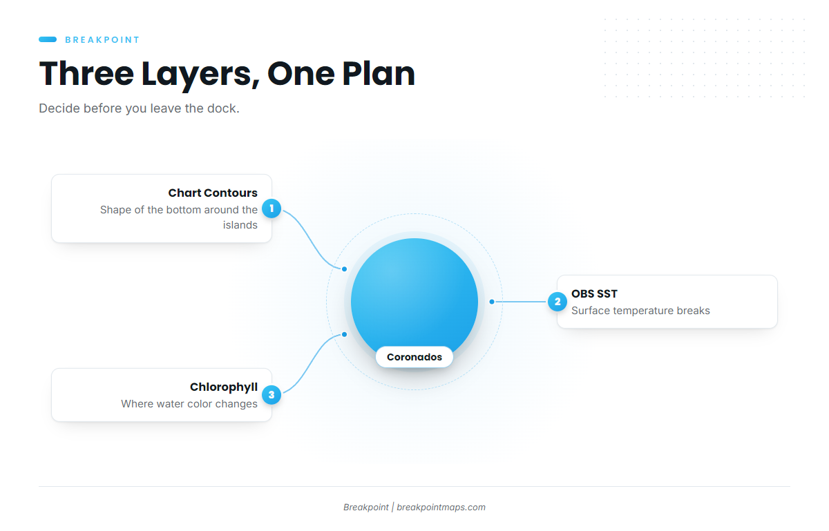
Three layers help you choose between North Island, the Middle Grounds and the Rockpile before you leave the dock:
- Chart Contours show the shape of the bottom around the islands.
- OBS SST shows surface temperature breaks.
- Chlorophyll shows where water color changes.
Chart layers are not for navigation, and contours do not replace a navigation chart. Satellite SST can be blocked by cloud or fog, and September to April fog days are common. The Fish Intel species pages explain how the species view reads these layers.
When Yellowtail Show at the Coronados
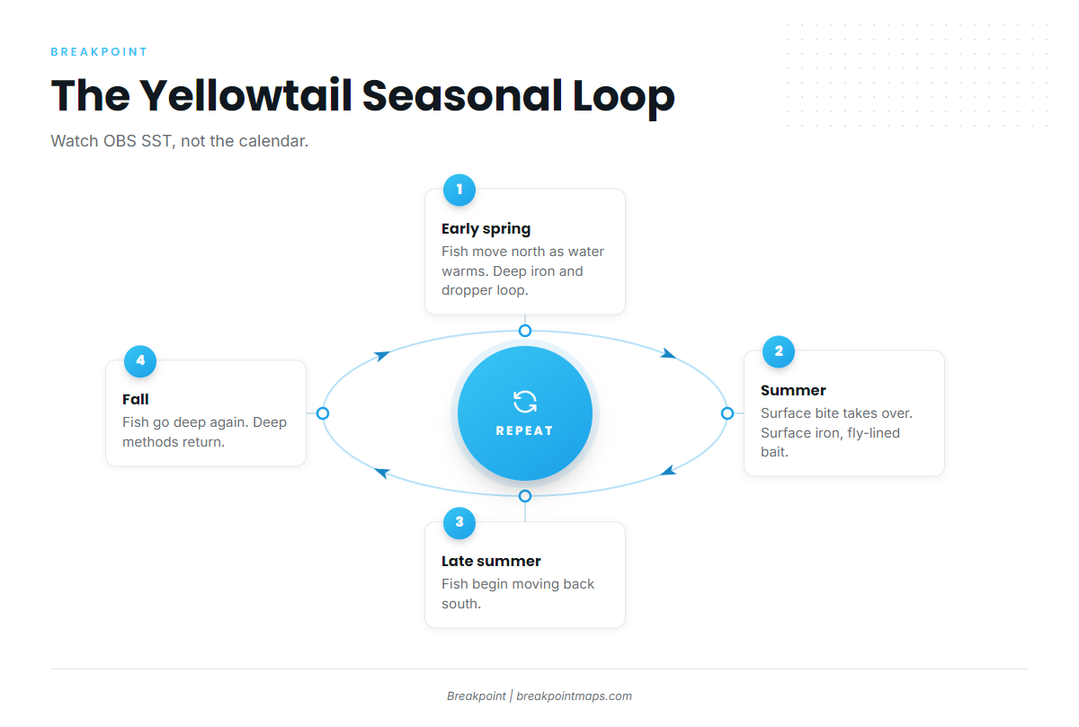
NOAA Fisheries says yellowtail move north in early spring as water warms and back south in late summer and fall. Its NOAA Fisheries yellowtail research is the basis for the pattern below.
| Period | What to expect | Method lean |
|---|---|---|
| Early spring | Fish arrive as the water warms | Deep: iron and dropper loop |
| Summer | Surface bite takes over | Surface iron, fly-lined bait, slow-trolled mackerel |
| Late summer and fall | Fish go deep again as they move south | Deep methods return |
Watch OBS SST for warming water rather than relying on a calendar.
Tactics That Fit the Islands
Pick the method by the structure and the current, then adjust when either changes.
Yo-yo iron and dropper loop on deep structure
Fish these on the Rockpile in the early and late season.
Surface iron, fly-lined sardine and anchovy, and slow-trolled mackerel
Use these in summer when fish show on top along the kelp and in the lee.
Slow drift with a trolled sardine and chum
Use this on the Middle Grounds when fish meter under the boat.
Move when the current dies
When the current stops, the bite fades. Leave and find other structure.
Frequently Asked Questions
Do I need a Mexican fishing license on my own boat?
Yes. Mexico requires a valid license when a boat carrying fishing equipment is in its waters. Check CONAPESCA for coverage and how to buy one.
Do I need an FMM?
Mexico expects everyone aboard to carry an FMM and a passport. Check INM before the trip.
How do I report my return?
Report to CBP when you return to the US, using CBP ROAM. Check CBP for the procedure.
Do California size rules apply to fish caught in Mexico?
California’s rules govern fish you possess in California. There is a declaration for fish taken in Mexico. Check CDFW for the current requirement.
Can I fillet on the boat?
California has fillet rules for yellowtail. Read CDFW’s fillet rules before you cut anything.
When do yellowtail show at the islands?
NOAA’s pattern is north in early spring as water warms, south in late summer and fall. Watch OBS SST for warming water.
Which ramp should I use?
The Shelter Island launch ramp sits nearest the entrance. The Chula Vista, National City and Glorietta Bay ramps are the other public options, and Mission Bay is a separate harbor. Read NDBC 46232 and the NWS forecast before towing.