




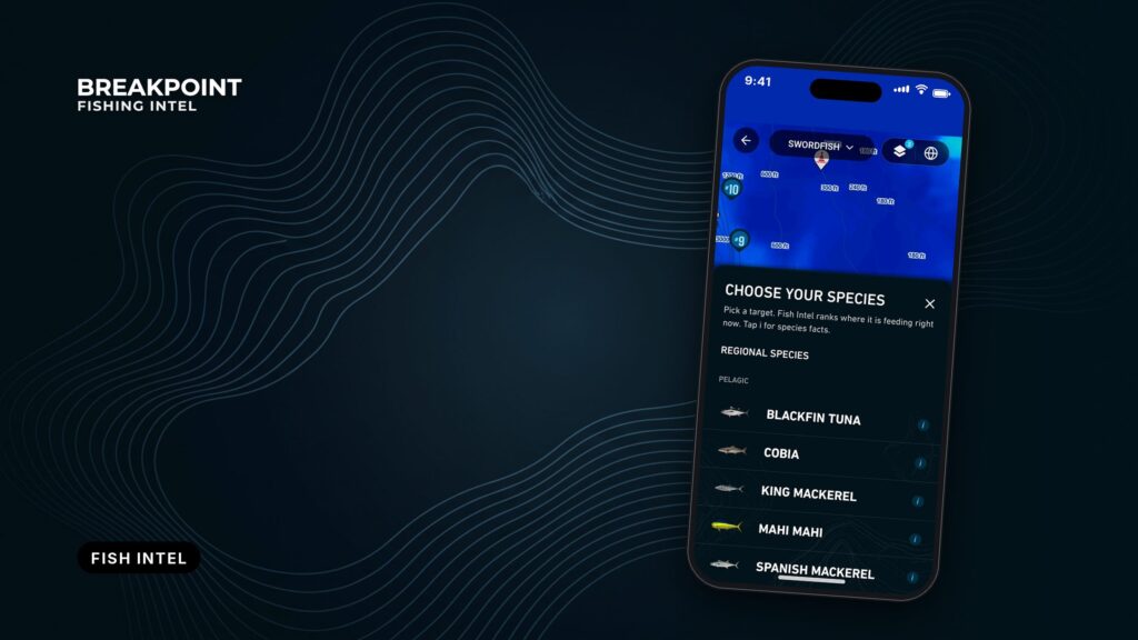
A Fish Intel species page in the Breakpoint app collects what you need to decide where to look for one target species. The hotspot score is calculated per species, so every section on the page either feeds that score or changes how you read it. This guide goes through each section in the order it appears in the app and explains how it relates to the score.
What a species page shows
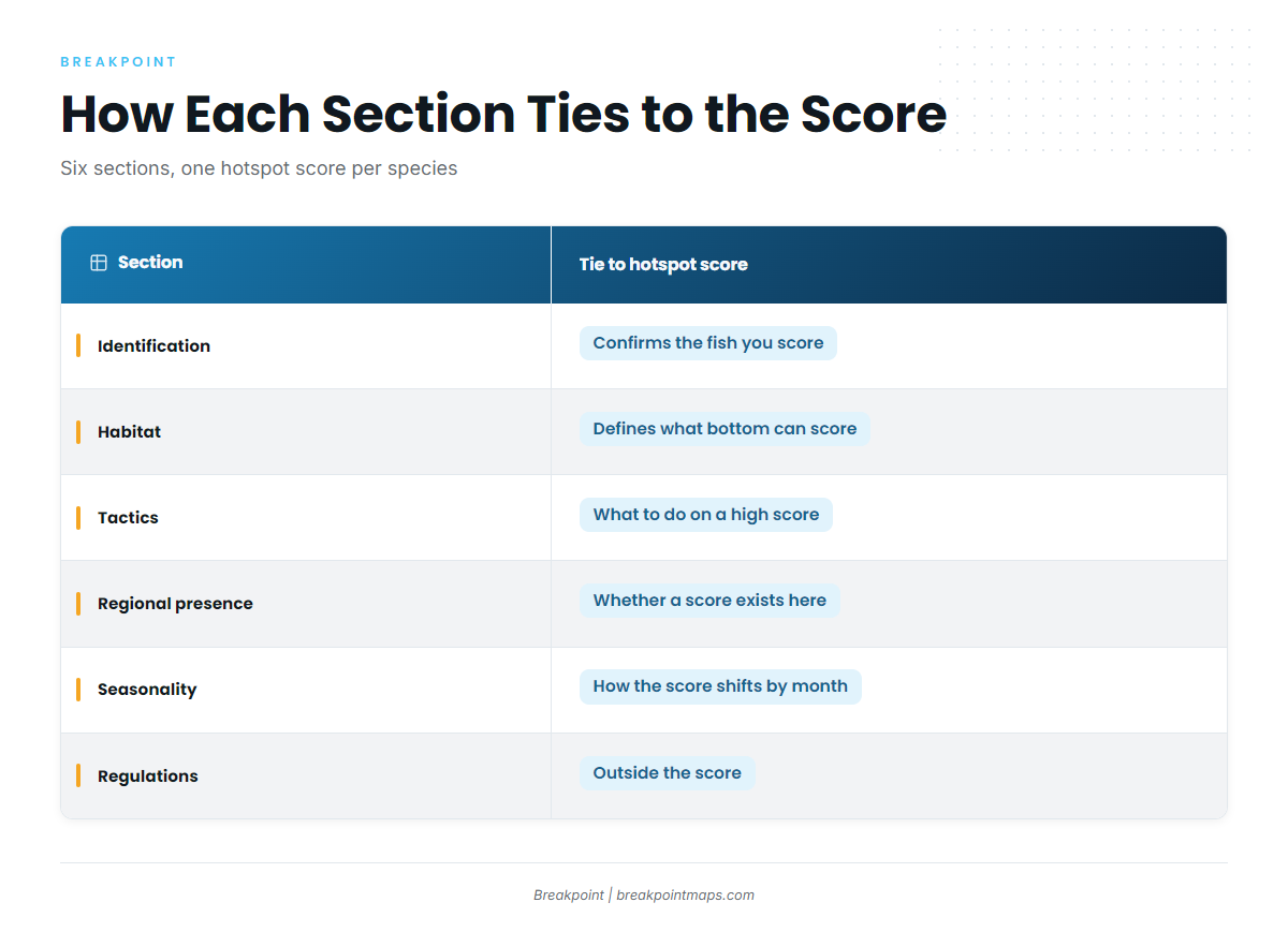
Each species page covers six things about one fish: identification, habitat, tactics, regional presence, seasonality, and where to find the regulations.
| Section | How it ties to the hotspot score |
|---|---|
| Identification | Confirms the fish you are scoring is the fish you caught. |
| Habitat | Defines what bottom or water can score. |
| Tactics | What to do once you are on a high score. |
| Regional presence | Whether a score exists in your waters at all. |
| Seasonality | When and where the score shifts through the year. |
| Regulations | Whether you can keep the fish. This row sits outside the score. |
Read the sections as filters, in this order. Regional presence tells you whether the species lives in your waters. Habitat tells you which bottom or water holds it. Seasonality tells you whether it is there this month. Tactics tell you what to do when you arrive.
The scoring method is covered separately in our guide to how we score fishing hotspots.
Species and regions covered
Fish Intel covers these species in these regions.
- Sablefish: Pacific Northwest and Pacific Southwest
- California yellowtail: Pacific Southwest
- Blueline tilefish: Gulf of Mexico, Atlantic Southeast and Atlantic Northeast
- Cobia: Gulf of Mexico, Atlantic Southeast and Atlantic Northeast
- Mahi-mahi: Gulf of Mexico, Atlantic Southeast, Atlantic Northeast, Pacific Northwest and Pacific Southwest
- Pacific halibut: Pacific Northwest
A species only scores where it lives. The Regional presence section below explains how that works.
Identification
The identification section shows the field marks that separate a species from its look-alikes, so you know which fish the score and the rules apply to. Because the score is per species, a misread fish means you are reading the wrong page and the wrong rules.
Mahi-mahi illustrates the problem. The South Atlantic Fishery Management Council notes that mahi-mahi colors fade almost immediately after death, so confirm the ID on a fresh fish rather than going by color hours later.
Mistaken identity is how legal fish get released and illegal fish get kept, which is why identification sits next to the regulation links.
Habitat
The habitat section shows the depth, bottom type, and water a species uses, which is why only certain bottom can score. Blueline tilefish are a clear case. NOAA Fisheries describes blueline tilefish habitat at NOAA as the outer shelf, shelf break, and upper slope at 98 to 774 feet, on irregular bottom with ledges, crevices, boulders, or rubble piles. Flat sand inshore does not score for them, however good the surface looks.
Habitat can also shift with size and location. Madigan et al. report that offshore yellowtail are caught near floating kelp mats and inshore fish around anchored kelp beds. Our guide to California yellowtail at the Coronado Islands shows a species page put to use.
Tactics
The tactics section covers what to do once you are on a high-scoring spot: structure to work, baits, and presentation. The score points you to where to look, while tactics cover how to fish once you are there. They do not change the score.
Cobia show how the two connect. The Florida Fish and Wildlife Conservation Commission describes cobia around buoys, pilings, and wrecks, taken on live crabs and small fish with medium to heavy tackle, in FWC’s cobia profile. A high cobia score near marked structure tells you to work the structure first.
Regional presence
The regional presence section shows which of the regions Breakpoint covers a species lives in, which determines where a score can exist at all. Cobia are absent from the eastern Pacific, according to cobia range on FishBase, so there is no cobia score off the West Coast.
Species that do live in a region are read against local water. Our guide to Pacific halibut off Westport reads a Pacific Northwest species against a single port.
Sablefish add a lesson about depth. The Washington Department of Fish and Wildlife says WDFW lists adult sablefish on mud bottom at 300 to 1,500 m, with Puget Sound as a nursery. The source uses meters, so we keep them.
Seasonality
The seasonality section shows when a species moves and spawns, which explains how and why its score shifts through the year. The Florida Museum reports that cobia migrate south and offshore to warmer water in autumn and winter, then north along the Atlantic coast in early spring.
Temperature limits matter too. The Western Pacific Fishery Management Council describes mahi-mahi as restricted by the 20°C isotherm. We keep °C because the source does.
The same water can score differently in different months, so read the score alongside the seasonal pattern on the page.
What the score can’t see
The hotspot score is a guide to where to look, not a forecast of catch.
- No promise of fish. A high score is a better place to start, not a guarantee.
- Sea state is numbers only. We show wind, wave height, and period. Check the official forecast for the water you plan to fish.
- Charts are not for navigation. Chart layers are for planning. Use official charts and your plotter to navigate.
FAQ
What is a Fish Intel species page?
It is the per-species page in Breakpoint that covers identification, habitat, tactics, regional presence, and seasonality, and links to regulations. Each section ties back to that species’ hotspot score, either by feeding it or by changing how you read it.
Which species and regions does Fish Intel cover?
Fish Intel covers sablefish, California yellowtail, blueline tilefish, cobia, mahi-mahi, and Pacific halibut. The regions are Gulf of Mexico, Atlantic Southeast, Atlantic Northeast, Pacific Southwest, and Pacific Northwest. Each species has a page only in the regions where it lives.
Does a high hotspot score mean fish are there?
No. The score is a guide to where to look and does not promise fish. Use the habitat and seasonality sections to judge whether the water and the time of year fit the species before you commit to a run.
Why does Breakpoint link to regulations instead of listing limits?
Rules differ between state and federal waters and change by season and quota. The page points you to the agency that sets them: NOAA Fisheries, the South Atlantic Fishery Management Council, or the state agency for the waters you fish. Check it before every trip.
Is chart data safe for navigation?
No. Chart layers are for planning only. Use official charts and your plotter to navigate, and the official marine forecast for wind, wave height, and period.
Get Fish Intel on your phone
Download Breakpoint from the App Store or Google Play and open the species page for your target fish.