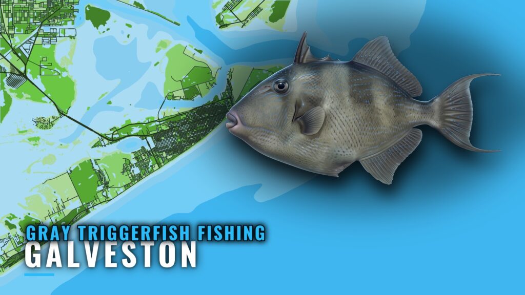
Gray triggerfish fishing out of Galveston comes down to bottom fishing at offshore rigs, including a nearshore rig stop on the way home from a tuna run. Every distance below is measured from the Galveston jetties, the entrance channel all boats use. The sections cover run distances, named grounds, the local method, and where to find the rules. The wider picture is in the gray triggerfish fishing in the Gulf of Mexico and the Gulf of Mexico fishing guide.
When triggerfish turn up off Galveston
Triggerfish are also caught on a nearshore rig on the return trip from a tuna run. That is the documented pattern here, and it depends on circumstances rather than the calendar.
Rig catches here are logged as triggerfish, with no species named. Confirm that a fish is a gray triggerfish before you keep it, using the gray triggerfish identification and the general picture page. The NOAA Fisheries gray triggerfish profile is the federal reference for the species itself.
Tuna-run crews get the most out of this, since the stop costs little on a boat already headed home. Private owners should treat triggerfish as a bonus on rig trips rather than a reason to make one.
How far Galveston boats run
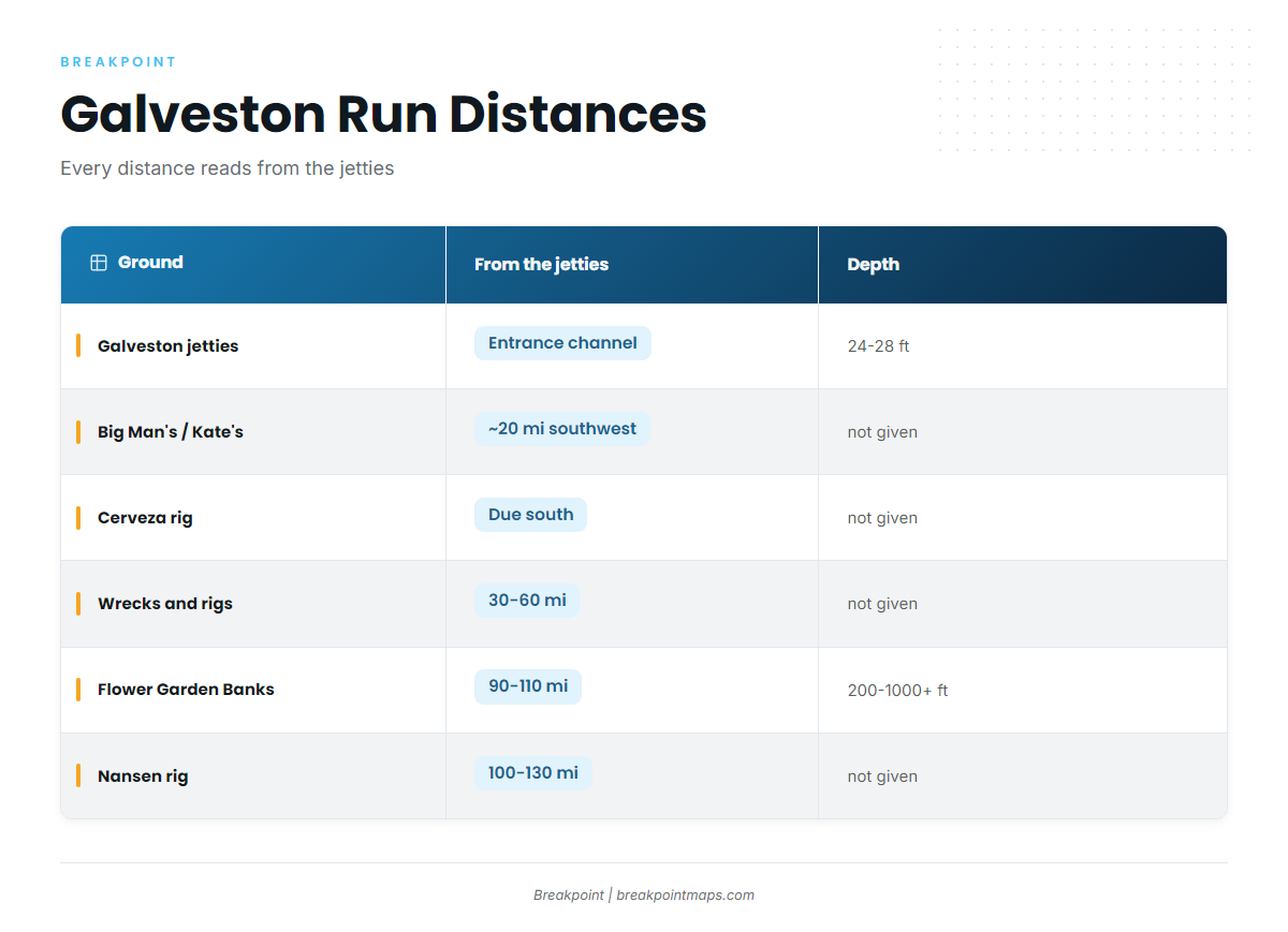
The grounds range from the entrance channel to runs past 100 mi. This table reads from the jetties.
| Ground | Distance or bearing from the jetties | Depth where given |
|---|---|---|
| Galveston jetties | At the entrance channel | 24-28 ft (where bull reds were taken) |
| Big Man’s Nearshore Reef | Roughly 20 mi southwest | Not given |
| Kate’s Nearshore Reef | Roughly 20 mi southwest | Not given |
| Cerveza rig | Due south | Not given |
| Wrecks and rigs | 30-60 mi | Not given |
| Flower Garden Banks | 90-110 mi offshore | 200-1000+ ft |
| Nansen rig | 100-130 mi | Not given |
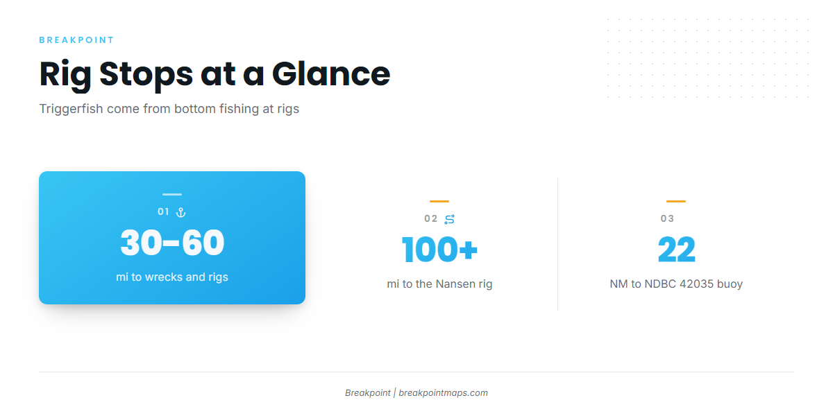
The nearest NOAA buoy is NDBC 42035, 22 NM east of Galveston, at 29.235 N 94.410 W. Check wind, wave height, and period there, then read the official NWS marine forecast before you run.
Grounds and structure off Galveston
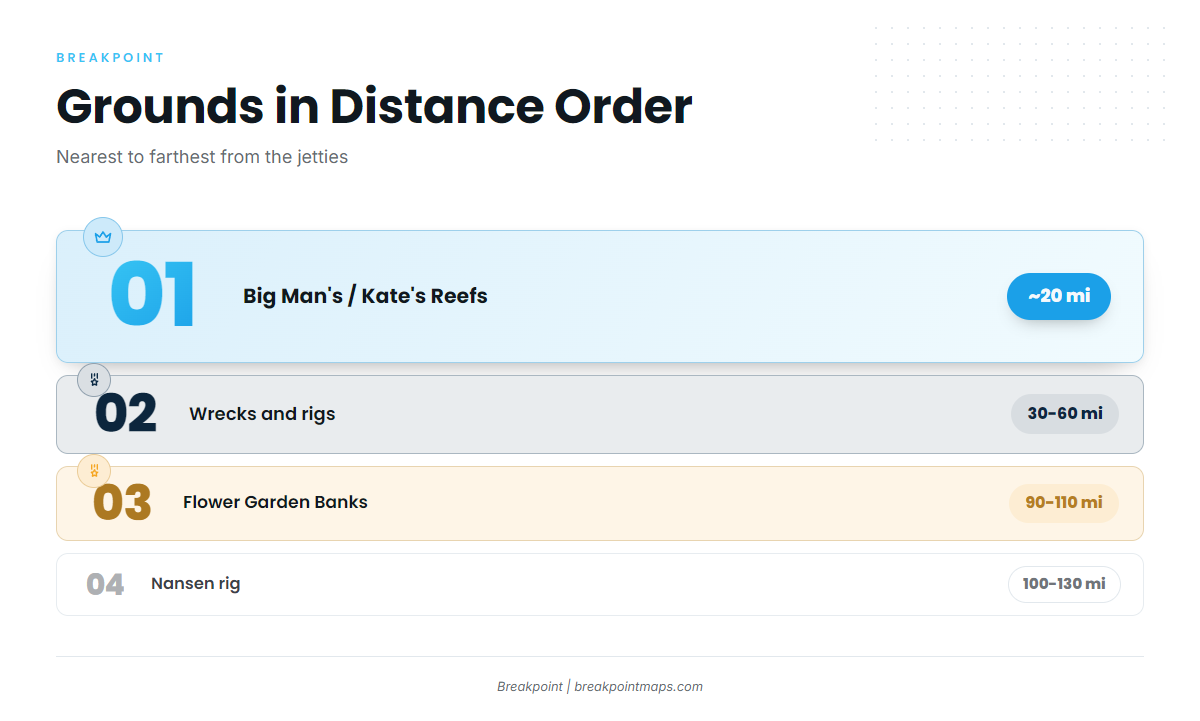
These are listed in rough distance order, with the piers last. Chart layers are not for navigation.
Galveston jetties
The north jetty sits at Bolivar and the south jetty at Galveston Island, both at the entrance channel. Bull reds have been taken here in 24-28 ft. The jetties serve as the zero point for the run and are not a triggerfish spot.
Big Man’s and Kate’s Nearshore Reefs
Both are named nearshore reefs roughly 20 mi southwest of the jetties. They are the closest named reef structure on this page.
Cerveza rig
The Cerveza oil rig sits due south of the jetties. It is the nearest rig reference for the offshore picture, and it is where the nearshore rig stop on a tuna return trip fits.
Wrecks and rigs, 30-60 mi
This is the mid-range band of wrecks and rigs, 30-60 mi out. Bottom fishing at rigs is the documented local method here.
Flower Garden Banks
The banks sit 90-110 mi offshore in 200-1000+ ft. The run is long enough that it should be planned as its own trip.
Nansen rig
The Nansen rig is a yellowfin tuna night-fishing destination, 100-130 mi out, and the anchor of the tuna run. The triggerfish stop happens on the way home, not here.
Seawall piers
The 61st Street and 91st Street piers are pay piers on the Galveston seawall, the shore-side option for anglers without a boat.
How triggerfish are fished here, and who fishes them
The local method is bottom fishing at rigs. For broader reef-fish technique, see the reef fish guides.
Three groups fish this:
- Private boat owners working Galveston offshore rigs.
- Tuna-run crews who stop at a nearshore rig on the yellowfin tuna return trip.
- Pier anglers on the seawall, who fish from shore and are not part of the rig fishery.
The rig stop is cheap for a crew already running home. For an owner making a dedicated run, the 30-60 mi band is the working range.
FAQ: gray triggerfish fishing out of Galveston
Are triggerfish caught out of Galveston?
Yes. Bottom fishing at offshore rigs produces them, including a nearshore rig stop on a tuna return trip. Catches are logged as triggerfish, with no species named.
How far do Galveston boats run for rigs and reefs?
Big Man’s and Kate’s are roughly 20 mi southwest of the jetties. The Cerveza rig is due south. Wrecks and rigs run 30-60 mi, the Flower Garden Banks sit 90-110 mi out, and the Nansen rig is 100-130 mi out.
What are the 61st and 91st Street piers?
They are pay piers on the Galveston seawall, the shore-side option for anglers without a boat.
Which buoy covers the Galveston run?
NDBC 42035, 22 NM east of Galveston, at 29.235 N 94.410 W. Pair its readings with the official forecast before you run.
Where are the fishing rules for Galveston?
TPWD sets the state rules, and federal rules apply on the long offshore runs. Check both before you fish.