




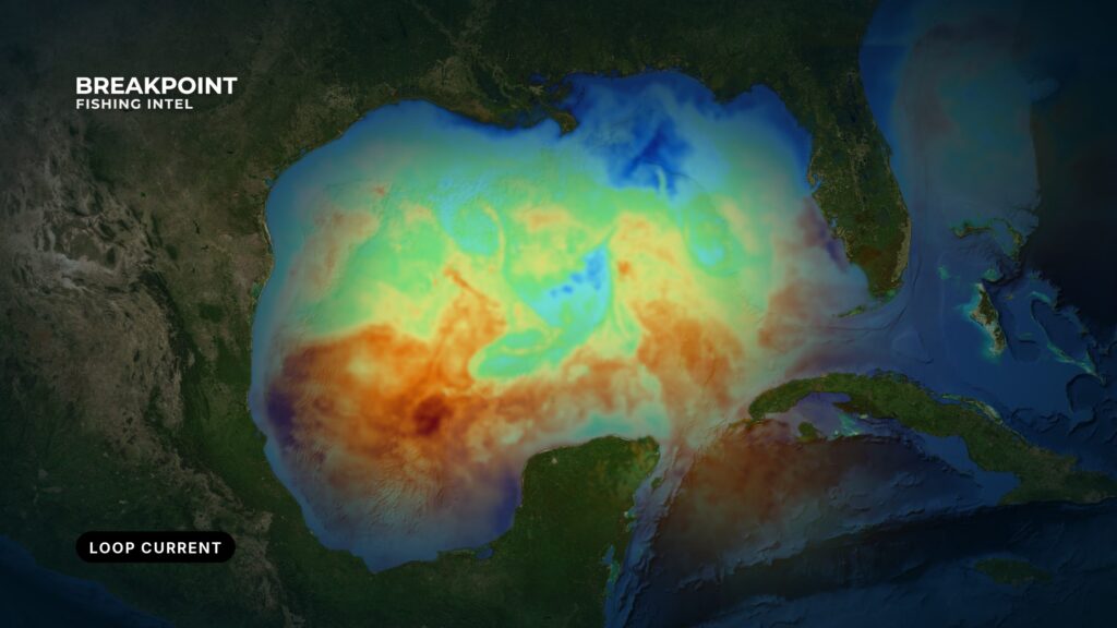
Not for navigation. Breakpoint charts are for trip planning. Navigate with official charts and your vessel’s instruments.
The Loop Current is the Gulf’s main source of blue water, and its edges and eddies decide where offshore water fishes. Warm Caribbean water enters the Gulf through the Yucatán Channel, makes a clockwise loop, and leaves through the Florida Straits. From there it becomes the Florida Current and then the Gulf Stream.
Loop Current fishing in the Gulf of Mexico rests on that geometry. Where the current sits, how far north it reaches and where it sheds warm rings set up the temperature breaks, color lines and eddies you run to. This guide covers how the current changes shape and sheds eddies, what it does to temperature, color, height and speed, what it means by area, and a pre-run layer check built on public data. None of it guarantees fish, but it gives you a better call on where to look.
What the Loop Current Is
According to NOAA’s Loop Current page, the Loop Current is a flow of warm water that enters the Gulf, curves east and south along Florida’s coast, and exits through the Straits of Florida. It then runs up the Atlantic Seaboard.
In order:
- Caribbean inflow: Warm water comes through the Yucatán Channel between Mexico and Cuba.
- Northward push: The flow runs north into the Gulf.
- Clockwise turn: The current bends east and then south.
- Florida Straits exit: It leaves the Gulf south of the Keys as the Florida Current.
- Gulf Stream: Off Florida’s east coast it continues north as the Gulf Stream.
Its reach varies. Sometimes the current barely enters the Gulf, and sometimes it pushes far north toward the Louisiana shelf. The Loop Current and the Gulf Stream are the same western boundary current system under different names along its path.
Federal agencies, including NOAA and the National Hurricane Center, now use the name Gulf of America. Data portal labels may show either name. We use Gulf of Mexico.
For fishing, what matters is that the current carries clear, warm, blue offshore water, and the pelagic fish that live in it, within reach of the northern Gulf.
How the Loop Current Changes Shape and Sheds Eddies
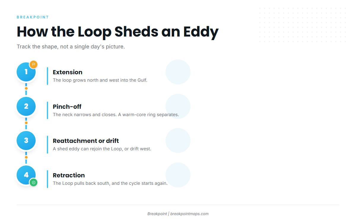
The Loop does not hold one shape. It moves through a rough sequence, and each stage changes where blue water sits.
- Extension. The loop grows north and west into the Gulf.
- Pinch-off. The neck of the loop narrows and closes. A ring of Loop water separates as a Loop Current eddy, also called a warm-core ring: an anticyclonic, clockwise-spinning ring of warm, blue water with a raised sea surface.
- Reattachment or drift. A shed eddy can reconnect to the current, so an eddy that looks separate on Monday’s map can be part of the Loop again by the weekend’s data. Treat any single day’s picture as provisional.
- Westward drift and retraction. Eddies that stay separate drift west across the Gulf toward Texas and Mexico and weaken over time. The main current retracts toward the Yucatán Channel.
Shedding has no reliable calendar. Peer-reviewed work describes intervals between sheddings that vary widely, so you cannot plan a season around a date.
Smaller features matter too. Cold-core frontal eddies are cyclonic, counterclockwise eddies with a depressed sea surface and cooler, often greener water. They ride the Loop’s edge and help shape its meanders and the pinch-off. The shear between a frontal eddy and Loop water is where edges sharpen and convergence builds. Follow the shape over several days rather than relying on one map.
What the Loop Current Does to Gulf of Mexico Water
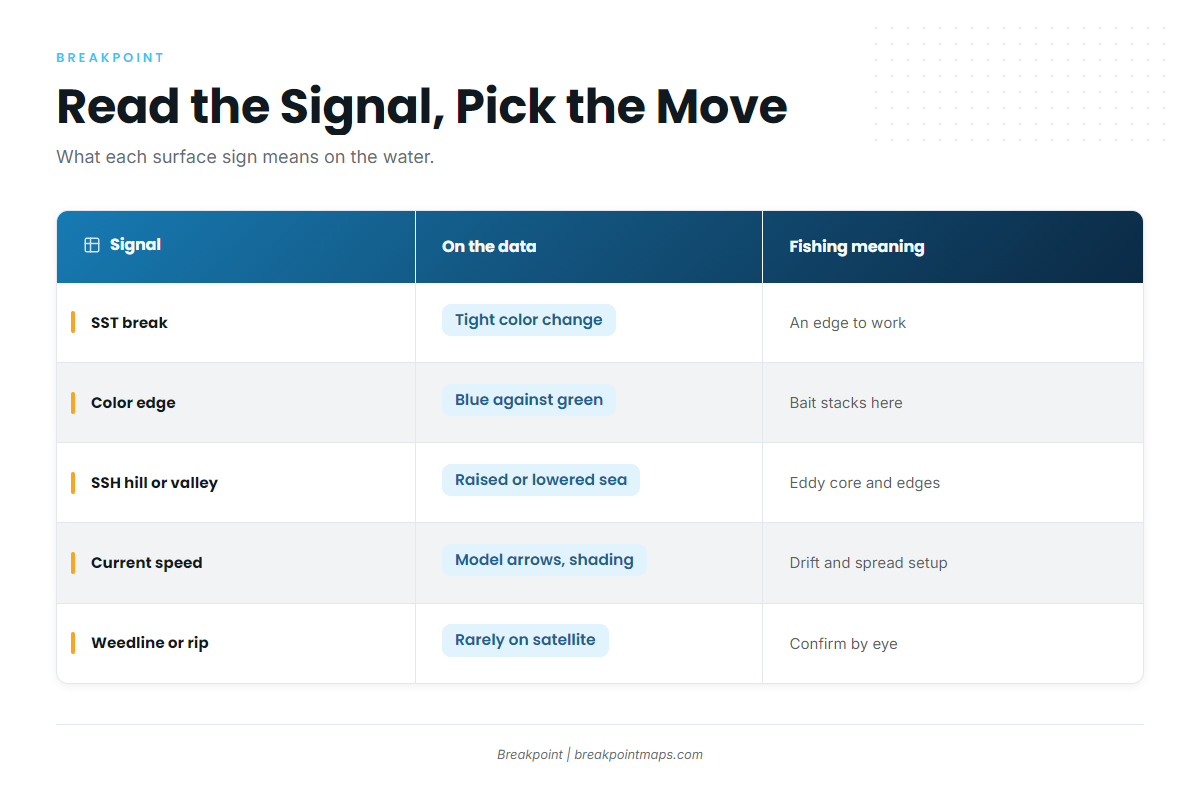
Temperature, color and rips are the surface signs of the current. They are the same cues as reading offshore water anywhere, scaled up to a current that runs the Gulf. Each signal below maps to something you can act on, and each has a blind spot.
| Feature | What it looks like on the data | What it means for fishing | What the data misses |
|---|---|---|---|
| SST break | A tight band of color change on SST | An edge to work. Pick a side by bait and birds | Cloud gaps. Composites lag a moving edge |
| Color edge | Blue against green on chlorophyll | Bait concentrates near the line | Cloud. Coastal or river water can blur it |
| SSH hill or valley | A raised or depressed sea surface on altimetry | The core and edges of a warm-core or cold-core eddy, even under cloud | Coarse resolution and no sharp surface edge |
| Current speed | Arrows or speed shading from models | Drift, spread and deep-drop decisions | These are forecasts, not observations |
| Weedline or rip | Usually not on satellite layers | Convergence that holds bait and gamefish | You find it with your eyes |
Temperature
Loop and eddy water runs warmer than the surrounding shelf and Gulf water, and that contrast makes the edge. Fish hold along the break because it concentrates bait, so work the side where the bait, birds and weed are rather than choosing by the numbers alone.
Yellowfin tuna, wahoo, mahi and blue marlin are the pelagics anglers look for along these edges. That is an association, not a promise. For the fishing side of the edge, see how fish use temperature breaks.
A federal HMS permit is required to fish for tunas and billfish in federal waters, so check NOAA Fisheries’ HMS permit page before fishing.
Color
Loop water is a deep, clear blue because it carries little chlorophyll. Shelf and river-influenced water reads green. The blue-to-green line is where bait stacks, and a sharp line usually means active shear.
The Chlorophyll layer is the map view of this edge. For more on reading it, see chlorophyll and water color maps. Cloud blocks chlorophyll the same way it blocks SST.
Sea Surface Height
Think in hills and valleys. Warm-core water stands higher, so it shows as a hill, a positive sea surface height anomaly. Cold-core water sits lower and shows as a valley.
Altimetry is satellites measuring the height of the sea surface. Radar altimetry sees through cloud, so it shows the eddy when SST is blank. It is also coarse: it shows where the feature is, but not the sharp edge you troll.
Current Speed
The Loop and its eddy edges carry a strong, fast flow. Speed drives three decisions:
- Drift: How fast you move over the bottom decides weight choice and whether a deep drop is workable.
- Spread: Trolling direction relative to the flow changes how your baits track.
- Fuel and time: Running against the flow on a long run costs both.
When wind runs against current, check wind speed, wave height and period. The National Weather Service marine forecast has the official values.
Weedlines and Rips
Convergence, where water masses at different speeds meet, gathers Sargassum, debris and bait into lines. Fish hold along the line, often on the downcurrent side. Satellites rarely show these lines, so they serve as the on-water confirmation that you found the edge the layers pointed to.
Where the Loop Current Matters in the Gulf of Mexico
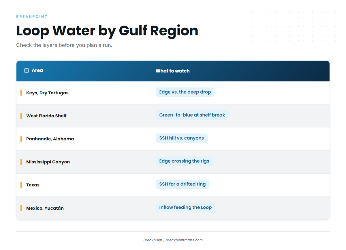
Distances change with every extension and every eddy, so check the layers before you plan a run.
| Area | What Loop or eddy water does there | What to watch on the layers |
|---|---|---|
| Florida Keys and Dry Tortugas | The current turns into the Florida Straits. The blue edge sits relatively close to the reef line | Edge position against the deep drop |
| West Florida Shelf and Middle Grounds | The Loop presses on the shelf edge. Intrusions change temperature and bait | Green-to-blue transitions along the shelf break |
| Panhandle and Alabama | Blue water is in reach only when the Loop extends far north or an eddy drifts near | SSH hill position and the SST edge against the canyons |
| Mississippi Canyon and Louisiana rigs | Loop or eddy water over canyon and platform structure | Whether the edge crosses the structure, and current strength for drifting |
| Texas | Eddies arrive late, older and weaker | SSH for the ring. Treat its SST edge as softer |
| Mexico and the Yucatán | The inflow side that feeds the whole system | Inflow position |
Florida Keys and Dry Tortugas
The current turns into the Florida Straits here, and blue water and its edge sit relatively close to the reef line. Watch where the edge sits against the deep drop on Chart Contours.
West Florida Shelf and Middle Grounds
The Loop presses against the shelf edge and escarpment. Intrusions and upwelling along the edge change water temperature and where bait sits. Watch for green-to-blue transitions along the shelf break. Oceanographers also study the Loop’s influence on red tide in this region.
Panhandle and Alabama
Out of Destin, Pensacola and Orange Beach, blue water comes within reach only when the Loop extends far north or an eddy drifts near. Watch the SSH hill position and the SST edge against the canyons and the deep contours.
Mississippi Canyon and Louisiana Rigs
When Loop water or an eddy edge reaches the canyon and the deepwater platforms, the rigs sit in blue water with structure underneath, which is the setup anglers wait for. Watch whether the edge crosses the structure and how hard the current runs for drifting.
Texas
Eddies arrive late in their drift, older and weaker. Out of Port Aransas, a drifted warm-core ring can bring blue water toward the rigs and banks. Watch SSH for the ring, and treat its SST edge as softer than a fresh Loop edge.
Mexico and the Yucatán
This is the inflow side. Water through the Yucatán Channel feeds the whole system, and the position of the inflow influences whether the Loop extends or retracts.
How to Track the Loop Current in the Gulf of Mexico With Public Data
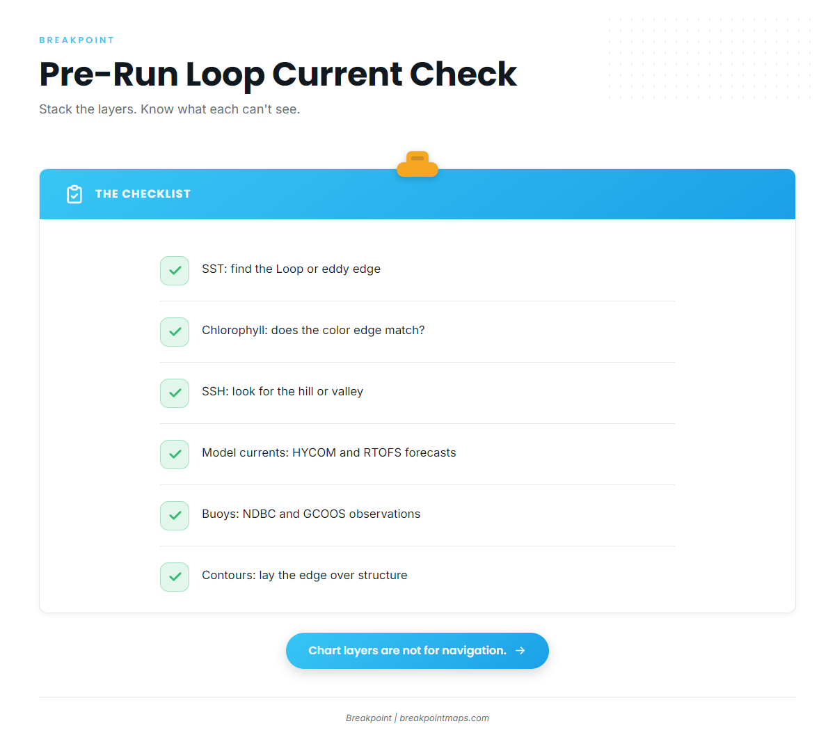
No single layer tells the whole story, so stack them and know what each one cannot see. Work through this checklist the night before a run:
- SST. Open a recent SST pass from NOAA CoastWatch and find the Loop or eddy edge. Compare single passes against multi-day composites. For the method, see how to read a temperature break on an SST map.
- Chlorophyll. Confirm that the blue-to-green edge lines up with the temperature edge.
- Sea surface height. Check altimetry from Copernicus Marine or NOAA sources for the hill (warm-core) or valley (cold-core), especially when cloud blanks steps 1 and 2.
- Model currents. Check HYCOM and RTOFS for speed and direction. Treat them as forecasts that show the likely flow, not observations.
- Buoys and observations. Check NDBC buoys and GCOOS products for observed water temperature, wind and waves near your route.
- Compare against the bottom. Lay the edge over depth contours. An edge crossing structure, such as a canyon, a shelf break or a rig field, is where to start.
Breakpoint stacks OBS SST, Chlorophyll and Chart Contours on one map, so you can compare the edge to the bottom in one view.
Chart layers are not for navigation.
Know what the data cannot see:
- Cloud blocks SST and chlorophyll.
- Composites blend several days and lag a moving edge.
- Altimetry is coarse and has no sharp edge.
- HYCOM and RTOFS are model forecasts.
- Eddies detach and reattach.
- Little is known about the current below the surface.
When the layers disagree, trust the most recent observation and go look.
The Loop Current and Hurricanes
Loop Current and eddy heat, meaning deep ocean heat content, can fuel storm intensification, and the National Hurricane Center issues the official forecasts.
FAQ
What is the Loop Current?
It is a current of warm Caribbean water that enters the Gulf through the Yucatán Channel, makes a clockwise loop and exits through the Florida Straits. From there it becomes the Florida Current and then the Gulf Stream. Its northward reach changes from one period to the next.
What is a Loop Current eddy?
It is an anticyclonic, clockwise-spinning warm-core ring that pinches off the Loop. It shows as a sea surface height hill and as warm, blue water. It drifts west, weakens over time and can sometimes reattach to the main current.
Is it the same as the Gulf Stream?
It is part of the same system. The Loop leaves the Gulf through the Florida Straits as the Florida Current, which becomes the Gulf Stream along the Atlantic coast. The names change along the path, but the flow is continuous.
Why is it called Gulf of America on federal maps?
Federal agencies, including NOAA and the National Hurricane Center, use the name Gulf of America. Data portals may show either label, so search both names. We use Gulf of Mexico.
How can I see where the Loop Current is?
Check SST, chlorophyll, sea surface height, model currents and buoys, then lay the edge over depth contours. Cloud blocks SST and chlorophyll, and model currents are forecasts, so cross-check. Chart layers are not for navigation.
Does the Loop Current affect hurricanes?
Yes. Its deep heat can fuel intensification. The National Hurricane Center has the official forecasts.
Conclusion
Follow the shape of the current over several days instead of a single day’s map. Read the edge on SST and color, and confirm it with sea surface height when cloud blanks the rest. Treat model currents as forecasts, then put the edge over structure and pick where to start.
Run the layer check the night before and again in the morning. To see the stack in one view, check the edge against OBS SST, Chlorophyll and Chart Contours in Breakpoint and decide where to start looking. Chart layers are not for navigation.
The layers will not put fish on the line, but they do improve the decision about where to look.