




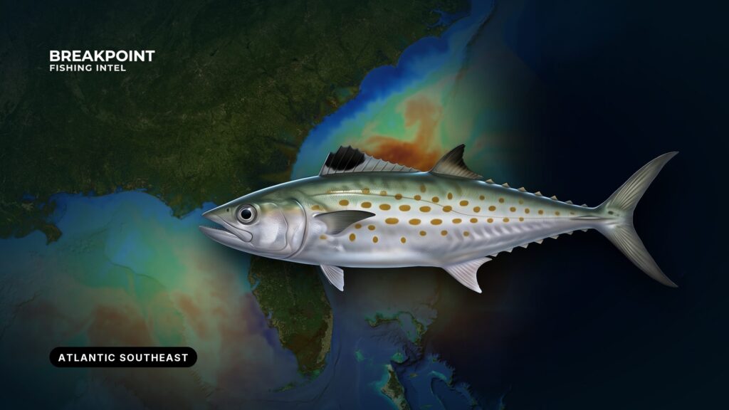
Spanish mackerel follow warm water up and down this coast, and the 68°F line tells you when they arrive nearshore. Spanish mackerel fishing in the Atlantic Southeast runs from North Carolina through South Carolina and Georgia to Florida’s east coast, and the fish are reachable from piers, beaches, inlets and small boats. This guide covers where and when to look, the water and structure that hold fish, how anglers work them, and the rules that change at 3 nautical miles. We can’t promise fish, but we can help you decide where to fish and which rules apply to the water you are in. For the wider picture, see our guide to fishing the Atlantic Southeast.
Spanish mackerel at a glance
Identify the fish before you apply the rules. Spanish mackerel have gold or yellow spots on the sides and a black front on the first dorsal fin. They run smaller than king mackerel, which show a gray dorsal fin and no spots as adults. Off Florida’s east coast, cero mackerel add yellow-bronze streaks along the lateral line. The Spanish mackerel species guide covers identification and biology in full.
Two facts matter for fishing:
- Prey: NOAA lists herring, menhaden, sardines, mullet, needlefish and anchovy as the main prey, with shrimp, crabs and squid to a lesser degree.
- Stock: The Atlantic stock is not overfished and is not undergoing overfishing, according to the Atlantic stock status summary from the SEDAR 78 assessment. Recreational anglers take roughly 62% of landings.
Where and when to find Spanish mackerel in the Atlantic Southeast
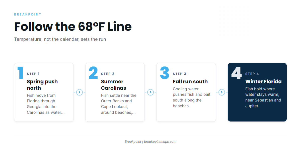
Spanish mackerel prefer water above 68°F, and that temperature largely determines where they are. NOAA notes that mackerel live farther north in summer and farther south in winter, so timing follows the water rather than the calendar.
| Phase | What the water does | Where to look |
|---|---|---|
| Spring push north | Nearshore water warms past 68°F | Fish move up from Florida’s east coast through Georgia and into the Carolinas |
| Summer in the Carolinas | Warm water settles along the beaches | Outer Banks, Cape Lookout, beaches, inlets and nearshore reefs |
| Fall run south | Cooling water pushes fish and bait south | Along the beaches, piers and surf, a strong window for shore anglers |
| Winter on Florida’s east coast | Water stays above the threshold only in the south | Sebastian and Jupiter are reference points along that coast |
Fish that winter in Monroe County waters belong to the Gulf migratory group, covered in our guide to Spanish mackerel in the Gulf of Mexico.
A cold front can push the 68°F edge south or offshore within days, so check current water temperature before you go.
The water and structure that hold them
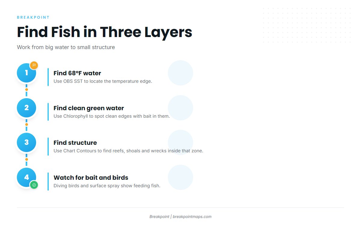
Start by finding 68°F water, then clean green water with bait in it, then structure inside that zone.
Temperature and clean green water
Spanish mackerel hunt by sight and favor clean green water over dirty, churned water. After a hard blow, look farther out for clearer water. Edges where clean water meets off-color water are worth working.
Inlets and tide lines
Moving tide flushes bait out of inlets. Tide lines and current seams collect bait and debris, and the fish work the edges. Points where current pushes bait against the beach also hold fish.
Nearshore reefs, wrecks and shoals
Artificial reefs, wrecks, live bottom and shoals hold bait, and mackerel use reefs, shoals and color changes as travel lanes. On the Outer Banks, fish cruise the sloughs just beyond the outer bar.
Piers, bait pods and birds
Ocean piers act as structure. Signs of feeding fish include:
- Diving terns, pelicans and gulls.
- Glass minnows, anchovies and menhaden spraying at the surface.
- Nervous water and splashes.
Reading it on the map
Three layers in Breakpoint help here:
- OBS SST to find the 68°F water.
- Chlorophyll to find clean green water edges.
- Chart Contours to find nearshore contours, shoals and reef areas.
The data has limits. Cloud blocks satellite passes, so a gap in OBS SST is missing data, not cold water. A color change seen by satellite does not guarantee fish, and chart layers are not for navigation.
How anglers fish for Spanish mackerel here
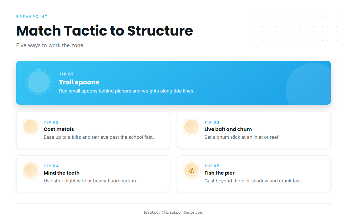
Tactics follow the structure. Boats troll the edges, and shore anglers cast to what they can see.
Trolling spoons behind planers and weights
Trolling small spoons is the standard boat method. Clarkspoons run behind planers and trolling weights to reach different depths. On a small center console or bay boat, keep the spread simple and stagger distances and depths so lines do not tangle.
Troll along tide lines, beach edges, inlet mouths and the edges of nearshore reefs. Speed matters, because these fish hit fast-moving baits. King mackerel and cobia share these trolling grounds, so see our guides to other coastal and offshore gamefish.
Casting metals at breaking fish
Ease up to the edge of a surface blitz rather than running through it. Cast metal spoons or jigs past the school and retrieve them fast.
Live bait and chum
When fish refuse artificials, live or frozen natural baits work. A chum slick at an inlet or reef holds fish near the boat. Catch bait with a sabiki or cast net, and glass minnows are a good match when they are the bait in the water.
Leaders and bite-offs
The teeth cut line. Choose either a short light wire leader or heavy fluorocarbon. Wire costs bites in clear water, and fluorocarbon costs some lures. Avoid shiny swivels and hardware that draw strikes at the knot.
From the pier, beach and jetty
Shore anglers have a short list of methods that work:
- Throw the right lure. Use Gotcha plugs from piers and casting spoons from the beach, cranked back as fast as the reel turns.
- Cast past the shadow. Fish cruise beyond the pier shadow. Quarter your casts in a crosswind.
- Read the scene. Watch birds and bait, and watch the other anglers on the pier.
- Pick the tide. Fish jetties and inlet rocks on moving tide.
On a licensed Florida pier you are covered for the license. See Licenses below.
Before the run, check where the 68°F edge sits on OBS SST. Temperature, clean water with bait, then structure: that order decides most days. Where you are on the water also determines which rules apply, so the next section covers them.
Guides to Spanish mackerel fishing from specific ports: Boynton Beach, Darien, Carolina Beach, Edisto Beach, Fernandina Beach, Golden Isles, Hatteras Village and Folly Beach.
Frequently Asked Questions
What water temperature brings Spanish mackerel nearshore?
Above 68°F, according to the SAFMC. The fish follow that edge north in spring and south in fall. A cold front can move the edge in days, so check the water temperature rather than relying on the calendar.
Do I need a wire leader?
Not always. A short light wire leader stops bite-offs. Heavy fluorocarbon draws more bites in clear water but loses some lures. Pick one based on water clarity and how much you mind losing lures.
How do I tell a Spanish mackerel from a king mackerel?
Spanish have gold spots and a black front dorsal fin. Kings have a gray dorsal and no spots as adults. The two species carry different bag and size limits, so identify the fish first. The species guide has the full comparison.
What is fork length?
Fork length runs from the snout tip to the fork of the tail. The minimum is 12 inches in Florida state waters and in federal Atlantic waters, per FWC and the SAFMC.
Do I need a license to fish a Florida pier?
Not on a pier that holds a valid pier license, according to FWC. Otherwise you need a saltwater license, unless you are under 16 or covered by another exemption.
Which rules apply past 3 miles?
Federal Atlantic migratory group rules from the SAFMC and NOAA Fisheries: 12 inches fork length, 15 per person, head and fins intact. Florida also requires a license to land the fish in Florida.
How should I keep the catch?
In Florida waters, land fish whole. Gutting and gill removal are allowed, per FWC. In federal waters, keep head and fins intact. Bleed and ice the fish quickly to protect the meat.
Can I keep a fish cut off by a shark?
Yes, according to the SAFMC, if it is within the bag limit and meets the minimum size.