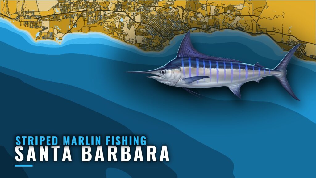
Striped marlin fishing out of Santa Barbara depends on timing, the Channel Islands, and a short list of named structure. If you run your own boat from Santa Barbara, this page covers when the fish arrive, which direction to head, what is on the chart, and how boats work them.
When striped marlin are here
Striped marlin show up in late summer and stay into fall, so that is the window to plan around.
Late summer into fall
The season opens late in summer and runs into fall. Treat the edges of that stretch as soft.
A regional window
The timing follows the Pacific Southwest pattern (see also the Pacific Southwest region guide) and is not a Santa Barbara-specific record. Fish reach this end of the chain on their own schedule.
| Season | What to expect |
|---|---|
| Late summer | Window opens across the region |
| Fall | Fish work up the island chain |
Where boats run
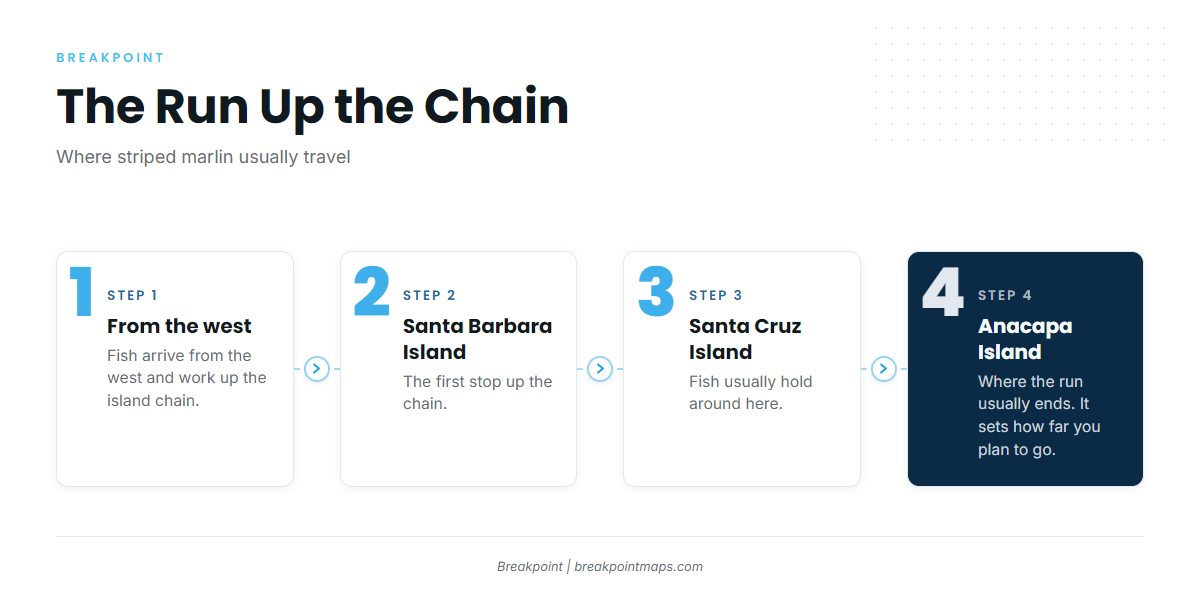
Striped marlin arrive from the west and work up the Channel Islands in chain order. The main decision is how far up that chain to commit.
Up the chain from the west
Marlin come in from the west and move up the island chain to Santa Barbara Island. From there the run continues toward the northern islands.
Santa Cruz and Anacapa
Fish usually hold around Santa Cruz and Anacapa Islands, and these two islands set how far you plan to go. For how fish move through the region more broadly, see the full migration picture.
- Santa Barbara Island: the first stop as fish move up the chain
- Santa Cruz Island: a usual holding area
- Anacapa Island: a usual holding area
Grounds and structure on the chart
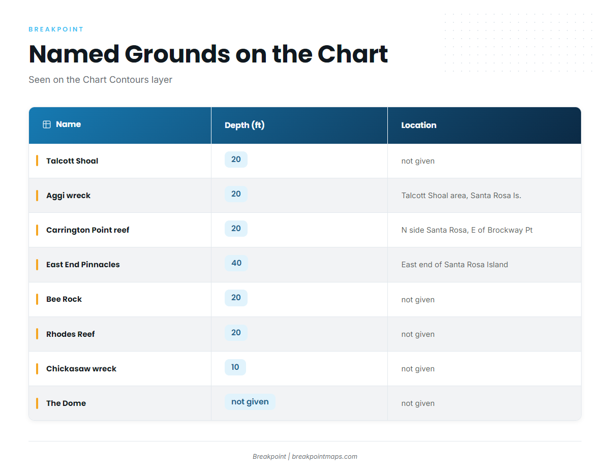
The named grounds below appear on the Chart Contours layer. Chart layers are not for navigation.
| Name | Depth (ft) | Location |
|---|---|---|
| Talcott Shoal | 20 | not given |
| Aggi wreck | 20 | In the Talcott Shoal area off Santa Rosa Island |
| Carrington Point reef | 20 | North side of Santa Rosa Island, east of Brockway Point |
| East End Pinnacles | 40 | East end of Santa Rosa Island |
| Bee Rock | 20 | not given |
| Rhodes Reef | 20 | not given |
| Chickasaw wreck | 10 | not given |
| The Dome | not given | not given |
Santa Rosa Island: Talcott Shoal, Aggi wreck, Carrington Point reef, East End Pinnacles
The Santa Rosa structure sits in a tight group. The Aggi wreck lies in the Talcott Shoal area off Santa Rosa Island at 20 ft. Carrington Point reef is on the north side of the island, east of Brockway Point, also at 20 ft. East End Pinnacles rise to 40 ft at the east end.
Other named spots: Bee Rock, Rhodes Reef, Chickasaw wreck, The Dome
Bee Rock and Rhodes Reef both show 20 ft, and the Chickasaw wreck shows 10 ft. The Dome carries a name only, and no published bearing comes with these spots.
How it’s fished here
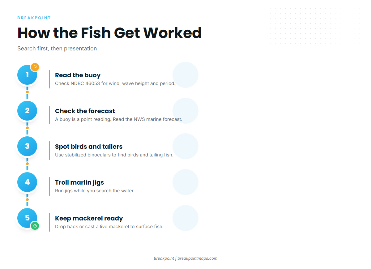
Boats search first and present second. The search is visual, and the presentation depends on what the fish are doing when you reach them. For more on gear and method, see the tackle and technique detail.
Spotting birds and tailers
Boats use stabilized binoculars to spot birds and tailing fish. Birds and surface activity are what put you on a fish.
Jigs on the troll, mackerel ready
Boats troll marlin jigs with a live mackerel ready. When a fish shows on the surface, the mackerel is dropped back or cast to it.
Who runs for them
This run suits an owner-operator on their own boat, deciding distance, timing, and conditions without a skipper to lean on.
Reading 46053 before the run
The nearest buoy is NOAA NDBC station 46053, East Santa Barbara. It reports wind, wave height, and period. A buoy reading is a point observation and a forecast is only a forecast, so check the NWS coastal marine forecast alongside it before you commit.
FAQ: striped marlin fishing out of Santa Barbara
When is the striped marlin season off Santa Barbara?
Late summer into fall. That is the regional pattern and not a Santa Barbara-specific record, so treat the edges of the window as soft.
Which islands usually hold striped marlin?
Fish move up the chain from the west to Santa Barbara Island, then usually hold around Santa Cruz and Anacapa Islands. Those two set how far you plan to run.
What bait is ready on the troll?
A live mackerel is kept ready while trolling marlin jigs. It is dropped back or cast to fish showing on the surface.
What buoy covers the channel?
NOAA NDBC station 46053, East Santa Barbara. It reports wind, wave height, and period. Pair it with the official marine forecast.
Where do I read about other billfish?
Our billfish guides cover the other species in detail.