




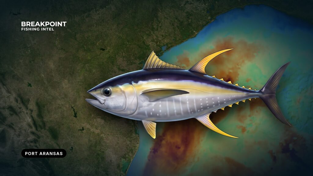
Yellowfin off Port Aransas hold around deepwater structure and blue-water edges past the Texas shelf, and the route to them starts at the Aransas Pass jetties. This guide is for anglers running their own boat out of the Gulf of America (Gulf of Mexico). It draws on official sources: the Coast Pilot, NWS, TPWD and NOAA.
For yellowfin biology and tackle, see yellowfin tuna biology and tackle. This page covers the water between the jetties and the shelf edge. It does not promise fish; it helps you decide where to look on a given day: which structure, which edge, and whether an eddy is within range. The sections cover the jetties, the shelf structure, timing drivers, reading the day, and the rules.
Leaving Port A Through the Aransas Pass Jetties
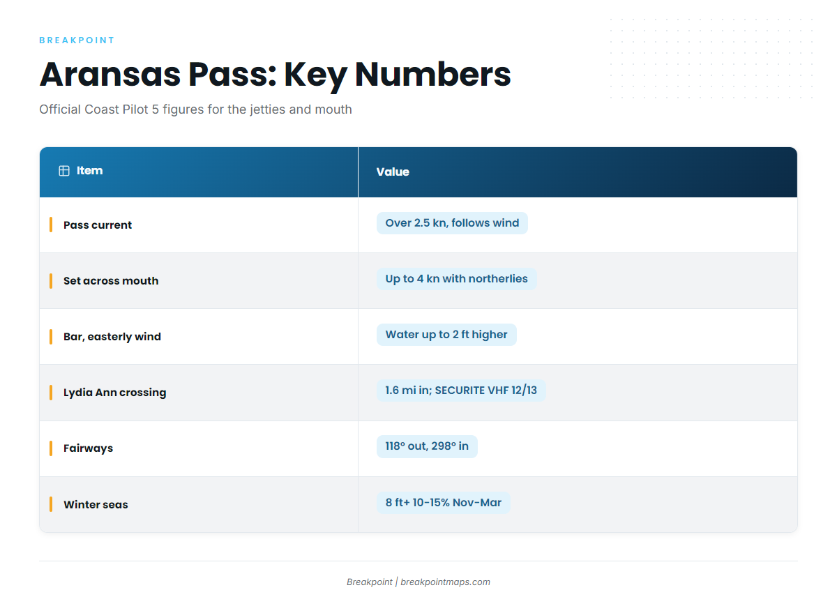
Aransas Pass runs southeast to the Gulf between the Mustang Island and San Jose Island jetties, and its current follows the wind. Plan around these figures from Coast Pilot 5, Chapter 11:
- Currents in the pass at times exceed 2.5 knots and follow the wind closely.
- Outside the jetties, a southbound set reinforced by northerlies has been reported up to 4 knots across the mouth.
- Easterly winds disturb the bar and lift the water inside the pass by as much as 2 feet.
- A sudden wind shift from south to north produces especially disturbed water over the bar for a short time.
Leaving the harbor, you reach the Lydia Ann Channel crossing about 1.6 miles inside the entrance jetties. Deep-draft ships use this channel, and collisions, groundings and close-quarters passing have been reported there. The Coast Guard asks for a SECURITE call on VHF-FM channels 12 and 13 before crossing. Outside, the outbound fairway runs 118° and the inbound fairway runs 298°. These lanes are not a traffic separation scheme.
A front changes both the bar and the set at the mouth, since a north wind arriving behind a south wind disturbs the water in both places. Plan the return through the pass as carefully as the exit.
For the go or no-go decision, read the NWS Corpus Christi marine forecast and the NDBC station PTAT2 observations. Take wind, wave height and period from those official products and decide from the numbers.
Departure and Conditions Table
| Item | Value | Source |
|---|---|---|
| Pass current | At times exceeds 2.5 kn, follows the wind | Coast Pilot 5 Ch. 11 |
| Set across the mouth | Southbound set with northerlies reported up to 4 kn | Coast Pilot 5 Ch. 11 |
| Bar | Easterly winds disturb it and raise water up to 2 ft. A south-to-north shift briefly disturbs it further | Coast Pilot 5 Ch. 11 |
| Lydia Ann crossing | About 1.6 mi inside the jetties. SECURITE call on VHF 12 and 13 | Coast Pilot 5 Ch. 11 |
| Fairways | 298° inbound, 118° outbound. Not a traffic separation scheme | Coast Pilot 5 Ch. 11 |
| Winter seas | 8 ft or more 10-15% of the time, November through March | Coast Pilot 5 Ch. 11 |
| Fog | Likely near the pass late November through February | Coast Pilot 5 Ch. 11 |
| Forecast and buoy | NWS Corpus Christi marine page; NDBC PTAT2 | NWS / NDBC |
Launch, Fuel and Range
Public launch and fuel options around the pass:
- Dennis Dreyer Municipal Harbor ramps at Roberts Point Park.
- Conn Brown Harbor Point Park ramp in Aransas Pass.
- Deep Sea Headquarters and Fisherman’s Wharf, both with fuel listed.
Plan the round trip from your boat’s own burn figures, with a reserve, and allow for the extra burn of a head sea on the way home.
The Texas Shelf and Its Named Public Structure
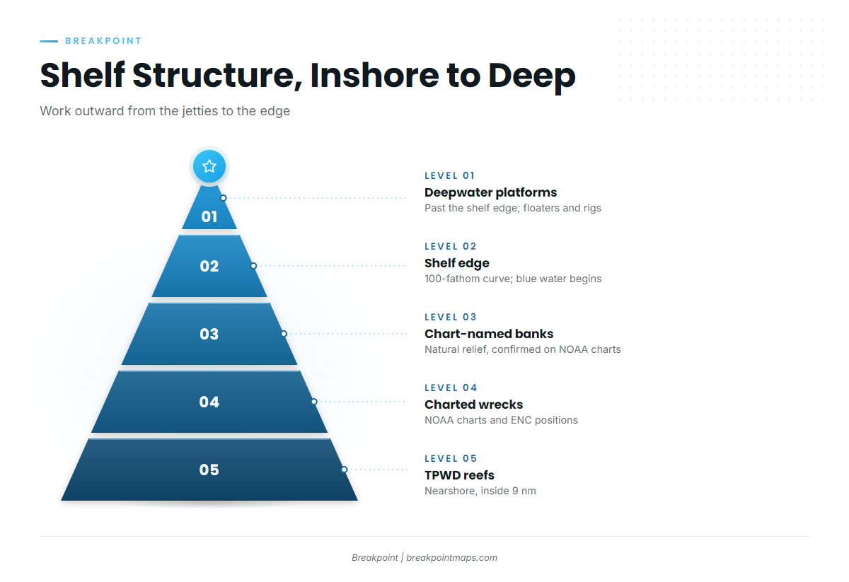
Public structure off Port Aransas steps outward in stages: nearshore reefs inside 9 nautical miles, then wrecks, reefs and platforms on the Texas shelf, then deepwater platforms past the shelf edge. TPWD treats water beyond 9 nautical miles as federal, which matters for the rules below.
Work outward in this order:
- TPWD Artificial Reef Program sites, including Rigs-to-Reefs.
- NOAA-charted wrecks.
- Chart-named banks.
- The 100-fathom curve and shelf edge.
- Deepwater platforms and floaters beyond the edge.
Yellowfin are oceanic fish that associate with floating objects and structure, as the NOAA Atlantic yellowfin profile describes. The nearshore reefs hold bait and mark the run, while the shelf edge and deepwater structure are where yellowfin typically hold.
Chunking and night fishing at deepwater structure, and drifting baits down-current from platforms and floaters, are widely used on this coast. Platforms are installed, moved and removed, so check the current chart and structure lists before the run.
Parts of the shelf were surveyed long ago, so charted soundings and wreck positions can be old. Treat chart positions as starting points. For species and ports along the rest of the coast, see the wider Gulf offshore picture.
Named Structure Table
| Name | Type | Where to get coordinates |
|---|---|---|
| Port Aransas Reef | Artificial reef | TPWD Artificial Reef Program |
| Mustang Island Liberty Ship Reef | Artificial reef (ship) | TPWD Artificial Reef Program |
| 828 Reef | Artificial reef | TPWD Artificial Reef Program |
| A-16 Reef | Artificial reef | TPWD Artificial Reef Program |
| A-85 Reef | Artificial reef | TPWD Artificial Reef Program |
| NOAA-charted wrecks | Wreck | NOAA charts and ENC |
| Chart-named banks | Natural relief | NOAA charts and ENC |
| Deepwater platforms | Platform / floater | Current NOAA chart and structure lists |
Before the run, plot the TPWD reef sites and charted wrecks on Chart Contours so the shelf edge, the reefs and the deep structure sit on one screen.
When Yellowfin Show Up off Port Aransas
Yellowfin off Port Aransas follow warm blue water and bait, so their arrival tracks water temperature and Loop Current eddies more closely than the calendar. Five drivers matter:
- Water temperature. The species ranges roughly 65 to 88°F, according to the Florida Museum.
- Bait. Fish stack on edges and structure where bait concentrates.
- Loop Current eddies. Eddies break off and drift west, sometimes pushing warm, clear water toward the Texas shelf.
- Gulf spawning. Spawning in the Gulf runs May to August, per NOAA and ICCAT.
- Winter deepwater structure fishing. Fish are worked at deepwater platforms, often at night. Weigh that against the Coast Pilot winter seas and fog numbers above.
Eddy shedding and Gulf-wide movement are covered in how yellowfin move through the Gulf. What matters on a given day is whether warm, clean water and bait sit within your range of structure.
Reading Blue-Water Edges and Loop Current Eddies on the Day
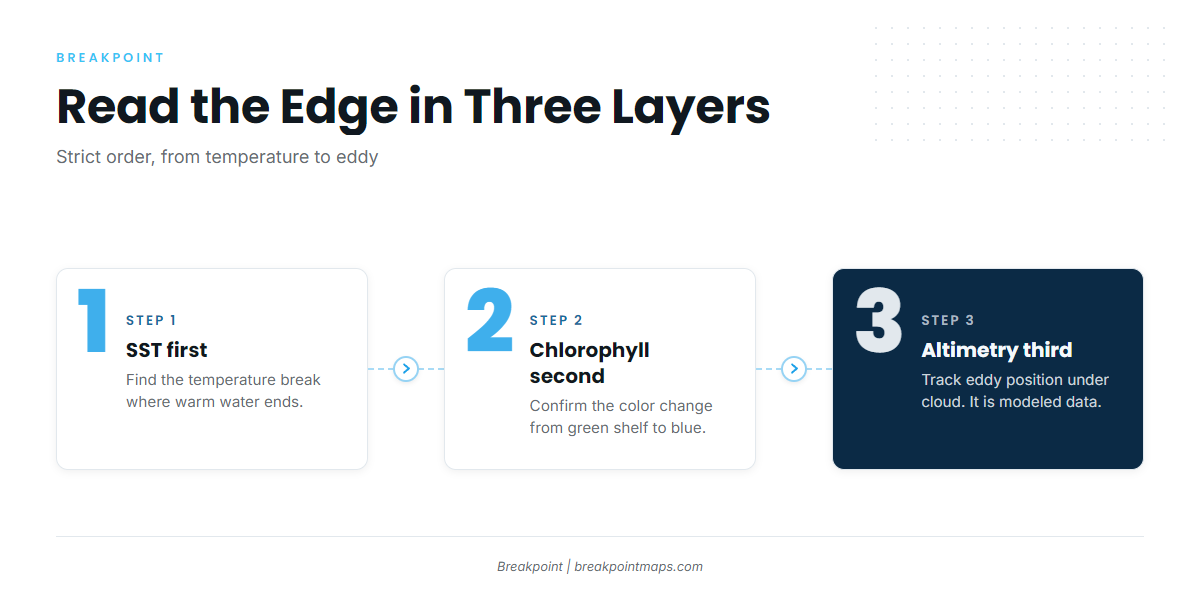
Start with sea surface temperature, confirm with chlorophyll, and use sea surface height when cloud hides both.
- SST first. A temperature break shows where warm water ends.
- Chlorophyll second. Chlorophyll shows color, not temperature. Green shelf water against blue offshore water is the color change.
- Altimetry third. Sea surface height shows eddy position under cloud. It is modeled from satellite tracks and shows the eddy’s overall shape rather than the surface edge you fish.
An eddy edge is where warm, clear Loop water meets green shelf water. Bait stacks there, and sargassum weedlines and rips often mark it.
The data has limits. Cloud blocks SST and chlorophyll passes, and a blank pass is missing data, not cold water. A forecast is only a forecast.
Viewing OBS SST, Chlorophyll and Chart Contours together puts a temperature or color edge against the shelf break and the 100-fathom curve, showing which structure sits nearest the edge. Chart layers are not for navigation.
Week-Before and Morning-Of Checklist
- Watch the OBS SST trend for a break moving toward or away from the shelf edge.
- Check Chlorophyll for a color change lining up with the temperature break.
- Track eddy position on sea surface height when cloud blocks the passes.
- Note which reefs, wrecks and platforms sit nearest the edge on Chart Contours.
- Read the NWS Corpus Christi forecast and PTAT2 for wind direction and shifts before committing to the pass.
- Confirm the fuel plan covers the round trip, a head sea home and a reserve.
Frequently Asked Questions
How far offshore is blue water from Port Aransas?
The distance moves with eddies and the season, so no fixed figure holds. Blue water typically begins around the shelf edge and the 100-fathom curve. Check OBS SST and Chlorophyll for where the edge sits that day.
Do I need an HMS permit for yellowfin off Texas?
Yes. A private boat fishing for tunas needs the HMS Angling permit from NOAA Fisheries. Bag, size and reporting rules are on the HMS site.
Do I need a Texas license if I fish in federal waters?
Yes, to possess the fish in state waters or land it in Texas. You need a license plus a saltwater endorsement. Federal waters begin at 9 nautical miles.
When do yellowfin show up off Port Aransas?
Warm, clean water, bait, eddies reaching the western Gulf, and winter work at deepwater structure drive it. The calendar matters less than those conditions. For general tactics, see yellowfin tuna biology and tackle.
What should I watch the week before a trip?
Watch the SST trend, a matching chlorophyll color change, and eddy position on sea surface height. Watch the NWS Corpus Christi forecast for fronts.
Where can I launch and fuel in Port Aransas?
Launch at the Dennis Dreyer Municipal Harbor ramps in Port Aransas or at Conn Brown Harbor in Aransas Pass. Deep Sea Headquarters and Fisherman’s Wharf have fuel.
What if clouds block the SST image?
A cloud gap is missing data, not cold water. Use the last clear pass and Chlorophyll, and use sea surface height for eddy position. Treat altimetry as modeled.
Is Breakpoint chart data for navigation?
No. Chart layers are for planning, not navigation. Navigate on official NOAA charts and approved electronics.
To plan the run, download Breakpoint from the App Store or Google Play and put the shelf edge, the structure and the day’s water on one map.