Where yellowfin fit off Ventura
Boats leave Ventura Harbor, on the mainland side of the Santa Barbara Channel, for Anacapa, Santa Cruz and Santa Rosa Islands. Yellowfin tuna fishing out of Ventura depends on warm water, and the Ventura port page has the harbor, launch ramp and fuel details you need before you leave the dock.
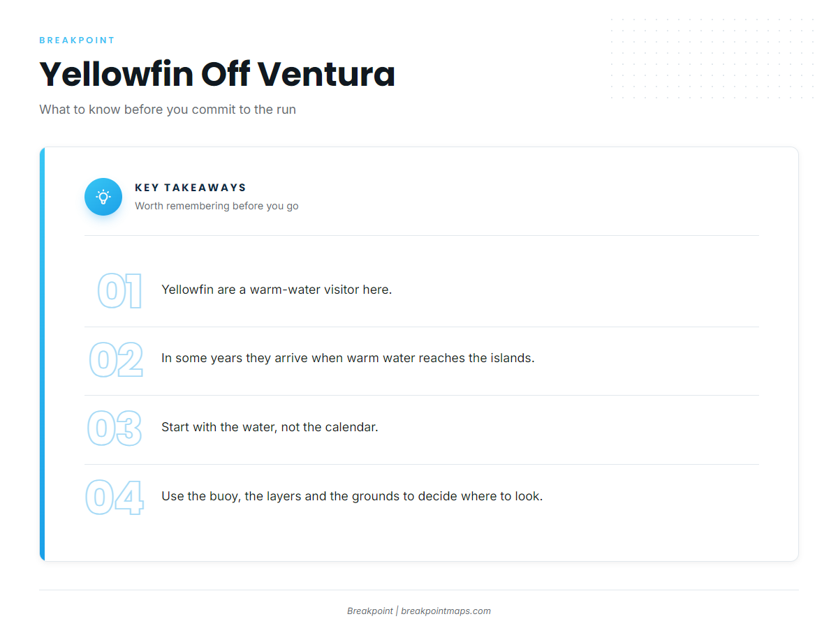
Yellowfin are a warm-water visitor here. In some years they arrive when warm water reaches the islands, so the decision starts with reading the water rather than checking the calendar. This page covers the buoy, the chart layers, the grounds in island order and the closures next to them.
For biology and the temperature picture, see the yellowfin tuna species guide. For the pattern beyond this port, see the Southern California yellowfin guide (see also the Pacific Southwest fishing guide).
- Harbor: Ventura Harbor, Santa Barbara Channel side
- Islands: Anacapa, Santa Cruz, Santa Rosa
- Deciding factor: sea surface temperature reaching the islands, not a date
Reading the water before the run
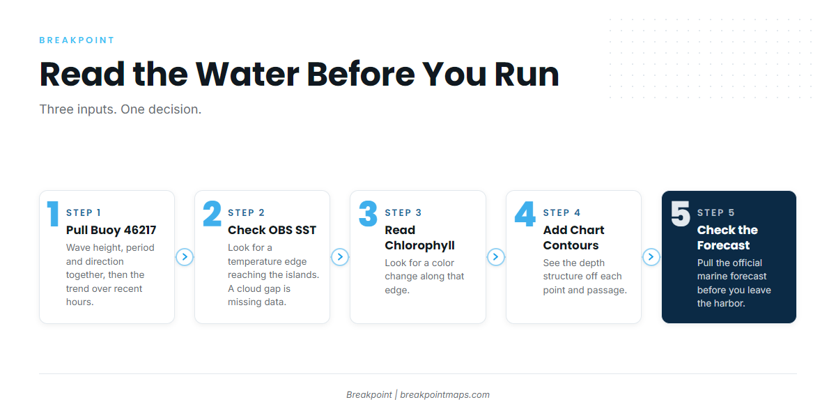
Check the buoy and the chart layers before you decide to leave the dock. Both show what the water is doing at the islands, and neither shows where the fish are.
The Anacapa Passage buoy
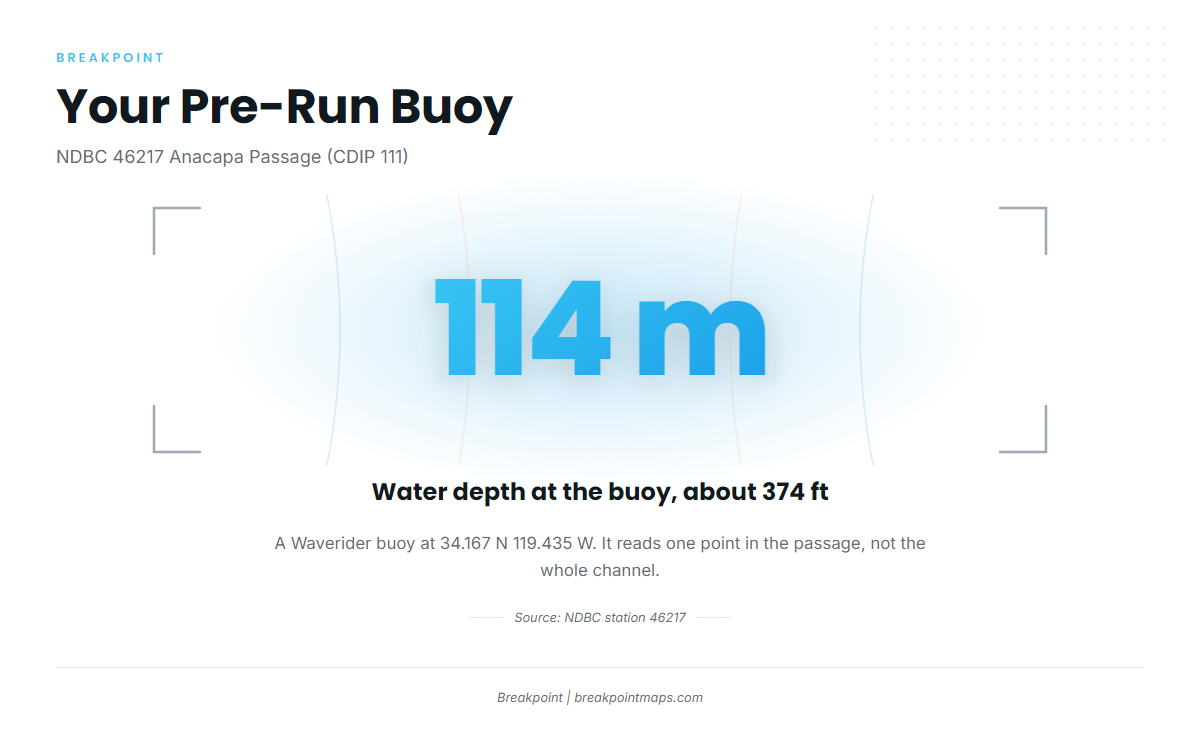
The nearest NOAA buoy is NDBC 46217 Anacapa Passage, CA, also designated CDIP 111. It is a Waverider buoy at 34.167 N 119.435 W, in 114 m of water, about 374 ft. Live readings are on the NDBC station 46217 page.
Read wave height, period and direction together, and compare the latest readings with the trend over the previous hours. The buoy reads one point in Anacapa Passage, not the whole channel or the water off each island, so treat it as one input alongside the official forecast.
Pull 46217 and the official marine forecast before you leave the harbor. Start with the NWS East Santa Barbara Channel forecast, then check these numbers:
- Wind speed and direction
- Wave height
- Wave period and direction
OBS SST, Chlorophyll and Chart Contours
Check OBS SST for a temperature edge reaching the islands, then Chlorophyll for a color change along that edge. The edge matters more than any target number. Chart Contours shows the depth structure off each point and passage you plan to work. Lay the edge over the structure and you have a short list of places to look.
Cloud can block a satellite pass, so a gap on OBS SST is missing data and says nothing about cold water. The chart layers are not for navigation.
| Layer | What you check | What it tells you |
|---|---|---|
| OBS SST | Temperature edges near the islands | Whether warm water is reaching the channel |
| Chlorophyll | Color change along an edge | Where clean water pushes against green |
| Chart Contours | Depth structure off points and passages | Where relief sits under the edge |
Grounds and structure
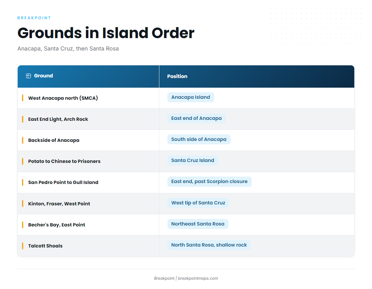
The grounds below run in island order from the harbor: Anacapa, then Santa Cruz, then Santa Rosa. We print no distances, so plot the run on your own chart.
| Ground | Position |
|---|---|
| North side of West Anacapa, Frenchy’s Cove to west end (SMCA) | Anacapa Island |
| East End Light and Arch Rock | East end of Anacapa |
| Backside of Anacapa | South side of Anacapa |
| Potato Harbor to Chinese Harbor to Prisoners | Santa Cruz Island |
| San Pedro Point, Yellowbanks to Gull Island closure | East end of Santa Cruz, past the Scorpion closure |
| Kinton Point, Fraser Point and West Point | West tip of Santa Cruz, next to Santa Rosa |
| Becher’s Bay and East Point | Northeast side of Santa Rosa |
| Talcott Shoals | North side of Santa Rosa, shallow rock fishing |
Anacapa Island
East End Light and Arch Rock mark the east end of the island, and the backside is the south side. The north side of West Anacapa, from Frenchy’s Cove to the west end, is an SMCA. See the Regulations section below.
Santa Cruz Island
Potato Harbor to Chinese Harbor to Prisoners is the first stretch on the island. San Pedro Point, Yellowbanks to the Gull Island closure sits at the east end, past the Scorpion closure. Kinton Point, Fraser Point and West Point make up the west tip, next to Santa Rosa. The Scorpion and Gull Island closures are boundaries on this run, and the Regulations section covers them.
Santa Rosa Island
Becher’s Bay and East Point are on the northeast side. Talcott Shoals is on the north side and is shallow rock fishing. Chart Contours shows the shoal relief, so read it before you set up.
How it is fished here and who fishes it
Working the island edges
Cover water along the island edges, the points and the passages. Start where the temperature edge on OBS SST meets the structure on Chart Contours. Yellowfin tuna fishing out of Ventura comes down to finding where warm water and island structure line up. The Southern California yellowfin guide has the wider methods.
Ventura Sportfishing and the Endeavor
Ventura Sportfishing (Ventura Harbor Sportfishing) is the local landing that lists yellowfin tuna. Owner Tucker McCombs captains the Endeavor. You can find the operation at Ventura Sportfishing at Ventura Harbor. Following the sportboat’s reports is one way to scout before you run your own boat.
- Operator: Ventura Sportfishing (Ventura Harbor Sportfishing)
- Owner and Endeavor captain: Tucker McCombs
- Use for you: a read on the water before your own run
FAQ about yellowfin tuna fishing out of Ventura
Which buoy should I watch before leaving Ventura?
Watch NDBC 46217 Anacapa Passage (CDIP 111), a Waverider buoy at 34.167 N 119.435 W in 114 m of water, about 374 ft. It reads one point in the passage, not the whole channel. Pair it with the official marine forecast before you leave the harbor.
Where is the nearest ground to Ventura Harbor?
Anacapa comes first in island order. Work East End Light and Arch Rock, or the backside on the south side. The north side of West Anacapa is an SMCA. We give no distance, so plot the run on your own chart.
Does a Ventura charter target yellowfin?
Yes. Ventura Sportfishing lists yellowfin tuna, and Tucker McCombs is the owner and captains the Endeavor. Their reports are one way to scout the water before you run your own boat.
Where do I find the Channel Islands closures?
The closures near these grounds are the West Anacapa SMCA, Scorpion and Gull Island. The California Department of Fish and Wildlife sets them. The state regulations page points to the agency’s official rules, so check them before fishing.
Where are the guides for other tuna species and ports?
You can browse tuna fishing guides by species for other tunas and other ports.