




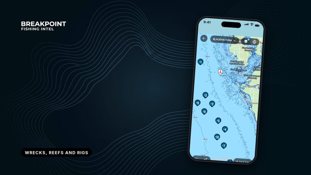
Not for navigation. Breakpoint charts are for trip planning. Navigate with official charts and your vessel’s instruments.
Most offshore bottom is open sand or mud. Fish stack where something hard rises off it: a wreck, an artificial reef or a platform. Wrecks, reefs and rigs as fishing structure each give fish hard substrate, a current break and shelter. Bait collects there and predators follow, though each type does the job a little differently. Each also has an official public source for its position.
This guide covers public, permitted sites only. It contains no secret numbers, just where the official ones live and what they can and cannot tell you. By the end you can name the source for each structure type, load verified positions into your plotter and confirm them on sonar. Telling structure from open bottom on the screen is a companion skill, covered in reading bottom structure.
Why does structure hold fish on open bottom?
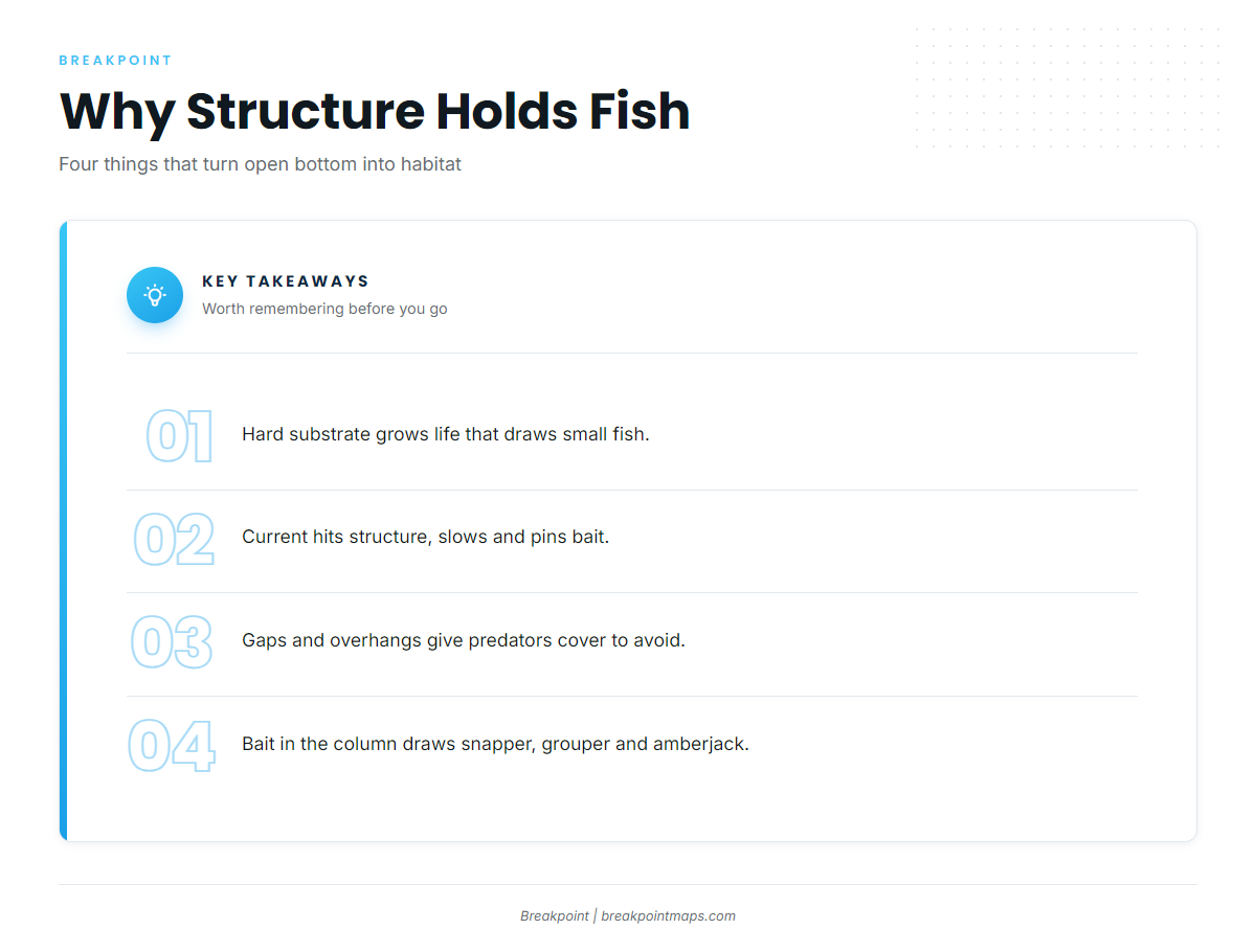
Structure is anything that breaks up flat bottom and gives fish a reason to stay. Four things happen around it, in this order:
- Hard substrate. Hard surfaces grow barnacles, algae and other encrusting life, which draws small fish.
- Current break. Current hitting structure slows, eddies and pins bait on one side.
- Shelter. Gaps and overhangs give cover from predators.
- Bait column. Bait in the water draws red snapper, grouper and greater amberjack, with king mackerel and cobia working above them.
Published research on wrecks as habitat shows that wrecks serve as refuge for commercially important fish.
One term runs through the rest of this page: vertical relief, the height of the structure above the bottom. It is the main reason the three types fish differently.
Wrecks
A wreck is a sunken vessel or debris on the bottom. Some sank by accident and some were sunk on purpose as reefs.
How a wreck fishes depends on its condition and how it lies:
- Relief depends on hull condition and whether the wreck sits upright or on its side.
- Debris fields spread fish around the main hull.
- Bottom species hold tight to the structure, and amberjack hang above high-profile hulls.
The Oriskany Reef is a deliberately sunk vessel managed by Escambia County. It sits 22.5 nm southeast of Pensacola Pass in 212 ft of water.
Wrecks break down, settle and scatter, so a position that fished one way a decade ago may fish differently today. Typical targets are red snapper, greater amberjack, grouper and gray triggerfish.
Artificial reefs
An artificial reef is purpose-built or placed material deployed by a permitted public program. Examples are reef modules, concrete, decommissioned vessels and bridge rubble. The UN Atlas of the Oceans lists wrecks, rigs, pipelines and designed modules among the structures that can serve as artificial reefs.
State artificial reef programs label their sites so you can find them. North Carolina uses AR numbers, and the sites off Topsail Island show how it works:
| Site | Distance from inlet | Depth |
|---|---|---|
| Topsail Reef (AR-360) | 2 nm | 44 ft |
| Tom Boyette Reef (AR-362) | 8 nm | 54 ft |
| AR-366 | 13.1 nm | 66 ft |
Nearshore reefs are often the reachable starting point. St. Pete Beach Reef sits 5.1 nm out in 30 ft. They also see the most traffic, so expect company and pressured fish.
Oil and gas platforms
Platforms are production structures on the Gulf of America (Gulf of Mexico) shelf. Some are standing, some have been removed, and some were toppled or cut down in place as reefs. The Rigs to Reefs program lets decommissioned platforms become permanent reef rather than being hauled away.
How a platform fishes depends on how it stands:
- Standing platform. Hard substrate runs from the bottom to the surface, so it fishes the full water column. King mackerel and cobia work the upper water, with snapper and amberjack below.
- Toppled or reefed platform. It fishes the bottom only.
Removals change the grounds, so check BSEE status before you count on a rig. For rules near active structures, go to BSEE and the Coast Guard.
How do wrecks, reefs and rigs compare?
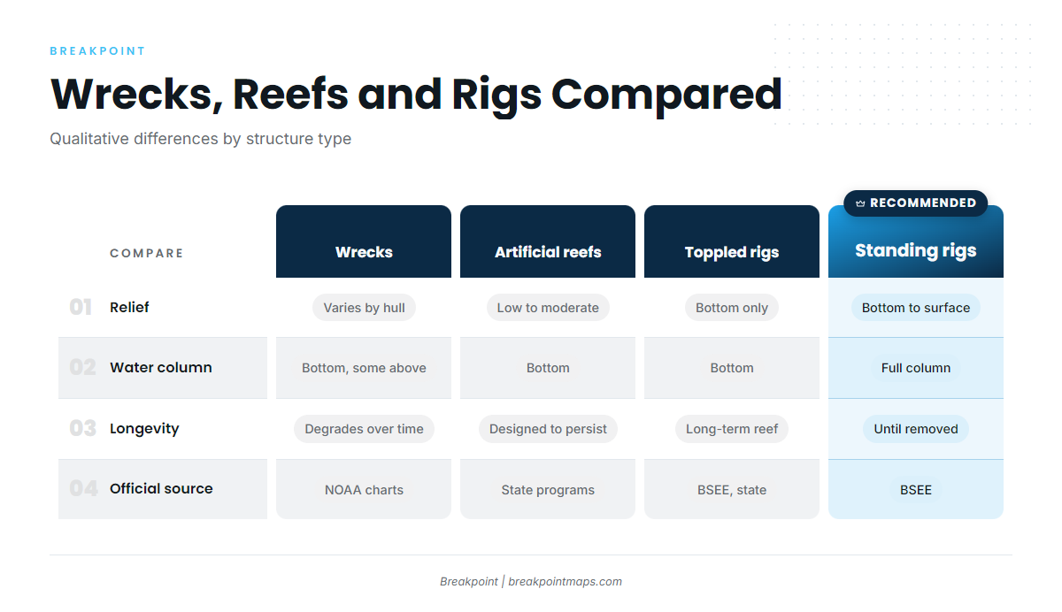
Wrecks, reefs and rigs as fishing structure differ most in relief and in how much of the water column they use.
| Wrecks | Artificial reefs | Standing platforms | Toppled/reefed platforms | |
|---|---|---|---|---|
| Relief | Varies with hull | Low to moderate, material-dependent | Bottom to surface | Bottom only |
| Water column used | Bottom, some above | Bottom | Full column | Bottom |
| Typical species | red snapper, greater amberjack, grouper | red snapper, gray triggerfish, vermilion snapper | king mackerel, cobia, red snapper, greater amberjack | red snapper, greater amberjack |
| How long it lasts | Degrades over time | Designed to persist | Until removed | Long-term as reef |
| Position stability | Can shift or scatter | Surveyed at deployment | Fixed while standing | Fixed |
| Official source | NOAA charts | State programs | BSEE | BSEE / state programs |
| Fishing pressure | Varies | Often high nearshore | Varies | Varies |
Swipe the table sideways to see every column.
Man-made structure gives you something natural bottom often does not: a known position and a target you can plan around. Natural relief such as ledges, humps and drop-offs holds fish for the same reasons, but you find it by reading the bottom rather than looking up a published number.
Where do official positions come from?
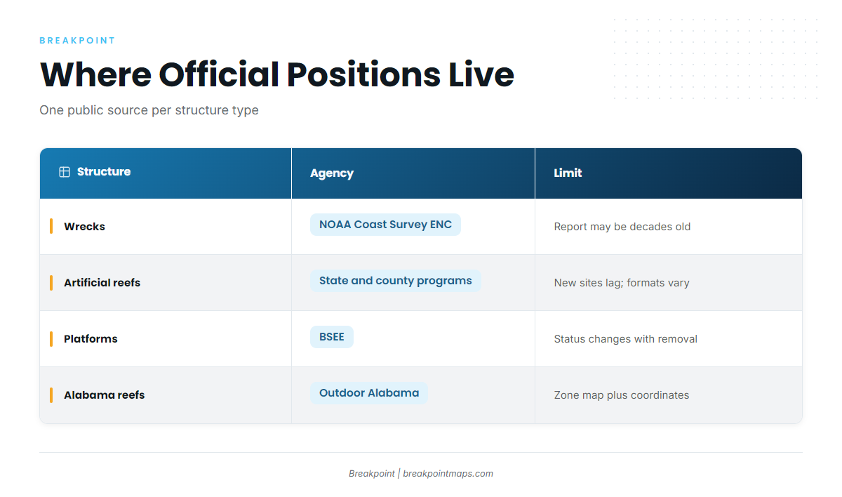
Each structure type has one agency to start with.
| Structure | Agency | What it shows | Limits |
|---|---|---|---|
| Wrecks and obstructions | NOAA Office of Coast Survey (ENC) | Charted position, symbol, sounding where known | May come from a decades-old report; position can be approximate |
| Artificial reefs | State programs and counties | Permitted site coordinates, depth, material | New deployments lag publication; formats vary |
| Platforms | BSEE | Platform locations and status | Status changes with decommissioning |
NOAA charted wrecks and obstructions
NOAA’s electronic navigational charts (ENCs) mark wrecks and obstructions with symbols. The symbols separate dangerous wrecks from non-dangerous ones, wrecks with a visible hull, and general obstructions. Read the symbol and any sounding beside it together, the same way you read depth areas in ENC soundings and depth areas.
A charted wreck can be a hazard as well as structure. The NOAA Coast Pilot 5 chapter for the Pensacola approach notes the wreck of the old battleship Massachusetts on the south end of Caucus Shoal, marked by a lighted bell buoy.
A charted wreck may come from a decades-old report. Its position can be approximate, and the wreck itself may have moved or broken up since.
Chart layers and fishing maps are not for navigation. Use official NOAA charts.
State artificial reef programs
State and county programs publish reef coordinates, and they are the primary source for permitted sites:
- The Outdoor Alabama artificial reef program publishes public coordinates and a zone map. The reef zone runs 13 to 25 miles south of Dauphin Island.
- The North Carolina DMF reef guide lists AR-numbered sites with depths.
- The Escambia County Oriskany Reef page covers the county-managed vessel off Pensacola.
- The Pinellas County artificial reef guide gives positions and bearings from the Pass-a-Grille entrance marker.
Texas Parks and Wildlife and Florida FWC also run artificial reef programs and publish site information on their own pages. Formats vary by program, and coordinates come in degrees-minutes or decimal degrees, so convert carefully before you enter them.
BSEE platform data in the Gulf
BSEE, the Bureau of Safety and Environmental Enforcement, is the federal source for platform and structure data in the Gulf, and it also publishes Rigs to Reefs information. The data covers where platforms are and what their status is.
Status changes. A rig that was on your list last year may be gone, so cross-check status before you plan a run.
Where does Breakpoint fit in?
Breakpoint’s Chart Contours layer shows the depth lines around a charted or published position, so you can see the relief before you run. Chart layers are not for navigation.
From numbers to fish: how do you verify a position on the water?
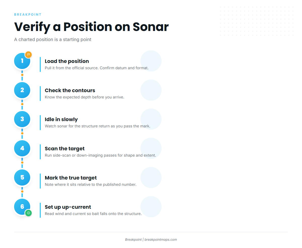
Published coordinates carry a datum, WGS84 or NAD83, and older reports and survey age can also offset a position. Match your plotter’s datum and coordinate notation to the source before you enter anything. Then check the bathymetry contours around the position so you know what depth and shape to expect on arrival.
- Load the position. Enter the published number from the official source and confirm its datum and format.
- Check the contours. Look at the depth lines around the mark so you know the expected depth.
- Idle in slowly. Watch sonar for the structure’s return as you pass the mark.
- Scan the target. Run side-scan or down-imaging passes to see its shape and extent.
- Mark what you find. Save the actual target and note where it sits relative to the published number.
- Read wind and current. Set up so your bait falls onto the structure from the up-current side.
A charted position is a starting point, and the sonar return tells you what is actually there.
What rules apply on reef sites?
Some reef sites carry gear limits, including Special Management Zones. Rules differ by agency and by site. Check with NOAA Fisheries and the state agency that runs the water you fish: Outdoor Alabama, North Carolina DMF, Florida FWC or Texas Parks and Wildlife. Use the state program pages above, and check the rules before you fish.
This page covers public, permitted sites only.
Frequently Asked Questions
What is an artificial reef?
It is material deployed on purpose by a permitted public program to create fish habitat. Reef modules, concrete and decommissioned vessels are common examples. State and county programs publish the coordinates, so start with the program that manages the water you fish.
Are oil rigs good for fishing?
Yes, as structure. Standing platforms hold fish through the whole water column, and toppled or reefed rigs hold them on the bottom. Platforms are removed over time, so check BSEE status before you plan a run. We never promise fish, only a better decision about where to look.
Where do I get official reef coordinates?
Get them from state and county artificial reef programs, such as Outdoor Alabama, North Carolina DMF and Pinellas County. Confirm the datum and coordinate format before you load anything into your plotter, since formats vary by program.
What does a wreck symbol on a NOAA chart mean?
It marks a charted wreck, and the symbol separates dangerous wrecks, non-dangerous wrecks and wrecks with a visible hull. The source report can be decades old, so the position may be approximate. Chart layers are not for navigation. Use official NOAA charts.
Why is a charted wreck not where my sonar shows it?
Common causes are a datum mismatch, an old survey report, or a wreck that has shifted or broken up. Verify on sonar and mark the true target. Treat the published number as a place to start looking.
What does not for navigation mean?
Fishing map layers are planning tools. They do not replace official NOAA charts for getting a boat from one place to another. Keep official charts aboard and use them.
Conclusion
Structure stacks the food chain, and relief decides which part of the water column fishes. Each type has one official source: NOAA for wrecks, state programs for reefs and BSEE for rigs. Knowing wrecks, reefs and rigs at that level lets you work from the public record instead of rumor.
The routine is short. Pull the official position, check the contours around it, and verify the target on sonar before you set up.
To plan the night before with the depth lines in front of you, download Breakpoint and open Chart Contours around the sites you plan to fish. It won’t promise fish, but it will help you decide where to look, and your sonar settles the rest. Chart layers are not for navigation.