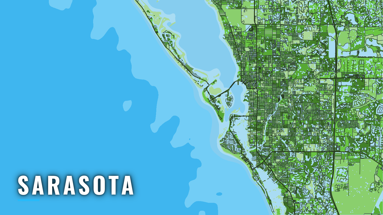

About Sarasota
Offshore fishing out of Sarasota starts on the east shore of Sarasota Bay, behind Siesta Key, Lido Key and Longboat Key. Boats reach the Gulf of America (Gulf of Mexico) through Big Sarasota Pass, New Pass or Longboat Pass. The fishing runs year-round, and what holds on the reefs shifts with the season. Anglers target gag and red grouper, snappers, amberjack, king and Spanish mackerel and cobia, with sailfish in winter and spring.
Florida’s rules, the license and the State Reef Fish Angler designation are on our Florida fishing regulations page. Check the FWC saltwater license rules before you fish.
Access and navigation
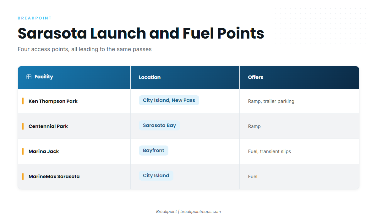
Four public launch and fuel points cover most offshore trips out of Sarasota, and all of them lead to the same three passes.
Ramps and marinas
- Ken Thompson Park boat rampCity Island, next to New Pass, with trailer parking.
- Centennial Park and Boat RampSarasota Bay access off the Tamiami Trail. Park redevelopment may affect lanes, so check the City page before you tow.
- Marina Jack docking informationbayfront marina with fuel and transient slips.
- MarineMax Sarasota, City Islandfuel on Ken Thompson Parkway, near New Pass.
Bay run and bridges
The Ringling Causeway Bridge is a fixed span on the Intracoastal Waterway with 65 ft of vertical clearance and 100 ft of horizontal clearance. The SR 789 bridge over New Pass is a bascule span with 23 ft of clearance, and 33 CFR 117.311 covers its openings. Both figures come from the NOAA Coast Pilot 5, which handles the Intracoastal Waterway bridge table in Chapter 12.
Big Sarasota Pass, the main route
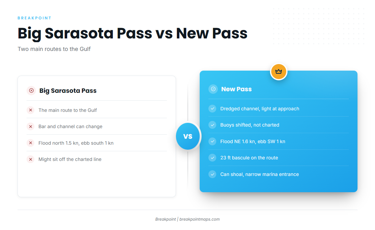
The Coast Pilot describes the bar approach and the channel as subject to continual change. Private daybeacons and a light mark the approach. The channel can sit somewhere other than where the chart shows it, so treat the plotter line as a starting point.
New Pass, the alternative
New Pass has a dredged channel with a light at the approach. Its buoys are shifted to mark the best water and are not charted, and the channel is subject to shoaling, so the chart plotter is not the final word. The 23 ft bascule bridge sits on this route. The entrance to the City Island marina alongside the channel is narrow and the current there can be strong, which matters if you launch at Ken Thompson Park or fuel at MarineMax.
Other inlets
Longboat Pass lies about 9 miles north-northwest of Big Sarasota Pass, and its entrance changes as well. It opens onto Anna Maria Sound, toward Cortez. Venice Inlet, 12 miles south-southeast, is a separate jettied inlet.
Currents and the ebb against wind
In Big Sarasota Pass the flood sets north at an average 1.5 knots and the ebb sets south at 1 knot. In New Pass the flood sets northeast at an average 1.6 knots and the ebb sets southwest at 1 knot. When an ebb runs out against an onshore wind, a pass can stand up and get steep, and a return trip timed into those conditions may look very different from the run out.
Weather pattern
From June through September, thunderstorms are most likely in the late afternoon and evening, and at sea they frequently occur at night. From fall through spring, cold fronts occasionally bring strong, gusty winds. Keep a margin in the plan.
Before you commit to a pass
Look at the water when you arrive. Check the NWS Tampa Bay marine forecast for GMZ853, Englewood to Tarpon Springs, which covers out to 20 NM, and the readings at NDBC station VENF1, Venice. We’d look at both before committing to Big Sarasota Pass. If conditions look bigger than you want, switch to New Pass or stay inside.
Fishing conditions
Sarasota’s offshore grounds step out from nearshore county reefs to deeper reef sites and ledges, then to the Florida Middle Grounds for boats with the range.
Nearshore, M-8 Reef lies about 7 miles west of Lido Key, and Silvertooth Reef lies off Siesta Key. Farther out, deeper county reef sites, natural ledges and hard bottom hold red grouper, gag, snappers and greater amberjack.
The Florida Middle Grounds lie about 95 miles northwest of the Tampa Bay entrance, a long-range option for boats built for it. Seasonal reef fish protection areas apply there under 50 CFR 622.34, and The Edges is closed to all fishing January through April.
Chart Contours shows the deeper reef band where the county sites sit. OBS SST and Chlorophyll show where warm or clean water is pushing in. Chart layers are not for navigation.
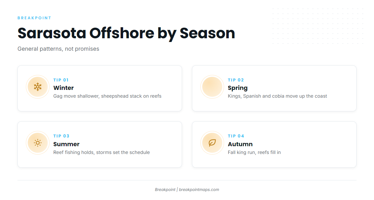
Winter
In winter, gag grouper move shallower and sheepshead stack on the reefs. Mangrove snapper, black drum and redfish work the reefs and bay edges, and sailfish show offshore. Check FWC to see whether gag is open, since the dates change. Blackfin tuna can show farther out for boats with the range. Fronts can close the window, so check GMZ853 before you go.
Spring
In spring, king and Spanish mackerel and cobia move up the coast. The king mackerel run is the main event, with tripletail and mangrove and lane snapper alongside. Gag and sailfish continue. Amberjack stay on the deeper sites, so check FWC for the season.
Summer
In summer, the reef fishing holds, and the weather pattern sets the schedule. Mangrove snapper, cobia, king and Spanish mackerel and gag stay on the reefs, and blacktip, bonnethead and lemon sharks move in. Afternoon and night thunderstorms from June through September tend to push trips to early starts and early returns. Check FWC for red snapper dates.
Autumn
In autumn, king mackerel come back through on the fall run and the reefs fill in. Spanish mackerel, snappers, cobia, permit, tripletail and gag all fit the pattern. Cold fronts return from fall onward. Pick the depth band that matches the forecast window. You can find your port, the passes and the grounds in the state and port guides on breakpointmaps.com if you want the layers beside the plan.