
About Swansboro
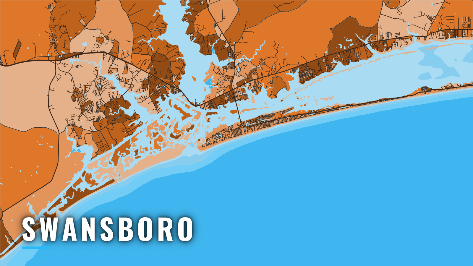
Swansboro sits on the west bank of the White Oak River, 3 miles north of Bogue Inlet, and its offshore fishing runs through that inlet into Onslow Bay. Boats leave the river, run the Intracoastal Waterway to the inlet, and cross the bar into the open Atlantic. The Coast Pilot notes that the inlet channel is used almost exclusively by local fishermen.
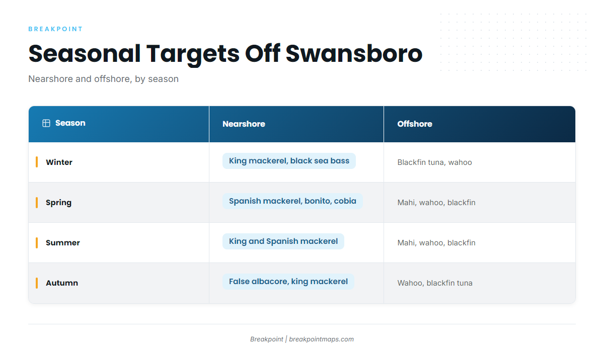
The water fishes year-round, and the nearshore and offshore targets change by season: king mackerel, Spanish mackerel, cobia, false albacore, mahi, wahoo, blackfin tuna and black sea bass. Red drum, speckled trout and flounder fish inside. Species detail is in the Atlantic Southeast fishing guide. The state sets the rules for North Carolina waters, so check NC DMF size and bag limits before you fish. Cobia and gag seasons are set by proclamation.
Access and navigation
Every offshore run from Swansboro starts at a ramp or a slip and ends at the Bogue Inlet bar.
Ramps and marinas
- Emerald Isle Boating Access AreaNC Wildlife Resources Commission public ramp close to Bogue Inlet.
- Casper’s MarinaSwansboro marina with fuel listed.
- Hammocks Beach State Parkstate park ramp open daily, with limited trailer parking.
Inlet behavior
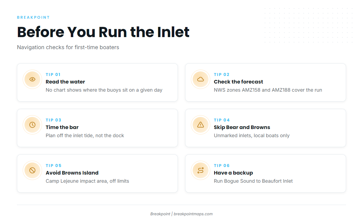
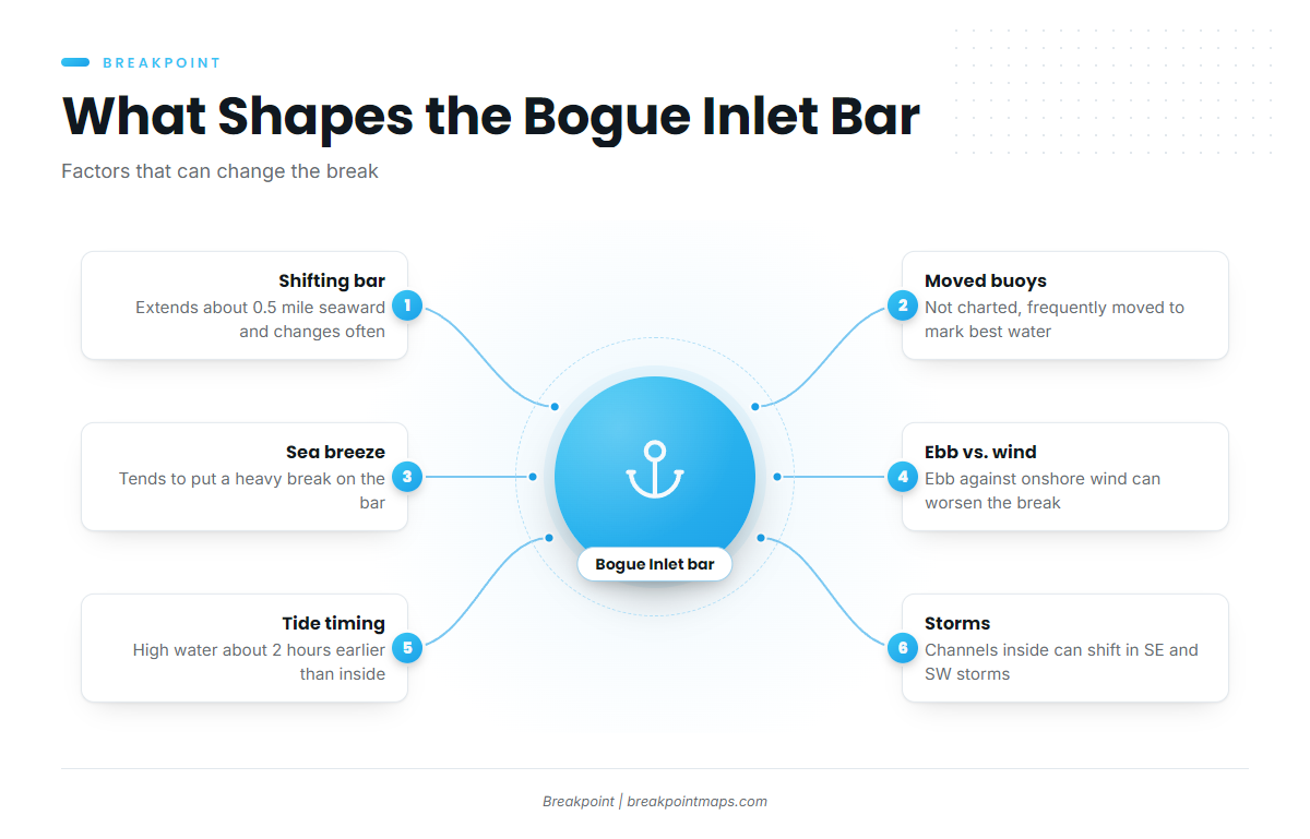
NOAA Coast Pilot 4, Chapter 5 describes Bogue Inlet as obstructed by a shifting bar that extends about 0.5 mile seaward and changes often. The buoys marking the channel are not charted and are frequently moved to mark the best water, so no chart, ours included, shows where they sit on a given day. Channels inside the inlet can also shift, particularly in southeast and southwest storms.
Wind direction tends to decide how the bar behaves. A sea breeze, even a light one, tends to put a heavy break on the bar, while a land breeze can blow strong without the same break. An ebb running against an onshore wind might make the break worse. The mean tide range is 2.2 ft, and high water at the inlet comes about 2 hours earlier than at the head of the marshes inside, so time your bar crossing off the inlet rather than the dock.
Restricted areas
Bear Inlet and Browns Inlet, 3 and 6 miles west, are unmarked and used by local boats only, so they are not an alternative. A firing-range danger zone lies offshore between Bear Inlet and New River Inlet, the approach to Sneads Ferry. New Topsail Inlet, farther southwest off Topsail Island, is also entered over a shifting bar.
Browns Island, on the ICW between Swansboro and Sneads Ferry, is an off-limits Camp Lejeune impact area, whether or not training is under way. A Sea Turtle Sanctuary Marine Protected Area runs from Bogue Inlet to New River Inlet.
Alternative approach
Beaufort Inlet, 22 miles east at the far end of Bogue Sound, is the deeper approach to Morehead City. The inside route runs east along the ICW through Bogue Sound.
Forecast and close
Read the NWS Newport/Morehead City marine zones before you go. AMZ158 covers out to 20 nm and AMZ188 covers 20 to 60 nm. The bar changes faster than any survey, so look at the water and the official forecast when you arrive. If the bar looks bigger than you want, run the sound to Beaufort Inlet instead.
Fishing conditions
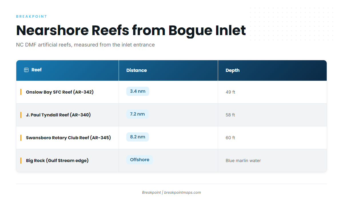
The named nearshore grounds are NC DMF artificial reefs, measured here from the Bogue Inlet entrance. The NC DMF Artificial Reef Guide lists them.
| Reef | Number | Distance from entrance | Depth |
|---|---|---|---|
| Onslow Bay Sport Fishing Club Reef | AR-342 | 3.4 nm | 49 ft |
| J. Paul Tyndall Reef | AR-340 | 7.2 nm | 58 ft |
| Swansboro Rotary Club Reef | AR-345 | 8.2 nm | 60 ft |
Big Rock is the Gulf Stream-edge ground offshore and is blue marlin water.
OBS SST helps read the Gulf Stream edge, and Chart Contours help read the reef depths before the run. Chart layers are not for navigation.
Winter
King mackerel and black sea bass fish closer in. Blackfin tuna and wahoo are found offshore toward the Gulf Stream. Runs depend on weather windows, so check the AMZ zones before you commit. Black drum and sheepshead fish inside.
Spring
Spanish mackerel, bluefish, Atlantic bonito and king mackerel fish nearshore, and cobia arrive late in the season. Mahi, wahoo and blackfin tuna fish offshore. Cobia rules are set by proclamation, so check NC DMF before you fish.
Summer
King mackerel and Spanish mackerel fish nearshore, and amberjack hold on the reefs. Mahi, wahoo and blackfin tuna fish along the edge offshore. For the wider picture, see the guide to blue marlin in the Atlantic Southeast.
Autumn
False albacore fish nearshore. The king mackerel run in the Atlantic Southeast reaches this stretch of coast, and wahoo and blackfin tuna fish offshore.