Atlantic bluefin tuna fishing out of Block Island happens on the "south of Block" grounds, which start about 10 miles south of the island. For an owner running a center console, this is a conditions-driven trip rather than a daily one. Hula Charters calls bluefin an opportunistic, longer-trip target, run offshore when conditions line up.
The sections below cover timing, the run, the charted structure near the island, how local boats fish, and who runs the trips. They give numbers and reference points to help you decide where to look, and they make no promises about fish.
When bluefin are around Block Island
Bluefin are around Block Island from June onward, and the mid-summer school-size runs are the trips local charters talk about. For how that timing fits the wider coast, see our Northeast bluefin guide (see also the Atlantic Northeast fishing guide). For general species behavior and tackle, start with the Atlantic bluefin tuna guide.
June onward
The window opens in June, so plan your trips from that start.
Mid-summer school fish
Hula Charters runs its school-size bluefin trips in mid-summer, which is the stretch to aim for if school bluefin are your target.
Where boats run: south of Block
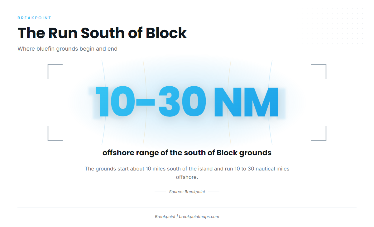
The south of Block grounds start about 10 miles south of the island and run 10 to 30 nautical miles offshore. Every trip out of Block Island is framed by those two numbers.
Distance from the island
- The grounds begin about 10 miles south of the island.
- They extend 10 to 30 nautical miles offshore.
Work out your fuel and return from those two numbers before you leave the dock.
Planning the longer trip
Hula Charters treats bluefin as an opportunistic, longer-trip target, run when conditions line up. Make the go or no-go call from the official NOAA marine forecast, and read the numbers in it before you commit to the run.
Named grounds and structure
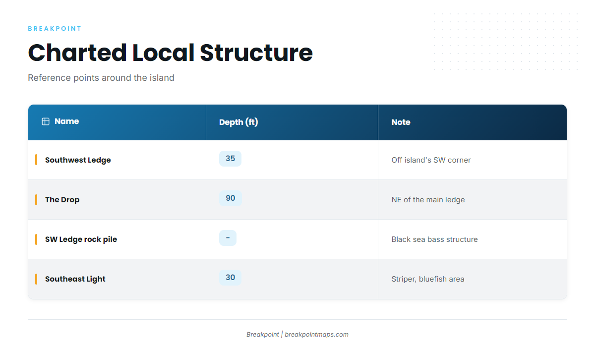
Southwest Ledge sits in 35 ft just off the island’s southwest corner, and The Drop falls to 90 ft northeast of it. Both are charted local structure and useful reference points on the way to and around the run south. They are not marks where we say bluefin hold. Check the positions against Chart Contours in the Breakpoint app, and keep in mind that chart layers are not for navigation.
Southwest Ledge
Southwest Ledge is 35 ft, just off the island’s southwest corner. The Peanut is a named spot on the ledge. The Drop is 90 ft at 41-08-01.8 / 71-39-35.3, northeast of the main ledge. The Southwest Ledge rock pile is at 41-07-17.3 / 71-39-53.9 and is black sea bass structure.
North Rip / North Reef
North Rip / North Reef is charted local structure near the island.
Southeast Light and The Pinnacle
Southeast Light is a striper and bluefish area in 30 ft. The Pinnacle is a named spot at Southeast Light.
Block Island Wind Farm
The Block Island Wind Farm is a named reference point near the island.
| Name | Depth (ft) | Position | Note |
|---|---|---|---|
| Southwest Ledge | 35 | Just off the island’s southwest corner | |
| The Peanut | Southwest Ledge | ||
| The Drop | 90 | 41-08-01.8 / 71-39-35.3 | Northeast of the main ledge |
| Southwest Ledge rock pile | 41-07-17.3 / 71-39-53.9 | Black sea bass structure | |
| North Rip / North Reef | |||
| Southeast Light | 30 | Striper and bluefish area | |
| The Pinnacle | Southeast Light | ||
| Block Island Wind Farm |
Positions are for planning. Chart layers are not for navigation.
How bluefin are fished here
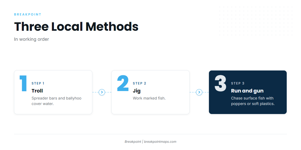
Local boats fish bluefin three ways: trolled spreader bars and ballyhoo, jigging, and running and gunning with poppers or soft plastics. Trolling covers water, jigging works fish you have already marked, and running and gunning works fish on the surface. Rig for all three if you can, since the day decides which one you use.
Trolling spreader bars and ballyhoo
Trolling spreader bars and ballyhoo is how you cover water on the south of Block grounds. Pull the spread through the area, let fish find it, and switch tactics once you locate them.
Jigging
Jigging is the method for fish you have marked. Once you see them on the sounder, you drop to them instead of pulling a spread past.
Running and gunning
Running and gunning means running to fish showing on the surface and casting poppers or soft plastics to them. It rewards a boat that can move fast and reposition.
Who runs them: Block Island charters
Three Block Island charters list Atlantic bluefin tuna:
- Hula Charters on Block Island, Capt. Matt King, aboard the Hula Dog.
- Block Island Fishworks guided charters, Capt. Christopher Willi, aboard the Jessica Kate, a 23 ft Maycraft CCX.
- Snow Fly Charters, Capt. Greg Snow.
The Block Island Inshore Fishing Tournament is usually held in July.
If you would rather book a trip before running your own boat, our tuna fishing guides are the place to start.
FAQ
How far do you run for bluefin out of Block Island?
The grounds start about 10 miles south of the island and run 10 to 30 nautical miles offshore.
When are bluefin around Block Island?
They are around from June onward. Hula Charters runs its school-size trips in mid-summer.
What methods do local boats use?
Trolled spreader bars and ballyhoo, jigging, and running and gunning with poppers or soft plastics.
Which Block Island charters target bluefin?
Hula Charters (Capt. Matt King), Block Island Fishworks (Capt. Christopher Willi) and Snow Fly Charters (Capt. Greg Snow).
When is the Block Island Inshore Fishing Tournament?
It is usually held in July.