
Atlantic bluefin tuna fishing out of Gloucester means a run east and south of Cape Ann to a short list of banks and ledges: Stellwagen Bank, Jeffreys Ledge and Tillies Bank. The charter captains who fish from Gloucester name these grounds, and so do we. For biology and general tactics, use our Atlantic bluefin tuna guide. This page covers how far boats run, the depths to mark, the methods used locally and who fishes this port.
When bluefin are around Gloucester, and how far boats run
Timing changes from year to year, so this page gives no calendar. It covers the run, the buoy to read and the numbers that decide a day.
Season varies by year
Per Tuna Hunter, each year differs. Plan around the fish rather than a fixed date. For the wider timing picture, see the Atlantic Northeast bluefin guide (see also the wider Atlantic Northeast guide).
Run distance
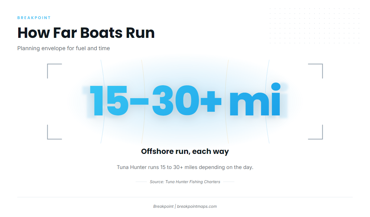
Tuna Hunter runs 15 to 30+ miles offshore, depending on the day. Coastal Fishing Charters runs its 9-hour tuna trip to Stellwagen Bank or Jeffreys Ledge. Use those two figures as a planning range for fuel and time:
- Distance: 15 to 30+ miles each way, as reported by Tuna Hunter.
- Time: a 9-hour day is Coastal Fishing Charters’ benchmark for a full trip to Stellwagen or Jeffreys.
Reading NDBC 44013
NDBC station 44013, Boston is the nearest NOAA buoy we point to. It sits 16 NM east of Boston at 42.346 N 70.651 W, in 64.6 m of water. Read its wind, wave height and period before you commit to the run, then check the official marine forecast.
Grounds and structure that hold bluefin
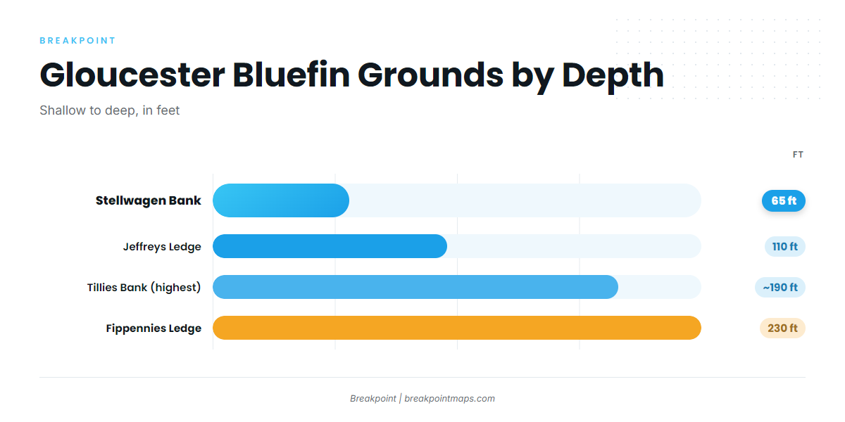
The grounds run from shallow to deep: Stellwagen Bank at 65 ft, Jeffreys Ledge at 110 ft, Tillies Bank at about 190 ft on its highest spots and Fippennies Ledge at 230 ft. The wrecks on Stellwagen add finer structure.
| Name | Depth | Position note |
|---|---|---|
| Stellwagen Bank | 65 ft | Sanctuary bank between Cape Ann and Cape Cod |
| Jeffreys Ledge | 110 ft | – |
| Tillies Bank | about 190 ft (highest spots) | East of Cape Ann |
| Fippennies Ledge | 230 ft | – |
| Patriot (fishing vessel wreck) | 100 ft | Northwest corner of Stellwagen Bank |
| Josephine Marie (fishing vessel wreck) | 105 ft | Southern end of Stellwagen Bank |
| Unidentified trawler wreck with mooring | 105 to 110 ft | On Stellwagen Bank |
| Heroic (former minesweeper fishing vessel wreck) | – | – |
Mark these depths with the Chart Contours layer in Breakpoint. Chart layers are not for navigation.
Stellwagen Bank
Stellwagen sits at 65 ft, a sanctuary bank between Cape Ann and Cape Cod. It is one of the two destinations for the Coastal Fishing Charters 9-hour trip, and Sweet Dream, Tuna Tail and Karen Lynn all name it.
Jeffreys Ledge
Jeffreys Ledge is 110 ft. It is the other destination for the Coastal Fishing Charters 9-hour trip.
Tillies Bank
Tillies Bank lies east of Cape Ann. Its highest spots are about 190 ft.
Fippennies Ledge
Fippennies Ledge is 230 ft, the deepest on the list.
Stellwagen wrecks
Three wrecks sit on Stellwagen Bank. The Patriot is at the northwest corner, 100 ft. The Josephine Marie is at the southern end, 105 ft. An unidentified trawler wreck with a mooring sits on the bank at 105 to 110 ft. The Heroic, a former minesweeper fishing vessel, is also a known wreck.
How bluefin are fished out of Gloucester
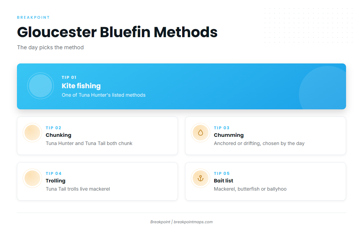
Per Tuna Hunter, the day decides among kite fishing, chunking or chumming, and trolling, anchored or drifting. For deeper method and tackle breakdowns, see the kite, chunk and troll guides.
| Method | Who lists it | Notes |
|---|---|---|
| Kite fishing | Tuna Hunter | Chosen by the day |
| Chunking or chumming | Tuna Hunter; Tuna Tail (chunking) | Anchored or drifting, chosen by the day |
| Trolling | Tuna Hunter; Tuna Tail | Tuna Tail trolls live mackerel, butterfish or ballyhoo |
Kite fishing
Tuna Hunter lists kite fishing among its methods.
Chunking and chumming, anchored or drifting
Tuna Hunter chunks or chums, and fishes anchored or drifting. Tuna Tail chunks. Whether to anchor or drift depends on the day, with no fixed rule.
Trolling and bait
Tuna Hunter trolls. Tuna Tail chunks and trolls with live mackerel, butterfish or ballyhoo.
Who fishes for bluefin out of Gloucester
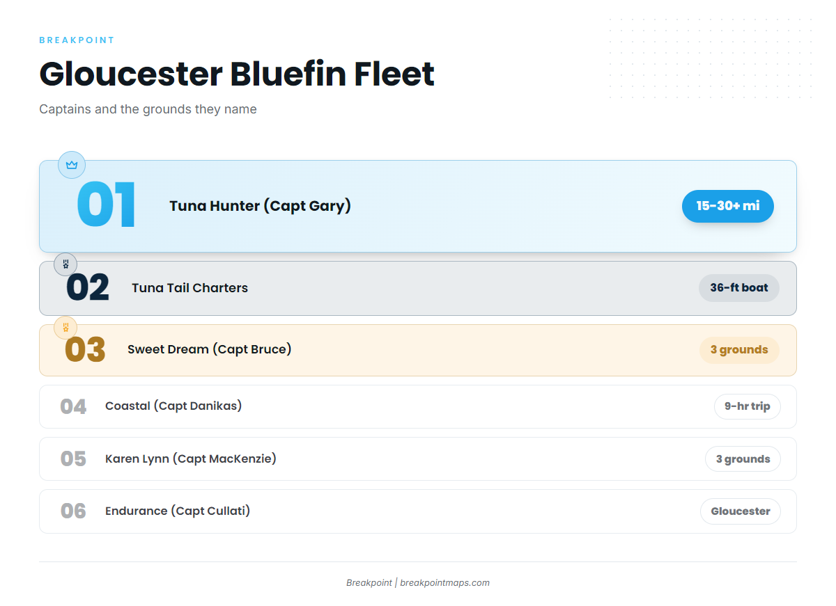
Six Gloucester charters list Atlantic bluefin tuna. Their grounds and methods show what the local fleet does.
- Tuna Hunter Fishing Charters: Boat named Tuna Hunter, Captain Gary per the operator’s own site. Runs 15 to 30+ miles depending on the day. Kite, chunk or chum, troll, anchored or drifting, chosen by the day.
- Tuna Tail Charters: A custom 36-foot boat, per the operator’s site. Fishes Stellwagen, Jeffreys and Tillies. Chunks and trolls with live mackerel, butterfish or ballyhoo.
- Sweet Dream Sport Fishing Charters: F/V SWEET DREAM, Captain Bruce per the operator’s own site. Fishes Stellwagen, Jeffreys and Tillies.
- Coastal Fishing Charters: Captain Nick Danikas, per the operator’s rates page. Runs a 9-hour tuna trip to Stellwagen Bank or Jeffreys Ledge.
- Karen Lynn Charters: Capt Collin MacKenzie signs the operator’s posts. Fishes Stellwagen, Jeffreys and Tillies.
- Endurance Charters in Gloucester: Captain Frank Cullati.
FAQ: bluefin out of Gloucester
How far offshore do boats run for bluefin from Gloucester?
Tuna Hunter runs 15 to 30+ miles depending on the day. Coastal Fishing Charters runs a 9-hour trip to Stellwagen Bank or Jeffreys Ledge.
What depth is Stellwagen Bank?
Stellwagen Bank is 65 ft, the shallowest of the listed grounds. Jeffreys Ledge is 110 ft, Tillies Bank’s highest spots are about 190 ft, and Fippennies Ledge is 230 ft.
When is the bluefin season out of Gloucester?
Per Tuna Hunter, each year differs.
What methods do Gloucester boats use for bluefin?
Per Tuna Hunter, the day decides among kite fishing, chunking or chumming, and trolling, anchored or drifting. Tuna Tail chunks and trolls with live mackerel, butterfish or ballyhoo.
Which buoy should I check before running?
NDBC station 44013, Boston, 16 NM east of Boston at 42.346 N 70.651 W in 64.6 m of water. Read its wind, wave height and period before you go.