Atlantic bluefin tuna fishing out of Nantucket runs from summer into fall, and boats work the water east and south of the island. This briefing covers when the fish are around, where boats run, the named rips and structure, how the fishery is worked locally, and who fishes it. For getting out of the harbor and reading conditions, start with the Nantucket port page.
No NOAA buoy is listed for this port, so check the official NWS marine forecast before you run. This page points to places to look and does not promise fish.
Season and where boats run
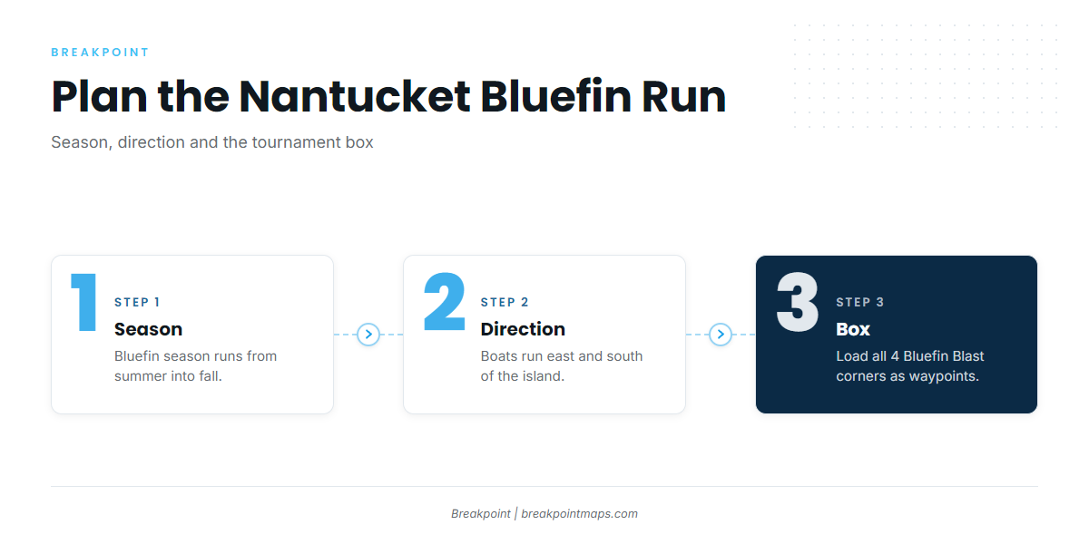
The season runs from summer into fall, and boats head east and south of the island. The Bluefin Blast box gives coordinates for the water tournament boats fish.
Summer into fall
Bluefin season at Nantucket runs from summer into fall. That window frames the trips, tournaments and charters below. Biology and migration are covered in the Atlantic bluefin tuna species guide.
East and south of the island
Bill Fisher Outfitters runs bluefin trips both east of the island and south of it. The Northeast bluefin guide (see also the Atlantic Northeast fishing guide) covers the wider picture for both directions. The grounds section below is organized by side of the island to match.
The Bluefin Blast box
The Bluefin Blast defines its fishing area as a box from 41°05’N to 41°50’N and from 68°43’W to 69°55’W. The 4 corners:
- NW 41°50’N 69°55’W
- SW 41°05’N 69°55’W
- NE 41°50’N 68°43’W
- SE 41°05’N 68°43’W
The box covers a wide piece of water east and south of the island. Load the 4 corners as waypoints before leaving the dock.
Grounds and structure around Nantucket
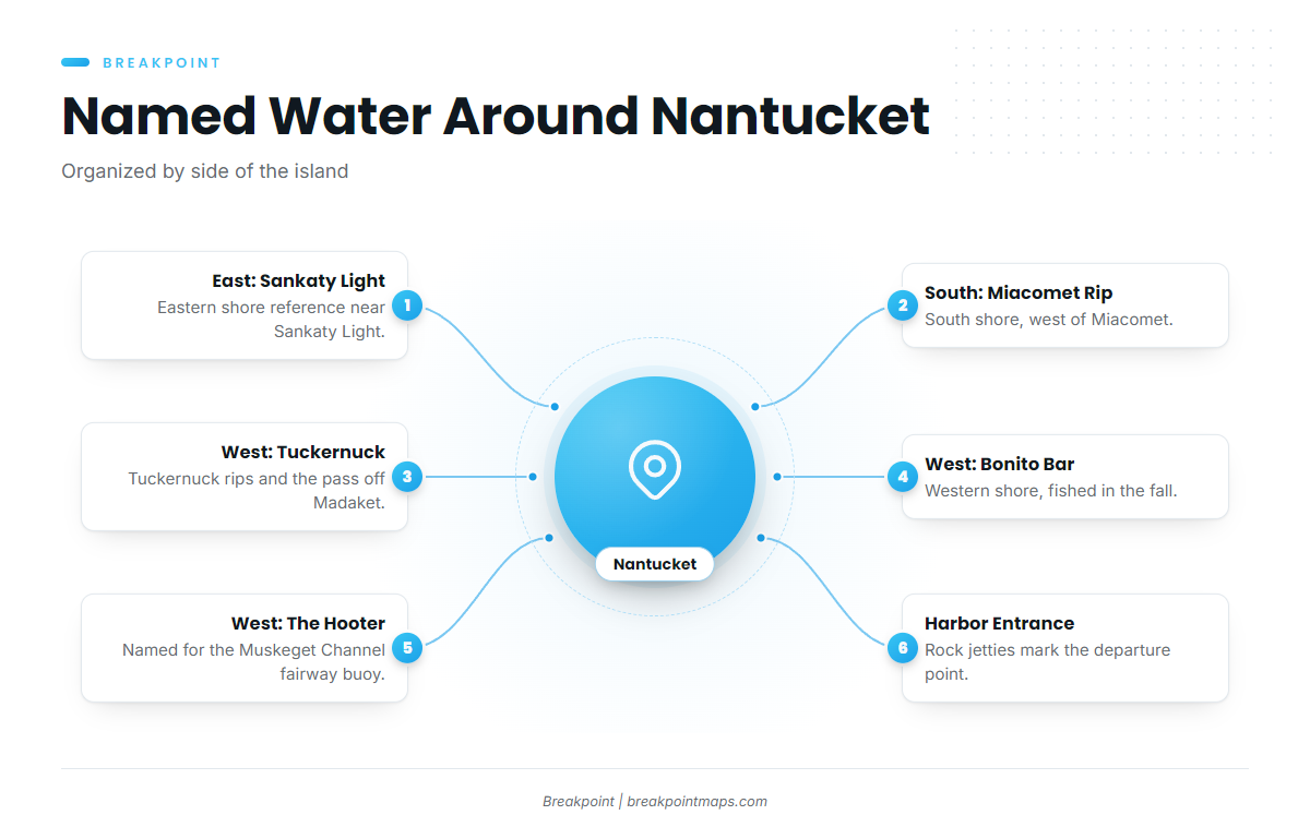
The named water around the island is grouped here by side. Chart layers such as Chart Contours can help locate these named rips, but they are not for navigation.
| Side of island | Named ground | Descriptor |
|---|---|---|
| East | Sankaty Light | Eastern shore near Sankaty Light |
| South | Miacomet Rip | South shore, west of Miacomet |
| West | Tuckernuck rips | Western shore |
| West | Madaket to Tuckernuck pass | Rip-edge pass between Madaket Harbor and Tuckernuck Island |
| West | Bonito Bar | Western shore, fished in the fall |
| West | The Hooter | Named for the fairway buoy at the end of Muskeget Channel |
| Harbor | Rock jetties | Protect the Nantucket Harbor entrance |
East side and Sankaty Light
The eastern shore near Sankaty Light is the east-side reference point, and it lines up with the runs east of the island.
South shore
Miacomet Rip sits on the south shore, west of Miacomet. It ties to the runs south of the island.
West end and Tuckernuck
The Tuckernuck rips and the rip-edge pass between Madaket Harbor and Tuckernuck Island are on the western shore. Bonito Bar is also on the western shore and is fished in the fall. The Hooter takes its name from the fairway buoy at the end of Muskeget Channel.
Harbor entrance
Rock jetties protect the Nantucket Harbor entrance and serve as the departure reference for every run.
Other named water around the island includes Great Point Rip and The Gauls.
How bluefin are fished from Nantucket
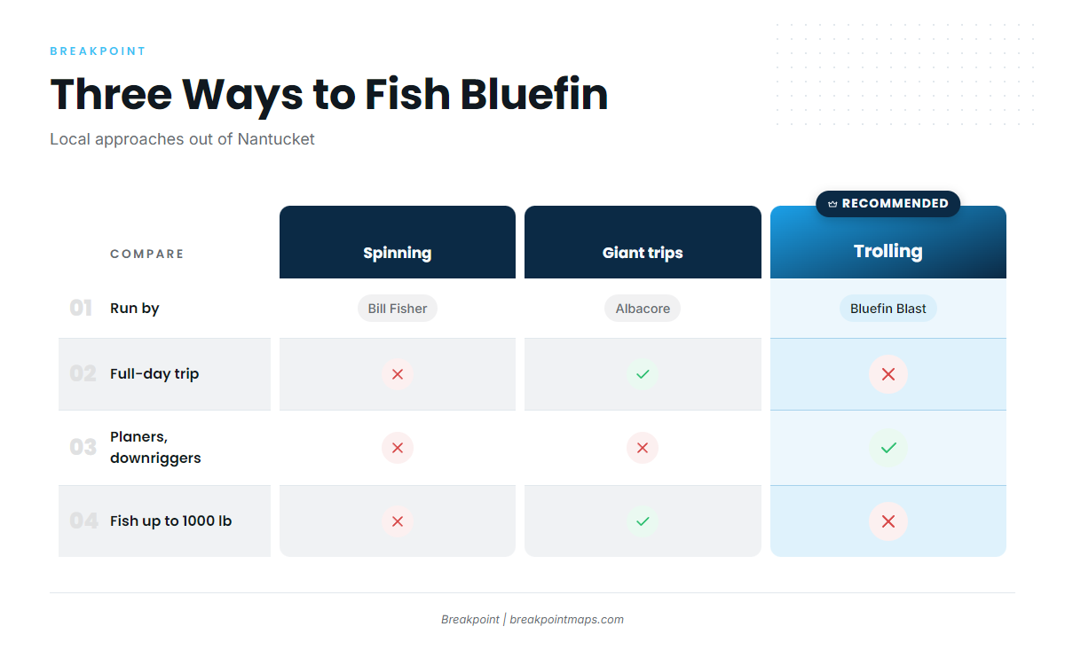
Three local approaches show up around the island: trolling, spinning gear and full-day giant trips. For broader technique, see the tuna fishing guides.
Trolling
Trolling is the format of the Bluefin Blast. Planers and downriggers are allowed, so a tournament spread can fish deep as well as at the surface.
Spinning gear
Bill Fisher Outfitters runs bluefin on spinning gear, a different local approach from the tournament trolling format.
Giant trips
Albacore Charters offers full-day trips for giant bluefin up to 1000 lb.
Tournaments
The Bluefin Blast is fished inside the box listed above. The Big Game Battle is a Nantucket bluefin tournament, usually held in July.
Who fishes bluefin out of Nantucket
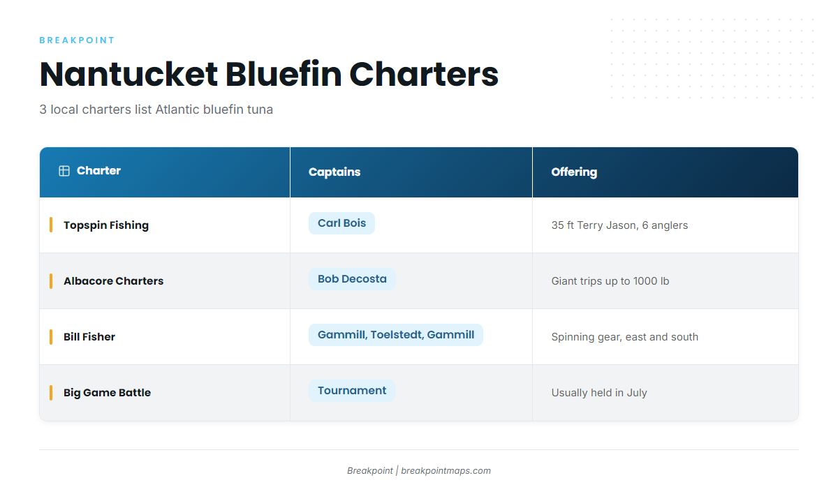
Three local charters list Atlantic bluefin tuna.
Topspin Fishing Charters
Captain Carl Bois runs the 35-foot Terry Jason for up to 6 anglers. The operator’s site is the Topspin Fishing Charters website.
Albacore Charters
Captain Bob Decosta, per the directory listing, runs full-day trips for giant bluefin up to 1000 lb. See the Albacore Charters website.
Bill Fisher Outfitters
Captains Corey Gammill, Bill Toelstedt and Cam Gammill run bluefin on spinning gear, east and south of the island. See the Bill Fisher Outfitters website.
| Charter | Captains | Offering |
|---|---|---|
| Topspin Fishing Charters | Carl Bois | 35-foot Terry Jason, up to 6 anglers |
| Albacore Charters | Bob Decosta | Full-day giant trips up to 1000 lb |
| Bill Fisher Outfitters | Corey Gammill, Bill Toelstedt, Cam Gammill | Spinning gear, east and south of the island |
FAQ
When is bluefin season at Nantucket?
It runs from summer into fall. The Big Game Battle is usually held in July.
Which way do boats run for bluefin out of Nantucket?
East of the island and south of the island, per Bill Fisher Outfitters.
What are the Bluefin Blast boundaries?
The box runs from 41°05’N to 41°50’N and from 68°43’W to 69°55’W. Corners: NW 41°50’N 69°55’W, SW 41°05’N 69°55’W, NE 41°50’N 68°43’W, SE 41°05’N 68°43’W.
What methods are allowed in the Bluefin Blast?
Trolling, with planers and downriggers allowed. The tournament also follows its own event rules.
Which charters fish bluefin from Nantucket?
Three charters list Atlantic bluefin tuna: Topspin Fishing Charters (Captain Carl Bois), Albacore Charters (Captain Bob Decosta, giant trips up to 1000 lb) and Bill Fisher Outfitters (Captains Corey Gammill, Bill Toelstedt and Cam Gammill, spinning gear).