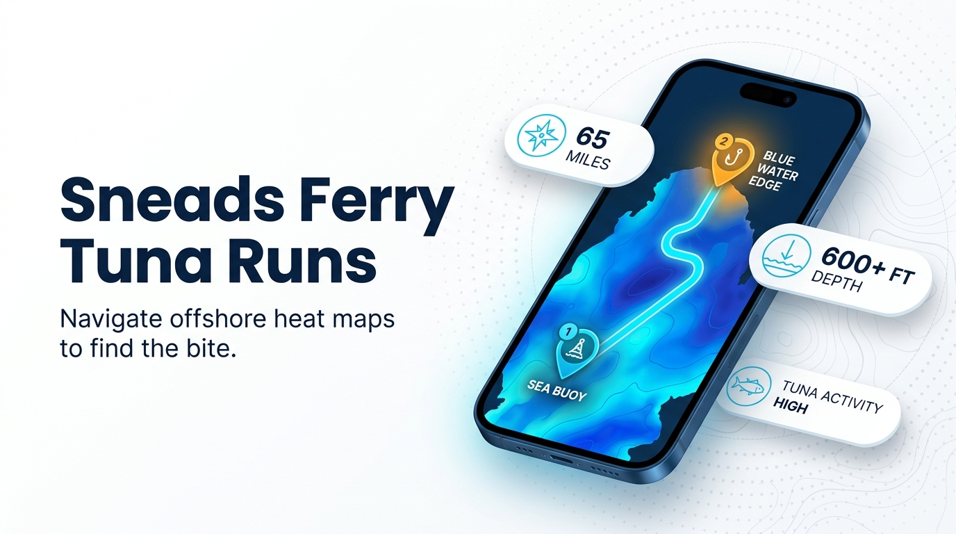
Tuna trips out of Sneads Ferry are Gulf Stream runs of 45-65 miles, measured from the New River Inlet sea buoy area. This guide covers how far boats run, the named structure near the inlet, how tuna are fished, who lists tuna trips, and what to check on rules. Blackfin tuna fishing out of Sneads Ferry starts with that run, so plan fuel and weather around it before you plan tackle.
How far boats run out of Sneads Ferry
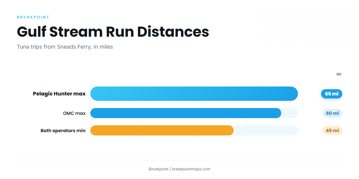
Pelagic Hunter’s Gulf Stream trip runs 45-65 miles, and OMC’s trips run 45-60 miles. Both list Tuna on those trips.
The run is measured from the New River Inlet sea buoy area, the zero point for every offshore leg. A 45-65 mile run each way sets the fuel and weather planning for a self-run boat, so check the NWS coastal marine forecasts for wind and seas before you commit. For the wider picture of the Gulf Stream off the Carolinas (see also the Atlantic Southeast region guide), use the regional guide.
| Operator | Listed run | Listing |
|---|---|---|
| Pelagic Hunter | 45-65 miles | Tuna, Gulf Stream trip |
| OMC | 45-60 miles | Tuna |
Grounds and structure near Sneads Ferry
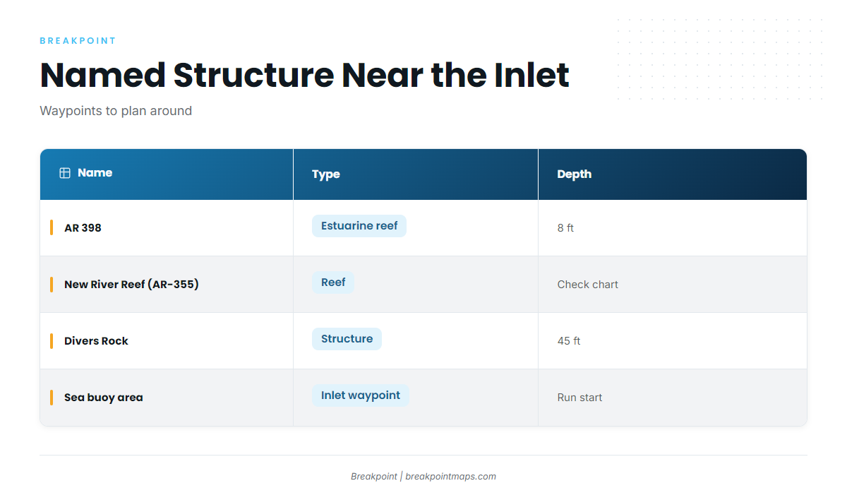
Four named places sit near the port: AR 398, New River Reef (AR-355), Divers Rock, and the New River Inlet sea buoy area. Chart layers are not for navigation.
| Name | Type | Depth |
|---|---|---|
| AR 398 | estuarine reef | 8 ft |
| AR-355 | reef | |
| Divers Rock | structure | 45 ft |
| Sea buoy area | inlet waypoint |
New River Inlet sea buoy area
This is the inlet waypoint where offshore runs begin and the zero point for the 45-65 mile figure.
New River Reef (AR-355)
New River Reef (AR-355) is named reef structure near the port, listed in the NC artificial reef guide. It works as a nearshore waypoint and is not a tuna spot.
Divers Rock
Divers Rock is named structure in 45 ft of water near Sneads Ferry. Like AR-355, it is a nearshore waypoint and not a tuna spot.
AR 398
AR 398 is the New River estuarine reef, in 8 ft of water. It is estuarine structure and not tuna water.
How tuna are fished here
The local method on Gulf Stream trips is trolling. The long run comes first, then you cover water once you arrive.
Who fishes for tuna out of Sneads Ferry
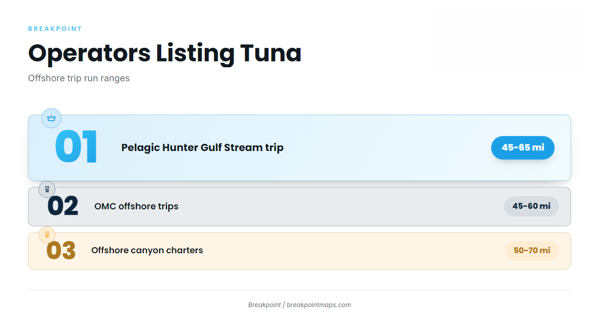
Two local operators list Tuna on their offshore trips. Their listings say "Tuna" without naming a species, so use the guide to telling tuna species apart.
Pelagic Hunter
Pelagic Hunter Fishing Center lists Tuna on its 45-65 mile Gulf Stream trip.
OMC
OMC lists Tuna on its 45-60 mile trips.
When blackfin are around
Neither listing carries a species or a season, so neither confirms blackfin specifically. For seasonality and the species picture, use the blackfin tuna guide.
FAQ: blackfin tuna fishing out of Sneads Ferry
How far is the run for tuna out of Sneads Ferry?
Blackfin tuna fishing out of Sneads Ferry means a 45-65 mile Gulf Stream run, measured from the New River Inlet sea buoy area.
Which operators list tuna trips out of Sneads Ferry?
Pelagic Hunter lists Tuna on its 45-65 mile Gulf Stream trip, and OMC lists Tuna on its 45-60 mile trips.
Do the local listings name blackfin?
No. Both listings say "Tuna" without naming a species.
How is tuna fished out of Sneads Ferry?
Trolling on Gulf Stream trips.
Is AR 398 a tuna spot?
No. AR 398 is an 8 ft estuarine reef in the New River and is not tuna water.