Cobia fishing out of Panama City Beach means a run into offshore Gulf waters to a set of named reefs and wrecks. This guide covers those sites, from the pier reefs about 3 nm out to the Liberty Ship about 10 miles offshore, with depths in feet, who fishes for cobia from the port, and where the rules live.
When cobia are off Panama City Beach
Cobia are fished here in offshore Gulf waters. The timing of their movement along the Gulf coast is covered in our Gulf cobia guide (see also the Gulf of Mexico fishing guide), which carries the seasonal picture across the Gulf. For baits, tackle, and how the fish are worked, see the cobia species guide.
Where boats run and the structure that holds fish
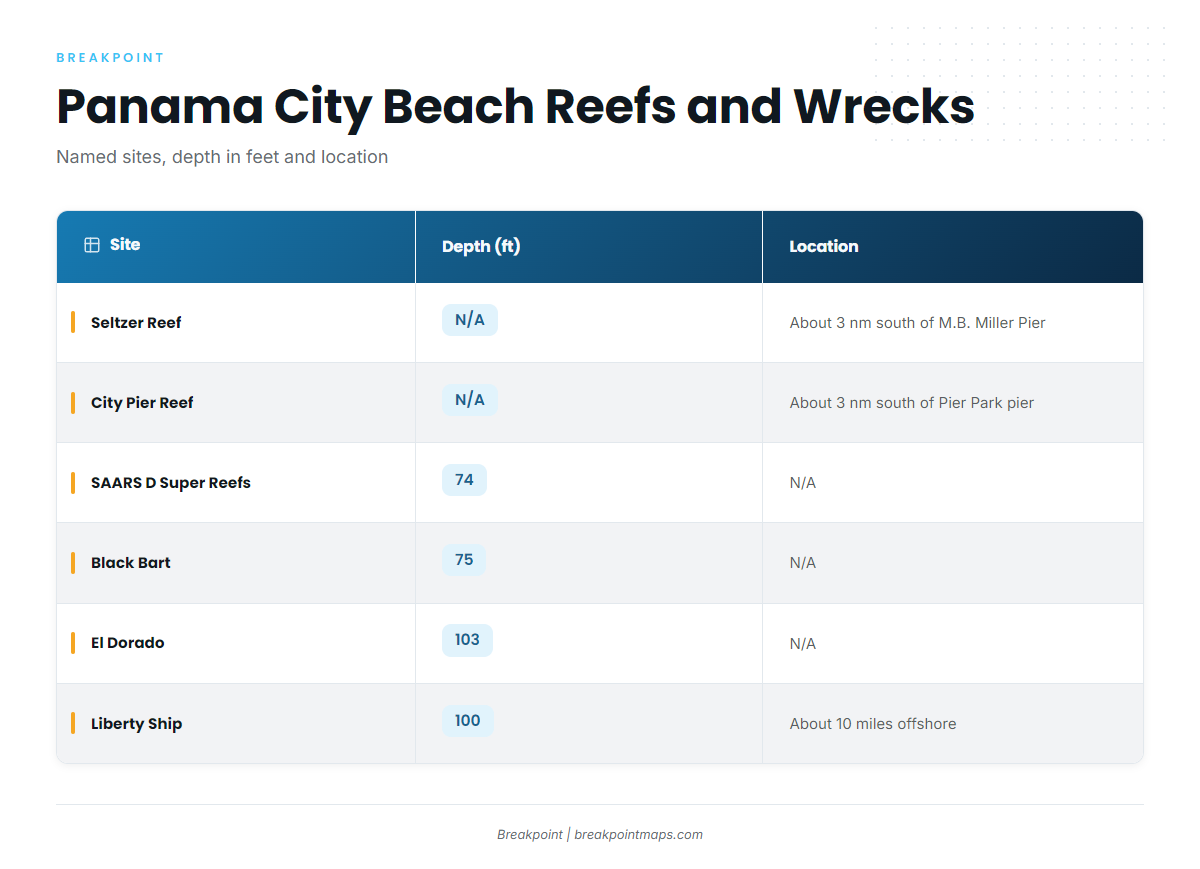
Boats run into offshore Gulf waters to Bay County artificial reefs and ship wrecks. The pier reefs sit about 3 nm out, and the farther sites run to the Liberty Ship, about 10 miles offshore.
Seltzer and City Pier reefs
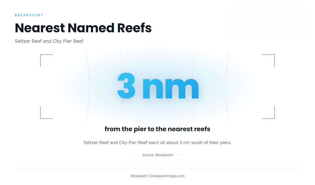
Seltzer Reef sits about 3 nautical miles south of the M.B. Miller County Pier. City Pier Reef sits about 3 nautical miles south of the city pier at Pier Park. They are the nearest named sites on this page.
SAARS D Super Reefs
The SAARS D Super Reefs are five 18-ft modules, BC2015 sets 17 to 21, on a 74 ft bottom. The modules rest at 73 to 75 ft.
DuPont Modules
DuPont Modules 1 to 11 are Bay County reef modules, funded by the Florida Fish and Wildlife Conservation Commission (FWC) in 2012.
Black Bart and USS Strength
Black Bart is an oilfield supply ship wreck in 75 ft. USS Strength is a minesweeper wreck.
El Dorado
The El Dorado is a cruise ship wreck in 103 ft.
Liberty Ship
The Liberty Ship is a 441 ft WWII wreck in 100 ft of water, about 10 miles offshore. It is the farthest site on this page.
Site table
| Site | Type | Depth (ft) | Location note |
|---|---|---|---|
| Seltzer Reef | Artificial reef | About 3 nm south of the M.B. Miller County Pier | |
| City Pier Reef | Artificial reef | About 3 nm south of the city pier at Pier Park | |
| SAARS D Super Reefs | Reef modules (five 18-ft, BC2015 sets 17 to 21) | 74 (modules 73 to 75) | |
| DuPont Modules 1 to 11 | Reef modules (Bay County, FWC-funded 2012) | ||
| Black Bart | Oilfield supply ship wreck | 75 | |
| USS Strength | Minesweeper wreck | ||
| El Dorado | Cruise ship wreck | 103 | |
| Liberty Ship | 441 ft WWII wreck | 100 | About 10 miles offshore |
Reading the bottom
The Chart Contours layer shows bottom relief around these sites. Chart layers are not for navigation, and a waypoint does not guarantee fish. Check the official NWS marine forecast before you run.
Who fishes for cobia out of Panama City Beach
Reel Groovy Experiences lists cobia among its targets. It runs the 43 ft Reel GRooV, captained by Capt. Gary Ray. For other coastal and offshore gamefish, the species pages cover each fish.
FAQ
How far do boats run for cobia from Panama City Beach?
Boats run into offshore Gulf waters. The named sites range from the pier reefs about 3 nm out to the Liberty Ship about 10 miles offshore.
What is the closest reef to shore?
Seltzer Reef and City Pier Reef each sit about 3 nm south of their piers. Seltzer Reef is south of the M.B. Miller County Pier, and City Pier Reef is south of the city pier at Pier Park.
How deep is the Liberty Ship?
The Liberty Ship sits in 100 ft of water. It is a 441 ft WWII wreck about 10 miles offshore.
What are the SAARS D Super Reefs?
They are five 18-ft modules, BC2015 sets 17 to 21, on a 74 ft bottom, with the modules at 73 to 75 ft.
Where do I find cobia rules for this port?
FWC covers state waters and NOAA Fisheries covers federal waters. The Florida regulations page and the federal rules guide linked above point to both. Check both before you fish.