Striped marlin fishing out of Dana Point starts at a small-craft harbor in the lee of the point, with an entrance between two breakwaters that faces east into the Gulf of Santa Catalina. The Dana Point port guide covers the entrance, ramp and fuel dock. From the harbor mouth, marlin water means 14 Mile Bank, Santa Catalina Island and San Clemente Island. This guide covers the water temperatures to look for, the named grounds, what to read before you leave and where the rules live.
When striped marlin are off Dana Point
Striped marlin presence off this coast follows water temperature, so the calendar is best read in degrees. The numbers below indicate whether a given pass of water can hold fish.
Water temperature that holds fish
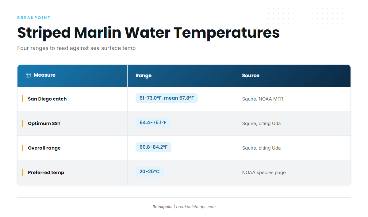
NOAA lists a preferred range of 20 to 25°C for striped marlin. Squire, writing in the NOAA Marine Fisheries Review, gives the catch temperatures for fish landed at San Diego and cites Uda for the optimum and overall ranges.
| Measure | Range | Source |
|---|---|---|
| Catch temperature, fish landed at San Diego | 61 to 73.0°F (16.1 to 22.8°C), mean 67.8°F (19.9°C) | Squire, NOAA MFR |
| Optimum sea surface temperature | 64.4 to 75.1°F (18.5 to 24°C) | Squire, citing Uda |
| Overall range | 60.8 to 84.2°F (16 to 29°C) | Squire, citing Uda |
| Preferred temperature | 20 to 25°C | NOAA species page |
The thermocline is the layer where temperature drops quickly with depth. NOAA puts striped marlin in the surface layer above it 86% of the time, so surface temperature is the number that matters.
Read those ranges against the OBS SST layer to see where the 64 to 75°F water sits on a given pass. Chart layers are not for navigation. For biology and general methods, see the striped marlin species guide.
Why years differ
Striped marlin are highly migratory, according to FishBase. NOAA says they travel thousands of miles across international boundaries, and juveniles move east toward Mexico’s coast. Whether 64°F-plus water reaches this part of the gulf changes from year to year, and the fish follow it. The Pacific Southwest striped marlin guide (see also the Pacific Southwest offshore fishing guide) covers the regional picture.
Where boats run from the harbor
Inside warm water, structure narrows the search. According to the FishBase striped marlin profile, abundance rises with distance from the continental shelf, and fish come close to shore only where deep drop-offs occur. Fishes of Australia says they are most often seen near islands, seamounts and boundary currents. A seamount is an undersea mountain rising from deep water.
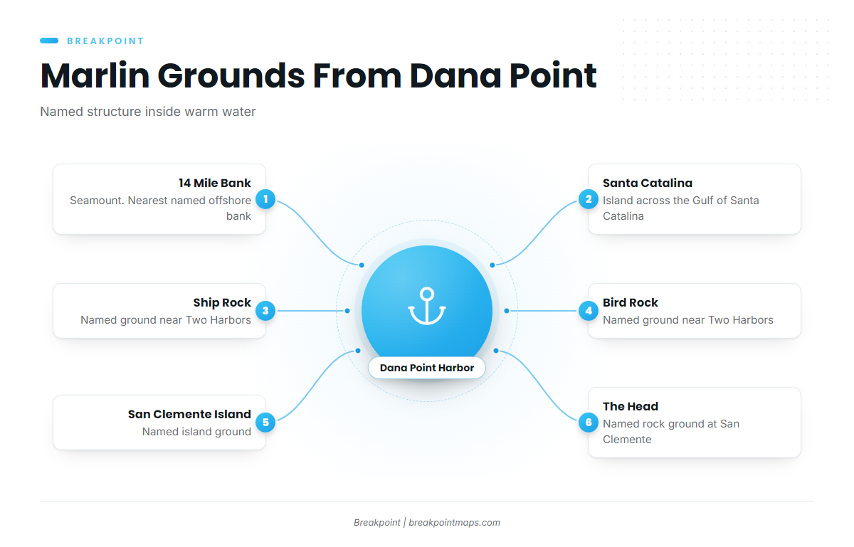
The named grounds below fit that description. The Chart Contours layer shows where the bottom rises. The list runs from the nearest named bank outward.
14 Mile Bank
14 Mile Bank is a named bank on the port’s list of grounds and the nearest offshore structure named for Dana Point. It is a seamount, which puts it in the kind of water described above.
Santa Catalina Island
Catalina sits across the Gulf of Santa Catalina. Ship Rock and Bird Rock are named grounds near Two Harbors, the near-side Catalina port. Avalon is the island port you reach on Catalina trips.
San Clemente Island and The Head
San Clemente Island is a named ground, and The Head is a named rock ground at the island. Within warm water, these grounds are where the structure sits, which narrows where you look. They do not promise fish.
Leaving Dana Point Harbor
Everything in this section comes from NOAA U.S. Coast Pilot 7, Chapter 4. The fog and swell figures are climatology: they describe how often something happens, not what will happen tomorrow.
Entrance
The harbor is entered from the east between two breakwaters, each with a light at the seaward end. Three hazards to know on the way out:
- A rock covered 7.5 feet and marked by a lighted buoy lies about 300 yards northeast of the south breakwater light.
- A submerged sewer outfall line passes about 300 yards east of that light.
- Numerous uncharted private racing buoys are reported off the entrance.
Fog
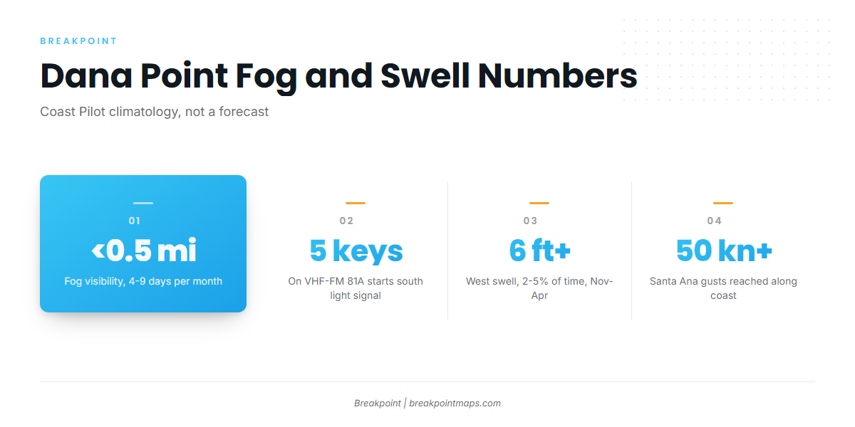
In the Gulf of Santa Catalina, fog cuts visibility below 0.5 mile on about 4 to 9 days per month from September through February and in May. It is most frequent in September and October. It is mostly land fog that drifts out at night and begins to clear by late morning. The sound signal at the harbor’s south light starts when you key the microphone 5 times on VHF-FM channel 81A.
Swell and Santa Ana wind
From November through April, west swells from distant storms reach 6 feet or more about 2 to 5 percent of the time. In winter, seas occasionally exceed 9 feet.
Santa Anas blow from the northeast or east and cross Orange County to reach the ocean near Newport. They have reached 50 knots or more along the coast. Beyond 50 miles from shore they are described as of little concern. Apart from forecasts there is little warning, though a dark-brown dust cloud sometimes gives 10 to 30 minutes. Newport Bay is 11.5 miles of coast from Dana Point.
Where to read conditions
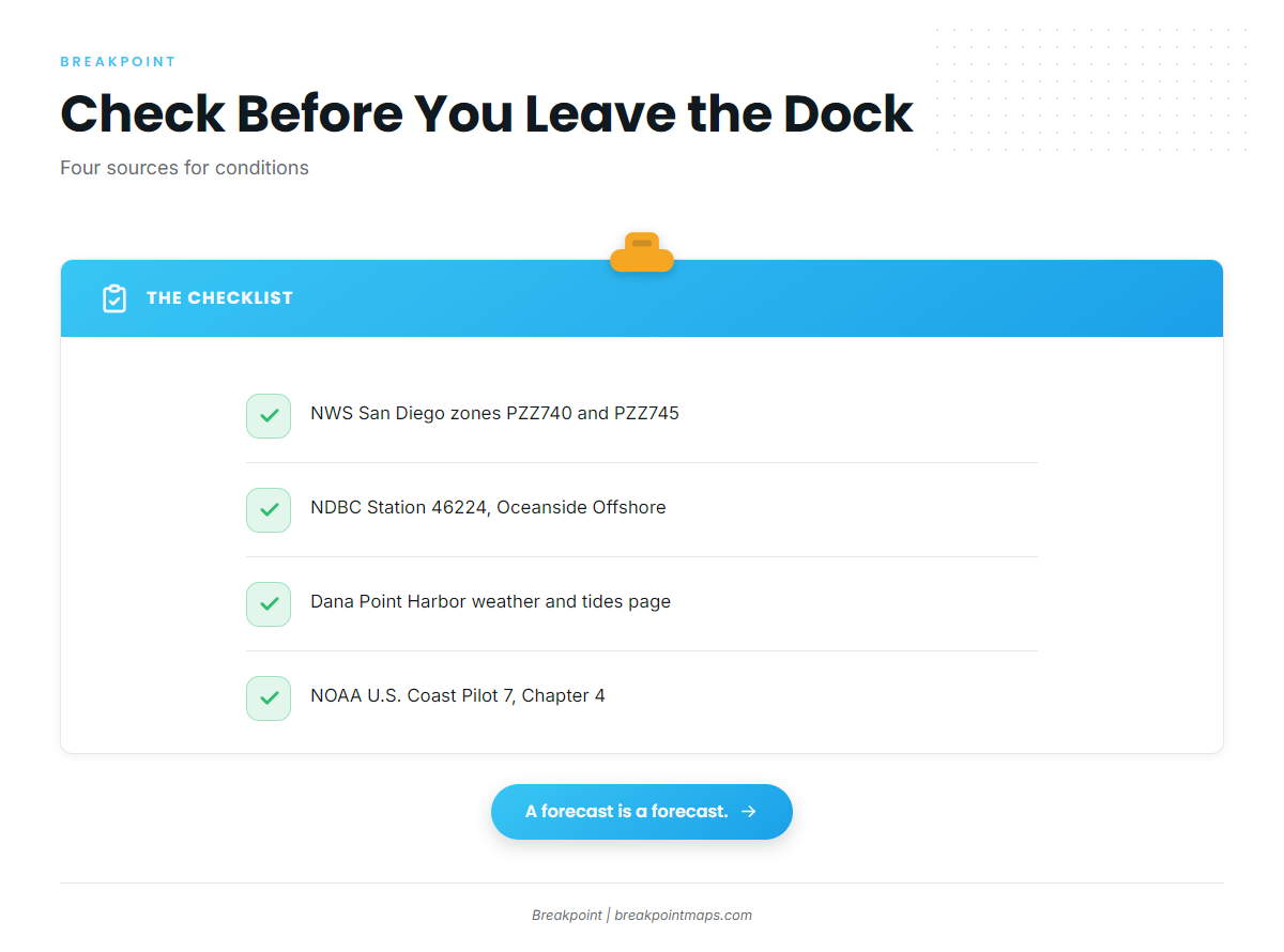
Four sources cover the run:
- NWS San Diego marine zones, coastal marine zone forecasts for zones PZZ740 and PZZ745
- NDBC Station 46224, the Oceanside Offshore buoy
- Dana Point Harbor weather page, with local weather and tides
- NOAA U.S. Coast Pilot 7, Chapter 4, for standing harbor notes
Check the zone forecast and 46224 before the run.
Who fishes for marlin out of Dana Point
Slip holders run from The Marina at Dana Point. Trailer boaters use the Dana Point Harbor Launch Ramp, run by Embarcadero at Dana Point, which also offers dry storage and launch services. Fuel is listed at the Dana Point Harbor Fuel Dock.
The harbor’s offshore boats also work other species. Dana Wharf’s species-by-season list names yellowtail, bluefin tuna, yellowfin tuna and dorado in summer and autumn.
Marlin fishing here has a tag-and-release side. NOAA says most striped marlin caught in recreational tournaments are tagged and released. The billfish guides cover the wider billfish picture.
FAQ: striped marlin out of Dana Point
What water temperature should I look for off Dana Point?
For striped marlin fishing out of Dana Point, look for surface water between 64.4 and 75.1°F, the optimum range Squire cites from Uda. Fish landed at San Diego were caught in 61 to 73.0°F water, with a mean of 67.8°F.
Which grounds do boats run to from Dana Point Harbor?
The named grounds are 14 Mile Bank, Santa Catalina Island with Ship Rock and Bird Rock near Two Harbors, and San Clemente Island with The Head. Santa Catalina and San Clemente are islands, and 14 Mile Bank is a seamount, which is the kind of structure striped marlin are associated with.
Where do I check wind and swell before leaving?
Start with the NWS San Diego coastal marine zone forecasts for zones PZZ740 and PZZ745. Add NDBC Station 46224, the Oceanside Offshore buoy, for observed conditions. The Dana Point Harbor weather and tides page covers local conditions at the harbor.
Does fog matter for an early departure?
NOAA’s Coast Pilot puts visibility below 0.5 mile on about 4 to 9 days per month from September through February and in May, most often in September and October. It is mostly land fog that clears by late morning. The harbor’s south light sound signal starts when you key the microphone 5 times on VHF-FM channel 81A.
Do I need a report card for striped marlin?
CDFW lists marlin among the offshore species that need no report card. Your sport fishing license still applies, and so does the Ocean Enhancement Validation south of Point Arguello unless you hold a one-day or two-day license. Check the CDFW page before fishing.
What should I know about the harbor entrance?
The entrance faces east between two breakwaters, each with a light. A rock covered 7.5 feet lies about 300 yards northeast of the south light, marked by a lighted buoy. A sewer outfall line passes about 300 yards east of that light. Uncharted private racing buoys are reported off the entrance.