Wahoo off Panama City Beach at a glance
Wahoo fishing out of Panama City Beach is offshore Gulf trolling, and the local format is tournament trolling. The reefs and wrecks near port are useful reference marks to save as waypoints, but they are not a promise of fish.
This page covers the local timing anchor, where boats run, the named structure near port with depths and positions, how the fishery works, and where the rules live. For launch, pass and port details, see the Panama City Beach port page.
When wahoo are around Panama City Beach
The local timing anchor is the Bay Point Billfish Open, the tournament that includes wahoo. It usually runs in June.
Treat the event as a reference point rather than a calendar. Plan around the forecast, and check wind, wave height and period before you commit to an offshore run. Seasonality and biology are covered in our wahoo species guide.
Where boats run and the structure near port
Boats run to offshore Gulf waters. For the wider picture, see the regional guide to offshore Gulf wahoo water (see also the wider Gulf of Mexico guide).
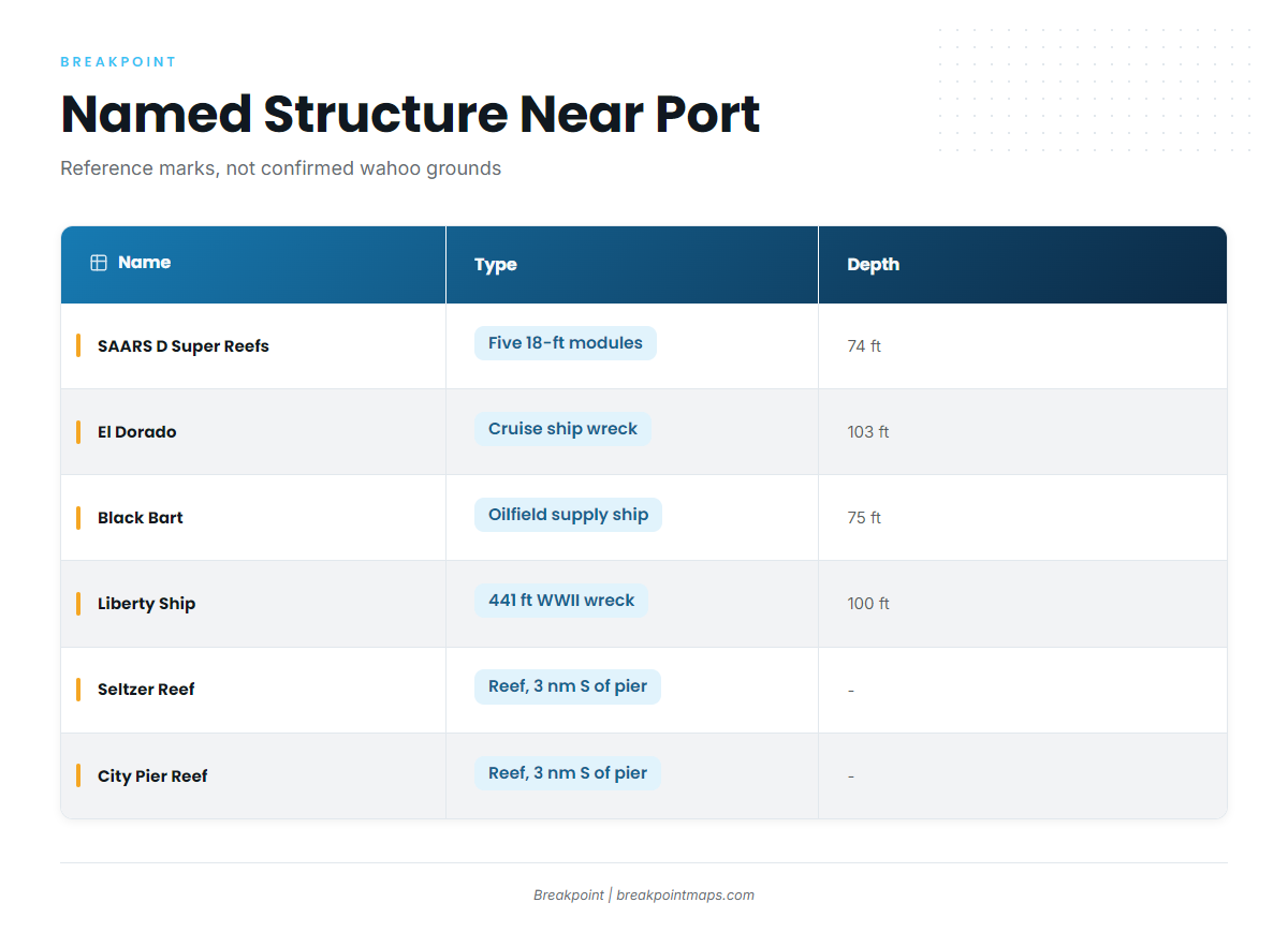
The reefs and wrecks below are named structure near Panama City Beach. They are reference marks and nearshore structure, not confirmed wahoo grounds. Published depths are to the bottom, and a chart mark does not tell you whether fish are there.
Super reefs and modules
The SAARS D Super Reefs are five 18-ft modules (BC2015 sets 17 to 21) in 74 ft of water, with the modules resting at 73 to 75 ft. The Panama City Beach super reefs are the centerpiece of the Bay County artificial reef program.
DuPont Modules 1 to 11 are Bay County reef modules, FWC-funded in 2012.
Pier reefs
- Seltzer Reef: about 3 nautical miles south of the M.B. Miller County Pier.
- City Pier Reef: about 3 nautical miles south of the city pier at Pier Park.
Wrecks
- El Dorado: cruise ship wreck, 103 ft.
- Black Bart: oilfield supply ship wreck, 75 ft.
- USS Strength: minesweeper wreck.
- Liberty Ship: a 441 ft WWII wreck in 100 ft of water, about 10 miles offshore. The 441 ft is the ship’s length and the 100 ft is the depth.
Structure table
| Name | Type | Depth | Position |
|---|---|---|---|
| SAARS D Super Reefs | Five 18-ft modules (BC2015 sets 17 to 21) | 74 ft (modules 73 to 75 ft) | |
| DuPont Modules 1 to 11 | Bay County reef modules, FWC-funded 2012 | ||
| Seltzer Reef | Reef | About 3 nm south of M.B. Miller County Pier | |
| City Pier Reef | Reef | About 3 nm south of the city pier at Pier Park | |
| El Dorado | Cruise ship wreck | 103 ft | |
| Black Bart | Oilfield supply ship wreck | 75 ft | |
| USS Strength | Minesweeper wreck | ||
| Liberty Ship | 441 ft WWII wreck | 100 ft | About 10 miles offshore |
Save these as waypoints and check them against Chart Contours. Chart layers are not for navigation.
How it is fished and who fishes it
The local method is the tournament trolling format. Crews troll offshore Gulf waters and fish to the tournament’s rules.
Bay Point Billfish Open
The Bay Point Billfish Open site is the primary source for the local tournament that includes wahoo. It usually runs in June and draws crews who troll offshore Gulf waters. Private owner-operators fish the same water outside the event.
The same trolling water is covered for other offshore gamefish in our species set.
FAQ: wahoo fishing out of Panama City Beach
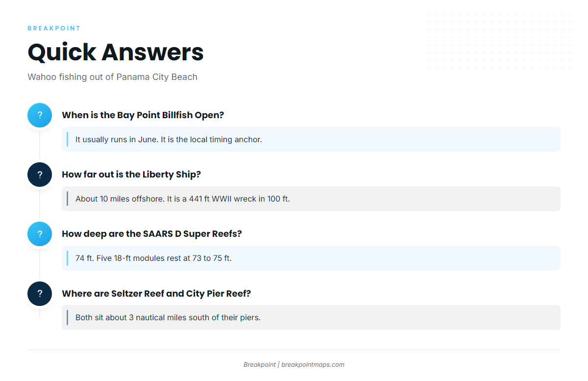
When is the Bay Point Billfish Open?
For wahoo fishing out of Panama City Beach, the local timing anchor is the Bay Point Billfish Open, usually in June. For the broader seasonal picture, use the species guide linked above.
How far out is the Liberty Ship?
The Liberty Ship is about 10 miles offshore. It is a 441 ft WWII wreck in 100 ft of water.
How deep are the SAARS D Super Reefs?
The SAARS D Super Reefs sit in 74 ft. The five 18-ft modules rest at 73 to 75 ft.
Where are Seltzer Reef and City Pier Reef?
Seltzer Reef is about 3 nautical miles south of the M.B. Miller County Pier. City Pier Reef is about 3 nautical miles south of the city pier at Pier Park.
Where do I find wahoo limits?
Limits are on the Florida regulations page and the federal rules page linked in the section above. Check both before fishing.
Where do I check conditions?
Read wind, wave height and period in the official NWS marine forecast before running offshore, and use those numbers to make the call.